Heavitree Local History Society
Taking an interest in Heavitree's past
Articles
Articles relating to Heavitree and its past.
These may be connected with research that has been undertaken, subjects that have been covered at our quarterly meetings, or, material that has been gleaned from other sources.
- Heavitree - An Overview
- The Origin Of 'Heavitree'
- Roman Exeter and Life in Neighbouring Areas
- Fore Street Heavitree - A Roman Road?
- Heavitree And The Domesday Book
- Heavitree Parish Boundary
- Wonford And The Great House
- The History Of The Ludwell Valley
- Heavitree Stone And Heavitree Quarries
- The Lost Rivers of Exeter and Heavitree
- Lost Houses of Heavitree: Cross Park Cottage, East Wonford Hill
- A Social History Of The Royal Devon And Exeter Hospital
- Digby - City of Exeter Lunatic Asylum
- Heavitree And Infectious Diseases
- Heavitree As A Place Of Execution
- Higher Cemetery
- Almshouses Of Heavitree
- Pubs Of Heavitree
- The Heavitree Brewery
- Heavitree Toll Houses
- Growth And Development In The Nineteenth Century
- The Gordon Lamp
- Heavitree And The Railways
- Heavitree And The Trams
- Heavitree Urban District Council
- Heavitree Pleasure Ground
- The Widening Of North Street
- The Annexation Of Heavitree
- Churches Of Heavitree
- Education In Heavitree
- Retailing In Heavitree
- Recreation And Pastimes In Heavitree
- Heavitree Bridge
- Wyvern Barracks
- The Inter-War Years
- Heavitree In The Second World War
- The Post-War Years
- Heavitree Social Centre
- Famous Heavitree Residents
- Neighbourhood Watch 1831 Style
- Disorderly Houses In Heavitree
- Heavitree Police
- Heavitree Postboxes
- Researching A Heavitree Silk Merchant
- Researching Heavitree At The Devon Heritage Centre
- The Cathedral Archives And Heavitree History
- Ladysmith Road Squilometre Project
- The Entrepreneurial Spirit of Heavitree And The Heritage Of Victor Street
- Mile Lane, Beacon Heath: A Hidden Heavitree Treasure
- Memories Of Heavitree
- Snippets From The Local Press
- Researching Family History
- Exeter Civic Society And Their Work In Heavitree
- Heavitree Around the World
- Obituaries
Heavitree - An Overview
For many centuries Heavitree's parish boundaries swept right around from Countess Wear to Cowley, although by 1800 its population, despite its size, was less than 900.
By the time the Heavitree Urban District Council (HUDC) was set up at the end of the 19th century, Wonford, Polsloe, Whipton and Stoke Hill were still within that boundary. Nowadays Heavitree is an identified ward for local election purposes - an area loosely centred on the Fore Street shops.
It is possible that Fore Street, Heavitree is on the route of a Roman road into Exeter, but to date this is unproven. What is known is that Fore Street was on the main Exeter to London road by the 1500s and this, together with the location of the parish church, led to Wonford's local pre-eminence being gradually usurped by the hamlet of Heavitree.
It is known that before William the Conqueror arrived on the scene Heavitree manor was part of the Wonford royal estate. Wonford was the name given to an ancient 'hundred' but unlike many other hundreds it didn't have a minster church. The role seems to have been taken by an early Christian place of worship on a prominent position on the edge of the estate at Heavitree.
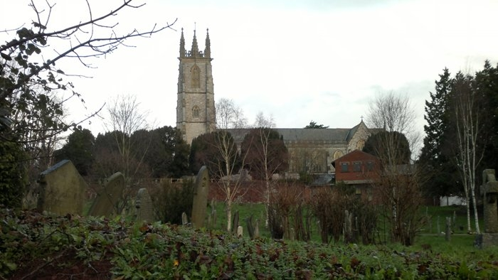
The Parish Church, Heavitree in 2013
For centuries, Heavitree provided the inhabitants of Exeter with food, building materials, and, as the city grew in importance, labour. However, the relationship between the city of Exeter and the village of Heavitree wasn't always amicable. Exeter, because of its importance, has been besieged on many occasions since 1066. The besieging armies would have camped in Heavitree and demanded that the local farmers provided them with food while stopping trade with the city's inhabitants.
Although there is no recorded evidence, it is likely that this forced collaboration would have led to recriminations when hostilities ceased. This may have been the reason why people living within the city walls called those living in St Sidwell's "Grecians", or untrustworthy, and Heavitree was nominated as the place for executions.
Despite this friction Heavitree became a honey-pot for wealthy Exeter merchants and people returning to England after making their fortunes with the East India Company. One of the main reasons for the building of Baring Crescent, Salutary Mount, Mont-le-Grand and Regents Park during the first half of the 19th century was the good health record of the parish. Whilst scores of people died from Cholera in Exeter, Heavitree residents escaped almost unscathed.
This expansion escalated as Exeter's prosperity increased. By the middle of the 19th century the city fathers were keen to include Heavitree in the city's boundaries, but it wasn't until 1913 that annexation finally took place and ended a thousand years of independence.
Scroll to top of pageThe Origin Of 'Heavitree'
Most place names are either personal, i.e. named after a person, or topographical, i.e. named after a local feature in the landscape.
These derivations are not always apparent in modern English place-names as most are rooted in ancient languages such Celtic, Latin, Old English or Norman French.
Another barrier to tracing the derivation of an English place-name is that it will undoubtedly have changed over the years. The following are just a few examples of Heavitree found in old texts and documents:
- 1086 Hevetrowa (Domesday Book)
- 1130 Hefatriwe
- 1179 Eveltrea
- 1270 Hevedtre
- 1345 Hevtre
One theory as to the origin of the name Heavitree is that it was derived from it being the common place of execution for malefactors, signifying the heavy or sorrowful tree. Another possibility is that it refers to the ‘head tree’, and yet another suggestion is that it is made up of ave or avon (water), and tree the British word for town or settlement.
Most place-name experts now agree however that it probably derives from the personal name Hefa and the Old English word treow meaning a tree, post or beam. Heavitree is included in a group of 38 settlements which have similar characteristics, namely adjacent to a boundary of an estate and associated with a meeting-place. A tree is a natural marker for both purposes.
Scroll to top of pageRoman Exeter and Life in Neighbouring Areas
The Romans invaded Britain in AD 43, in four legions, which spread across the country. Legion II Augusta was chosen to campaign along the South-West coast. The legion journeyed from Strasbourg (then in Germania), took the Isle of Wight, then moved right down into the South-West. Their commander was Vespasian, who later became Emperor, thus all his past and deeds were recorded in Roman histories, giving us detail about the military campaigns.
We often hear that the Romans never got down into Cornwall, but this isn't true. There is good archaeological evidence that they campaigned right into ‘the toe’ of the South-West. A fort was recently discovered at Calstock. The legion may have taken its time to get into the far South-West. They spent a lot of time in Dorset but by the AD 50s were certainly campaigning down into ‘the toe’.
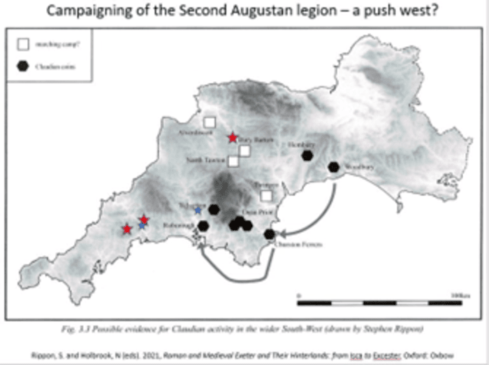
Campaigning of Legion II Augusta
There is no evidence of major battles between the Romans and the Iron Age tribes of the South-West, collectively known as the Dumnonii. Legion II Augusta was an elite force of more than 6000 well-disciplined troops. There was unlikely to have been any cohesive opposing force. The legionaries wore state-of-the-art armour, segmented to allow free movement, and were incredibly well disciplined. Facing any barbarians, they would’ve been a force to be reckoned with.
When moving into the South-West, once an area was placated / occupied, the legion needed to find a base, so they would place a reserve of troops there, ready for the event of any uprising. For this they chose Exeter, an ideal access point at that time, located just above the tidal reach, with a supply of fresh water.
There was no previous large Iron Age settlement here. The area was probably only occupied by typical Iron Age settlements of the South-West: round houses bound by enclosures and dispersed around the countryside. There was probably no overall leadership, maybe just some localized groups or a series of chiefdoms.
Having decided on Exeter as the site for this leg of the invasion, the Romans cleared an area in the centre and constructed their fortress. These were all wooden buildings, except for one: the bath-house. There was predominantly housing for 6000 troops, a hospital, granaries, a workshop for repairing weapons, etc. It was basically a square in the countryside, defended by a ditch and ramparts.
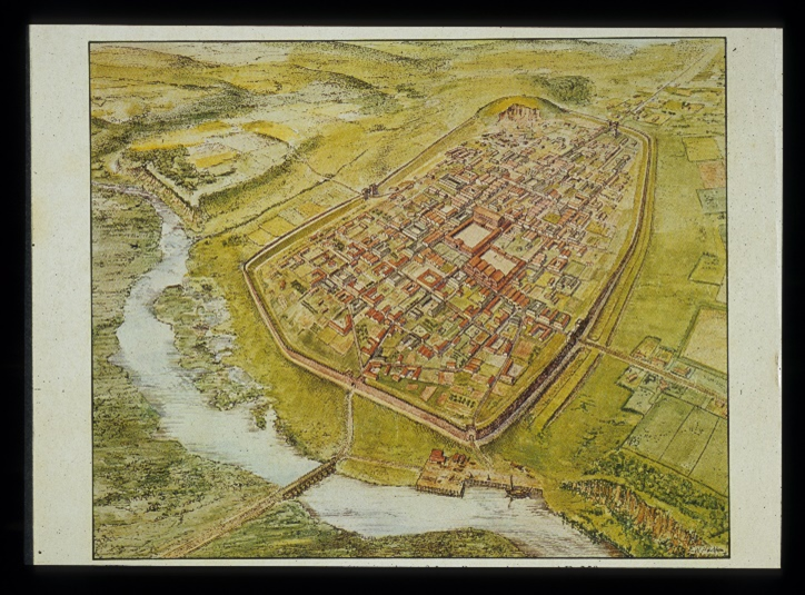
 |
 |
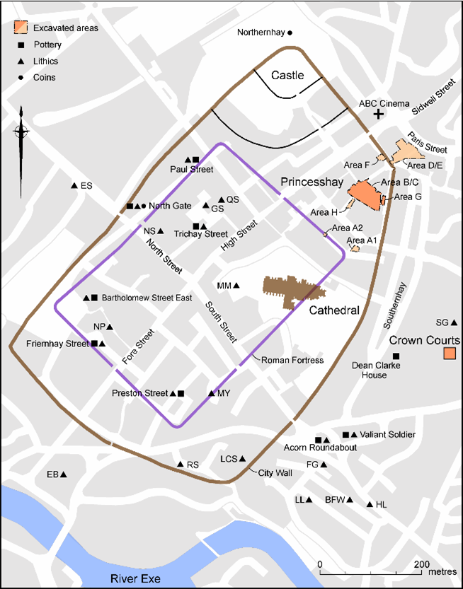 |
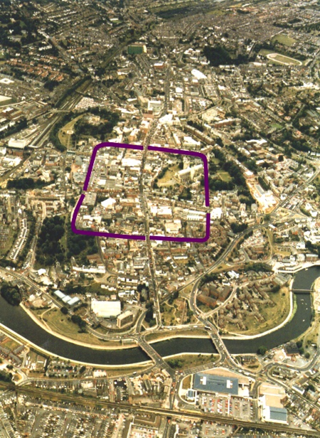
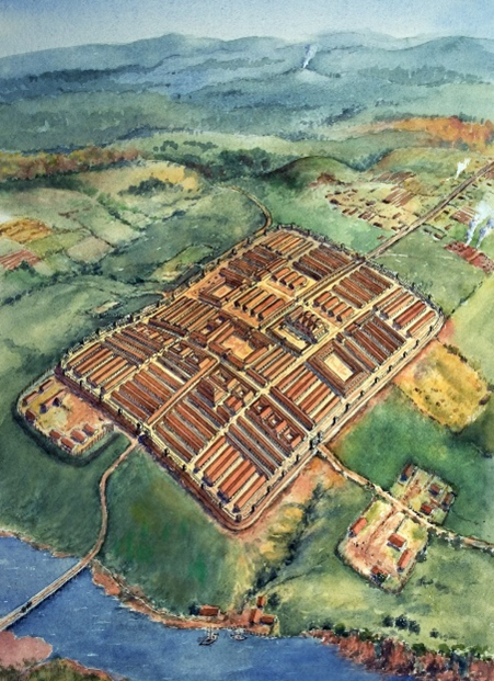
| Aerial shot showing the location of early Roman Exeter | Artist's impression of early Roman Exeter | Location of early Roman Exeter + the walls added in AD 200 |
|---|
Arriving at what is now the High Street / Fore Street junction, they would have set up their surveying tool, the groma, to measure right angles and straight lines, and divide the area up in blocks, with the headquarters set in the central building where all the major roads would meet.
Initially there would have been ramparts made from wood, dug into trenches. There is still evidence of these trenches / impressions of posts, for example in Bartholemew Street. The city wall was added later, around AD 200.
The barracks would have been a long building with smaller rooms at the front for equipment, and a bunk bed system of about 8 beds per room. Not all would be used at the same time as some would be on duty while others rested.
The plan for Roman fortresses was fairly consistent, with its Principia (headquarters), barracks and straight roads. The Principia was likely to have been of considerable height, consisting of two storeys. The buildings were made of timber and wattle, plastered over and painted to look like stone.
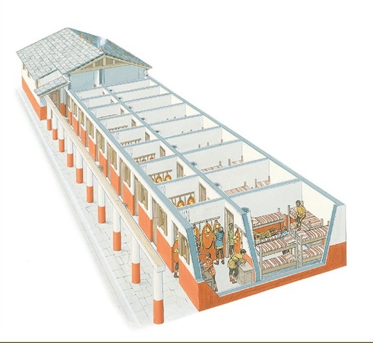 |
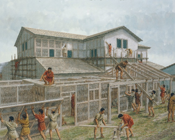 |
| Layout of a typical Roman barracks | Peter Connolly painting showing construction of a typical Principia |
|---|
The central fortress of the settlement had a road which led down to where Topsham Road Aldi now stands, and beyond. Here were Roman military warehouses at St Loyes.
In the 1st century the tidal reach of the River Exe came to about here, and the road would have been constructed at this time. Goods would come in, be offloaded, taken to Exeter or St Loyes, then dispatched to other sites. There would have been a quay area with barges loading and unloading into warehouses.
Excavations at the Millbrook area of Topsham Road found remains of a late Iron Age settlement, with evidence to show that the Romans had taken it over for their own use. Whoever was living there would have been moved along and perhaps resettled, so the Romans could use the house for their military objectives.
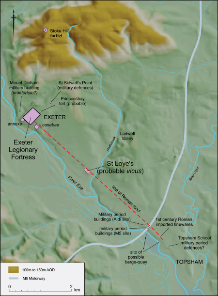
Map showing road leading from the central fortress to the military warehouses
Under the Cathedral lies the remains of the only stone-built building: the bath-house. Built in AD 60, it was intended to have been the bath-house for troops for a considerable period. This shows they would’ve expected the legion to be here for centuries. It would have been opulent with coloured mosaics, glassware, and Purbeck marble basins. The stone would have been the dark purplish volcanic stone excavated from the quarry at Rougemont. The Romans were the earliest stone builders in Britain, and the bath-house would’ve been unlike anything seen before in the area.

Aerial shot showing wider layout of sites
Beyond these military sites, in Heavitree indigenous farmsteads with dispersed huts and enclosures would have remained. There may have been a road (Fore Street?) with roadside ditches and wooden post trench buildings flanking it.
The legion was here until AD 75, so in total only for about 20 years. At this point, they were uprooted and taken to Wales, where there was trouble. There was probably little reason for the army to remain in the South-West, although some forts and auxiliary troops remained for a few more years.
Exeter then became the regional capital of the South-West that the Romans had chosen it to be. The front of the Guildhall makes a best guess at the foundation of the City of Exeter civil administration as AD 80.
The amazing bath-house, equipped for the use of 6000, now became the Basilica Forum. A civic centre was one of the first requirements of any Roman city. It was filled in, new floors were built, and steps were built on top of the furnace, the heating system for the bath-house. With the legion gone, every Roman town needed its basilica forum. It was no less opulent. As the centre of administration for the area, no expense would have been spared.
The city of Exeter after AD 200 showing the city walls
The Roman walls survived, and have now been rebuilt in many places, with some medieval underpinning from when the ground was dropped.
As Exeter became more important and a fully functioning city, it began to acquire the trappings of that type of city. The walls were more of a boundary statement. There would’ve been a temple, and likely an amphitheatre (possibly located by the modern-day Iron Bridge). A new civilian bath-house would possibly have been located at the top of South Street. City gates were built.
Once you were outside the walls, you would be back into the simple, rural areas, and isolated farmsteads that wouldn’t have changed much since the Romans’ arrival. However, there were changes that affected everyone. For example, the Roman economic system was monetised. Prior to their arrival there was no coinage, so this would have been a major change for farmers.
Scroll to top of pageFore Street Heavitree - A Roman Road?
Introduction
There has been much speculation and debate over the possibility of Fore Street Heavitree having a Roman origin but it may never be proven. Even if it began its life as a solidly-built Roman military road, nineteen centuries of continuous use, and its slope, would have removed all physical evidence. However, it is a worthwhile exercise to investigate the possibility by association with the proven routes and the intelligent interpretation of the topography where gaps exist.
Roman Technique
Roman roads were constructed by the army, for the army. When the Second Augustan Legion built their fortress at Exeter in the 50s A.D., roads leading to it from the rest of Roman Britain, and in particular the contemporary Legionary fortress at Lincoln at the other end of the Fosse Way, will have been laid out in predictable ways, with forts placed at intervals equivalent to a day's march. The Antonine Itinerary of the third century A.D. listed the mileage between important places such as posting stations and major towns. Included on the south coast route between Dorchester and Exeter, for example, is Moridunum, which may mean defensible place by the sea, and, although no hard evidence for a fort has yet been found, it is likely to have been close to present day Seaton. To the west of Exeter there is Nemetostatio and may be the fort known as North Tawton. Further west we have Tamaris, yet to be found, but must be a fort guarding the crossing of the river Tamar. It took until 1998 to find the Roman fort near Honiton on the Fosse way; everyone knew it was there somewhere.
Physical Evidence
With the aid of an Urban Database, which precisely locates and superimposes all known archaeological evidence onto modern topographical maps, it is now much easier to see what was going on at any given period. The gates and many of the roads leading from the original Legionary fortress are known from excavations. An aerial photograph showing the very straight line of Topsham Road would have continued through Exeter's South Gate into the fort and out of the North Gate. Interestingly, the suspected route from the North Gate was never found during excavations in the area of the Iron Bridge. However, evidence has been found for the road turning north and running up what is now Paul Street. An East Gate, near St Stephen's Church in the High Street, would have run in a straight line to join what is now Sidwell Street. The apparent wobble in the line of this road, from the later City Gate to Sidwell Street is thought to be the result of recutting City defences during the Civil War. The road from the West Gate would have run to the Exe Bridge and beyond.
Thus far none of this helps the cause of Fore Street Heavitree except that during recent excavations in Princesshay, Roman road metalling was unexpectedly found running diagonally, due East from the Fort. This is still not quite in line with Fore Street Heavitree but does allow us to break the predictable 'dead-straight' grid mould.
Interpretation
Of the two Roman roads running to Exeter from the east - the Honiton-Exeter route seen as an extension of the Fosse Way, and the south coast road from Dorchester - the best alignment for Fore Street Heavitree comes from the latter. The south coast route arrives at Clyst St Mary and the bridging of the Clyst, then follows a straight line section of the Topsham parish boundary (always a good indicator of pre-Norman land division) to Sandy Gate, then on to Quarry Lane and East Wonford Hill. The building of the railway, outer bypass and M5 motorway now make this route less obvious.
The Fosse Way from Honiton is known with certainty as far as the Rockbeare Straight. Margary describes a subsequently bendy route from Clyst Honiton, closely following the low ground of the old A30, to join the South Coast road at Heavitree Bridge at the bottom of East Wonford Hill (Margary, 108). However, if one takes a look at a modern map we see another potential route into Exeter over a ridge via Blackhorse Lane to Gipsy Hill and then Hollow Lane. From this point the line can be imagined running to join the Pinhoe Road close to Polsloe Bridge, then to Blackboy Road, Sidwell Street and Exeter's East Gate. Unfortunately no Roman road was discovered during the building of the M5 motorway.
Conclusion
There seems to be little doubt that Fore Street Heavitree had its origins as a Roman road and could have led to both the East Gate and the South Gate of Exeter, forking at Livery Dole, before running via both Magdalen Road and via Heavitree Road + Paris Street.
References:
Margary, RD, 1955 - Roman Roads in Britain Vol. 1, London
Heavitree And The Domesday Book
The Domesday Book is not consistent in the manner of its recording; Heavitree's entry is very short on detail. It mentions only two carucates of land and two ploughs: one for Roger, who holds the manor, and one for the villain - the two serfs were probably ploughmen. That makes for a population of just four families in 1086: Roger's, the villain's and the two serfs' - surely there must have been more.
A carucate, like the hide elsewhere in the country, is a measure of cultivated land which a plough team could work in a year, and could be used to calculate tax. For most of the country, a carucate, or hide, would have been reckoned on 120 acres but in the southwestern counties (heavier soils?) it is more often reckoned at only 40 or 48 acres (Finn, 25).
How much bigger than its likely 96 acres of arable was the manor at this time? What about woodland (crucial for fuel and the grazing of pigs), orchards, pasture, sheep and cattle? How did this tiny manor, and its later church of St Michael, in the two centuries following Domesday Book, become the centre of such a large parish, stretching from Cowley Bridge in the north to the Clyst at Bishops Clyst in the south, including a total of ten churches and chapels (Orme, 121)?

A map showing the extent of Heavitree parish
at the end of the 13th century (Orme, 1991)
As for the plough and its oxen team, it must be remembered that ploughing had been developed over thousands of years before 1086. The plough itself was a valuable and effective tool, with all the components we see on a modern plough: a coulter to cut the turf, an iron 'share' to break the ground, and a mouldboard for turning the furrow. Ploughshares were even sought as payment for rents (Finn, 57). The oxen (castrated bulls), were small beasts about the size of the Dexter breed, and the eight would constitute two teams of four.
References:
Finn, RW, 1973 - Domesday Book; a Guide, London;
Orme, NI, 1991 - The Medieval Chapels of Heavitree, Proceedings of the Devon Archaeological Society No 49, 121-129
Heavitree Parish Boundary
For at least 1000 years prior to 1913, when it was annexed by Exeter, Heavitree parish, which included Polsloe, Stoke Hill, Whipton, Broadfields and Wonford, looked after its own affairs. It has been suggested that the site of its parish church, St Michael and All Angels, was one of the earliest Christian sites in Devon.
The administrative area known as a parish appears in King Alfred's laws and had both spiritual and secular functions. As land-owners and residents had to pay a tithe or tax to their parish church it was essential that the vicar and church officials knew the precise extent of their parish. The parish gradually became the accepted local government unit below the county and was given responsibility for administering the poor law acts, highway maintenance and enforcing the law.
The need to define and defend individual and group territorial boundaries seems to be a basic human instinct that is also found in many animals. The practice of marking land boundaries with physical objects such as wooden posts or stones has lasted for at least 3000 years (see Deuteronomy 19:14) and Tudor boundary stones marking Heavitree's parish boundaries can still be seen.

A map from the 1930s showing Heavitree parish boundary
Boundary stones or markers rarely defined every bend and kink in parish boundaries and as accurate maps only became available in the late 19th century parish councils used a technique to define and identify boundaries which dated back to ancient Greece and the Romans. It went under the name of 'beating the bounds'.
Throughout the country vicars and parish officials led a group of their parishioners, including in many places young boys, around their parish boundary. Each boundary stone or significant bend in the boundary was struck with a willow wand or a rock. In many parishes a boy was raised by the ankles and his head was bounced on the stone or the ground. The reasoning was that making young boys witness and take part in in the ceremony would ensure the survival of the group memory and they would make convincing witnesses if the boundary dispute was ever brought to court.
Perambulating Heavitree's twenty mile boundary took most of a day and regular stops for refreshment were required. On returning to the church an ale-feast was often held. Many parishioners used the occasion as an excuse to get drunk and misbehave. It is perhaps no coincidence that the word 'bounder' means a cad or person of objectionable manners.

Heavitree parish boundary overlain on a modern OS map
The beating of the bounds traditionally took place on Rogation Sunday, but in an attempt to avoid the fights that often broke out when groups of high-spirited, semi-intoxicated youths from neighbouring parishes met, some churches switched the ceremony to their church's dedication day.
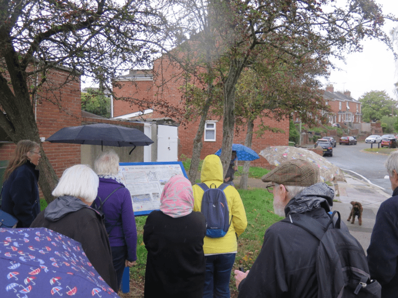
Some of the stones which marked the boundary of Heavitree parish have been in existence for many centuries, but in 1897 the Heavitree Urban District Council celebrated Queen Victoria's Diamond Jubilee by erecting some additional stones and reviving the beating the bounds ceremony which had lapsed over the years. The ceremony again lapsed after the 1913 annexation, but was revived for a second time in 1975 by a group of local enthusiasts. Since then the ceremony has taken place every three years or so.
A booklet published in 2007 by the HLHS exists containing a record of Heavitree's surviving parish and the UDC boundary stones + a description of how to follow as closely as possible the 1897 boundary.
Anyone wishing to attempt the walk will find a good street map is useful. Walkers are warned that bridle paths are often very muddy in winter so stout shoes are advisable; flooding is also possible in low-lying areas after prolonged heavy rain. The Countryside Code should be adhered to at all times. The walk is of moderate difficulty with one long climb in the Stoke Hill area.
Boundary Walk - Full route (14.3 miles, 9 boundary stones)
Boundary Walk - Shortened route (0.3 miles, 4 boundary stones)
Wonford And The Great House
Numbering in this article corresponds to that in the Wonford Village History Trail, designed by the Heavitree Squilometre.
This is a great little walk that takes you through the history of the area. Using wi-fi, it can be followed as you go from the browser on your mobile phone.
Further information:
Wonford village was part of the historic royal manor of Wonford, and was named after the old name for the Northbrook: Wynford.
There is a direct line along Wonford Street: from the site of the Manor House at one end to Heavitree Parish Church on higher ground at the other.
Church and Manor were there as prominent landmarks. This is indicative of the power relationship in the 12th century: the serfs / people would be living between two powers, one at each end of the village: church and lord.

Early 20th century map of Wonford Village (left)
Yeomen would have rented burgage plots from the lord, thus he would have held that village. Back-alleys like Hope Lane and Bovemoors indicate that the village is likely to have been planned this way, as statement of ‘you belong to me’!
The 1901 OS map of the area shows remnants of medieval settlements and three main centres of population: Wonford village, the quarries, and the centre of Heavitree.
In the past, Heavitree was the outlier of Wonford, and would have gradually grown. These days, Wonford is considered to be the outlier of Heavitree.
1. Wonford Great House
The Great House would have faced the village. Looking at Coronation Road, one can almost see the shape of where it would have been. A care-home now stands on the site.
A lot of heritage was lost as developers moved quickly giving archaeologists insufficient time to investigate what might have been left there. However, early pottery from the Great House has been discovered, dating from the late 1100s / early 1200s, the time of King John.
It's believed that the DeMandeville’s owned the House, although it's unlikely that they lived there. By 1236, it seems to have gone to the Gervaise family: Walter and Nicholas. These would have been French / Norman noble families.
Research has concluded that the House:
- Sat on a square plot of around 700m2, including a square moat
- Its front gate would have faced the village, with a small bridge over the moat
- It would have had a steeply gabled roof and small windows
- The first house, dating to around 1200AD, may have been timber.
Later versions were almost certainly constructed from Heavitree Stone
Local artist, Steve Bramble, helped design a logo based on these facts. This can be seen on an information board where the House once stood.
Information board giving details of Wonford Great House
2. South Wonford Infants’ School
A typical example of a Victorian school. The building dates from 1878, and originally educated around 60 children aged 4-7. A year later an additional classroom and chapel was added.
Almost every house in Wonford Street had children who attended the school.
It ceased to be used for teaching in the 1940s, and is now flats.

South Wonford Infants’ School
3. Site Of Smith’s Dairy (St Loye's Court)
Where St Loye’s Court now stands, there was a dairy in the 1900s.
Charlie Smith and his son Tom had a dairy farm at the top of Quarry Lane; they sold and delivered milk by horse and cart from this site.
Apparently, Charlie used to sometimes drink too much cider, but his horse knew the way around.
4. South Wonford Terrace
A terrace of working-class houses, built in the 1840s to house gardeners and labourers.
As Wonford Village became less reliant on local farms and orchards from the 1900s onwards, the houses became homes to dressmakers, nurses and cab drivers.
Originally built as two-up two-down cottages, the number of occupants ranged from 1-8, as people would often rent out a room to supplement their income. For example, the Sinclair family of 6 also had 2 lodgers.
5. Scudders Buildings
A row of workers’ cottages, originally thatched, built in the 1860s.
They were home to railway workers, carpenters, labourers and bricklayers. William Gibbs, a labourer for the council, lived at number 61 in 1911 with his 8 children and wife, all in one tiny cottage.
Well-known character Granny Lake lived at number 63, and would sit outside making Honiton Lace.
There were two toilets outside for the whole block. These were eventually moved inside due to the risk of Scarlet Fever, but the house dwellers were reluctant.
Scudders Buildings
6. 45 + 47 Wonford Street
Two red brick buildings, built in the 1850s.
Number 45 is named 'Verney House'.
Number 47 was originally a shop. A quick look at its occupation over the years shows it being a coal merchant, hairdressers, TV repair shop, video rental shop and gas appliance shop. It was converted into flats in the 2000s.
There is water running underneath the road surface here. This could well be the culverted Blackbrook water course, which once ran through the village, and likely filled the moat of the Great House.
7. Vine Cottage
Probably the oldest building on the street. It was built before 1800, with recent changes visible.
In 1834, a robbery occurred in which £30 was stolen from William Barrell, whilst he and his family were at church.
Subsequently, the family must have fallen on hard times as William was sent to debtors’ prison in 1845. He committed suicide by jumping into the River Exe in 1852.
In 1861 John Madge, a licenced victualler, bought the cottage.

Vine Cottage
8. 31-35 Wonford Street
Evidence of the Exeter Blitz. A bomb killed two here, and left a crater 43 feet in diameter and 15 feet deep.
9. Cherry Gardens
A small development of houses from the 1960s, built originally for staff and families of the prison service.
It was built on the cherry orchard run by the Langdon family, who also had a butcher’s on Woodwater Lane.
The orchards were used for a locally-made cherry brandy. The Heavitree Brewery later owned it and claimed it was the best you could buy.
10. The Wonford Inn
Previously a private house known as Oakbeer Cottage, part of a farm.
It became a pub in 1866. It is the last of three pubs serving Wonford Village, and looks set to close.

The Wonford Inn
11. 3-15 Wonford Street
Dating from the 1830s, the first building (number 3) was originally a shop that sold beer. In those days, tea and coffee were extremely expensive, so beer was widely drunk instead.
In the 1950s, the shop was called Rosie's, but was renamed Elston's when Rosie married a Mr Elston.
12. Hope Hall + Hope Place
Hope Hall was built as a Baptist Chapel in 1905. The Baptists used the building until 1931 before vacating to larger premises a short distance along Wonford Street.
The building has had various uses over the years, and for a while was Heavitree’s Community Centre. When it was decorated, the baptismal font was found under the floor.
Next to the Hall are eight terraced cottages built in 1890. They shared a common water pump and probably privy, as was the norm at that time.
Hope Hall And Hope Place
13. Fort Villa
In the 1800s, as Wonford Village expanded, a number of larger houses were built alongside the workers’ cottages.
Built in 1826, Fort Villa is one of these. An example of a grand villa that would’ve been occupied by ‘the gentry’.
Alfred Brooking lived here between 1897 and 1926; he was chairman of Heavitree Urban District Council. When he died, he left the request that he be buried with an open bottle of chloroform.
Fort Villa was converted into a residential home for the elderly in the 1960s, reputedly Exeter’s first.
14. Cornish Units
During World War II, many homes were destroyed and people were left with nowhere to live.
Pre-fabricated houses, known as Prefabs for short, were a short-term answer to the housing crisis.
Prefabs could be built in a matter of hours from concrete sections, manufactured in the factory and transported to the construction site. Often, the entire structure was transported from A to B on the back of a lorry.
There were a number of designs of prefab. The Central Cornwall and Artificial Stone Company constructed thousands of one of the most easily-recognisable types.
Prefabs were built to be temporary and only last 10 years, but many still stand, such as those in Butts Road, built in the 1950s.
15. Murder / Suicide
On a February morning in 1933, neighbours heard gunshots coming from a cottage.
A woman was found with one foot protruding from a downstairs window; it seems she was trying to escape. She had a severe gunshot wound to the back, and died on the way to hospital.
Her husband was found inside with his head partially blown away. He was holding a double-barrelled shotgun with a cord attached to the trigger.
16. Baptist Chapel
Opposite the Wonford Inn, stands the “new” Baptist Chapel, built in 1931 as a replacement for Hope Hall.
The Chapel closed in 2003, as the congregation had fallen to just two. A reflection of just how markedly allegiance to God, and thus church attendence, has nationally declined since the end of World War II.
In 2004 the premises reopened as the Baptist Union headquarters.

Baptist Chapel
17. Wonford Garage
An ‘old school’ garage stands on the site of what used to be Shepherd’s Court, a terrace of workers’ cottages.
In 1956, the business was owned and run by JK Pritchard and Sons. To this day it is run by the Pritchard family.
18. Site Of Abott's Farm (Draycott Close)
There used to be four acres of orchards here, as well as a fine thatched farmhouse.
The house was demolished in 1964 to make way for Draycott Close.
19. Heavitree & Wonford United Services Victory Hall
Built in 1922, by local veterans who served in World War I, as way to remember fallen servicemen, and as a meeting place for the local community.

Heavitree & Wonford United Services Victory Hall
20. Site of Havill’s Farm (Amersham Court)
On this site in 1840, sat “a commodious dwelling house” called 'Havill's Farm'.
Herein lived George Havill with his wife, Jane, their ten children, two servants, and a nursemaid. As well as the main farmhouse, gardens and orchard, George Havill owned Havills Meadow (roughly where the Wonford Leisure Centre now stands).
A Master Butcher by trade, he continued to build his business in the 1870s and 1880s with the help of sons Albert and Frederick (who also became butchers), as well as a number of live-in Butchers Apprentices or Assistants.
Alongside the farm, was Havill's Slaughterhouse, one of two in Wonford. There you could buy fresh eggs, milk and cream. The freshly slaughtered meat was sold at Havill & Sons butcher's shop in Exeter.
Scroll to top of pageThe History Of The Ludwell Valley
Pre-History
Ludwell Valley is a place people have been drawn to since the Neolithic period. It has been continually used and occupied for 6,000 or 7,000 years. There is nowhere else in Devon that can say this.
People used flint and other stones to make tools e.g. blades and scrapers. From the Iron Age onwards, the clay was used for pottery, and the land for agriculture. A lot of early pottery found on sites elsewhere in Devon has been shown to have been made from clay from Ludwell Valley. There is no evidence of kilns in the Valley, which suggests that the clay may have been dug up, then made into pottery elsewhere.

An aerial view of the Ludwell Valley
There are long gaps in the historical record, the next detailed glimpse we get into the history of the Valley being in the 1840s. However, there have been a number of finds, a selection of which can be seen in the RAMM ‘Making History’ section:
- Several enclosures and barrows, likely to date back to the Bronze Age;
- A medieval field boundary buried on the northern edge of the Valley;
- The Topsham/Heavitree parish boundary going back to at least the tenth century;
- A large number of bones unearthed in the 1960s in a field below Pynes Hill, which may be remains of those who died in the Prayer Book Rebellion battle of Clyst Heath on the 4th and 5th August 1549;
- Seventeenth century pottery fragments: Westerwald pottery, which came from Germany and was owned by high status individuals; and courseware, made locally, possibly from Ludwell Valley clay, and used by lower status people.
Why Is It Called Ludwell?
“Ludwell” comes from two Old English words: “hlude", loud, with "hlaw", a hill; and hence "the loud (or rapid) river by the hill”?
W.G. Hoskins suggested the name means “loud spring”. There is a spring, now under the kitchen floor of Ludwell House. Maybe there was an old watercourse, fed by the spring, which Ludwell Lane now follows, flowing down to join the Northbrook?
“Hlaw” translates not only as hill but also mound, especially a barrow. Was there a prehistoric burial mound, the haunt of restless unquiet spirits of the ancestors?
How The Northbrook Gave Wonford Its Name
The old name for the Northbrook, recorded in a Saxon charter of 937 AD, was Wynford. This probably derives from the Celtic “gwyn ffrwd”, meaning the white, fair, or holy stream.
“Wynford” changed over time to “Wonford” and this became the name of the manor of Wonford, which belonged to the Saxon kings, and thence of the Hundred.
Heavitree, built on the Exeter to London road, gradually became more important. Wonford had ceased to be a royal manor by the 12th century; Heavitree is the name the parish has been known by ever since. We can see from maps that almost all Ludwell was originally within Heavitree Parish, with only a tiny bit in the Topsham Parish.
Ludwell Lane
The footpath running up from Ludwell Lane by the side of the Fernleigh Nurseries rejoins Ludwell Lane and aligns precisely on Heavitree Parish Church. Did it originally run straight to the church, and the modern alignment is to avoid the steep slopes?
The northern end of Ludwell Lane disappears under Rydon Lane. This is where one of the two main local Iron Age encampments was! Could Ludwell Lane have followed a route used by our Iron Age ancestors over 2,000 years ago to travel between one of their main settlements and the sacred site marked by the ancient yew tree which may have given its name to Heavitree?
The 1844 Tithe Map
In the early 1840s, a tithe map was drawn up for each parish. The purpose was to assess who owed tax and how much. Most of the tax was due to the vicar or parson, replacing the old system whereby farmers and smallholders had to give one tenth (a tithe) of their produce to the vicar every year. The map records the name of every field, its size, whether it was arable or pasture, who owned it and who farmed it.
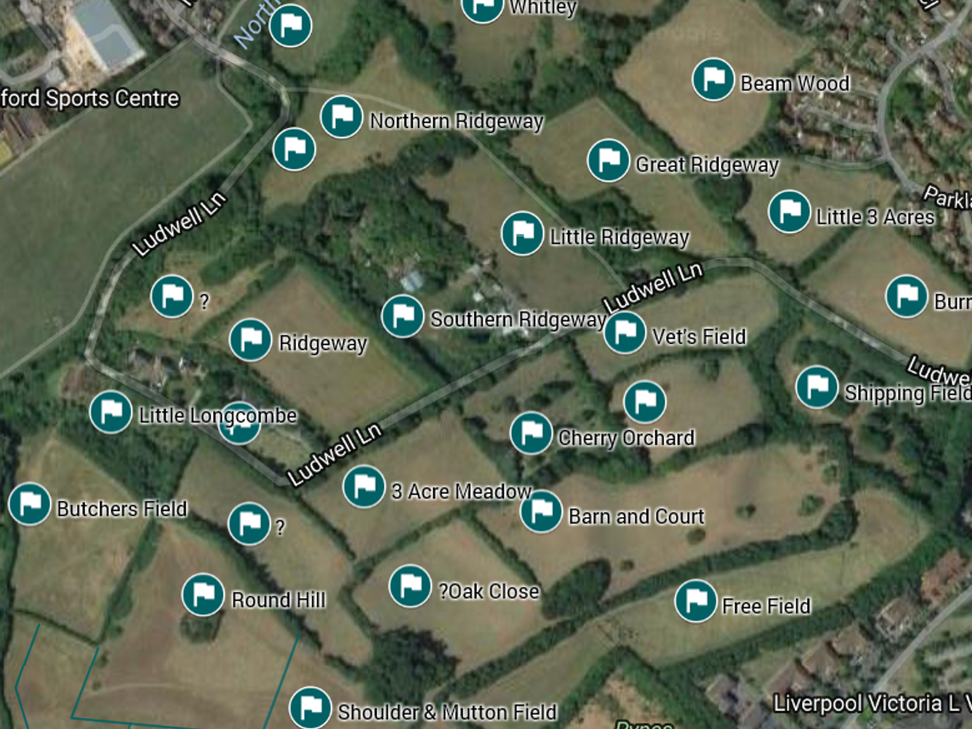
An aerial view of the Ludwell Valley showing the 1844 field names
Ludwell Valley was within Heavitree parish. The vicar was owed £450 a year; other lessees another £580. It would take a craftsman about 8 years to earn £450 in the 1840s!
Fields were fairly small, typically 4 or 5 acres. Unlike today, most were used for arable crops, with lots of fruit. Most landowners were men holding a fairly small number of fields, although a few owned larger holdings, up to 50 fields and over 200 acres. Fields were not necessarily grouped together into blocks according to ownership – it was more common to own ‘one here, and one there’.
Rev. William Arundell
The Rev. William Arundell was born in 1798 in Pinhoe. He was 46 when the Tithe Map was drawn up, and owned nine fields in the Valley, plus another sixteen elsewhere in the parish. By the time of the 1861 census, if not before, he was the rector of Cheriton Fitzpaine, which is about 5 miles north of Crediton. He was then 63, his wife, Sarah, only 37. Sarah in fact was his second wife, whom he married in 1847. They had at least two children, sons aged 11 and 12, although they were not living at home (maybe away at boarding school?). The family were pretty well off, having no less than seven live-in servants: a footman, a groom, garden boy, cook, kitchen maid and two housemaids. By 1871, times must have become a little harder and they had only four servants. The two boys had both gone up to Oxford University. Two years later, William died, aged 75, leaving nearly £12,000 (equivalent to over £600,000 today).
Samuel Melhuish
Samuel Melhuish, the Rev. Arundell’s tenant farmer, lived in the Abbots and Pyne area of South Wonford. He was born in 1781 in Cheriton (thus the connection to his landlord?), so was over 60 at the time the tithe maps were drawn up. His wife was called Ann, and at the time of the 1841 census, there were three teenagers living with them, a girl of 18 and two boys, aged 14 and 17, both agricultural labourers. By 1851, aged 70, he was farming and employing two labourers, William Clement and Arthur Barnicoot, both of whom lived with the family. His 9 year old grandson Robert was also living with them as was a female house servant called Ruth Eveleigh. By 1861, things had changed again. Samuel was widowed, but still head of the household, still farming at the age of 79, employing three men and a boy. Living with him was his 47 year old son Robert, also a farmer, Robert’s wife Martha, Samuel’s grandson and three grand-daughters, the younger two of whom, aged 10 and 14, were at school. This arrangement continued until 1871, although by then the family included Samuel’s one year old great grandson, William, and a 16 year old agricultural labourer called William Philips. Samuel died later that year at the very good age of 89. The family lived at Pynes Farm.
Pynes Hill Farm
The farm was on the opposite side of Ludwell Lane to the Fernleigh Nurseries in the corner of what is now the Cherry Orchard. It had been there since at least the 1890s, and probably a lot longer, but was gone by the 1960s, and possibly by the 1940s; there are still signs if you look carefully enough. The gateposts of the entrance to the Cherry Orchard from Ludwell Lane are solid stone affairs, very different to the more modern gateposts used elsewhere in the park by the Council. They are in fact the gateposts of the old farm entrance. Near the cattle’s drinking trough you can find the odd brick or fragment of floor, all that is left of that farm.

A map showing the location of Pynes Hill Farm
Francis Hurford of Topsham leased part of this farm to Mark White of Hallhayes Farm, Wellington, Somerset in 1932. The lease had strict conditions: not to break up any permanent pasture; to preserve all the trees in the Cherry Orchard; maintain the hedges in good condition; keep at least 40 apple trees and currant bushes in the garden; manage the farm “according to the best rules of husbandry practiced in the neighbourhood”; prevent, as far as possible, any trespass onto the land; and purchase the farm’s milk round after a year.
The Snow Family
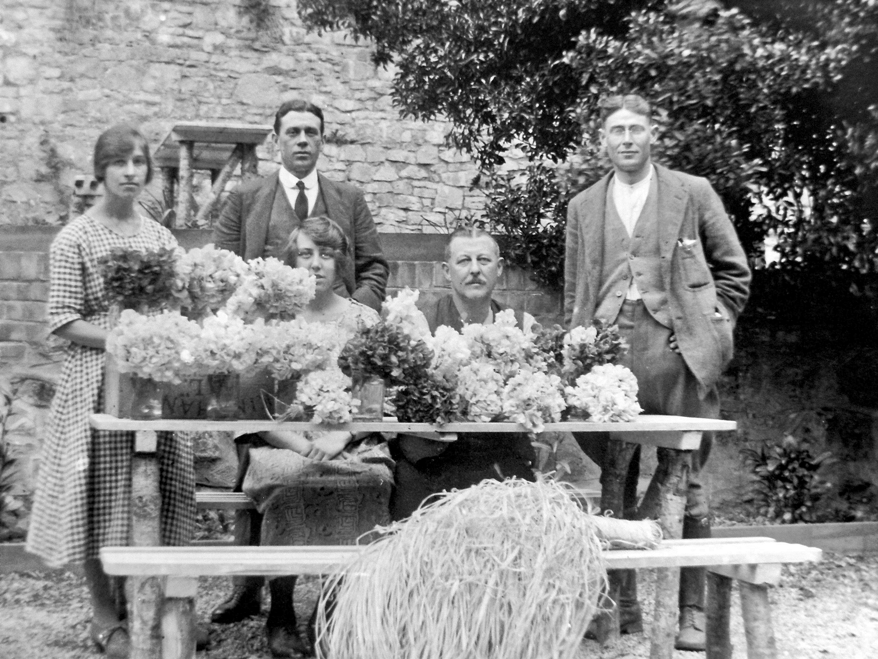
The Snow family were connected with the Ludwell Valley in the early 20th century. Edgar and Hilda Snow were landlords of the old Country House Inn on Topsham Road (and their family landlords of two other Heavitree Brewery pubs: The Windsor Castle and the London & South Western Tavern). They did well there, and in 1920 bought Ridgeway field, and then Ludwell Gardens in 1928. This was productive arable land – they grew fruits and vegetables, and it was also good for bulb growing. They developed a commercial business – sending daffodils and other flowers to Covent Garden market in London, with, it is said, flowers even being exported to Holland! Tulips to Amsterdam! The family only sold these fields to the Council in 2019.

Edward Snow and his family, outside the Country House Inn, Topsham Road
(image courtesy of Mrs P & Dr G Richardson)
Edward Snow and his family, with cut flowers grown in the Ludwell Valley
(image courtesy of Mrs P & Dr G Richardson)
The Council And Ludwell
In the 1920s, the council started buying up land around Exeter, first to re-house people from the old West Quarter and then after the war, to replace houses destroyed by enemy bombing. Most of the land is now the Rifford Road and the Burnthouse Lane estates. Ludwell Valley was spared, presumably because the land was too steep, and Wonford Playing Fields because the land had been used as a tip, and then for dumping some of the rubble from the wartime bomb damage.
Once the Council took over ownership of fields in the park, they installed tenant farmers. The last tenant was Bernard “Tiger” Hooper. He was said to be a strong-willed man. He grazed his cattle on the park all year round, which made it a muddy and smelly experience for walkers, although some field edges were fenced off for them. He had a piggery where the new cherry orchard has been planted; full of old railway carriages, gates and vicious dogs! When Tiger died in 1998, the Council decided to take back the management of the land in order to have better control.
In 1983, the Council took the far-sighted decision to set up Valley Parks in Exeter, so Ludwell is protected. In May 2019, the management of the Valley Park was transferred from the City Council over to Devon Wildlife Trust. Ludwell Life and Exeter City Council are working together to create a new community orchard. This will turn what is currently a featureless field, low in habitat value, into a place for sitting and for picnics, provide a harvest for local people of fruit (the trees planted are all old Devon varieties), and also enriched habitat for wildlife. There will be a flat space to hold small community events too.
There is an old cherry orchard in the park, dating back to 1840, which contains some trees that are well over a hundred years old. These are being replaced, and a new cherry orchard was planted and is also being added to every year. The old hedges in the Valley also contain trees that are hundreds of years old, including pollarded Elms. These are being protected, and hedges that were removed in the 1920s are being reinstated. Wildflower meadows are being planted and hopefully this will continue. Ash tree die-back will be a devastating problem for Ludwell, as well as for the rest of the country, in the future. Vandalism and pollution are problems, but despite this, the Panny is still home to hundreds of creatures: kingfishers, dippers, egrets, ravens, buzzards, sparrowhawks, and maybe an otter. One of the objectives is to get people using the Ludwell Valley Park more – it is such a wonderful green space and we could all benefit from spending some more time there.
Scroll to top of pageHeavitree Stone And Heavitree Quarries
During the Permo-Triassic period, around 280 million years ago, the climate in Devon was like that of the present-day Sahara. Seasonal flash floods swept large quantities of sediment into the valleys and the plains fringing the deserts. As the stones within never had the chance to wear down, they remained angular and sharp. It is this mixture of stones and sediment, known as breccia, present in the Heavitree area, that was quarried and used for building in the Exeter area, where it was called Heavitree Stone.

A map showing the location of quarries in the Heavitree / Wonford area
Although Heavitree Stone had been in use for a long time, the first quarries opened at Heavitree, Wonford, Whipton and Exminster, around 1340, and continued operating until the mid-19th century. The first recorded use of Heavitree Stone was in Exeter’s Underground Passages in 1349. Cathedral records indicate a sudden increase of stone being brought in from Whipton - no less than 650 loads were conveyed in 1349-50. For some reason, the Cathedral was required to repair the City wall by the East Gate. It seems that this may have been because the Cathedral had decided to simplify its water supply (previously taken from St Sidwells well and carried around the city by conduit to Cathedral Close) by cutting through the East Gate, hence the repairs and material required.

The Underground Passages
Post-1350 and through the 1400s, there was a great flowering of masonry skills after the devastation of the Black Death, and a real pride in workmanship and in re-building of the city. The use of Heavitree Stone ashlar (large, square-cut blocks of stone) was connected with a big increase in the quality of building and was regarded as a real showpiece.
Heavitree Stone's heyday was in the 15th and 16th centuries. Churches dating from the period indicate that it was the preferred choice in Exeter. St Mary Steps is built from grand Heavitree Stone ashlar, as is St Stephen's, and the tower of St Martin's; Heavitree's St Clare's Chapel is a lovely example. Sadly, St Michael's Church is made from limestone, not Heavitree Stone, but perhaps it used to be. When it was rebuilt by the Victorians, part of the old church probably went to form the boundary wall between the two graveyards, which contains a whole mix of interesting materials: Heavitree Stone, red sandstone, volcanic blocks and medieval floor tiles.

A wall at Heavitree Parish Church
Another place in Exeter where we can see Heavitree Stone from the Middle Ages is in the old city walls. Although in places the Heavitree Stone is actually beneath the Roman volcanic stone, this does not mean that it is older, but is actually because the older wall is on top of the newer part; the ground would've been much higher on both sides, so when this was levelled, would've been underpinned with Heavitree Stone.
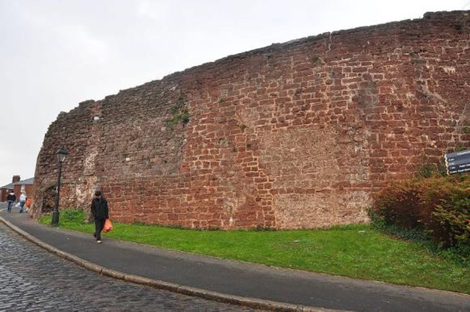
A section of the City wall
Moving away from Exeter there are some wonderful examples of the use of Heavitree Stone, in Alphington, Kenn, Kenton and Exminster churches, but in general its use peters out in favour of more local sources within a few miles.
Although Heavitree Stone is a high-quality material, it is prone to weathering. For this reason, there was something of a move away from its use from the 17th century onwards, but there are later examples, such as Wynards Almshouses and Chapel on Magdalen Street.

The chapel of Wynards Almshouses
Heavitree stone was used so ubiquitously through the City that its remnant walls act as a kind of red skeleton showing the shape of our City from 500-600 years ago. Today there are many lesser examples that can be still be seen in the form of low, basal courses that would have been beneath traditional cob or wooden structures.
Scroll to top of pageThe Lost Rivers of Exeter and Heavitree
Why study the lost rivers of Exeter?
After many years of teaching geography, geology, and history, when John Davidson (our speaker in Mar 2026) finished teaching, he wanted to share some of the things he’d picked up along the way.
Forty years ago he was inspired by his mentor and head of Geography who told him to ‘read the landscape’ – and that is exactly what is needed when trying to find the lost rivers of Exeter. Not only are there bumps, slopes and dips in the land that give clues, there are also man-made remains that raise questions.
John’s son asked, "Why is there a bridge over nothing at Bull Meadow?" It’s actually the remains of the old viaduct crossing a valley that used to carry the now-culverted Chutebrook stream.
Modern view of the viaduct over the now-culverted Chutebrook at Bull Meadow
Street names are puzzling as well: ‘Well Street’, ‘Chute Street’, and ‘Brook Cottages’, for example. John used to travel to work by bus and initially wondered why people asked the conductor to stop at ‘Heavitree Bridge’ when there was no bridge in sight.
John was also confused about mills. Why were there no mills in Exeter other than on Exe Island? This is actually due to the nature of Exeter’s rivers: they rise very quickly in rain and then go back down to a trickle, making only the two main leats on the main river suitable for powering mills.
Glimpses of streams amongst the urban landscape are also tantalising, and the more you’re interested in them, the more you’ll spot.
Before the First Inhabitants of Exeter
The Roman centre of Exeter was a relatively flat plateau that was protected by steep slopes on two sides. On the South side was a steep slope down to the River Exe Valley and on the East was a steep drop toward the Longbrook Valley (a small stream valley). The North and West sides were more gently sloping down to the surrounding countryside.
The geology of Exeter is mainly made up of two important rock groups: the Culm Measures and Permian Breccias. Culm Measures are very old sedimentary rocks formed 300-320 million years ago from deep marine sediments. The Culm Measures are grey/black, slaty, and impermeable, meaning that water cannot soak into them, but the Permian rocks are permeable, thus springs form where they meet the Culm.
There is evidence of a wooden Roman aqueduct, which brought water to the fortress and town of Exeter. To supply this, the Romans drew water from local springs at St Sidwells, Longbrook, and further away in Stoke Hill and Pennsylvania.
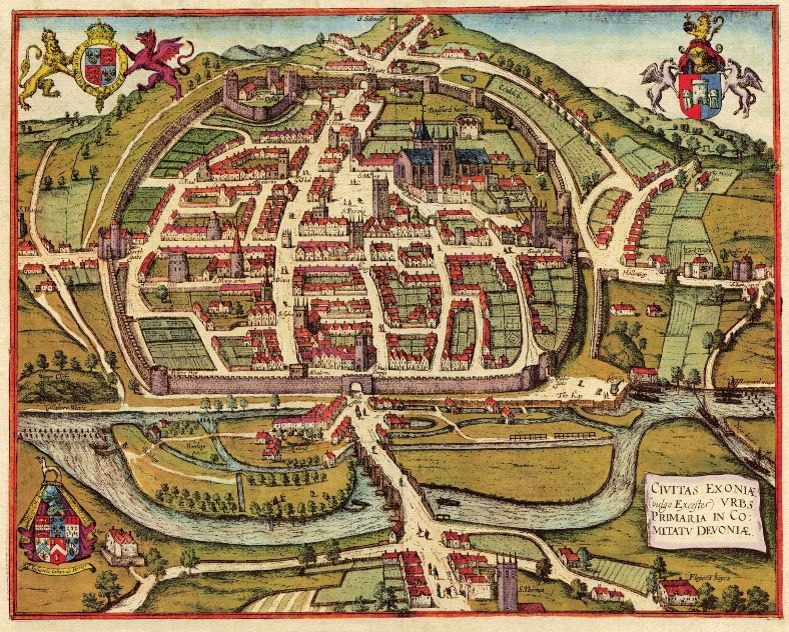
Hand-coloured town plan of Exeter, by Braun and Hogenberg, published 1617
The Crolditch was fed by springs and wet ground on the Eastern side of Exeter, and fed a small stream outside the city walls. It may or may not have been used as a Roman sewer. When the first houses of Southernhay were being built, the area still felt very rural. The neglected parts of the ditch had become stagnant and filled with rubbish. There were complaints that it was full of dead horses (large horse fairs were held there for centuries, and animals that died or became diseased ended up dumped in, or near, the old ditch and low ground). Everything was levelled and made sanitary, but the line of modern Southernhay still follows the curve of Crolditch, along the southern edge of the medieval city walls.
Coombe Brook was a small valley brook further east/north-east of Exeter. It was also used by the Romans, who wanted to keep it clean, so alongside it they built a ditch to take run-off from their bathhouse. It appears in maps from 1610, 1677 and disappears on maps by 1709. There is a bricked up arch in the city wall behind the Customs House. Was this the exit of the Coombe Brook?
By late Saxon/Norman Exeter, the two main streams, Longbrook and Chutebrook, were still natural, but were valuable as a source of water and drainage. The Chutebrook probably stayed closer to its natural state, and flowed through the valley (Bull Meadow Park, Magdalen Road area) towards lower ground south-east of the city.
Exeter in the 1800s
At this time, the Longbrook and Chutebrook were still on the map. Here, the Chutebrook, also known as the Shytebrook and Shutebrook, started at St Anne’s well horse trough. Its source was three springs, which joined up quickly at Chute Street. From its name, we know it was definitely used as a sewer/refuse dump. Its steep course meant that when it rained the water would flush things through.
Bull Meadow ravine was bridged in 1832, and the Longbrook and Chutebrook started to disappear soon after that.
The 1832 Cholera epidemic was blamed on the miasma (bad smells), but it was actually water borne. When they started burying the streams, it didn’t go away. They also got rid of the open market in Queen Street, creating a covered market in 1828, but it wasn’t until 1860 that they realised it was spread via water in shallow wells, contaminated by human waste, in poorer areas. Despite having one of England’s oldest municipal water systems, Exeter’s system had leaky pipes, uneven supplies, and poorer areas lacked reliable access and so depended on shallow wells instead.
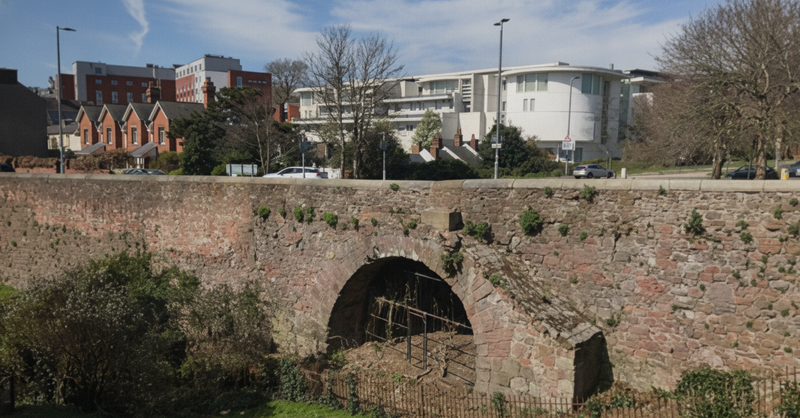
The Chutebrook that ran through what is now Fairpark Car Park was culverted in 1843-5. It can still sometimes be heard after heavy rain. John once waded through the vegetation in an overgrown area and saw there was definitely still some water on the surface. The Chutebrook outfall into the Exe (near Larkbeare House) is currently degraded, but the council is working on it.
The culverted stream runs down Polsloe Road to Sidwell Street, and another part goes under Holloway Street/Topsham Road. This part is very interesting as there is actually a 13th century red vaulted bridge 2.4m underground, beneath the modern road. A contemporary of the old Exe Bridge, it is known as Larkbeare Bridge and it crossed the Chutebrook. It has a ribbed stone vault, gothic style chamfered ribs, a narrow arch over the brook and intact medieval stonework. This bridge would’ve existed to save having to have a ford to cross the road, and in more modern times a new road was simply built on top of it. Engineers from the council still have to go down a manhole to check the mortar. At one point they were scared by a ghost, and an exorcism was performed. The stream there is still flowing.

The Iron Bridge, built 1834-5
The Iron Bridge was one of the first of its kind in England, and when it was built in 1834-5, there was still a river here – the Longbrook. The enormous St Anne’s Brewery (now housing) was one of the major historic breweries and deeply connected to the water system. It was named after St Anne’s Well, and water was brought from the well to the brewery through pipelines and conduits, and gravity. This water was really clean, but their waste was dumped into the Longbrook.
St James' Park railway station sits on a natural drainage corridor between higher St Sidwell’s ridge (spring fed ground) and the lower Exe Valley. When they were cutting the tunnel leading to the station, the railway builders encountered medieval and post-medieval storm drains, stone and brick culverts, and buried watercourses.
The Longbrook valley lies alongside Exeter Central station, and a stream ran by it. Apparently, there is a secret door, with iron ladders. You can find the Longbrook under the station itself, emerging near the Mill-on-the-Exe.
The Buckerell Bore once came up at The Exeter School, then ran on to Rivermead Road. After a drought in the 1970s, the spring, which was by a tree, started to move up the playing fields until it was really close to the buildings. The spring has now been capped and the pond filled in. At Nuffield car park, on the left, you can see the stream on the surface for a short distance. It is managed for wildlife. On Wonford Road it is possible to see part of the brook from one side of the bridge; it is then culverted and goes under the road.
By the 1940s, only two waterways remained above ground: Taddiforde Brook near the University, and the Northbrook.
The Northbrook, which is largely still on the surface, started at Mincinglake Stream (the nuns’ stream and fish pond); the lower point became the Won Ford or the Northbrook. It was once home for amphibians, trout, roach and salmon. Its tributaries are the Whipton Brook, Heavitree Pleasure Ground and the Won Ford from the Parish Church (John can’t find this on any maps but knows he’s seen it on one somewhere).
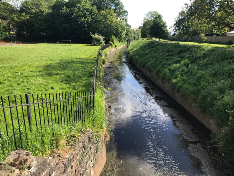
The Northbrook in Wonford
The Northbrook is actually famous in Geography textbooks as permission was given to monitor it through building data. There are two types of river: pre-urban river flow and urbanised river flow. After building, urbanised rivers are more prone to flash flooding, which washes away all of the sediment. After rain, the water levels rise and fall very fast. Because of the lack of sediment, the running water has more power – water can also rush out and erode the ground, causing potholes. This is why much of the Northbrook is a really steep channel.
Mincinglake Valley Park used to be a refuse tip, but very little was documented when refuse was deposited. Following closure of the tip, it was landscaped by adding on top. However, tree roots now penetrate into the landfill, below which is the Northbrook. The water of the Northbrook is brown at this point because it is carrying the leachate. Fortunately, this is monitored by the Environment Agency, but may carry pollutants. By the time it reaches Calthorpe Road, much of the cloudiness is gone. Hamlin Lane Playing Field is another old landfill. After it gets to Sweetbrier Lane, it goes into a concrete channel.
The Whipton Brook comes down from Beacon Heath, but was culverted in the Summer Lane area following flooding in Oct 1960. It is remains above ground in Pinhoe Road, then follows half a kilometre of fairly natural stream, some of it running through people’s gardens. It disappears under the Exmouth branch line, before emerging again in Bodley Close / Thornpark Rise, then joins the Northbrook in Vaughan Road. After flowing along a man-made concrete channel, it is now culverted from Sweetbrier Lane / Vaughan Road junction.
As early as the 1930s, the stream was culverted at Heavitree Bridge. The Bridge itself actually remained until 1958. Unfortunately, the culvert cannot always cope with the run-off from housing, so it takes the surface route and causes flooding. There is no easy solution. The culvert comes out at Rifford Road, eventually goes under Topsham Road, the golf course, and onto the River Exe.
The Heavitree Pleasure Ground tributary is visible on the map - it originally continued past the Pleasure Ground into Higher Cemetery. In the dip on Hamlin Lane opposite the Cemetery you can find flagstones (near the access to garages) – the root of the stream is underneath. After heavy rains, water flows on the surface. It must be culverted at the Pleasure Ground – there is no trace by the tennis courts so it must be quite deep down.
Taddiforde Brook rises in fields and springs east of Exeter and parts of it can be seen in the landscaped ponds of the Streatham Campus. The stream has suffered from ‘cutting down’ in a deep channel, but is down to be re-landscaped, restored to a more natural, meandering river.
The new idea of ‘daylighting’ – revealing streams from being buried and making them look more natural, is catching on. A lot of culverts are disintegrating: brick and stone are losing mortar; iron is rusting. It’s much easier to maintain things on the surface. This was done in Saw Mill River, New York, and also in Sheffield. In South Korea, daylighting a river in 2005 has cooled temperatures by 3 degrees. This could be an excellent idea with climate change raising temperatures around the world.
Locally, we have one plan by Devon Wildlife Trust. They hope to rewild the part of the Northbrook in Ludwell. The next plan is to remove the concrete box channels and maybe one day go up to Hamlin Lane.
Scroll to top of pageLost Houses of Heavitree:
Cross Park Cottage, East Wonford Hill
[The following article has been researched and compiled by Stephen Bees. He has permitted the HLHS to publish the article here, but all credit goes to him.]
Introduction
At the bottom of Fore Street, Heavitree is the one milestone. Nearby, the entrance to Heavitree Social Club is a piece of ground where a cottage once stood known as Mile End Cottage.
Later known as Cross Park Cottage, The Ryalls, and finally as No. 8 East Wonford Hill, the cottage fronted directly onto the road and marked the end of Fore Street and the beginning of East Wonford.
Built in the Georgian period, on land belonging to the Thomas U. Salter family of Heavitree, the rendered brick and stone cottage with rusticated quoins and slate roof was given listed building status in 1974. Sometime later, possibly in the same or next decade, it was demolished.
A description of the cottage, taken from auction and sales adverts, show it contained two attic rooms, two front bedrooms, a dining room and lounge, kitchen, bathroom, a scullery, a back yard together with a walled garden (a shared boundary wall with Wingfield Park / Heavitree Social Club).
A photograph on Heavitree Local History Society website of a tram at Cross Park Terminus shows the very edge of the cottage. The illustration below shows the cottage placed alongside the tram. The entrance to Heavitree Social Club is just beyond the tram.
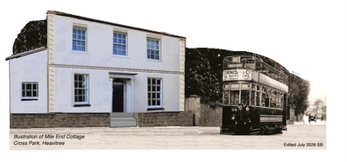
Illustration of Mile End Cottage, Cross Park, Heavitree [Credit: Stephen Bees]
The cottage is shown on various maps, and the rooftop is the only feature on an aerial RAF photo of 1945. The census of 1841 listed the cottage as part of Fore Street. Later recorded as on the London Road, and then as East Wonford.
The occupiers
a) Mile End Cottage
A retired army surgeon
William Thornton, (1778 – 1847) a retired army surgeon, had settled in Sidwell Street, Exeter and set up a business practice in Paris Street in 1834 as a surgeon, dentist and audiologist.
William bid, unsuccessfully, for the position of eye surgeon at Exeter Eye Infirmary. It was probably the end 1830s when William moved from Sidwell Street into the cottage with his wife Matilda and their two daughters.
It was a brief stay, as the family were living in London in 1842.
A retired naval captain
The next tenant of Mile End Cottage was another retired military man, Capt. William Henry Higgs, RN.
William was born in Exeter and joined the navy as a volunteer at 15. His last appointment was as commander of the Packet Service based at Hobbs Point, Pembroke - for taking mail to Waterford, Ireland.
William and his older sister Charlotte, both unmarried, moved into the Mile End Cottage around 1846.
After William died in 1863 at 82, Charlotte went to live with a nephew in London.
b) Cross Park Cottage
A clergyman
The next tenant of the cottage, which would be known as Cross Park Cottage, was the Rev. Thomas William Chignell, the Unitarian Minister of George’s Meeting in South Street, Exeter (now a Wetherspoon’s pub).
The reverend has the lion’s share of comments of this article, but there is not enough space on the page to give a full account of his history.
Thomas was one of the most eloquent and learned ministers in the West Country, and the oldest non-conformist minister in the West to occupy the same pulpit without interruption for over forty years.
Although a man of remarkable gifts, but of delicate health, some say he was never a popular preacher.
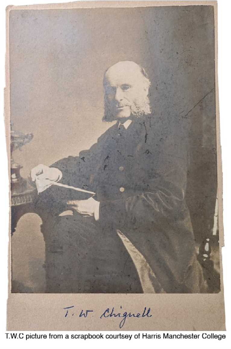
Rev. T.W. Chignell (picture from a scrapbook, courtesy of Harris Manchester College)
Born at Colchester, Thomas studied at Homerton, a dissenters’ academy. He was an Independent minister at Portsea, Hampshire, and taught Latin, Greek and German privately.
It was in 1862 when Thomas accepted an invitation of the Exeter Unitarians after he was proposed by Sir John Bowring. Sir John and Lady Bowring would be among Thomas’s personal friends.
For sale
In 1866 Cross Park Cottage was put for sale. The owner of the Knoll (Heavitree Social Club) John Spark, a retired linen draper of Colsons and Spark, High Street, Exeter, was selling the Knoll along with a small detached genteel cottage ‘in the occupation of a good tenant’. The Chignell family were already sitting tenants, and continued to be tenants, having moved from Mount Radford a couple of years earlier.
Eyes closed
Now in his 50s, Thomas is described by one newspaper: ‘A preacher whose style is peculiar. He has the habit of closing his eyes for emphasis of a sentence and his action consists of lowering the right shoulder in a succession of bows to the books before him. His delivery in the pulpit is very slow, and it is evident that every word is carefully weighed. The moulding of some of the sentences is exquisitely beautiful.’
Thomas had complied a hymn book which he used at the chapel, some of the hymns were his own. Dressed in a cassock, a gift from worshippers, Thomas’ sermons were marked by constant ‘references, drawn from a wide range of reading, from Aristotle, to Dante, to Gothe, to Carlyle, to Rousseau, perhaps, above all, to Spinoza.’
Thomas would advertise on a chalk board, put outside the chapel, the topic of his next lecture - raising a few eyebrows from the more conservative minded. He lectured at various institutions and societies; from the lofty Exeter Literary Society and the Exeter Institution to the more humble venue of the Working Men’s Mutual Improvement Society in Preston Street.
Out of a tragedy
In 1871 Thomas’s wife Martha died at 35, shortly after giving birth to a son – their seventh child. Staying with the family at the time of the tragedy was Martha’s sister Jane, and their mother. Jane stayed on as a ‘housekeeper’ to support the family. A few years later Thomas and Jane married, in Switzerland. In England at that time, it was illegal for a man to marry his dead wife’s sister. They married at Neuchatel in the Hotel de Ville (The Town Hall) in 1874.
It was a feature at George’s Chapel on Sunday evenings to hold lectures and orchestral concerts. Thomas’s liberal views show he was in favour of Sunday opening of museums and libraries, and as an ardent promoter for adult and children’s education, he was a trustee of New School House in Paris Street.
Now old and frail, Thomas would have witnessed the laying of the tram tracks in front of their home. After 43 years living at Cross Park Thomas died in 1906. He was buried at Higher Cemetery, Heavitree.
The extract below from The Devon and Exeter Gazette, was written by a friend of Rev. Thomas Chignell: ‘As a preacher he managed to avoid entirely the preachers common-place of phrase, thought, and action. He loved nature with an ardour which I have never known surpassed. I connect him in my memory with walks near his own house under blooming orchard trees, along green lanes… sweet it was, too, to talk to him by his own fireside in his room, where the pictures reflected his own discriminating love of art, and his bookshelves were full to overflowing of his favourites and teachers’.
During the summer of 1907, a coach party of 80 Unitarians from Crediton, in horse-drawn brakes, passed through Heavitree on their way to Sidmouth. The party noticed the vacant cottage that had been the Chignell’s home.
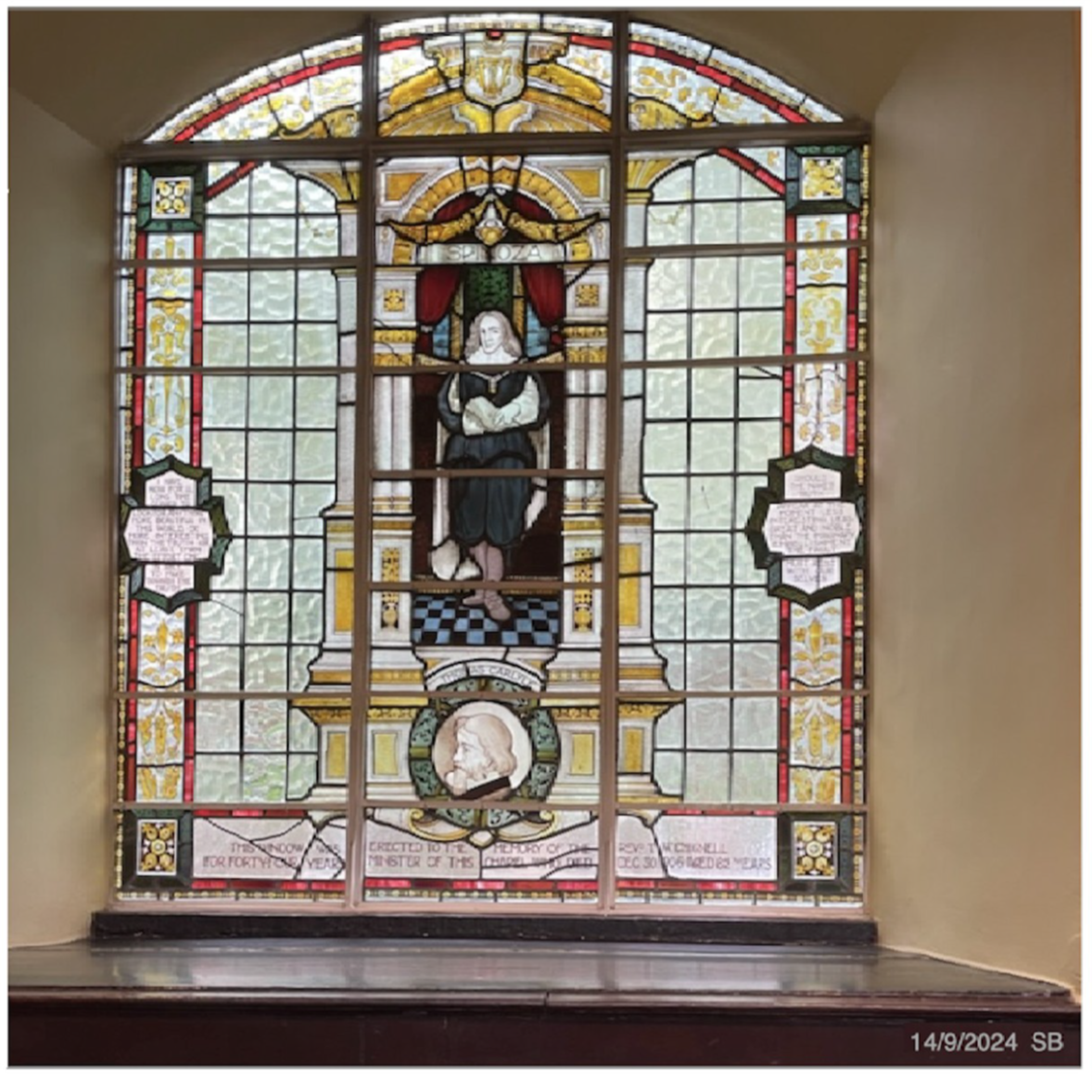
A stained-glass window memorial
Such was the regard for Rev. Chignell a memorial window was installed in George’s Chapel. The design of the window, which was subscribed for by members of the congregation and friends, is a full-length representation of Spinoza, the philosopher, with a medallion of Carlyle at the bottom. There is also an inscription which states: This window was erected to the memory of Rev. T.W. Chignell. For over forty years Minister of this Chapel who died Dec 30th 1906, aged 82.
c) The Ryalls
A watch, clock and jewellery shop owner
With the departure of widow Jane Chignall, who went to live with her stepdaughter in London, Cross Park Cottage was sold in 1908. The new owners of the cottage were an older couple, John and Elizabeth Morgan. The Morgans ran a watch, clock and jewellers shop on the corner of South Street and Sun Street, Exeter and lived on the premises.
It seems likely the new name for the cottage, The Ryalls, was chosen as reminder of when Elizabeth was the housekeeper to a clergyman at The Ryalls, Seaton.
Shortly after they bought the cottage Elizabeth was widowed and she moved to Wynards House in Magdalen Street, Exeter, and the cottage was let.
A newspaper sub-editor
The next occupier, Leonard Richards, was a sub editor of Exeter Flying Post. Leonard and the residents of Cross Park Terrace had to endure a ‘duck pond’ in 1915. For months ‘motorists and pedestrians were spattered with liquid mud as they passed the tram terminus’. Eventually the nuisance problem was cured by raising the level of the rails for the road to be ‘properly barrelled’.
Leonard and his wife Bertha and their son Ronald appear to have been happy to live in Heavitree. After five or six years living at The Ryalls, they migrated uphill in Heavitree to live at Regents Park.
A bookbinder & leather goods craftsman
Alfred Noakes was a sitting tenant when Elizabeth Morgan died in 1916 and her cottage advertised for sale. It was sold for £270 to John Charles Lamacraft, a retired publican of the Coach and Horses, Sidwell Street.
Lamacraft lived his retirement at Pinhoe, and The Ryalls’ tenant, Alfred Noake, a bookbinder with a shop in Fore Street, Exeter, continued to live there briefly. Alfred, a keen chess player, returned to live at St Leonards.
The Ryalls, although recently sold in 1916, was once again advertised for sale in 1919, with sitting tenants.
A retired bank clerk
The sitting tenants, having moved from Oakford House, Kingsteignton, were another elderly couple, Jacob Jeans, a retired bank clerk, and Hannah his wife and their daughter Grace. They paid rent of £20 per annum. Shortly after moving into The Ryalls, it seems family wanted to move to Topsham, but their plans changed. Jacob died in 1921 at 75. Hannah and Grace moved to Kent.
During the summer of 1921, The Ryalls remained empty, but returning to visit her mother-in-law at Heavitree Park, Norah Richards, a widow, and an Irish actress of the Punjab, India, ‘picked a flower in T.W.C.’s (Chignell) garden’. The Richards family had been Unitarian friends of the Chignells.
(Norah Richards has her own illuminating history on Wiki, and elsewhere.)
The same year, a motorcycle race from Exeter to Lyme Regis and back – just under 70 miles, saw the riders were checked in at the finish at Cross Park Terminus.
A postal officer
The electoral register of 1922 lists the next occupiers of the cottage as Robert and Jessie Branscombe and Jessie’s sister Eliza Wakeham.
Robert, who before moving into The Ryalls had lived opposite, had a long career with the HM Post Office in Queen Street, Exeter; a career perhaps inspired by his parents who had the post office and grocer shop on Fore Street, Heavitree.
The Ryalls with its walled garden might have been an asset, with Robert becoming the secretary of Heavitree Horticultural Society. Annual shows were often held in the meadow of Heavitree vicarage.
Numerous accidents happened with the trams, some more serious than others. On one occasion when Robert was about to get on the tram at the terminus he was knocked down by a car. Suffering with a bruised right hip and abrasions to both hands, he hobbled home.
Not long after Robert wrote to the local press about the dangerous actions of car drivers frequently passing on either side of a stationary tram - both cars going in the same direction!
Robert was the only occupier of The Ryalls born and bred at Heavitree, though in the late 1930s when his wife Jessie died, he moved to live at Pinhoe. Before he left, he may have seen the tram rails torn up.
d) No. 8 East Wonford Hill
With new houses built on the north side of East Wonford Hill, so came a house numbering system.
All houses down the hill that had ‘names’ were given numbers. The Ryalls became No. 8 East Wonford Hill and the row of old cottages on this south side of the hill no longer had odd and even numbers.
A Semper Fidelis foreman
Moving into No. 8 were Charles and Emily Wood. When they arrived from Kennford, both were in their 40s.
The Exeter motto was used happily by various organisations. Charles had been foreman at the Semper Fidelis workshop, the only industry (mainly carpentry) in Exeter entirely run by WWI disabled ex-servicemen. Later in life Charles worked as an agent distributor while Emily worked for an outfitter.
During WWII Charles and Emily gave shelter to a blitzed-out family and as such were entitled to an extra ton of coal, but strict regulations, and the departure of the family before the coal was delivered, cost the Woods a hefty £10 fine.
By comparison, a few years later in 1946, Charles was fined £1, with £2 11s 2d costs, for driving without due care and attention. Charles stated in court that he had ‘almost completed a thesis on road accidents and how to avoid them.’ (!) The bench refused a plea that he had a clean licence for 40 years.
After the Chignell family, Charles and Emily were the longest occupiers of no. 8. Charles died in 1951 and Emily continued to live there for another 20 years. Although Emily died in 1971 her probate was not settled until 1974. The same year, by coincidence, the Town and County Amenities Act came in to force and no. 8, along with many other houses in Heavitree, was given listed building status.
Demolition of the property
It seems likely Cross Park Cottage was pulled down in the 1970s or 1980s. No record has been found at the Devon Heritage Centre, and old copies of The Express & Echo, which might have reported the demolition, have been digitised, but only as far as the early 1960s.
A point of reference might come from the adjacent house.
No. 10 was a small double-fronted house and known as The Cot. A descendant of one of the occupiers recalls The Cot was demolished between 1972 – 1976. (It was not on the 1974 listed buildings of Heavitree.)
All that remains today on the site of Cross Park Cottage are the outline of a brick wall on the pavement, and a flight of 3 steps that are roughly in the correct place for the entrance. A larger wall of about 5 feet tall (1.5m) existed to the right of the cottage.
I was a paperboy in the 1960s and cycled by the cottage. I wish I could remember it.
Perhaps the best reminder of the cottage and the Rev. Chignell is the stained-glass window at George’s Meeting House / Wetherspoons in South Street, Exeter. A worthy place to visit the next time you are in Exeter. Admire the window, with a beverage of your choice!
Memorial stained-glass window to Rev. T.W. Chignell, George's Meeting House [Credit: Stephen Bees]
Sources:
- Heavitree Local History Society
- British Newspaper Archives
- FindMyPast & Ancestry records
- Maps.nls.uk
- Swiss marriage record, flora.ne.ch / archives de l’Etat de Neutchatel
- Chignell photograph & picked flower, Harris Manchester College Archives HMC/PP/CH2
- Letters of William Hale White (a cousin of Rev. Chignell) re: a housekeeper, Bedfordshire Archives
A Social History Of The Royal Devon And Exeter Hospital
This article contains portraits from a collection donated to the RD&E Hospital. Each one was produced either on appointment of the figure or brought with them when they came onto the board. The paintings acted as the PR tools of their day, and tell the history of the RD&E from a really interesting angle.
When the RD&E (Southernhay) site was put up for sale to private developers, the paintings were rescued with a view to reuniting them in the boardroom at the RD&E (Wonford). However, there was insufficient space therein, so a new boardroom was proposed.
Many, rightly or wrongly, took exception to this; the paintings had, after all, been in storage for many years.
They were gifted to the RAMM to be restored, and recently displayed at an exhibition there.
The RD&E Hospital was established in 1743 in Southernhay, Exeter, by Dean Alured Clarke. In the late 1600s / early 1700s, the idea of the great and the good coming together was very popular: the conception of public service.

The original RD&E Hospital, Southernhay, Exeter
Clarke (below) had trained in London and was acutely aware of the development of district hospitals at that time. When promoted to Dean of Winchester, the first thing he did was to gather the important people of the area around him and found Winchester Hospital. He then moved to Exeter; just a few records show how he went about his mission to build the Devon and Exeter Hospital. He came here in 1741 and got things moving, but unfortunately died a year later.

Dean Alured Clarke (founder of the RD&E Hospital)
Bishop Stephen Weston (below), Clarke’s boss, extolled the parish clergy and parishioners to donate money. This was raised by subscription, relatively small, but many of them; this gained pace as people recognised the hospital was to be a reality. The next stage was to secure the land.

Bishop Stephen Weston
John Tuckfield (below) was a local business-person, and later both alderman of, and MP for, the city. He was the president of the board. His portrait was painted by Thomas Hudson who produced three portraits in the collection; he was famed for his painting technique of textiles.

John Tuckfield
Ralph Allen (below) was born in Cornwall to a mining family. His mother was involved in the emerging postal service. At this time, many seams of copper were being discovered; those laying claim to them needed to register their ownership with an office in London. Unscrupulous people might intercept and change the name on the letter. Ralph recognised this and at 19 moved to Bath and became a postmaster. He rationalised the service in England and unified the whole system. He was the Bill Gates of his day, and made a huge fortune.
Once this wealth was in investments, he began opening stone quarries; the whole of Bath used this stone. These two careers made him a multi-millionaire. Having secured his place on earth, Ralph went about buying his stairway to heaven. In the painting, he is pointing to the deed that transfers part of his fortune to the hospital.

Ralph Allen
Having garnered everything, the board next went about attracting the best medical men.
John Patch Senior (below) is painted in the mode of lecturer. He is gesturing to learned text about the human hand; there is also a flayed arm in the painting. The portrait is remarkable, because at the time both the church and state were vehemently opposed to dissection of the human body.

John Patch Senior
Patch was the surgeon in Paris to James Edward Stuart (son of the deposed James of England, claimant to the English and Scottish thrones). The infant prince had been taken to France where James II had set up his court in waiting. Looking closely at the top right of the portrait, behind some crude over-painting, is a bookshelf with volumes on.
John Sheldon (below), surgeon at the RD&E, was a remarkable person. The Age of Enlightenment is embodied in some of his interests. He was somewhat bizarre. He kept the naked embalmed body of a 24-year-old woman next to his bed for thirty years. His widow gave the specimen to the RD&E.
The body was believed to have been his first love, who died of consumption when he was treating her in the final stages of illness. He also once ascended in a static balloon and was on course to travel the whole of the South Coast (but got off in Sunbury).
An interesting talk on John Sheldon, that's free to listen to, can be found here.

John Sheldon
The painting of Sheldon is very interesting because of the figure in the background. Around 1820-25, three royal academicians were involved in discussions about how Christ’s dead body would have looked on the cross. They were very interested in how the body would have ended up, and thought that the pose used by many artists was anatomically incorrect.
Until 1832, the Anatomy Act stated that the only bodies legally available for dissections were those of executed criminals. Therefore, casts of flayed cadavers were very important to medical schools and art galleries.
The three academicians approached a surgeon, and in 1801 he was asked to find a suitable subject. It just so happened that he knew a judge with an ‘open / shut case of murder’ coming up. James Legg, a Chelsea Pensioner probably suffering from dementia, challenged another Pensioner in his home to a duel, shooting him through the chest. He was hanged and afterward his body dissected, casts being made, pre- and post- dissection. From these casts, smaller versions were sculpted; one is the piece depicted in this portrait, another remains in the life drawing room at the Royal Academy.
As for the RD&E itself …
By 1974 it had out-grown the Southernhay site, and was moved to a tower block within the grounds of Wonford House. The new site is now known as RD&E (Wonford).
| The new RD&E (Wonford) |  |
 |
|---|---|
| Artist's impression | Building work |
Initially, there were complaints from night-staff about the noise of gunfire from the nearby Wyvern Barracks, where the army shooting range was located.
Two people died falling from height at the hospital within a year of it opening, the first being a workman on the outside of the building, and the second a nine-year-old patient who fell down a service shaft.
In 1985, the building was the first major structure in the UK found to have concrete cancer (the alkali–silica reaction), which caused the concrete to expand and fail. It is thought that condensation from the kitchens was the primary cause.
The replacement buildings were built in several phases, the first phase being completed in 1992. This first phase included an ophthalmic unit which replaced the West of England Eye Infirmary, previously on its own site on Magdalen Street in the city centre.

Further building at the RD&E (Wonford)
The second phase was completed in 1996, followed by the Peninsula College of Medicine and Dentistry opening in 2004, and a new maternity and gynaecology unit, known as the Centre for Women’s Health, opening at Wonford in 2007, with maternity moving from its Heavitree site in Gladstone Road.
The Heavitree site had existed for years as a place of healing, albeit under the banner of the Workhouse. It still exists, and operates a number of outpatient services.
The Southernhay site was sold to private developers in the early 2010s, and has since been converted to housing whilst retaining the external façade.
Scroll to top of pageDigby - City of Exeter Lunatic Asylum
Old minutes from Exeter City Council meetings (rescued from a skip) provide very interesting snapshots of Exeter life in the past.
The minutes from the Asylum Committee are particularly interesting; they give a glimpse into the institution at various points over the years. Not a comprehensive history of the Asylum, but rather a peek at various points in time (and, of course, seen through the subjective eyes of the Council Asylum Committee).
Part 1: 1890
In the late 1800s, Heavitree wasn't yet part of Exeter, however the City sometimes took land to build facilities for which there was insufficient room in Exeter. One of these was the City of Exeter Lunatic Asylum. There was already a private mental hospital for the rich at St Thomas, replaced by the larger Wonford House (also in Heavitree parish) in 1869, but in 1880 the city decided to build its own municipal lunatic asylum, to treat the pauper lunatics of Exeter.
The land chosen was part of Digby Farm, within the old Heavitree parish. It was near the railway line, which would allow for building materials to be transported. In 1908, a station named ‘Clyst St Mary and Digby Halt’ was opened (350 metres from the current station).

OS Map dating from 1892-1908 showing the location of the City of Exeter Asylum, Digby
The Asylum was designed by Robert Stark Wilkinson. Exeter Memories describes the layout:
‘The building, of some 237 metres (777 ft) in length, was split into the more utilitarian north-western range containing the service, administration, and laundry rooms, along with accommodation for the laundry workers. The south-eastern range was a series of male and female ‘inmate’ areas separated by a recreation hall. In the centre of the range was a grand entrance into the main hall, as befits such a building. At one end of each range was a large tower, of differing design. There was also a farm for the Asylum, to the south-east of the main block, providing work for the male patients.’

Lithograph drawing of the Asylum

Early photograph of the Asylum

Photo amalgamation showing the position of the Asylum relative to current buildings.
Credit: Jerry Bird (Exeter Memories)
The first set of records dates from 1890, when the Asylum was still being equipped.
The accounts list purchases and services carried out: blankets, bedding, furniture, rugs, cutlery, carpeting, oil baize, brushes, oak posts and painting oils, sheets, trousers, armchairs, counterpanes, sheets, glass and earthenware, painting and writing, ironmongery, repairs to wire fences and ‘town dues on stone’.
The Council had to deal with a letter from W. Burrow, complaining that his tender for the supply of flour to the Asylum had not been accepted, despite it being the lowest. The Council informed him that:
‘Samples sent were made into bread before the Committee arrived at a decision, and that they were of the opinion that the small increase in the price of flour paid was more than compensated for by the superior quality.’
In 1890, the annual balance sheets showed that the Asylum loan, taken out in 1886, of £90,000 and a further £7,000, had been paid off by £7,381.

Sample from the minutes from the Asylum Committee
The City Asylum Committee met each month.
In January 1890, they were mainly discussing tenders for goods. The clothing purchased gives us an idea of what the patients would have been wearing:
’10 dozen men’s caps, 8 pieces of check shirting, pairs of flannel drawers, flannel vests, shawls, men’s stockings, 60 pairs of light cord trousers, 2 pieces of dress ticking, 20 dozen women’s stockings, 10 dozen flannel chemises, 600 yards of Wincey, 6 dozen pairs of stays, 6 pieces of striped skirting, 20 dozen women’s hats, 10 dozen pairs of braces, men’s and women’s boots and slippers.’
In March, there was discussion about setting aside wards for private patients, and also accommodating patients from London, Tiverton, Barnstaple and other Devon Unions. This seemed to worry the ‘Corporation of the Poor’.
A letter from their clerk demanded to know whether the weekly charge for lodging the City’s lunatics would be reduced to match the amount that would be charged for the ‘metropolitan lunatics’. The Committee replied, reassuring him that only the ‘better class of patients are to be received and that such patients can be maintained at a less expense than can acute and violent cases.’
Despite this, a compromise was suggested:
‘Being anxious to meet the views of the Corporation of the Poor, the Committee have offered to reduce the charge to 12s 10d per week, provided all the lunatics now at the Workhouse (which are chronic cases, the cost of whose maintenance is less than that of acute cases) are also sent to the Asylum.’
We find in April that the Corporation for the Poor refused to move these patients, deeming it ‘inexpedient’. The Asylum Committee dug their heels in accordingly and refused to reduce the charge per patient.
In December 1890, however, the Committee announced that they would reduce the charge for the Exeter patients from Lady Day (25th March) the following year.
The Commissioners in Lunacy made their annual inspection and it all sounded very positive:
‘The various day rooms and corridors present throughout a very bright aspect, and are made cheerful by the prints on the walls and the abundant supply of plants and ferns. The healthy appearance of the latter is perhaps due to the absence of gas, and the advantage in this respect which the Asylum has of being lighted by electricity.’
Great praise was given to Dr Rutherford and attention was drawn to the Medical Officer’s report:
‘… I have called attention to the great importance of early treatment of insanity; but I am afraid that until the public can be made to understand that insanity is simply one kind of brain disease, and that if treated early many varieties of it are very curable, the unfortunate patients will continue to be either retained at home or in workhouses until the curable stage of their mental disorder is past.’
Other observations from the Commissioners were:
‘A woman having sustained fracture of the spine, though for several months thereby paralysed, has recovered from that injury and was today running about a ward …’
‘6 men and 8 women were in bed today, some of them to allay excitement and not really ill. 4 males and 7 females are registered as being under medical restraint, and no one was under mechanical restraint or seclusion. There has been no resort to the former method of treatment, and but few patients have been subject to the latter – 8 men for an aggregate of 57 hours, and 1 woman once only for an hour and a half.’
‘The epileptics are 24, and the actively suicidal stated to be 12. All these sleep under continuous supervision at night, and for constant watch over those dangerous to themselves proper instructions in writing are issued to the staff. We, however, today saw a suicidal woman left alone in bed, in whose case the special instructions were not withdrawn.’
‘The provision of clothing for both sexes is good, and their general appearance in the better wards is satisfactory. Except in one ward, where there are certainly a very degraded and noisy class of patients, the inmates of the Asylum under certificates behaved well in our presence. Their excitement, we believe, was to some extent due to want of sufficient outdoor exercise. There was no turbulence on the male side. It is only fair to say that most of the excited and untidy women had contracted bad habits before their admission here.’
The Commissioners did seem concerned by the lack of exercise that patients were getting, and recommended that Exeter Council give permission to construct a boundary walk for daily use, particularly for ‘Those women who are unfit to be taken on the public roads.’
The diet was found to be satisfactory, except that they recommended that coffee be substituted for water at dinner, ‘Since beer is no longer given in many asylums … the other general beverage of the working class should be given to patients.’
Regarding work, they found that, ‘Looking to the returns of employment, the male patients induced are 46, the female patients 52, of the former 18 only on land, of latter 10 in the laundry, in the kitchen and offices, and 16 at needlework … 10 men and 16 women are chiefly employed as ward cleaners.’
Sample from the accounts of 1890 showing typical purchases for the Asylum
Accounts for the rest of 1890 were mostly concerned with spending and income. Items purchased give a good idea of what was being eaten: cheese, butter, eggs, cocoa, coffee, split peas, bacon, dried fruit, tea, caraway seeds, jam, haricot beans, lard, mustard, pearl barley, tapioca, treacle, pepper, sago, nutmegs, Liebig Company’s Extract of Meat, rice, ginger, corned compressed beef, best ox, heifer beef and best ewe, flour …
Non-edible items are also interesting: genuine white lead, machine oil, petroleum, lump whiting, rotten stone, hearthstones, bee’s wax, black lead, ‘blue thumb’, Bryant and May’s Safety Matches, good light Scotch snuff, soap (disinfecting), soap (grey), soap (Milbay Laundry), good shag tobacco, Englebert’s Lubricant, rental of telephone, allowance to patients on trial/working, wines, spirits and beer …
The Superintendent of the Fire Brigade, a Mr Pett, came and examined the building and its means for the extinction of fire. He recommended ways of using water from the City Water Works and the Asylum Well and Reservoir; he also found the Asylum fire hydrants completely useless, suggested the purchase of one 30ft telescopic fire escape, and said that the male attendants should be instructed in the use of fire appliances, etc. He finished by suggesting that the fire hose should not be used for ‘flushing drains, etc.’
Part 2: 1918-19
By now, the asylum had been open for 33 years, and Heavitree, like the rest of the country, would have experienced huge loss and changes due to WWI.
1918
In 1918, staff had been asking for pay rises, which seem to have been agreed. The War had made it impossible to engage an Assistant Medical Officer, and so the Medical Superintendent George Bartlett had undertaken all of the medical work single-handed. He had requested a review of his salary, and it was recommended that it be increased by £125 per annum from 1919, with a further £100 from 1920 (this was the equivalent of £8250 today, a pay rise of almost £15,000 in two years).
In his report he spoke of the strain he was under due to short staffing thanks to the War:
‘The post of Assistant Medical Officer remains unfilled, and I have continued the duties single-handed. Being of military age I feel my position acutely and endeavour to do my utmost to cope with the many duties that fall to my share, so far no acceptable substitute having been suggested by the General Medical War Committee to release me for military duties.’
He reported the deaths of several employees sent to fight in the War: W. Mills (assistant cook), H. A. Penberthy (attendant), H. Rustell (attendant) and H. Rowe (gardener) – three of these deaths were in France and one in India. This made a loss of 5 of the 17 staff who had been sent to fight. Bartlett said that he was surprised how well the general staff’s health was, considering how low on male staff they were, and with all the heavy work involved.
He also spoke about the difficulty in obtaining all the things needed to run the asylum:
‘Everyone knows the trouble to obtain the necessaries for a household, and it needs no stretch of the imagination to judge how these difficulties are magnified when the household is an Institution.’
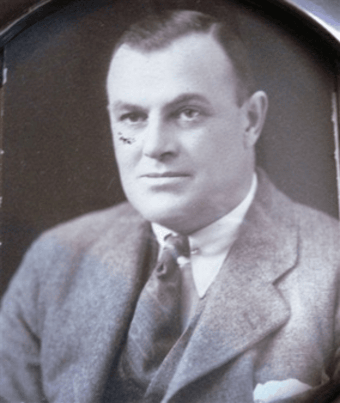
Medical Superintendent, George Bartlett
In May 1918, the War Office requested that the Institution be converted into a War Hospital, and preparations began for accommodating up to 800 wounded, however this was cancelled due to cessation of hostilities. During the War, the hospital had taken patients from Bristol, when Fishponds Asylum had been taken over for military use.
The details given about the 81 new inmates are quite interesting. In 1917-18, 20% were over 60 years old; 44% over 50; in 25% a previous attack was recorded; in 12% more than one attack had occurred; in 13% the mental defect was congenital; 55% were considered unrecoverable on admission.
The causes of admission were as follows: heredity (29), alcoholism (14) senility (15), adolescence (7), climacterium (menopause) (3), syphilis (7), stress, prolonged and sudden (12), war stress (12), cardiovascular degeneration (10), congenital defect (22), epilepsy (8), masturbation (4), organic brain disease (7), tuberculosis (8), operation (2), accident (2), and puerperium (the 6 weeks after giving birth) (3).
Many of these reasons for admission are shocking to us today, and paint a picture of just how different society was 100 years ago. We can see how unfairly women were treated in those times - not only subject to cultural and social pressures, women were deemed likely to fall prey to disorders of the mind related to their biological vulnerability and the female life cycle, marked by their susceptibility to a range of psychiatric conditions from adolescence and the establishment of menstruation, through childbearing, ageing and menopause. The condition ‘puerperal insanity’ was labelled and defined in 1820; thereafter male obstetric practitioners and psychiatrists took great interest in mental disorders linked to pregnancy and childbirth. By mid-century these conditions accounted for 10 per cent of female admissions in many asylums.
Masturbation had long been considered a cause of mental illness. John Harvey Kellogg, whose name is still famous on our cereals today, catalogued 39 different symptoms liable to affect a chronic masturbator, including general infirmity, defective development, mood swings, fickleness, bashfulness, boldness, bad posture, stiff joints, fondness for spicy foods, acne, palpitations, and epilepsy. He thought that meat and certain flavourful or seasoned foods increased sexual desire, and that plainer food, especially cereals and nuts, could curb it. He himself worked as a superintendent at a sanatorium, where he invented plain cereals for breakfast. (He also invented an enema machine that ran water through the bowel, then followed it with a pint of yogurt — half delivered through the mouth, the other half through the anus. Thankfully this didn’t catch on like Corn Flakes did!)
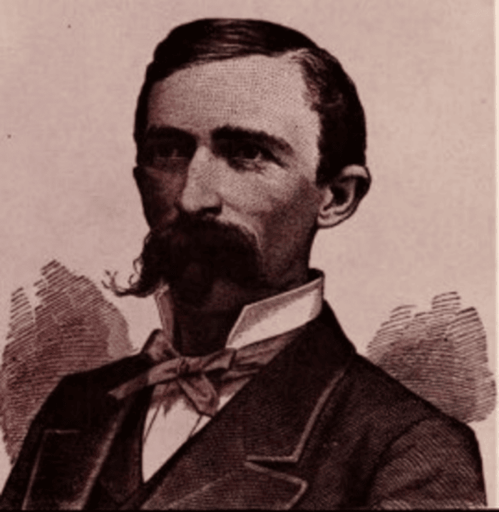
John Harvey Kellogg
9 male patients admitted had been in the Army, but only 3 had seen active service. 3 had already been discharged, 1 other showed good signs of recovery, 2 were cases of general paralysis, and the others were ‘very poor types’ and ‘weak-minded’ before joining the army. The 3 who had been on active service were classified as ‘Service Patients’ which meant they were treated as private patients; a procedure that was to apply to all soldiers and sailors admitted to asylums on their discharge, so that they would not be stigmatised as ‘pauper patients’.
The death rate was still very high. Only 44% were aged over 60 years. 24 people died from tuberculosis (only 5 of these were suffering with the disease on admission). Other deaths were from diseases of the heart (11), general paralysis (7), senile decay (10), arterial sclerosis (7), epilepsy (11), pneumonia (5), disease of the kidney (8), dysentery (6), enteric (typhoid) fever, exophthalmic goitre, peritonitis, carcinoma mammae (breast cancer), chorea (involuntary muscle movements), and cholelithiasis (gall stones).
The epidemic of typhoid fever which had commenced in July 1914 was still plaguing the institution. Nurses, 18 female patients and 5 male patients had contracted the disease since 1914.
There had been a high proportion of sickness during the year. 15 cases of dysentery occurred, and diarrhoea had been more than usually prevalent. Many of the cases admitted were in seriously impaired health, and the population contained a large number of infirm patients. The increase in TB was considered serious. The report states that ‘the cases commonly attacked belong to the adolescent dementia and stupor groups. These are usually so indifferent to the condition of themselves and of others as to be uneducable as regards the ordinary hygienic methods so essential for consumptive patients.’
One patient had committed suicide by drowning while on trial with an attendant. It transpired he had made several attempts before admission.
Serious casualties occurred in three cases: a male aged 36 precipitated himself through a window in the Recreation Hall, fracturing his skull and clavicle. A male aged 35 sustained a dislocation of his shoulder during an assault on another patient. A female aged 49 fractured her arm through a fall.
There were four escapes during the year: three were patients employed on the farm. Two were recaptured within a few hours, the third was absent all night but was recaptured the next day. The fourth escaped from the Airing Court through the negligence of a temporary attendant, and was absent all night, but was found at his home the next morning.
55% of the patients were employed, and neighbouring farms continued applying for assistance (no doubt due to a shortage of labour due to the War). Parties were sent out on 57 occasions; on a few occasions trusted men were sent without attendants (of which there was a shortage), the farmers fetching and bringing them back.
The Recreation Hall was still being used as a dormitory, but dances had been held as usual fortnightly, and the Christmas festivities were maintained as far as possible, despite the restrictions. No sports were held in the summer, but 8 cricket matches were played over the season, chiefly with local military teams.
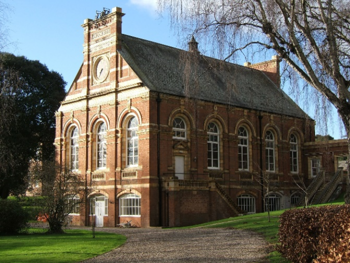
The Recreation Hall
The usual bi-weekly services in the chapel were well attended, and the Chaplain visited the wards regularly. The service for the Roman Catholic patients was held once a month as before.
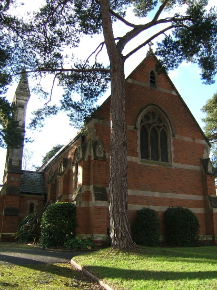
The Chapel
Like most institutions in WWI, the Asylum was clearly struggling with staffing, supplies, and the need for repairs, however A. H. Trevor, Commissioner of the Board of Control, spoke favourably of the food while inspecting:
‘The dinner today consisted of a substantial vegetable pie which was well served and looked attractive. Although the diet has necessarily been much restricted, the patients are evidently appreciative of the effort made to make their food palatable under difficult circumstances.’
Dr Bartlett held some views that would have been acceptable in 1918 but that sound like a sinister premonition of what was to come later in European history. In his report he stated that:
‘Referring to the cause of insanity, of the 101 cases admitted, … a family history of insanity was ascertained in 39 cases … . This figure would probably be higher if full histories were obtainable in every case, and if the reluctance of relatives to diverge such information could be overcome. The part that heredity undoubtedly plays in the causation of insanity cannot be too widely advertised as a warning and an education to the population as to what may be the result of the mating of unsound stocks.’
1919
By 1919, we would have hoped that things might be feeling more optimistic in Exeter Asylum, as expressed by long-term inmate Harry U, in this short poem:
‘Let’s hope the band on sports day,
Will play God save the King;
And finish with the Marseillaise,
And hear the nurses sing.’
Admitted to the asylum in 1891, in 1918 Harry was longing for familiar pre-war routines including sports day, the ripening of the orchard apples, and even the chimes of the hospital clock.
The Asylum Clock
Life had not been easy in mental institutions during the war. Most were strapped for cash, buildings had deteriorated, staff had been killed overseas, and patient mortality was incredibly high (this was blamed on quality of food, untrained temporary staff, and overcrowding preventing isolation of patients with TB and typhoid fever). Staff were under huge pressure, working up to 90 hours a week, with little leave, and often having to sleep close to inmates. Disciplinary methods for staff were harsh – you could be dismissed on the spot, and regulations were strictly enforced. There was a huge amount of resentment, and morale was low.
The National Asylum Workers’ Union (NAWU) was established in 1910. A year later Digby employees had tried to seek reduced working hours, but their request was dismissed, their work being described patronisingly as ‘not laborious or exacting’ with ‘no undue strain’. In 1914, 37 staff had again petitioned for improved working conditions, for example to have one day a week, or that patient entertainments should only be given during ‘recognised duty hours’. They received no sympathy or changes. In September 1918, the NAWU presented its ‘National Programme of Reform’ to the Asylum Officers’ Association (AOA). This was quickly followed by a series of strikes, with the Exeter City Asylum strike becoming one of the most well-known.
An early edition of 'The National Asylum Workers’ Union (NAWU) Magazine' from 1912
It began when a long-serving carpenter, Phillip G, returned from conscription and submitted a petition to Dr Bartlett for improved conditions and hours. This was refused as Dr Bartlett said his work was not up to scratch (apparently the matron had complained that he gossiped with staff when visiting the female wards). Phillip’s ‘insolent’ response to this prompted his instant dismissal, and the refusal to reinstate him after this harsh punishment prompted 42 Digby employees to strike and picket the main entrance.
Although many Exeter residents, the National Rail Union, and even some labour City Council members, supported the strikers, the Asylum Committee refused to capitulate; their attitude was ‘like granite.’ Blame was readily thrown around. At one point, it was even suggested that it was women who caused the whole crisis (the ‘young and flighty nurses’ whipping the men into a frenzy).
Eventually the Council supported the Asylum Committee and the strike was stopped. Retributions were harsh. Using ‘unnecessarily emotive language’, Bartlett drew up a list of ‘Loyal’ and ‘Strikers’ for the Committee. The strikers lost everything, including their pensions, and in some cases even their homes. They were forced to beg for their jobs back, but all requests were denied. This cringing letter from John, who had been the cow-man for 23 years, and lived in a tied cottage on the estate with his wife (who herself had accumulated 18 years of service), really demonstrates how harshly strikers were treated:
‘Will you please make an application to the Visiting Committee to accept an apology from me for leaving their service without notice. I am very sorry for what I did as I was driven to it by others. I request them to favourably consider my return to work again, considering all the circumstances under which I was.’
The Committee evicted him from his home AND pursued him for unpaid rent.
Another long-term employee, Mr G, who was married with four children to support, and who had worked in the asylum kitchen for 19 years, hoped that his War-service would help him get his job back, claiming:
‘During the whole time of the War, I did practically two men’s work, without a clear Sunday, and no annual leave taken.’
Even his wife wrote, begging on behalf of their children and times being so bad, but he was not given his job back, and they were condemned to a life of poverty.
The harsh recriminations of the Exeter City Asylum strike ruined the NAWU’s optimism. Finances prompted more public concern about asylums in general. There was much mistrust, and call for change in post-WWI Britain. This strike was the catalyst for many reforms over the coming years.
One of the most noticeable in Exeter Council meeting records is that the Asylum changed its name from Exeter City Asylum to Exeter Mental Hospital. This was indicative of the change in attitudes towards the mentally ill, paving the way for the 1930’s Mental Treatment Act, which recommended that mental illness be treated as a physical illness, and terms such as ‘lunatic’, ‘asylum’, and ‘pauper’ should be replaced by ‘mental disorder’, ‘mental hospital’, and ‘rate-aided’.
As for the years following the unrest, the controversial Medical Superintendent Bartlett left in 1920 and moved away; he was not a popular man after the strike. Some token changes were made to working conditions and pay: a 63 hour week was settled upon, and a nurse’s starting salary was set at £33 a year (about £6500 in today’s money); this included board, lodging, washing and uniform. Although the work undoubtedly remained incredibly hard, staff would not dare strike again.
'Discourses of dispute: narratives of asylum nurses and attendants, 1910-22' by Barbara Douglas (chapter 5 of the book 'Mental health nursing: The working lives of paid carers in the nineteenth and twentieth centuries'), describes the Exeter strike in great detail and is a good read.

City of Exeter Lunatic Asylum, Digby
Part 3: 1920s
Following the after-effects of the First World War: staff shortages, lack of money, and poor conditions, with strike action that had attracted a national interest, the 1920s were a time for a fresh start for the asylum, with the appointment of a new Medical Superintendent, and its new name: ‘Exeter Mental Hospital’.
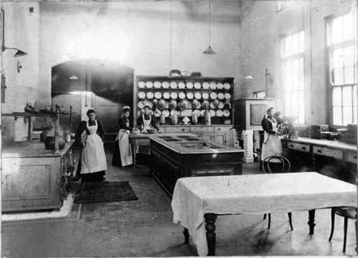
Asylum Kitchen (credit Pete Martin)
1922
In 1922 the Mental Hospital Visiting Committee had only good things to say about the state of affairs, stating that:
‘The patients, as a rule, upon discharge, testify to the kindness which they have received.’
They seemed keen to bolster the soon to be departing Dr Bartlett too, saying:
‘The Medical Superintendent has discharged his duties to the entire satisfaction of the committee, who have also to commend the conduct of the other officials of the institution.’
The reasons for admittance to the asylum included ex-soldiers presumably suffering after-effects of the War; ‘mental stress’ was given as the cause for 27 patients. Dr Bartlett frequently referred to the ‘unfavourable type’ of patients being admitted (i.e. old and in very poor health/ likely to die soon).
In 1922 there were two escapes:
‘A female patient affected her escape through the boot room at 7.20am one foggy morning, and though viewed on the farm she evaded the nurses and was not discovered until 9am. The same patient slipped away as patients were coming in from Court at noon and was able to reach Wonford, being retaken after an absence of eighty minutes.’

Medical superintendent George Bartlett
The atmosphere in the asylum seemed cheerier than it was during the War. A quarter of male patients (which Dr Bartlett calls ‘a large proportion’ although it seems small to me!) were allowed ‘on parole’ in the grounds; cricket and bowls were in full swing until 9pm in the summer. Entertainments and dances had been given as usual, and the Christmas festivities and annual fete were much enjoyed. The Topsham Cricket Club provided matches for their entertainment and three patients were able to take part in the League games. The croquet lawn was very popular and the chaplain visited wards every other week. There were bi-weekly services and monthly services for Catholics.
We don’t hear much about children in the mental hospital, but records show that they were sometimes there. Dr Bartlett happens to mention that a child was admitted from the Home of Good Shepherd, which was a home that cared for young women and girls in difficult circumstances (as a refuge or penitentiary). We do not know why the girl ended up in the mental hospital but on admittance she fell ill with Scarlet Fever. This caused a big panic and she was annexed into an unused room; when another patient fell ill, the unpleasant-sounding ‘needle room’ was made into an isolation area. This caused ‘endless anxiety’ and many comments about financial stringency meaning any attempts to isolate patients was ‘makeshift’ and dangerous.
Dr Bartlett also had much to say about the difficulties small mental hospitals faced in ‘classification’ of patients, saying:
‘recoverable cases must have close association with hopeless cases’ and referring to ‘juvenile idiots who obviously degrade the standard of any ward in which they are housed.’
He was very much representative of new ways of thinking about mental healthcare in the 1920s – Victorian asylums were starting to be thought of as not fit for purpose, with mental illness highly stigmatised, little distinction between short-term and chronic illness, and people ending up there for life.
In his report, Dr Bartlett spoke at length about the idea of ‘reception hospitals’ – small mental health units usually attached to general or district hospitals, which would aim to mainly treat patients voluntarily and in the short term. He, like many, believed that early intervention could prevent lifelong, unspecialised institutional care. These ideas would eventually lead to the 1930s Mental Treatment Act.

Logo of the Medico-Psychological Association, 1865-1927
Dr Bartlett also complained of the ‘lack of keenness’ of female staff to prepare themselves for the medico-psychological examinations, with ten males presenting themselves but only one female. For males the qualification would probably have been ‘Diploma in Psychological Medicine’ and for females the ‘MPA Certificate for Mental Nurses.’
The reason that female staff probably weren’t very keen to study for this qualification (which would typically take three years) were probably related to the inequality that gave them a really raw deal. Even if they passed the exam, opportunities for promotion or a pay rise were scarce; male staff were much more likely to be granted study leave or paid time off to prepare; there was a view that nursing was ‘natural’ for women and didn’t need advanced training; women rarely had any female role models or mentorship, and nurses especially had long, gruelling shifts with fewer breaks and support.
By October 1922, Dr Bartlett had handed in his resignation, having been appointed the post of Medical Superintendent in Derby County Mental Hospital. It is likely that his reputation never recovered after the strike action of 1918.
The Committee advertised for a new Medical Superintendent. The salary would be £700 rising to £800 per annum (£41,160 today) and would include an unfurnished house, coal, lighting, laundry, vegetables and garden produce. The person appointed should be under 45 years.
By December 1922, Dr Daniel McKinlay Reid had been appointed – it would be his first post as Medical Superintendent (he was previously Deputy at Govan District Asylum).
1923
The cost per pauper patient was reduced from 31/- week to 29/- week (£74.60 in today’s money) and the excess on the weekly charge that was paid for criminal and out of borough patients raised £1,399, which was transferred to the Buildings and Repairs Fund. The hospital was costing quite a lot in these – repairs and alterations amounted to £2,207 (£113,554 today). This included external painting and finally the installation of two boilers. A fitted hand-basin was recommended to be installed near to the lavatories ‘toward the promotion of the general health.’
The effects of the war were still being felt. One of the principal causative factors for admission was given as mental stress (bereavement worry about physical health, strain of War service, unemployment, etc).
A later comment about allowance from the Inspector gives an insight into the state of some of these men:
‘Nine service patients receive the weekly allowance of 2s 6d in money which they spend themselves, one has extra comforts obtained for him, one is unable to appreciate or benefit from it, and one refuses to draw it.’
Senility, climacterium (menopause), alcoholic excess and epilepsy were given as other reasons.
‘Defective heredity’ was found in 27 percent of the cases. 9 patients were discharged as ‘relieved’. The principal causes of the 25 deaths were: valvular or muscular disease of the heart (7), cerebral haemorrhage (3), phthisis, epilepsy and influenza. Only 5 were autopsied.
Two inquests were held, one for a female patient who died from a fracture of the skull just two weeks after admission, and a female who died suddenly from ‘rupture of the heart’ following a seizure. One operation mentioned, was of the amputation of the left arm of a female patient who was suffering from tuberculosis of the elbow (skeletal TB, where the bacteria enter the elbow joint).
Only one escape was recorded – a female escaped whilst with a walking party, eluding the nurses and making her escape for 6.5 hours, before being recovered at a house in Pinhoe.
Although health was considered to be satisfactory, the superintendent mentioned that:
‘For over three years there has been endemic among the female patients a group of skin diseases (having scabies undoubtedly as its origin) and despite much investigation and labour many patients are still affected. This I have regarded with a good deal of concern. On account of it, proper segregation, from the mental point of view, has often been impossible, and from the financial point of view, the cost incurred through extra laundry work must have been considerable. Again, patients’ friends often look with feelings of disgust upon skin disease of any kind, and because of this there is always the probability that private patients may be removed elsewhere. I need not say that much tact has to be exercised in dealing with enquiries regarding these conditions.’
Generally, patients were encouraged to work when possible. ‘Drifting’ was prevented by engaging patients in small tasks. Parole to visit friends, or attend amusements in the city, was granted to a small number of ‘reliable men’. Recreations and amusements were carried out: in the winter there were dances, several cinematograph exhibitions and Christmas celebrations. The Annual Fete was favoured with good weather and enjoyed by all, a tennis court had been completed and made use of by the female patients and Topsham Cricket Club continued to play matches in the grounds.
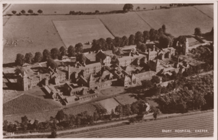
Digby Hospital
Clothing was described as ‘well-fitting suits, made of superior quality brown cloth’ by the inspector, but he observed that the males were not given night shirts. The superintendent said that they were trying to stop using corduroy and it seems the aim was for patients to be provided with dresses or suits individually made for each patient, to allow them to retain them and their boots on removal from one ward to another.
Food was considered to be improving after the privations of the War. The inspector said:
‘I saw an excellent dinner served to the men in their wards today which consisted of meat pie, with vegetables, followed by fruit pudding; this provided an ample meal which satisfied the men; the tables were neatly laid, the men took their meal in a quiet and well-ordered manner and the food provided was nicely served.
The diet generally is liberal and varied, the menu being revised each week, extras such as porridge, fish, bacon etc are given daily at breakfast; a second course is provided for dinner and cake or jam issued for tea on four days a week. A light supper of bread and cheese with coffee us allowed to those in the sitting up party.’
1924
This year some of the works carried out give us a nice picture into the different areas of the asylum. Works carried out included:
- Installation of a Thresh disinfector in the laundry
- Alterations of windows (from bars to sash)
- Provision of wash basins in lavatories
- Erection of piggeries
- Resurfacing and tarring roads and courts
- Repairs to greenhouse
- Repointing portions of South Front
- Alterations to cowshed floor
- Painting
- Overhauling and Repainting Water Storage Tanks
- Borrowing of £2000 to build two dwelling houses for Clerk and Steward and Head Attendant
- Purchasing a fire escape from Merryweather & Sons for £115
Although the farm and garden were profitable, there was a shortage of male patients to work on them, so efforts had been made to get men boarded out from other mental hospitals. So far this had not been successful.
Efforts had also been made to provide patients with suits and dresses that were ‘less of an Institution pattern’. Underclothing too was gradually being replaced by a type ‘less antiquated and shapeless than hitherto provided.’
The Superintendent said that most were able to appreciate the difference between being well and badly dressed, and that this may even contribute to recovery rates. This ‘of course’ applied more to women, and great effort had been made to please them with garment and colour, but …
‘… unfortunately the physical disabilities that so often accompany insanity tend to mitigate against the desired result.’
The death rate was fairly low this year, but these inquests were held:
‘E.A. who died on 5th January, through a fall causing an abrasion of the forehead, which became septic through his having boils on the body and through his restless and dirty habits.’
‘F.S. who died on 26th December, death having resulted from fractures of both bones of the right leg and bruising of the back.’
This casualty also sounded unpleasant:
‘A fracture – dislocation of the left elbow in a Private Patient, caused by her being pushed down in the Airing Court by another Patient.’
There were three escapees – one female (8.5 days!), two males (37 hours and 30 hours).
Throughout the winter a dance or cinematograph display was held almost every week. The nursing staff, Matron and Miss Webb gave a concert in March which was successful and it was hoped would become an annual event.
More female staff were now studying for and obtaining the Medico-Psychological Certificate which seemed to be becoming a requirement for working in the asylum.
1927
In addition to the Mental Hospital Committee, the books contain some occasionally interesting notes from Exeter Mental Deficiency Committee. This committee would have been formed in 1913, under the Mental Deficiency Act, which required all councils to have a committee to ‘assess, supervise and make placements for individuals deemed mentally deficient.’
The minutes this year included details of individuals to be detained in the workhouse (now called the ‘Poor Law Institution’) and also of ‘A.B’ who had got married. The committee resolved that:
‘In the view of the Committee, knowingly contracting marriage with a certified mental defective should be made a penal offence.’
Meanwhile at the Mental Hospitals, numbers had increased to 345 and the hospital was actually making a profit (£1305, 2s. 2d. [about £90,000 in today’s money]). A cinematograph was installed. The apparatus was to be worked by Mr Willcocks, and suitable films were to be obtained on hire from Pathe Freres Cinema Co.
The superintendent was pleased to say that:
‘The time has passed when it was thought necessary to restrain patients within the walls of their wards until discharge was given them. Nowadays much greater freedom is allowed, and, even though an occasional risk is taken, I am sure this a sound policy. It often speeds recovery and for those of a more chronic type it makes for greater happiness or content. 65 patients have parole within or beyond the grounds and during the year 43 have been permitted daily or (more frequently) weekend leave with relatives.’
He reported that the year was a good one for livestock and crops, giving insight into the Mental Hospital Farm:
‘Barley and hay were well harvested and the yield of potatoes and mangolds (a type of root vegetable grown primarily as animal fodder) was heavy, the former being of excellent quality. Many new apple trees and fruit bushes were planted. The supply of milk was well maintained, and it was found possible to issue it frequently to patients at dinner. Despite the fact that the herd has been subjected regularly to the Tuberculin test, two cows developed Tuberculosis and had to be destroyed. Further misadventure occurred when a cow died of Anthrax, and when owing to an outbreak of Swine Fever in a litter of young pigs it was necessary to slaughter the whole stock.’
The Report of the Royal Commission on Lunacy and Mental Disorder had come out in 1926 and was described as ‘an event outstanding in the history of the treatment of the insane’ by Dr McKinlay Reid. This report really represented the evolving attitudes towards mental health that we see reflected over recent years in the minutes of the Exeter Mental Hospital, as well as national feeling.
The report recommended:
- That mental illness was a medical condition, to be viewed and treated as a physical illness – moving away from the legal/custodial framing of ‘lunacy’
- Early intervention and voluntary admission to mental hospitals rather than forced detention or waiting for certification to be able to treat someone.
- More community care and integration of services rather than relying on large asylums.
In Exeter there was a rise in patients attending the Mental Clinic at the Exeter Dispensary (located at 26 Queen Street with a resident dispenser). Dr Reid spoke positively about the Mental Clinic:
‘Certain prejudices concerning institutions are disappearing, and general practitioners take fuller advantage of the facilities offered for advice and treatment. The fact that through its agency it is more possible to keep in touch with patients out on trial from the County and City Mental Hospitals is alone almost a justification for its inception.’
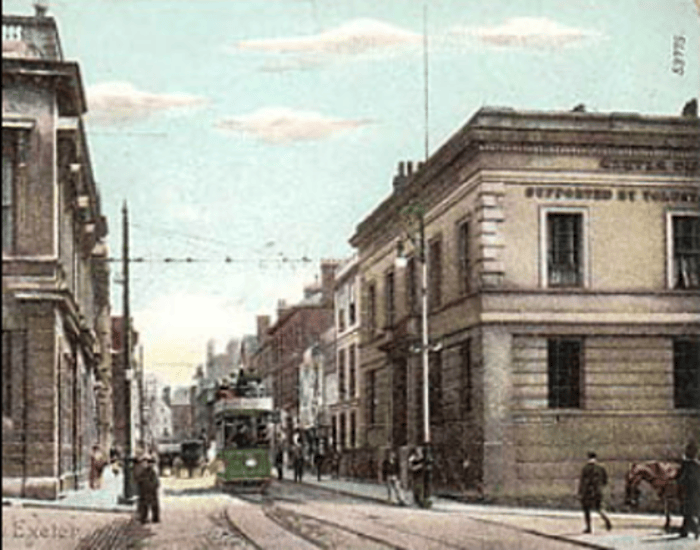
Exeter Dispensary, 26 Queen Street (on the right)
There were two inspections of the hospital in 1927. They reported:
‘The day being bright nearly all the patients were in the ward gardens, and some of the men were amusing themselves by playing clock golf. Instructions were given today for the croquet lawn to be mown and the hoops set out on the female side.
I was most favourably struck by the obvious friendly relations between the patients and the medical and nursing staff.
The day-rooms were well supplied with plants and flowers; the bookshelves were well filled, and there was a good supply everywhere of daily papers, picture papers, and magazines.
I saw a nice dinner being served of boiled fish and white sauce, potatoes and leeks, and jam tart. Although I was told that fried fish is the more popular fish dinner, today’s meal seemed to be appreciated.
Those seen were neat and clean in person and dress, each man having two lounge suits, and personal underclothing of good quality; all are provided with overcoats, night shirts, and toothbrushes.
The Committee have installed a wireless set, capable of carrying five loudspeakers, for the entertainment of the patients.’
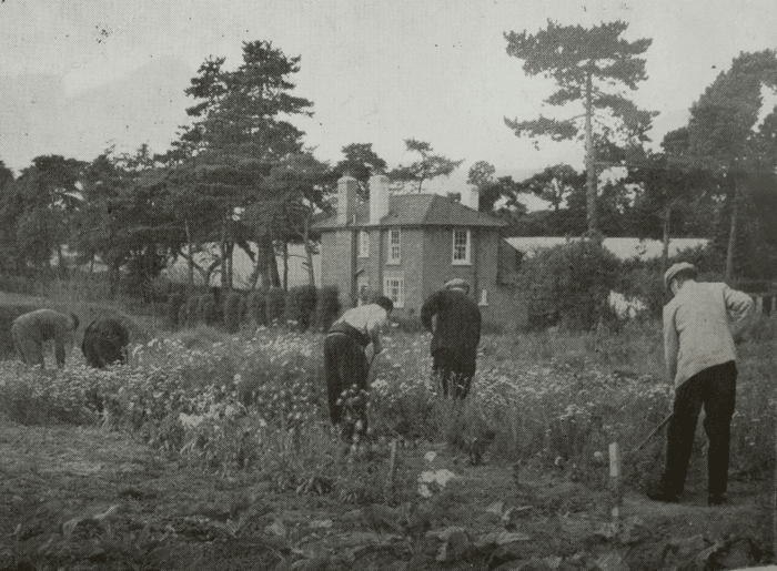
Patients gardening in Digby grounds. Photo courtesy of Tom Fairfax
1929
This year more technology entered the Mental Hospital: electric cooking equipment comprising oven range, fish fryer (capable of dealing with all required for patients and staff), a boiling table (like a flat stove top designed for mass catering of soups, pots, etc), and grill.
The inspector stated that ‘trial’ had been allowed to 18 patients, and in 3 instances money allowances were made. He asked the Committee to ‘consider the advisability of making use of their powers in this respect when granting trial.’
This year there was a large influenza outbreak, affecting 82 patients and 18 members of staff.
General paralysis (GPI) was a late-stage manifestation of untreated syphilis, affecting the brain. It caused delusions, mood swings, memory loss, seizures and eventually paralysis and death.
In 1917, Dr Julius Wagner-Jauregg introduced malaria inoculation as a treatment for GPI. The theory was that the high fevers could kill or weaken the syphilitic bacteria. Patients would be deliberately injected with malaria, then after a few fever cycles, given quinine to kill the malaria parasite.
Despite showing some effectiveness in many patients, this treatment obviously came with serious risks: death from malaria (5-20%), organ failure, or persistent malaria. Many of the patients would not be able to give informed consent.
Despite this, patients at Exeter Mental Hospital were given this treatment, the inspector boasting:
‘The treatment of general paralysis by induced malaria has been adopted at this hospital in cases which are considered suitable, and so far the opinion formed is favourable.’

Dr Julius Wagner-Jauregg
A report on 10 service patients was interesting but sad. All had a complete outfit of clothing for personal wear, including two or three suits made of good quality tweed clothes, and their neat, clean, and well-dressed appearance suggested they were very well attended.
One patient, owing to his mental state, was unable to benefit from pocket money, and one refused to claim it. The others received 2/6 week with which they bought their comforts when out with shopping parties.
Service patients received a special diet (along with the private patients). This included a variety of extras for the morning and evening meals, and a second course at dinner throughout the week.
All but one were expected to be in the institution permanently.
A very sad request came from one service patient. It makes you wonder how he must’ve felt having fought in the war. The patient stated:
‘I haven't been visited during the past six or seven years, and am anxious to see my relatives. Dr Reid is arranging for them to be notified of my wish to see them.’
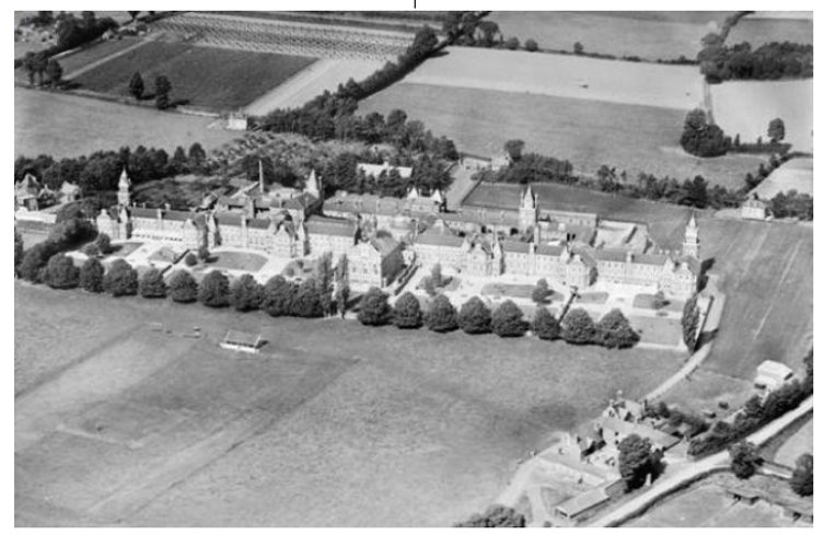
Digby Asylum 1928 (photo from Britain from Above)
Heavitree And Infectious Diseases
The Government-imposed national lockdown of Spring 2020, in response to the global COVID-19 pandemic, was a challenging time for everyone; it was certainly the first major disruption to everyday life experienced since World War II. Every person will have been affected differently by the restrictions: for some it will have been the longest period spent in Heavitree without leaving the area; some may have felt increasingly isolated and lonely, desperate for a change of scene, their wellbeing going downhill as time wore on; some may have used the time to do the jobs they never seemed to get around to; others may have taken up a new hobby, or discovered new things such as walks, wildlife, or historical facts; a few may even have paused to wonder what Heavitree might have been like in previous times of infectious diseases, epidemics, or pandemics.
Leprosy
Leprosy would have been a regular feature of life in Exeter and the rest of the country by 1050. The disease is a long-term bacterial infection that leads to damage of nerves, skin, eyes, and the respiratory tract, and deformity or loss of limbs.
The social perception of Leprosy in medieval communities was generally one of fear, and people infected with the disease were thought to be unclean, untrustworthy, and morally corrupt. Segregation from mainstream society was common, and people with Leprosy were often required to wear clothing that identified them as such or carry a bell announcing their presence.

Map from 1805 showing Magdalen Hospital (Image courtesy of Exeter Memories)
Leper hospitals were situated on the outskirts of towns. The clue to where Exeter’s main leper hospital (there were also many smaller ones) was located is in the name ‘Magdalen Road’. Many leper houses were dedicated to Mary Magdalen, probably because of her supposed brother Lazarus (described in the Bible as, ‘a beggar full of sores’); a shortened form of his name (Lazar) came to mean Leprosy. Others claim it was because of the association between her and sexual excess and prostitution, which were incorrectly associated with Leprosy.
According to ‘Exeter Memories’:
‘The Magdalen Hospital was situated in Bull Meadow and consisted of a quadrangle with a chapel on one side and small buildings to house the inmates on the other three. Inmates were confined to the hospital and could be punished with a stint in the stocks if found wandering in the city.’
For a while, lepers were permitted to collect alms door to door and claim tolls on corn, but after this was forbidden, they were reliant on charity and bequests from Exeter residents.
As Leprosy began to disappear (there were still cases being recorded in 1530), the hospital was used to house the poor; it was demolished in the middle of the 19th century. Only the name ‘Magdalen Road’ remains, reminding us of these poor people’s fate.
The ‘Historic England’ website reveals another lasting effect:
“The impact of Leprosy lived on - it had brought about an institutional response to disability in the form of buildings and methods of care which would strongly influence future generations.”
The Black Death
Like the rest of the country, Exeter was devastated by the Black Death, which we think (like COVID-19) came from China; it lost 1900 out of 3000 of its inhabitants.
The Italian poet Giovanni Boccaccio wrote:
“At the beginning of the malady, certain swellings, either on the groin or under the armpits … waxed to the bigness of a common apple, others to the size of an egg, some more and some less, and these the vulgar named plague-boils. Blood and pus seeped out of these strange swellings, which were followed by a host of other unpleasant symptoms — fever, chills, vomiting, diarrhoea, terrible aches and pains — and then, in short order, death.”

Image depicting individuals suffering from the Black Death
The Black Death, which was initially spread by rats, was very infectious and could be caught from respiration or from contact with an infected person. People who were perfectly healthy when they went to bed at night could be dead by morning. At the time, nobody knew how it was spread.
One doctor from the time said:
“Instantaneous death occurs when the aerial spirit escaping from the eyes of the sick man strikes the healthy person standing near and looking at the sick.”
Most people believed that the Black Death was God showing his anger at man – almost clearing the earth with a second great flood. It must have been terrifying. People sometimes even abandoned their sick or dying loved ones, because they were so afraid of catching it.
Ian Mortimer’s novel ‘The Outcasts of Time’ describes two brothers walking from Honiton to St Sidwells, Exeter, via Heavitree, at the time of the Black Death of 1348. The scene Mortimer paints shows us how times must have felt almost apocalyptic to people who lived in the village of Heavitree and the nearest city, Exeter – houses with their shutters closed, corpses everywhere, mass graves being dug:
“Death is all around us. I see it in the windows whose shutters remain open when dusk comes, and in the shutters that remain closed of a morning. I see it also in the unguided progress of a boat that floats down a river with the occupant slumped over the side, bumping into banks and quays. … In a few areas the crops lie unharvested, crumpled, and black, but in most places the disease struck after the grain was taken in. Less reassuringly, the fields are empty, devoid of workers. At dusk we are a mile from Exeter. More travellers approach – dark characters in ones and twos, shielding their faces with their hoods. A couple more carts come towards us. All these people are like shadows fleeing the city: wraiths of traders and merchants. But none of them are what you would call the naked poor, travelling on foot. The impoverished are staying behind – either to loot the houses of the rich or because they have nowhere else to go.”
This flight from the cities did not save people from the Black Death (although it did a good job of spreading it!), and farm animals could also be infected and die from it. It is interesting to note that during the current pandemic, moving from the city to the countryside and working remotely has become more popular, according to estate agents.

It was widely believed that the Black death was God showing his anger toward man
In Heavitree, the Black Death caused the death of two, if not three, vicars. Henry de Chippenham, who had held the post for less than a year, was succeeded early in 1349 by Walter Bers, who was himself followed by Adam de Kellesye. The date of institution of his successor, John Lisle, is not recorded, which suggests that Kellesye also may have died during the period of disorganisation caused by the Black Death. The higher death rate among the clergy may have left people doubting the church as an institution, especially as it was the church itself that had given the cause of the Black Death to be the impropriety of the behaviour of men. These holy men had been seen as God’s envoys on earth but were not immune to his punishment. This change in perspective would have sown seeds for The Reformation in years to come.
Heavitree and Exeter would have felt many other effects of the Black Death, for many years after – most directly via the huge shortage of labour brought about by such a reduction in workforce. This eventually led to wage increases, the abolition of serfdom, and the development of family surnames for the lower classes. Like today, the arts and culture suffered badly, for example a shortage of labour led to a halt in building Exeter Cathedral.
The Black Death never really went away completely returning to Devon several times over the next 300 years. Fatal pestilences are recorded to have happened in Exeter in 1378, 1398, 1438, 1479, 1503, 1546, 1569, 1590, 1603, 1624 and in 1625, more than 2000 people died. Although some of the suggestions for causes of, and cures for, COVID-19 have been extreme (5G and injecting bleach, anyone?), in the 17th century, people still mostly believed that the Black Death was a punishment from God; they tried everything from fasting to eating frogs’ legs, purchasing powdered ‘unicorn horn’, or rubbing a recently killed pigeon to buboes!
Sweating Sickness
The mysterious Sweating Sickness is thought to have spread from Henry VII's army after it landed at Milford Haven in Wales on 7th August 1485.
One commentator at the time described it as:
“A newe Kynde of sickness came through the whole region, which was so sore, so peynfull, and sharp, that the lyke was never harde of to any mannes rememberance before that tyme."

Image depicting an individual suffering from Sweating Sickness
Whereas other epidemics were typically urban and long-lasting, cases of Sweating Sickness spiked and receded very quickly, and heavily affected rural populations. 443 people died of the disease in Tiverton – a huge chunk of the town’s population. There is no record of its effect on Heavitree or Exeter, but it is likely to have been very fatal. Giddiness, headache and severe pains in the neck, shoulders and limbs occurred, followed by an intense sense of heat, headaches and delirium, a rapid pulse and intense thirst. Heart palpitations and chest pains were also common. Patients then had a strong urge to sleep, with many claiming that if the patient did doze off, they would seldom wake up again. It was particularly noteworthy for its speed – patients were often dead within three to twelve hours. Like COVID-19, people could catch it more than once.
Smallpox
Europe was struck by its first Smallpox epidemic in 1614; the frequency of epidemics rose during the century. After 1666, it replaced the Black Death as the most feared disease. By the early 18th century, Smallpox was a major cause of death in the British Isles.
The city was certainly subject to sudden outbreaks of the disease:
“The small-pox was very prevalent at Exeter in 1777, when out of 1850 who had it in the natural way, 285, rather more than one in seven, died of that fatal distemper.” (Magna Britannia, Vol 6)
‘Exeter Memories’ tells us that in 1871 there were plans to build a Smallpox Hospital in Polsloe Road, Heavitree, which did not impress the locals.
It does seem likely that, unlike in the North of the country, Smallpox was not endemic in the population of the South-West. This is thought to be because local parishes were much better at containing and isolating the virus. Those infected would often be sent to ‘pest-houses’, away from the rest of the population. Not many children would have had Smallpox, which would have meant fewer deaths, but a huge vulnerability when visitors arrived, or for anyone from Heavitree travelling to an area where Smallpox was rife.
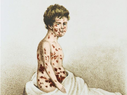
Image depicting an individual suffering from Smallpox
There was indeed much to fear from the infection. Three to four days after developing a fever, the characteristic pus-filled pocks would appear. They were extremely painful and would burst easily, giving off a foul odour.
The historian Thomas Macaulay describes it vividly:
“Always present, filling the churchyard with corpses, tormenting with constant fear all whom it had not yet stricken, leaving on those whose lives it spared the hideous traces of its power, turning the babe into a changeling at which the mother shuddered, and making the eyes and cheeks of the betrothed maiden objects of horror to the lover.”
During the 20th century, Smallpox was responsible for 300-400 million deaths, and in 1967 the World Health Organisation (WHO) estimated that around 15 million people had the disease and 2 million died in that year.
Fortunately, after various vaccination campaigns during the 19th and 20th centuries, Smallpox was considered to be globally eradicated in 1979 by the WHO.
Cholera

A riot at a Cholera burial in the Southernhay or Trinity burial yard (Image courtesy of Exeter Memories)
One pandemic that almost certainly would have contributed to the growth of Heavitree, was the Cholera outbreak of 1832. Officials were not sure how Cholera spread, and so many rules were put in place for disposal of bodies, clothes, and bedding, isolating patients, etc. The city spent a fortune supplying everybody with a ‘flannel belt’, thought to prevent the Cholera by keeping one’s stomach warm! People were frightened because they didn’t know the cause of the disease, which was later found to be spread via water. Paranoia, drunkenness, and lawlessness were rife, and just like in today’s pandemic, there were some who believed that the whole epidemic was a conspiracy. The city carefully recorded the number of cases, as we do today.

Heavitree seemed clean in comparison to the squalid conditions in the West Quarter
Since the outbreak was happening in the city (at its worst in the poor, crowded West Quarter), many people believed that quality of air had something to do with it, and Heavitree was thought of as a healthy place to live. It was marketed for its clean air, which attracted rich and poor alike. In 1801 the population was still just 833, but by 1901 this had risen sharply to 7529. The Cholera epidemic changed much about the city but also contributed towards Heavitree becoming a much more populous area.
Syphilis
Syphilis was the first disease to be widely recognized as a sexually transmitted disease, and was taken as indicative of the moral state of the people in which it was found.
“The disease started with genital ulcers, then progressed to a fever, general rash, and joint and muscle pains, then weeks or months later were followed by large, painful and foul-smelling abscesses and sores, or pocks, all over the body. Muscles and bones became painful, especially at night. The sores became ulcers that could eat into bones and destroy the nose, lips, and eyes. They often extended into the mouth and throat, and sometimes early death occurred. It appears from descriptions by scholars, and from woodcut drawings at the time, that the disease was much more severe than the Syphilis of today, with a higher and more rapid mortality and was more easily spread, possibly because it was a new disease, and the population had no immunity against it.” (John Frith)

Image depicting individuals suffering from Syphilis
We don’t know how many people suffered from Syphilis in Heavitree or Exeter, but it certainly would have been present in the population. Indeed, in August 2020 it was reported that there has been a 400% increase in Syphilis diagnosis in Exeter in the past twelve months! Luckily, we have antibiotics these days so won’t see anyone with a metal nose, or being subjected to blood-letting, swallowing mercury or baths in wine (the latter doesn’t sound so bad!).
Measles
In 1907, Measles, an airborne and extremely contagious virus, was mentioned in Heavitree School log:
“18th July 1907: cases of Measles increasing - school closed for the Summer Holidays two weeks earlier than fixed.”

Image depicting an individual suffering from Measles
Like COVID-19, Measles is usually spread through droplets in the air created when someone coughs or sneezes, and again like COVID-19 one could infect others before showing any symptoms oneself. Between roughly 1855 and 2005, Measles has been estimated to have killed about 200 million people worldwide, and 7 to 8 million children worldwide are thought to have died from Measles each year before the vaccine was introduced. In 1968 this vaccine almost eradicated Measles, along with Polio, Diphtheria, Tetanus, Whooping Cough, Mumps, and Rubella (although cases are now growing again as fewer people are vaccinated). Almost all children living in Heavitree up until the vaccine was introduced would expect to get Measles at some point, and it was one of the leading causes of death for under fives.
Tuberculosis
Tuberculosis (TB) is caused by a type of bacterium called Mycobacterium Tuberculosis. It is spread when a person with active TB disease in their lungs coughs or sneezes and someone else inhales the expelled droplets containing TB bacteria. Mortality from Tuberculosis was colossal: 1 of every 4 deaths recorded in parish registries from England at the end of the 18th century was attributed to the disease.

The Sanatorium, Whipton Isolation Hospital (Image courtesy of Exeter Memories)
In the same way that Measles devastated many families, bacterial TB would have affected young and old in Heavitree. Many Heavitree residents will remember the TB Sanatorium at Whipton Isolation Hospital and Honeylands Sanatorium. The latter was donated by the Wills family (ironically made rich by the tobacco industry) for children suffering from TB and other infectious illnesses like Diphtheria and Scarlet Fever. At this time, Heavitree would have had its own separate hospitals, and of course, Whipton fell within the Heavitree boundary.

Honeylands House
Some former patients shared their memories on the 'Exeter Memories' page. The sheer number of people, often children, who spent long periods in isolation, suffering from one of these horrible infectious diseases, is very striking:
“I was in the isolation hospital with scarlet fever 68 years ago, for a month, wasn't allowed visitors, could only talk to family through the window (it was closed of course), bit traumatic for a 10 year old.”
“My dad died of TB at Whipton Isolation Hospital 1956 - I was nine years old and he was 34 years old. We weren’t allowed to see him, so I used wave to him from Whipton Barton Road. They used to push the beds out onto the veranda as they believed fresh air was a cure.”
“I have many memories of my time there. I remember there were two matrons, one was called Matron Hutty, the other was Matron Jones; our school teacher was Miss Daw. We were treated very well and were allowed one visit a week on Sunday. My mother never missed a visit, even in the hardest of weather. Food was still rationed, but she always brought me something. A comic was always welcomed, plus an egg with my name written on it for my tea. We had lessons from 9:30 ‘til 11:30, then had our dinner, followed by an hour on a rest-bed in the conservatory. We had to lay on our backs and not move - the teacher sat in a high chair watching over us. I was the youngest of five. My mum walked all the way from St Thomas many times because she never had enough money for the bus fare. She was made of strong stuff; she gave her all. Sometimes my sister came with her. I remember well they came together to tell me my dad had died.”
“My dad was there with Diphtheria for about 3 months and wasn’t supposed to survive. The sister had to wrap him up in a blanket and take him to another part of the hospital where he was going die!! He pulled through but he had to leave his toy aeroplane behind that he had had for his birthday!!”
“I was there with scarlet fever Feb 1952 aged 7. The worst things were the injections in the backside. As I remember it, my folks had to stand on chairs and as you say talk through the outside window.”
“I was there at 7 years old in the isolation ward with scarlet fever. My mum could visit me by looking through a little window in the door. Talk about being isolated, and in there for over 6 weeks!!! Horrible experience but necessary to contain the fever from the public.”
“My mother was at the Whipton Isolation Hospital with Diphtheria ... probably 1920 at age 8? ... Her family travelled by tram to Polsloe Bridge from St Thomas and then walked ... but they could only see each other through the window. She was there again ... in 2003 ... in a 'new' recovery unit and fascinated the staff with her memory of being a young patient there.”
“TB was as feared then as Cancer is today.”
“During World War II, I had "Scarlet Fever" at age 5/6. In later years, I was told how lucky I was as my 8 year old cousin had died of it at Whipton Isolation Hospital. A 'Fumigation Wagon' came to sanitise the house! The outbreak must have been serious at the time.”
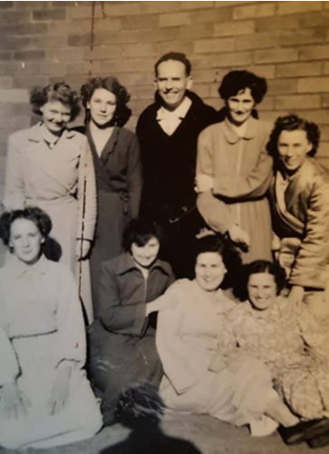
TB patients in their dressing gowns at Whipton Hospital 1952 (Image courtesy of Lynne Maclean, whose mother, a long-term patient, is included)
It wasn’t until the mid-1950s that the BCG vaccine started to be given to school children, and this, in combination with a better quality of life, and antibiotics and other drugs, meant that the disease was virtually wiped out in the UK.
tballiance.org describes the current TB pandemic in depressing terms:
“Tuberculosis is a pandemic, a global disease, found in every country in the world. It is the leading infectious cause of death worldwide. The World Health Organization estimates that 1.8 billion people — close to one quarter of the world's population — are infected with Mycobacterium tuberculosis, the bacteria that causes TB. Last year, 10 million fell ill from TB and 1.4 million died. TB is an airborne disease that can be spread by coughing or sneezing, and is the leading cause of infectious disease worldwide. It is responsible for economic devastation and the cycle of poverty and illness that entraps families, communities, and even entire countries. Among the most vulnerable are women, children, and those with HIV / AIDS. There is growing resistance to available drugs, which means the disease is becoming more deadly and difficult to treat. There were more than half a million cases of drug resistant TB last year.”
Spanish Flu

Newspaper image emphasising the gravity of Spanish Flu
The devastating Spanish Flu pandemic of 1918 left its mark on Heavitree. Although previous Flu epidemics would have affected people in Devon very badly, this particular outbreak would have felt a lot like today’s COVID-19, but even more deadly. The population was already reeling from the huge losses suffered in World War I.
Todd Gray describes how:
“In 1918, the Spanish Flu disrupted society by closing schools and shops. There was a shortage of healthy adults able to work, public transport services were curtailed, cinemas were closed to children and soldiers, visitors were barred to military barracks and hospital wards, and public events were cancelled. At the time, it was not initially understood that younger adults, and particularly expectant mothers, were more susceptible to the new form of Influenza. Death was often rapid: an individual apparently in good health in the morning could fall ill and die by the evening. One young Devon woman threw herself out of an upstairs window after contracting Flu. Local people were shocked by reports of ‘alarming proportions’ of the populations of towns being ill.”

Public Notice of restrictions to impede the spread of Spanish Flu
Newspapers of the time read much like our newspapers today, with daily death tolls and statistics. 'Exeter Memories' contains an excellent collection of articles from Exeter newspapers from 1918 – Influenza dominates the news, as COVID-19 does today.
Exeter and Plymouth Gazette - Saturday 28th December 1918:
“From November 9th to December 7th, 158 deaths were registered in Exeter, 49 of which were due to influenza and its complications."
Western Times - Wednesday 9th October 1918:
“Owing to the large number of both teachers and scholars away from the Elementary Schools of Exeter because Influenza, the Education Committee have decided to close the whole of the schools for a fortnight, as from Monday evening October 21st. In some of the schools, 50% of the teachers were laid up last week. Over 30 of the students of the Exeter University College have also been added to the local Flu victims, but the classes there are being continued as usual. Meanwhile, the medical faculty of the city are being kept exceptionally busy, and cases not only of the Flu, but of Pneumonia, have been very frequent in the city during the treacherous weather of the last fortnight."
Western Times - Monday 18th November 1918:
“Influenza's Toll at Exeter:
It was reported to Exeter Sanitary Committee at their meeting last week that, during September there were 79 births and 58 deaths, and during October 98 births and 188 deaths, being 11.38 and 42.76 per 1,000 respectively as against 11.57 and 27.42 in the larger towns. The deaths included 12 from Tuberculosis, 10 from Cancer, and 114 from Influenza and Pneumonia; 8 deaths occurred at public institutions. The Medical Officer reported that from 21st September to 2nd November 216 deaths were registered the city, 127 of which were probably due to Influenza and its complications; 53 were males and 74 females."
Exeter and Plymouth Gazette - Saturday 9th November 1918:
“The medical authorities tell that such a visitation (Influenza) has no sort of connection with the war but recurs at odd and long intervals. Some off us will, nevertheless, continue to 'hae our doots'. It seems fairly reasonable that we have a few million corpses under a few inches of earth, with all sorts of drainage complications, and the rough-and-ready improvised sanitary arrangements for armies numbering tens of millions of men, without paying some the general state of health. All soldiers that I know are convinced that the so-called Influenza epidemic is directly due to the war conditions, and there will eventually prove be truth in the general theory. A more difficult question upon which expert opinion differs, is the possible effects of constantly, and for long periods, drenching whole areas of France and Belgium with powerful and enduring poison gas."

Women wearing face-coverings to impede the spread of Spanish Flu
Even when researching the history of my previous house in Regent Square, the family living there at the time had lost family members to the Flu, including their 8 year old son. The Spanish Flu is estimated to have killed around 50 million people worldwide and did not pass Heavitree by. If you were living in Heavitree around this time, it is unlikely your life would have been untouched by the virus.
COVID-19
It is believed that the COVID-19 pandemic of 2020 originated in China in late 2019. Just as the mass movement of troops at the end of World War I promoted the spread of Spanish Flu, so today’s world of regular international travel for work and leisure caused the virus to reach most areas of the world at an alarming rate.
The symptoms of the virus - a high temperature, a persistent cough, and a change in smell or taste - took up to 7 days to emerge once you caught it. There were those, mainly the elderly or those with pre-existing respiratory illnesses, that were severely affected, often to the point of death. As knowledge of the virus grew, it emerged that there were a good percentage who showed no symptoms – these were the problematic ones as they were going about their daily lives unwittingly spreading the virus to others. This led to a great fear of the virus by most, especially as its symptoms were so similar to those of the common cold and Flu.
Countries were ill-prepared to deal with a virus they knew little about, yet which was spreading like wildfire. Fearing catastrophic effects, the only way to deal with the problem in the short-term, until longer-term strategies could be devised and implemented, was to impose severe restrictions on movement and mixing, with distancing required where mixing was unavoidable. Lockdown was essential at whatever cost.
By late March 2020, Heavitree, along with the rest of the country, was under national lockdown, in a bid to slow the spread of the virus and ensure health services would be able to cope and provide a service for the most needy. Schools, pubs, restaurants and cafés, places of worship, leisure centres, and all non-essential shops and businesses were closed. Travel was only permitted for essential work, the Government encouraging people to work from home where possible, to minimise mixing and the use of public transport. Many non-essential employers took advantage of a Government furlough scheme that allowed them to retain their workforce until they re-opened. Overnight things just ground to a halt as most people stayed inside with no need to go out. Everyone was however encouraged to leave the house for a short time once a day for local exercise and to stay sane, as long as they kept their distance from others and thoroughly washed their hands on return.
A few things that stood out in Heavitree during lockdown:
- At essential shops, there were empty shelves due to panic-buying of critical items; long queues built up due to the need to keep a minimum of 2m apart at all times; floor-markings, one-way systems, and one-in, one-out rules to enforce distancing; people wearing masks over nose and mouth.
- Fore Street Heavitree had probably not been as quiet for more than 100 years. One could stand in the middle of a normally extremely busy road and take a photograph!
- Due to the proximity of Exeter airport, there had always been a continual passing of aircraft in Heavitree’s skies. For most of the lockdown, the skies were near silent and vapour-trail free.
- Walking around the deserted streets of Heavitree, the main thing that stood out were the rainbows in people’s windows, often accompanied by messages of hope and gratitude to the NHS, and pavements covered in children’s chalk drawings.
- It became quite popular to leave a ‘free box’ outside one’s house. With charity shops closed, people left their unwanted items outside for other to help themselves.
The negative side of this was that the recycling areas, in which clothing donation bins were clearly closed due to the virus, were absolutely covered in bags of clothing and piles of unwanted shoes, all destined for landfill - an incredibly sad 21st century problem. It certainly made one realise how much ‘stuff’ we have today. Compare Hilda’s account of Heavitree in the 1930s, when, at Christmas, Heavitree children used to take their old toys to the poor children in Wonford, who had very little at all. - For many streets, the celebration of 75 years since VE day became about more than just remembering the end of World War II. The chance to share a drink with neighbours, albeit distancing from your own front garden, felt like a moment of hope and community in an otherwise very grey period. [There is a special newsletter with photos of the original VE day celebrations across Heavitree].

Long queues outside essential shops were the norm due to the obligation to distance from others

Fore Street, Heavitree devoid of traffic
| Rainbow drawings | Chalk drawings | |
|---|---|---|
 |
 |
 |
| Outside St Michaels Academy - a sign of hope, and gratitude to the NHS | Rainbow - depicting hope, and gratitude to the NHS | Heavitree Pleasure Ground |
| Commemorating 75 years since VE day | |
|---|---|
 |
 |
| Bunting and a cake in a front garden | Flags outside the Royal Oak |
Although it wasn’t known at the time, lockdown for most was to last until the end of June; some restrictions would remain even after that. By early summer, everyone had had enough of being cooped up and constrained. As soon as restrictions began to ease, most went overboard, keen to make up for lost time. Beaches at home and abroad were packed, families met up for the first time in months, and pubs were open again, leading to a good deal of anti-social behaviour sad to say. Businesses had lost thousands of pounds of income and so were keen to recoup as much as they could. Indeed, mixing was now encouraged to aid recovery of hospitality businesses, even if it was with distancing measures in place. [One can imagine what it must have felt like on VE Day in 1945, and for children when sweet rationing ended in 1954.]
In spite the fact that wearing of a face-covering in indoor public places was made compulsory from June, the increased mixing that was now taking place, especially that in enclosed spaces or for prolonged periods, was to have a downside. Schools, colleges, and universities re-opened in September for the first time since March; this didn’t help matters, especially where students travelled from one area to another. By early autumn, countries around the world began to see a disturbing increase in the virus once again. Governments were forced to impose a second batch of lockdowns – often shorter, more localised, and less stringent than the first – as they tried to balance virus-control against further economy damage and job losses that would follow.
Several vaccines had by now been discovered and were being tested, with the promise of mass-immunisation schemes for 2021. Until these were fully implemented, there would be further inconvenience for everyone. In the short-term, there would be the threat of additional lockdowns or restrictions, further deaths, and continuing strain on health services. In the longer-term, there would be massive job losses as businesses restructured or collapsed entirely due to loss of business, and an economy that would take decades to recover, as well as heightened problems with wellbeing and mental health. How long would it take for life to get back to some sense of normality? Would it ever be the same again? Nobody knew the answer to these questions.
COVID-19 had had long-lasting and far-reaching effects globally, well beyond the remit of the virus itself. Undoubtedly this was a significant period in history - future generations would learn about, and hopefully from, what others had been through.
Scroll to top of pageHeavitree As A Place Of Execution
Until 1531, those found guilty of crimes within the County of Devon, were put to death at the Livery Dole crossroads. In 1531, the place of execution was moved to the Sidmouth Road / Honiton Road junction at Ringwell. The situation remained unchanged until the opening of the Devon County Gaol in Exeter in 1795 when all executions were moved there. [For clarity, before 1795, if the crime had been committed within the City of Exeter both trial and execution would take place within the city; if the crime had been committed outside of the city the trial would take place in the city but the execution outside the city at Heavitree.]
Executions were public affairs, and were frequently witnessed by hundreds, sometimes thousands, of interested on-lookers of all ages, many employers allowing their workers to have a day's holiday. The prisoners were accompanied on their journey from Exeter Castle to Ringwell by huge crowds, many of whom paused for refreshment at the Heavitree inns. The local printers published broadsheets describing the characters of the people about to be executed setting out full details of their crimes.

A wooden engraving of a typical public execution
Those executed were rarely allowed in graveyards. Following execution, most bodies would have been displayed for a time as a warning, before being burnt, buried close to the gallows or sent for anatomical research. Before the 1832 Anatomy Act, such bodies were the only ones available for research by surgeons, etc, and grave-robbing was common. However, as demand began to outstrip supply, the Act made available any bodies that were unclaimed after death. This proved a viable means of disposal for those who died in hospital, prison or the workhouse.
The most famous executions to take place at Heavitree were of the 'Devon Witches' from Bideford, tried at Exeter Castle in 1682 and 1685. Much of the evidence against them would appear to have been hearsay, seeming extremely petty by today's standards given the outcome. There is a plaque by the castle gatehouse commemorating the women, put up and maintained by an American relative of Alice Molland, the last of the witches to be condemned to execution.
Scroll to top of pageHigher Cemetery
In the nineteenth century, as the population of Exeter grew in number, there was a corresponding increase in the number of burials required, especially during the frequent Cholera epidemics. This placed a huge strain on burial space, and the Lower Cemetery, off Bartholomew Street, failed to provide a long-term solution.
Land covering an area of 6 acres outside the city boundary at Heavitree was acquired by the Exeter Improvement Commissioners; 4.5 acres was reserved for Church of England burials, the remaining 1.5 acres for Dissenters or Non-Conformists (i.e. those who don’t follow Church of England principles) **. On 26th March 1866 the Higher Cemetery was opened, dedicated by the Reverend James Chapman, former Bishop of Colombo. The first recorded burial was that of Edward Leach Herbert on 7th June 1866.
The Lodge, designed by a Mr Luscombe and the two chapels **, one for the Church of England, the other for Dissenters, both built of Heavitree stone, and designed by Edward Ashworth, were built in 1865. Ashworth had moved to Exeter in 1846 and built or restored many Devon churches. He is buried in the cemetery, as is the proprietor of Robert Veitch and Son, the firm that carried out the landscaping works.
A small area, formerly called St Leonards Churchyard, and lying to the north of the lodge was added to the main cemetery in 1877. Although not added until 11 years after the main cemetery opened, it is the oldest piece of land used for burials now within the cemetery boundary. The shape of a circular coach-drive in this section, although now grassed over, is still visible and is delineated by the headstone positions. Remains exhumed from the ruined St Edmund’s Church are buried in this section.

The entrance to Higher Cemetery in 2017,
showing the Dissenters' Chapel (near) and the Church of England Chapel (far)
The cemetery, extended at least three times over the years, now occupies 45 acres, contains the remains of over 70,000 people, has over 12,000 memorials and is a peaceful wildlife haven. There is a section containing the bodies of those who died in World War I, another for World War II, and even a section for infant burials that was opened in 2007. Other memorials of great poignancy are those commemorating 83 victims of the 1942 Baedeker raids, an imposing granite cross to the 189 who perished in the 1887 Theatre Royal fire, and the grave of stone-carver Harry Hems. In addition, the cemetery holds the remains of those originally interred at several Exeter churches that have long vanished.
The Friends of Higher Cemetery was established in 2011 to help promote the cemetery and to complement the services of Exeter City Council who operate the cemetery.
Footnote:
** Separate chapels and burial areas for Church of England and for Dissenters would have been the norm of the day. Today this would be regarded as a frivolous waste of time and money, but not then as the Church of England wouldn’t be tainted by those it regarded with contempt for not adhering to its beliefs. The practice has long been abandoned and all denominations now use the same burial areas and chapel.
Sources:
Exeter City Council, 2002 – Higher Cemetery - history and lives;
Friends of Higher Cemetery, 2011 – Higher Cemetery time-line
Almshouses of Heavitree
Livery Dole Almshouses
The first documentary evidence of the name Livery Dole appears in a deed dated 1279. For centuries it was the scene of executions for persons from the County of Devon. In addition to executions by hanging, people found guilty of witchcraft, heresy and other ‘heinous’ crimes, were burnt at the stake.
This was the fate that befell Thomas Benet who was burnt at the stake on 10th January 1531, for denying the supremacy of the Pope. This was the last recorded execution at Livery Dole; hereafter they were moved to Ringwell.
Sir Thomas Denys, Sheriff of Devon, subsequently regretted allowing Benet’s execution to take place and as an act of contrition left instructions in his will for 12 almshouses to be built on the site. These were completed in 1594, rebuilt in 1851 and extended in the 1970s.
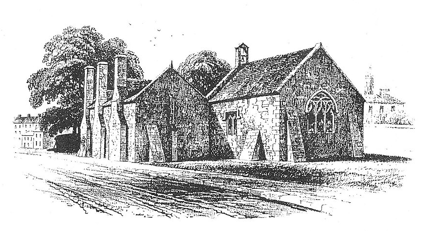
The sixteenth century almshouses at Livery Dole alongside St Clare's Chapel in 1850
Although it has often been claimed that the chapel at Livery Dole is medieval in date and was dedicated to St Clarus, this is now known to be false; it was in fact built with the almshouses adjacent to it in 1592.

The nineteenth century Livery Dole Almshouses
Duckes Almshouses
The original almshouses were granted to the parish by Richard Ducke in 1603. They were rebuilt on the same site in the 1850s. Action by Exeter Civic Society saved them from Council demolition in the 1970s.
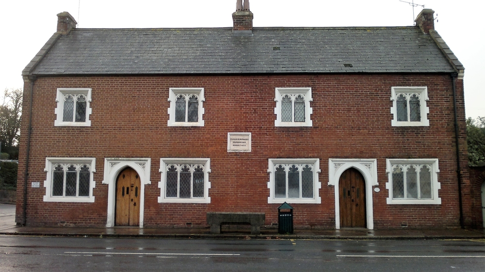
Duckes Almshouses in 2013
In front of the almshouses is a horse trough presented to the parish in 1876 in memory of Dr. Erasmus M Miles, M.D.
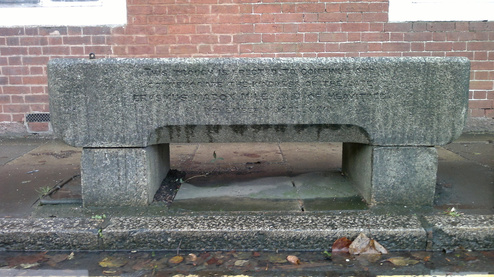
The horse trough outside Duckes Almshouses in 2013
Further reading: The Mystery Shield of Duckes Almshouses (Courtesy: Stephen Bees)
Manor Cottages
The cottages were built by John Sampson to the rear of what is now 120 Fore Street. He rented out two other properties that he owned - numbers 51 and 52 Regent Square - to pay for the upkeep of these. They were demolished in the 1960s.
| Maps showing Manor Cottages off Fore Street | Frontage | ||
|---|---|---|---|

| 
| 
| 
|
| Early 1950s | Early 1960s | Early 1970s | 2016 |
Pubs of Heavitree
The Horse And Groom Hotel
Originally known as the Horse and Jockey, this pub has been in existence since at least 1740. Until schools were built later in the nineteenth century, the building served as a public function room, along with its neighbour the Ship Inn. Both establishments were used for refreshments after pauper funerals, an allowance of 3/- per burial being paid until the 1820s.
 |
 |
| Date unknown | 2013 |
|---|
The Horse and Jockey was bought in 1891 by the Heavitree Brewery that had been brewing close to the rear of the premises since at least 1842. Part of the present pub building was occupied by Heavitree Fire Station until the 1930s, and then by a greengrocers.
For a few years in the early twenty-first century the pub adopted the name The Heavitree, before reverting back to the more popular Horse and Groom.
The Ship Inn
The Ship Inn has been in existence since at least 1740. Along with its neighbour, the Horse and Jockey, the building served as a public function room until schools were built later in the nineteenth century. Both establishments were used for refreshments after pauper funerals, an allowance of 3/- per burial being paid until the 1820s.
 |
| The Ship and Pelican in 2013 |
|---|
The Ship was used for the annual distribution of cloth to the poor until the 1820s; coroners' inquests took place there, and on one occasion in 1836 a prisoner was kept locked up overnight. The parish dinner for the poor to celebrate the coronation of King George IV was held there in 1821.
It was renamed the Ship and Pelican in the 1980s.
The Royal Oak
The Royal Oak originally stood on the corner of North Street and Fore Street (see map of Heavitree Towne 1816); it moved to its current location in the 1820s. It is one of the few buildings in Exeter to retain a thatched roof, but needed to be rebuilt following bomb damage in the Second World War.
 |
 |
| 1950s | 2013 |
|---|
The Windsor Castle
The Windsor Castle was originally called the Windsor Inn, and was owned by William Crowson, owner of the nearby Windsor Brewery which was founded in about 1860. William died in 1885, after which the Brewery was run by his widow and her son. Heavitree Brewery bought the Windsor Brewery in 1899, and continued brewing there until 1902, selling the premises in 1907. The brewery buildings remained until 1983 when they were demolished. The Windsor Castle continued to trade but finally closed in 2018.
 |
 |
| 1950s | 2018 |
|---|
Cat And Fiddle
Numbers 32-38 East Wonford Hill are Grade 2 listed 18th Century Cottages. Number 38 used to have the name plate 'Cat and Fiddle' – the reasons for which have been much debated in the past. Could this have been an old public house?
 |
| 32-38 East Wonford Hill in 2018 |
|---|
The St Loyes Public House And Hotel
The St Loyes Public House and Hotel in Salters Road opened in 1936. It was latterly owned by the Heavitree Brewery. In 2009 the Brewery applied to convert the property into residential flats. The work was completed in 2011 in a £500,000+ contract. The building retains period features such as the wonderful Art Deco windows, and has some noteworthy sections of Heavitree Stone brickwork on either side.
 |
 |
| Date unknown | 2018 |
|---|
The Heavitree Brewery
Brewing of ale in Heavitree by local farmers, land-owners and the church had almost certainly been carried out for many centuries before commercial brewing was recorded. Malting then took place at the Horse & Jockey Inn, the Ship Inn, at a brewery in Church Street from 1832 to 1857, as well as at the Windsor Brewery to the rear of Homefield Place. However there is one brewery that stands out above all others in Heavitree ...
The 'Heavitree Family Brewery' was founded in 1790 by John Wolland, a Heavitree farmer, land-owner and maltster. The brewery was originally located in Sivell Place, but in the early nineteenth century it moved to Church Street near to the church, and the Sivell Place site became a cooperage.
 |
 |
 |
 |
| 1889 OS map | Brewery from Church Street | Brewery from Parish Church | Annual outing 1907 |
|---|
Until 1890 the Heavitree Brewery purely sold the beer it produced, but this was about to change. Shares were offered in 'Heavitree Brewery Ltd' and there followed a series of purchases of both pubs and breweries, including the Royal Oak in 1890 and the Horse & Jockey in 1891, and the rival Windsor Brewery in 1899.
The company was almost brought to its knees, however, around 1920 when the manager embezzled a lot of money. He fled to Canada but was caught and sentenced to three years penal servitude and his accomplice to twelve months imprisonment. Things were saved by a supplier of the brewery whose bills were not being paid. He asked to see the books and was horrified! He was subsequently appointed to the board and set about putting everything in order.
 |
 |
 |
| Horse-drawn vehicle | Motor vehicle | Retail outlet |
|---|
There was another change of tack in 1970. Huge investment was required in the brewery and bottling plant, which could not be justified. Profit would double by buying in beer for their pubs under contract as opposed to making it exclusively for them. Thus on 1st May 1970 all brewing operations ceased; for the first time the company became entirely focused on managing tenanted pubs, of which they had 135. The shift came as a huge blow to Heavitree - seventy-six people lost their jobs, the majority were Heavitree residents whose families had worked for the brewery for years.
In 1984, the Church Street site was sold and redeveloped into sheltered housing (aptly named The Maltings), and the company moved away from Heavitree completely. However, the Brewery lives on and still manages many successful pubs; the signage 'A Heavitree House' indicating that the pub is owned by the Heavitree Brewery but managed by the landlord.
Scroll to top of pageHeavitree Toll Houses
Turnpike Trusts were formed in the eighteenth and nineteenth centuries to bring about an improvement in the country's road network, by bettering existing roads and constructing new ones, and placing of milestones, which became compulsory from 1766 onwards. The Exeter Turnpike Trust, one of the earliest in Devon, was formed in 1753 and remained in existence until it was disbanded in 1884. It became one of the largest in the country managing over 140 miles of road radiating from the city.
All traffic to and from the east and north had to pass through Heavitree, thus a number of toll houses and gates were installed in the parish. They were situated at:
- Marypole Head - built at the junction of Rosebarn Lane with Pennsylvania Road to deal with travellers going to and from Stoke Canon.
- Stoke Hill - erected at the foot of Rosebarn Lane in Old Tiverton Road. It used to be known as the Tiverton and Cullompton Gate.
- Withybridge (or Blackboy Gate) - stood on the south side of Blackboy Road just past the entrance to Mount Pleasant Road on the road to Cullompton.
- Heavitree Towne - built on the corner of North Street and Fore Street on the Honiton Road. It was later moved to the east of the Livery Dole almshouses.
- Heavitree Bridge - situated on the south side of the road at the east end of Heavitree Bridge.
- Livery Dole - stood at the point where present day Magdalen Road crosses Barrack Road.
- Sandy Gate - located near to the junction with Clyst Road.
- Mile End - near to County Hall on Topsham Road.

A view of Withybridge toll house and gate, at the junction of Blackboy Road and Mount Pleasant Road
Some roads such as Fore Street Heavitree and East Wonford Hill were repaired and improved by the Turnpike Trust. Others, such as Moor Lane, which now runs through the middle of the Sowton Industrial Estate, were entirely new roads.
The fee for passing through the gates was determined by the type of vehicle, the number of horses, and the purpose of the journey. People from the parish, soldiers on duty and clergymen often travelled free, but there were many disputes which had to be settled in the local courts. Many folk saw the gates and associated tolls as in infringement on movement that had hitherto been unimpeded.
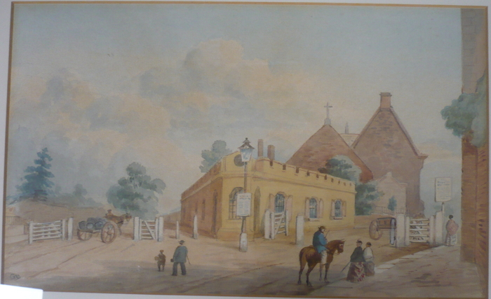
1884 painting by George Townsend of the Heavitree Towne toll house and gate, situated east of Livery Dole Almshouses
In spite of the admirable work done by the Trusts to improve the network and quality of roads, the advent of the railway in the mid nineteenth century offered a faster, more reliable form of travel and transportation than horse-drawn road vehicles, certainly long-distance, to both individuals and to industry. Within just a few years, income from tolls fell dramatically, and road building and improvement correspondingly ground to a halt. Toll gates became uneconomic and were removed, and although toll houses were sold they often remained empty. Turnpike Trusts remained in existence for several decades thereafter before being wound up. They had, however, over the period in which they were operational, served their purpose of a means to a dramatic improvement of highways. The network we see today has much to owe to this important period in history.
Scroll to top of pageGrowth And Development In The Nineteenth Century
Introduction
During the nineteenth century, Heavitree began a gradual but unwavering shift away from the small agricultural village by which it had hitherto been characterised. The number of residents and dwellings dramatically increased, and became more diverse. In 1569 the population stood at around 200. Even in 1801 the population was still just 833, but by 1901 this had risen sharply to 7529. Heavitree's growth was stimulated by the break-up of the Baring family estate, sold in the early nineteenth century, coinciding with a boom in building.

Map of Heavitree Towne in 1816, drawn in 2001 by Den Perrin, based on an original by John Coldridge
Johann Baring had come to Exeter from Germany in 1717 at the age of 20 to study serge-making. He married into the Vowler family who were wealthy Exeter merchants, and built up an extensive business in the wool and cloth trade. He became one of the richest men in the West Country, and invested heavily in land around Larkbeare and Mount Radford. His son John went on to become MP for Exeter, to co-found the esteemed Barings Bank in 1762, and establish both the Plymouth Bank and later the Devonshire Bank. Over three successive generations the amount of land in the vicinity owned by the Baring family grew, such that by the time of its break-up the estate comprised of practically all of the land between Larkbeare and Heavitree, including the whole of St Leonards.
The first development in Heavitree was that of Salutary Mount (now 2-30 Fore Street) which was built in the early nineteenth century. The construction of housing for the middle and upper classes continued with individual large houses such as Wonford Hill House (now Mowbray House) built in 1815, and Southlands (early 1830s), as well as groups such as Midway Terrace and Heavitree Park (both 1820s), and Mont-le-Grand and Regents Park in the late 1830s and early 1840s. Aside from the quality housing, a start had also been made on what became known as artisans' dwellings: Oakfield Street, dating from the early 1830s, was the first large-scale example of this.

An early view of Mont-le-Grand
Heavitree escaped practically unscathed from the Cholera epidemic of 1832 that so badly affected the City of Exeter and St Thomas. This may well have persuaded both developers and prospective residents to appreciate Heavitree all the more. Besley in his Exeter Guide and Itinerary of 1836 certainly did an excellent job of extolling the virtues of Heavitree:
“Always famous for the purity and salubrity of its air, its delightful situation, fine prospects and agreeable walks and rides, has, within these few years, felt extensively, the exhilarating hand of modern improvements.
A row of houses that divided the road has been taken down, the road widened, and the turnpike removed.
The vast number of genteel houses and villas recently erected here far exceed our limits of description. It presents a charming seclusion, though cheerfully situated on the great western road, contiguous, or almost adjoining to a populous and increasing city.”
Besley, Exeter Guide and Itinerary 1836
A slump in the housing market put a temporary halt on development for a while mid-century; no houses were said to be under construction in the 1851 census compared to 31 in 1841. However, it wasn't too long before things picked up, with building recommencing later in the 1850s and continuing at a steady pace thereafter. The large villas in Polsloe Road were built in the 1870s, and by the end of the century the large Polsloe Park housing estate was nearing completion.
Examples Of Nineteenth Century Housing
Beech House
Building
The house today known as 159 Magdalen Road was built c1810 by local builder William Hooper alongside several other properties, becoming known as 3 Baring Place. The land used for the development was acquired from the Baring family, in much the same way as the land used for Midway Terrace, where the Hooper’s themselves lived, Baring Crescent and St Margarets School. The Baring family were wealthy landowners and merchants in Devon before the family diversified and formed Baring’s Bank in the early 19th century. This bank would become famous two hundred years later with the rogue trader Nick Leeson. The Hooper family have a long history as builders in Exeter and were based at workshops and a builder’s yard in Paris Street. These premises were destroyed by fire in the 1830s, a careless apprentice leaving an untended flame which led to a major incident in which several adjacent houses were also burned to the ground. The Hooper family thrived regardless, with a Hooper becoming the Lord Mayor of Exeter in the middle 19th century. Their staff had less luck, including one hapless labourer who, drunk, fell asleep outside on their Christmas night out and subsequently died from exposure.
Early Years to 1850
The first identified tenant was John Wedgwood. Little record of him remains but it is likely that he was one of many tenants who occupied the house in the early decades whilst the Hooper family retained a mortgage and would have rented the properties on Baring Place. The next traceable occupants were the Doram family who occupied the house in the 1830s to vacate at some point in late 1841, for then a short tenure from James O’Dowda an Irish solicitor who died in 1842 aged just 45. He was the first of several legal professionals to live at the property, and possibly the first owner occupier. The property changed hands at least once more in the 1840s, at an auction in Dawlish to an unnamed widow. An incredibly detailed inventory of the furnishings and possessions left as part of her estate in 1850 survives for modern inspection, notably a Collard & Collard piano made by a company which still survives to this day.
Extension, 1850s and 1860s
The property was noted as vacant in the 1851 census, which corresponds to the likely building date of the rear wing and front balcony. At that time the balcony would have enjoyed much less interrupted views from an elevated position down to the Topsham Road and the river beyond. It is unclear if these works were commissioned by a new owner, or if perhaps the Hooper’s had once more become owners to renovate and extend the property. Dated bricks from the rear wing of the property are from 1854, which is also the earliest record of our new owner Robert Trewman residing at the premises. Trewman was a notable local figure from a notable family. The Trewman name is still visible today on the Burnet Patch Bridge, at Southernhay, Exeter’s first cast iron bridge erected in 1814. This bridge is named for the then Mayor Burnet Patch as it was built to aid him in the annual inspection of the city walls, which apparently he could not easily climb as had usually been the practice. Another R Trewman, at that time Receiver to the Mayor, had his name added to the bridge where it remains 200 years later. Our Mr Trewman, the son of he on the bridge, was a newspaper publisher who lived at the property throughout the 1850s, with issues of his “Trewman’s Exeter Flying Post” carrying the address of 3 Baring Place as the publishing address. Trewman and his family seem to have been forthright in their opinions, with his brother leaving the Flying Post to work for one of the main rival newspapers at the time, taking quite different editorial positions on several topics of the day. The Flying Post passed out of the Trewman family in the 1870s, some years after he vacated 3 Baring Place. The paper survived in one form or another until 1917 and was even briefly revived as a monthly magazine in 2012. As Trewman’s time running the newspaper was drawing to an end, a new family headed by John Ellis a local JP, and our next legal professional, moved to the property at some time prior to 1861, leaving through the next decade.
Drapers and Priests, the last Victorians, 1860s to 1895
As the Ellis’ moved away, the Spark family moved in at some point before the 1871 census. By this time John Spark was retired but he had spent a notable career as a draper, regularly travelling through Europe to source the newest and best materials and fashions for his thriving department store on the High Street. This store was until 1862 called Colson and Spark, Colson’s thereafter, until the 1950s when the store was purchased by the House of Fraser group and renamed as Dingles. Dingles survived as the House of Fraser until 2019 at which point the well-known building was acquired for development to a new hotel. The new restaurant serving the hotel and the public will open in 2022 and will be known as Colson’s, carrying the same branding and colours as the original store our resident worked to build over 150 years ago. Replacing the Spark family was a widow named Susan Barker. Little record of her life remains but notably she seems to have lived in Baring Place for many years, firstly at number 8 before moving for a short period to number 3 before the house was again sold by auction in 1885.
The White family moved in and stayed for nearly a decade. Arthur White was a priest, who had worked in several different parts of the country including a stint in Blaby, Leicestershire at a church where this writer would be christened more than a hundred years later. Arthur’s wife Georgena had the maiden name Travers, a branch of the wider Buxton family who were notable throughout the Victorian period and well beyond for their work as politicians, philanthropists and campaigners. Looking carefully at the £5 note in circulation until 2017 a crowd of people is visible in the background to the main picture of Elizabeth Fry, the man in spectacles is Georgina’s relative, a great uncle, Thomas Fowell Buxton, a remarkable man playing a key role as MP for Weymouth in the continued removal of the legacy of the slave trade in the 1820s and finding time to act as founding chairman of the RSPCA from 1824. In 1894 the White’s moved away so Arthur could work in a new parish at Littleham near Exmouth. The church remains a thriving part of the community, and has an incredible stained glass window in the nave, carrying an inscription memorialising Arthur and Georgena. Arthur’s estate passed back to the Buxton family, as they died without children, and a considerable sum equivalent to nearly £2m in today’s money was inherited by Travers Buxton. Much like his family before him, Travers Buxton worked as an anti-slavery campaigner to the end of his life in 1945, for a number of charities and alliances that still exist today.
Lawyers, 1895 to 1919
As the White family left, the house was purchased by Robert Campion, an Exeter lawyer. The Campions stayed at the property until 1919; both Robert and his nephew Henry were well-known figures across the city. The Campion law firm was originally based at the Bedford Circus in central Exeter, an area that was heavily damaged in the May 1942 air-raids and sadly reduced to rubble in the 1960s to make way for the shopping area found at the modern Princesshay and Bedford Street area of town. Through various mergers, partnerships, and takeovers, the Campion firm is now part of the Gilbert Stephens law firm based on Southernhay just a few hundred metres from the original offices at the old Bedford Circus. In addition to his legal work, Robert Campion acted for a time as Chairman of the Exeter Gas Light & Coke Company, after it had come into the control of the City council. This business was based across Exe island and Haven Banks, burning coal to produce the gas, known as coal gas consumed by the city for lighting and eventually heating before more modern supplies from the North Sea replaced this old method in the 1960s. After nearly a quarter of a century of busy living at 3 Baring Place the Campion family moved away in 1919. It is likely that when the Campion’s first entered the property they did not have electricity but that by 1919 it did.
Yes Sir, 1920 to 1927
Moving to the house in 1920 was Edwin Thirlwell England and his family. Edwin is the first occupant who we may see in photographs surviving in the public record. Edwin England was a teacher, and had moved to Exeter to become headmaster of the Exeter School after a successful university career at Trinity College, Cambridge and an early teaching career at the prestigious Charterhouse and Marlborough public schools. During his nearly eight years leading the Exeter School he oversaw a dramatic period for the school as the number of pupils, finances and facilities all expanded and changed whilst his own family grew larger. From many surviving records we know that many prospective pupils were interviewed at 3 Baring Place and it is possible that the property was indeed owned by the Exeter School, before the headmaster began to more usually live at Acland House on nearby Victoria Park Road. The England family moved away, firstly to London and then Birmingham where he continued his impressive career as an educator and the King Edward VI school, notably relocating the school from New Street to more open grounds at the present site in Edgbaston. This writer spent several losing days at those new grounds, playing the impressive Edward VI 1st XV.
Exeter 4003
The next family we can identify in the records at the property, now more usually known as 159 Magdalen Road was that of James Pearse Oliver who moved to the city from Dartmoor. The Olivers were an active business family, trading in porcelain in the 1920s before establishing a larger and more well-established scrap merchants called E. Pearse & Co based on Christow Road in Marsh Barton. The business has traded for many decades after James retired and the family had moved away, at various times operating from Taunton and Plymouth as well as Exeter. The Oliver’s have the distinction of being the first residents to enjoy their own home telephone, from 1938 and perhaps earlier. The original phone number was Exeter 4003. It is not known when the Oliver’s moved out but likely this was post-war and before James died in 1955 and passed the family business to his son Thomas.
Beech House

Beech House, 159 Magdalen Road (formerly 3 Baring Place) in 2019
After the Oliver’s left, post-war Britain was a much-changed country to the one of the 1930s with a radically different social and political order taking shape in the grip of major post-war debt and rationing. Houses like 159 Magdalen Road had up to this point been owned by wealthy families often with as many as four domestic servants living at the property. Perhaps the size of the property and the costs of modernisation put off new families from making it their home. In any case, the next time we discover the property in the records it has become Beech House and remained a residential home for the elderly from at least the early 1970s until 2018, variously in the care of the related Latham and Wilson families. With twenty-one beds in the property there have been perhaps more than 250 residents of Beech House during its time as a residential home, likely many more. It is unclear how the two properties were purchased and combined, but it appears that 157 was the first property acquired which no doubt gave inspiration for the name from the large tree by the front door. Historic England chose to Grade II list the property in 1974, by which stage the fire escape had already been erected at the 159 side, suggesting that the building had previously been combined so avoiding any challenges to the planning. The property was sold in December 2020 to Co-Living Developments and in 2023 became the home of Christopher Rudd and his family.
Courtesy: Christopher Rudd
Eagle House
Eagle House is a property in Salutary Mount (now 2-30 Fore Street), the earliest nineteenth century development of Heavitree. The name is unofficial, but it’s easy to see how it acquired it –two eagles face each other on the front corners of the roof parapet. There is also a large motif above the central front entrance.
Wikipedia states, 'The eagle with its keen eyes symbolized perspicacity, courage, strength and immortality, but is also considered "king of the skies" and messenger of the highest gods. With these attributed qualities the eagle became a symbol of power and strength in Ancient Rome.' This symbolism was adopted by European countries, particularly Germany during Nazi times, but also by the church, the RAF, etc.
Whilst not known if there is any significance to the decorative features of Eagle House, there are a number of theories: association with magistrates (as the symbol has been historically used to denote the power or jurisdiction of a magistrate), with Germany, or with an embassy. There is a house in Wonford Road, St Leonards, that has remarkably similar eagles on the parapets.

Eagle House in 2017
Members of the 'Exeter Memories' Facebook group remember a teacher at Ladysmith First School, Mrs Edna Lawrence, used to live there. A sweet, white-haired, well-spoken lady, who loved art, and once invited the staff of the school to her home in Heavitree for 'a lovely get together'. She said that the adjoining door was where her mother lived. Many ex-pupils of hers remember that she told them she lived there, so must have been immensely proud of it!
The property was used for Brethren services for a period after the 1942 bombing raids, and was a doctor's in the 1950s.

An 1888 auction catalogue for Eagle House
Sale documents from 1888 show just how wonderful the house was at that time. It is described thus:
A 'very desirable double-fronted family residence, with capital stabling, extensive gardens, range of hot-houses, a convenient brick-built cottage for gardener or coachman and other appurtenances.' The whole area covers about 19,400 feet and is for sale by auction.
The top floor contains two servants' bedrooms. The first floor is approached by two staircases (the principal one of which is lighted by a large bay window) and contains six bedrooms, a dressing room fitted with lavatory and a bath-room with 'Maughan's Patent Geyser Heating Apparatus and W.C.'
The ground floor houses the entrance hall with bay window, 20ft by 12ft dining room with a bay window that opens out under a veranda (entwined with a well-trained vine) and thence onto the lawn; an 18ft by 13ft drawing room with a bay window, 'communicating by folding doors' to the breakfast room (15ft by 13ft), which also has a bay window that opens under the veranda. There is also a lavatory and W.C.
There are well arranged 'domestic offices', which are shut off and comprise of a kitchen with a good cooking range and dresser, wash-house with furnace, well of excellent spring water, pump, knife-house, boot-house, china-pantry, larder, coal-house, W.C. etc.
The reception rooms and principal bedrooms are fitted with marble mantlepieces; the house throughout is fitted with cupboards and the roof is in excellent order having just been repaired and the gutters renewed with lead at 'a large outlay'. The 'sanitary arrangements' are good; there is a bountiful supply of water and gas is laid on.
There is a lawn with a summerhouse, flower gardens and 'a profusely-stocked' kitchen garden in a 'high state of cultivation', with 'a variety of choice fruit trees'.
There are a range of hot-houses: 90ft in length comprising of two vineries with good bearing vines; a cucumber house and two greenhouses; there is also a melon frame and 'a convenient brick-built cottage for coachman or gardener, with a separate entrance from the church path'. The whole of the garden paths are asphalted and edged with tile.
The stabling and outhouses consist of a coach house, harness room, three stall stabling, piggery, poultry house and potting shed.

An 1888 floor plan of Eagle House
Studying the floor plan, provided with the auction details, shows that the main entrance was the door between the two bay windows (which no longer appears in use), the hallway from which would lead to the dining room on the left, and the drawing room on the right. The current entrance(s), to the left of the bay windows, must have been a later addition or modification. At the time it was the entrance to the coach house.
The plan also shows the huge the amount of land belonging to the house. The garden stretches down for a way and extends behind three neighbouring properties all the way to 'Church Path'.
Finally, it's interesting to look at the small details that this auction paper offers us. The bottom of the Eagle House' gardens backs onto the 'Rosery (i.e. rose gardens) of R.N.G. Baker Esq', and to the right of the house is 'Church Path' which probably became 'Church Terrace' when terraced houses were later built. Today, four houses stand between the Eagle House and Church Terrace, and at the end of Church Terrace is a path which leads to the Parish Church - along what might have been the back of this house's gardens. To the right of Church Path is land belonging to R. Sanders Esq.
This auction catalogue really paints a picture of a much more bucolic Heavitree, with few properties, ample space, and some incredibly lavish residences. It would have been a Heavitree on the cusp of change, as not long after this auction took place, many more properties would have been built.
Heavitree Park
Heavitree Park is a series of five grand houses built in the 1820s by Edward Eardley, an Exeter China merchant who was also later involved in the Mont-le-Grand development. The name Heavitree Park reflects the taste of the well-off at the time; they wanted country houses, near the city, with healthy sounding names. This is underlined by the rustic look of the Lodge building at the entrance. Eardley was leased the land in 1825 on the condition he erected houses and outbuildings of brick and stone, not cob, to a value of £3,000 each. They were built by 1829.

The lodge at Heavitree Park in 2018
Wonford Hill House
Next to Heavitree Park is a house built around 1816 by James Tillyer Blunt, a retired captain in the East India Service. He called the property Wonford Hill House. It was subsequently renamed Mowbray House, and was lived in by a variety of people including Colonel Vaughan, Chairman of Heavitree Urban District Council in the early 20th century. It later became a hospital – first recorded as a home hospital under Miss Biggs and Miss Hunter in 1923. It was a well-known local maternity hospital until its closure in 1986. For a time after this the building was used for nursing training. It is now a residential property again.
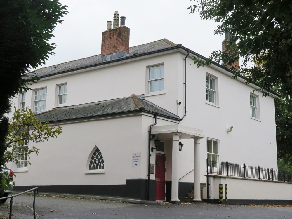
Mowbray House in 2018
Southlands
Southlands was built in the early 1830s by William Hooper, a member of an important local family of architects and builders. It was probably named after Colonel Samuel Smith who owned the land at the time of construction. Initially, Southlands was in fact two properties, but the one nearer to Polsloe Road was at some point renamed Clystlands; the other retains the name Southlands to this day.

Southlands in 2019
In 1834 the property was sold for £2,250 to the Reverend James Ford, brother of Richard Ford (who lived at Heavitree House in Church Street). Southlands remained in private hands until acquired by the City Council around 1950. The property has since seen use as a welfare centre and as sheltered housing. It was Grade II listed in 1974.
Clystlands
Clystlands was built in the mid 1830s by William Hooper, a member of an important local family of architects and builders. Initially, it was one of two neighbouring properties named Southlands, probably after Colonel Samuel Smith who owned the land at the time of construction. At some point, the one nearer to Polsloe Road was later renamed Clystlands, a name that it retains to this day.

Clystlands in 2019
In the 1840s the property belonged to John South Esq. The last private resident was Admiral Sir Charles Coke. After he moved out, in about 1926 it became the Clystlands private hotel, until St Lukes College purchased it after the war for a hall of residence. In 1982, the University of Exeter, which had absorbed St Lukes College, sold Clystlands and it became a private nursing home. It was Grade II listed in 1953.
Heavitree House, Church Street
Heavitree House was a small cob house, surrounded by an old cob wall, in Church Lane, Heavitree. It stood on twelve acres of land, including orchards, overlooking open countryside (now the RD&E Hospital).
The House was the home of artist and author Richard Ford (1796-1858), who in 1845 wrote the infamous "Handbook for Travellers in Spain" - the first Spanish travel guide. Ford lived at the property from 1835 until his death in 1858. During this time he set about enlarging and completely remodelling the House and gardens.
 |
 |
 |
 |
| 1889 OS map | Young Richard Ford | Older Richard Ford | Richard Ford's headstone |
|---|
Ford incorporated many items salvaged from buildings in the area - the fireplace was taken from a house pulled down in Rack Street (West Quarter), and the ornate staircase, gates and carved woodwork all came from King John's Tavern on South Street (which was being rebuilt). A font in the garden was possibly taken from the 1845 rebuild of parts of Heavitree Church; this has since been returned to the Church.
An enthusiastic collector, Ford filled the House with items from his travels. The bathroom was tiled with original tiles that he had picked up off the floor of the Alhambra, Granada. Part of the bath was made from the original register-chest at Exeter Cathedral, and there were sculpted heads on a parapet, from Italy.
In the grounds of the house, Ford laid out 'Moorish' style rectangular gardens, with many pools and fountains, lined with cypress trees and featuring a Moorish tower / gazebo building, echoing the Hispano, Berber, and Islamic architecture of Morocco.
 |
 |
 |
 |
| 1843 painting | House + gardens pre-1878 | House in good condition | |
|---|---|---|---|
Following Ford's death in 1858, Heavitree House passed to his son from his second marriage, Clare Ford. The House was let out until its sale in 1898 to Edward and Annie Shrimpton; they lived there until just before the First World War. The House then passed through several hands, before most of the grounds were sold at auction in 1938 for house building. The House itself remained and was used as a workshop during the Second World War, before falling into disrepair by 1949; it was demolished in 1960, despite being grade II listed, and replaced by further housing.
 |
 |
 |
 |
| 1938 auction plan | House in poor condition | Richard Ford Court flyer | Richard Ford memorial |
|---|
All that remains today are a few red sandstones from the garden, and a small black plaque bearing Richard Ford's name on the wall of Richard Ford Court in Meadow Way.
Further information on Richard Ford can be found here.
Stafford Lodge
Stafford Lodge, a large detached building facing the Livery Dole almshouses, was built between 1851 and 1861, and hidden from the road by a high Heavitree Stone wall.
In 1890 it was renamed Rowancroft, and was used as a girls school until 1921 by Mrs Chambers-Hogetts. The property was then vacant for a while, but by 1927 it was being used as an elementary school for boys in training for holy orders.
Stafford Lodge in 2013
In 1943 it was requisitioned by the Army and used to accommodate staff in the Army Pay Corps. It was a very comfortable billet, popular with both men and women serving in the regiment. It was rocked by tragedy when one of the female soldiers was murdered in the house by an American serviceman stationed in the city.
In 1947 the house became a hostel for St Lukes College. In 1978 ownership transferred from the College to the University of Exeter when the two were amalgamated. With demand for student accommodation growing, a large development of new residential blocks was built in 2009 on what originally was tennis courts and lawns.
Polsloe Park Estate
If you consider a rough rectangle bordered by Polsloe Road, Pinhoe Road, Ladysmith Road and South Avenue then you have the position and scale of the former Polsloe Park estate.
Today the area is more or less built up and it is hard to imagine what was there in the early nineteenth century. However, maps clearly show the estate consisting of a large house near the north-west corner (Polsloe Road / Pinhoe Road) together with extensive gardens, shrubberies and fields.

An 1880 OS map of Polsloe Park Estate showing completed building at the southern end
An article in Devon and Cornwall Notes and Queries (Volume 17 1932-3) tells us a little about its ownership:
"Prebendary Jonas Dennis of Polsloe Park, Exeter, a property which was owned for three generations, was stated in the Exeter Gazette, 1846, to be the ninth in descent from Sir Thomas Denys of Holcombe Burnell. A portrait of Sir Thomas in armour, understood to be to be a Holbein, was said to be in his possession."
Dennis seems to have been a colourful character. He was prebendary of the Royal Collegiate Church of the castle of Exeter, and was active in religious politics. This involvement included controversial election campaigns for convocation, the ecclesiastical parliament, and as a hard-line opponent of concessions to Catholicism. He was renowned for lengthy speeches, and in the Exeter Flying Post in 1819 he admitted of one diatribe that it had been “a long and laborious task and your patience was put to a tedious and severe trial."
Dennis placed a 'For Sale' notice for the estate in the Exeter Flying Post of 24th December 1846. This gives an excellent description of the property which once stood on the periphery of Heavitree, and of how the area was marketed to wealthy Victorians:
"Polsloe Park is situated in the most elevated and healthy part of the Parish of Heavitree, commanding views, which for extent, diversity, and richness of scenery, cannot be surpassed in the neighbourhood. It is within 10 minutes walk of the centre of Exeter, and has the two-fold advantage of a town and country residence. There are three carriage approaches, one without and two within the turnpike gate.
The house was built a few year since in the most substantial manner without limit as to price, for the late Proprietor's own residence, and the internal arrangements are complete, and adequate to the requirements of a large family.
It contains on the ground floor a spacious entrance hall, 27ft by 18ft, in which there is a fire place with a frontispiece beautifully and elaborately carved in oak and a grand staircase in character with the hall, drawing and dining room, each 27ft by 18ft and 12ft in height, library 18ft by 15ft.
There are five best bedrooms, each about 18ft by 14ft and 10ft in height, three dressing rooms and a water closet on the first floor. Three attics and room for three more in an unfinished state on the second floor and back staircase.
The basement offices consist of a kitchen 27ft by 18ft, back kitchen, servants' hall, butler's pantry, store closet, larder, beer, wine and coal cellars, with other useful offices, and is well supplied with pump water.
The land and pleasure ground attached to the house is three and a half acres; and from 35 to 40 acres immediately adjoining of rich pasture land may also be had if required."
The estate was duly sold in 1848 to wealthy tailor Stephen Brunskill. The electoral roll in 1856 had a Reverend William Grylls in residence. From around 1864 houses were being built on the southern end of the estate (now South, North and East Avenues) under the auspices of the Exeter Freehold Land Society established in 1857.

A 1905 OS map of Polsloe Park Estate showing completed building at the northern end
A major change at the northern end came about in 1881 with the construction of a long-forgotten sports ground for the Devon County Cycling and Athletic Society. The Exeter Flying Post reported:
"The ground acquired by the Society was a splendid site on the south side of Polsloe Park. It lays high and commands a wide range of scenery, including the estuary of the Exe."
The facility consisted of two tracks, one cinder for cycling, the other turf for foot races. The centre of the grass track was for tennis and cricket; the Exeter Cricket Club played here in 1884 and 1885. The Exeter Flying Post also reports:
"Under the trees which skirt the western end of the ground, a number of seats have been fixed for accommodation of spectators."
The mayor of Exeter opened the ground. In those days Heavitree was independent of Exeter, and the mayor is reported as saying that "although the grounds were outside the city boundary at present, he has no doubt that in future they would come within it (laughter)." His prediction of course finally came true in 1913.
The tracks, said the mayor, would "bear comparison with any in England." They were launched with a grand two day cycling and athletic meeting, and ended with "an excellent display of fireworks" witnessed by a great crowd of spectators. The principal piece was a bicycle and rider in motion, with the words "Success to our Sports."
| Early images of housing at the northern part of Polsloe Park Estate | |
|---|---|
 |
 |
| Manston Road | Ladysmith Road |
Despite all this, within just a few year plans were being drawn up for a housing estate (Park Road, St Johns Road, Jubilee Road, etc) on the site, and by 1886 roads were being laid out.
There was now housing at both the southern and northern ends of the site, but what about the middle? Here the Exeter Brick and Tile Company established a brickyard where Ladysmith Junior School playing fields are now. The company was formed in 1899 to manufacture 100,000 bricks per week.
Within forty years a quiet corner of Heavitree had been turned into a major hive of housing and industry. A small but representative example of the transformation the area saw during Victorian times.
Regent Square And John James Fry Ellis
John James Fry Ellis
John James Fry Ellis was born in 1849 and trained as a builder before specialising in plumbing and gas-fitting work. He married Brenda Louise Elliot, an Exeter girl of twenty years of age. They lived at 7 Plantation Buildings, Newtown later moving to 50 Clifton Road, which he owned, along with number 49, from where he ran his business as a registered plumber and gasfitter.

A 1904 OS map showing Plantation Buildings, Ellis' first home
Coming from a poor family (his grandparents were registered as paupers), it isn’t known where Ellis found the money to begin building and selling houses, but his ambition and enthusiasm for property is clear. Ellis had certainly chosen a trade that would have been in high demand as gas became more popular in the home. Personal contacts and connections were vitally important, and Ellis must have had these. No doubt he also took advantage of Exeter's huge need for new, rentable properties.

Bertha Villas, Alexandra Terrace (named after Ellis' eldest daughter) in 2019
In 1879 Ellis built two houses on Alexandra Terrace, Exeter, which he named Bertha Villas, after his eldest daughter. These were grand houses were described in 1880 by the Exeter and Plymouth Gazette as: “each containing, on the ground floor, front parlour with bay window, two kitchens, cupboards, larder, coal-cellar and WC; two gardens in front and garden at the back; on the first floor, drawing-room and bedroom and WC and lavatory off landing; on the second floor, two bedrooms. These houses are well-built and furnished in good style. They contain numerous cupboards and useful fixtures, gas and water pipes, two cisterns, lead pumps...”
Not long after this, Ellis transferred his business (which appears to have been flourishing) to a new owner, although he retained ownership of the building. He must have been ambitious, as he tried unsuccessfully to become a Sanitary Inspector for the Council.
Although it was a short-lived venture, it was perhaps this failure that inspired Ellis to take a new direction and become landlord of the Bristol Inn (destroyed in the Blitz, it stood where John Lewis is now, at 3 Sidwell Street). The 1881 census shows Ellis as Innkeeper, living there with Brenda, their eight children ranging from 11 years to 5 months, Louise Elliot, mother-in-law, and a general servant.

John James Fry Ellis with his wife Brenda and family c.1880
Many auctions of land and property were held at the Bristol Inn. Ellis himself bought land in Newtown at these auctions, and also sold newly-built properties in the area.
Perhaps being present at so many auctions, in an ever-expanding Exeter, was what inspired Ellis to purchase the land to build Regent Square, his most ambitious venture yet. Although he had already built several houses by this time, planning and building sixty-three terraced houses was a new challenge entirely. It’s not known where Ellis got the money, but one can only assume that it was being ‘in the right place at the right time’ combined with an urge to better himself, and a knowledge of the practical work involved in building houses, that led him to have such a dream, and to take such a risk financially. Conveyances show that he borrowed heavily to carry out his project.
By the end of 1882, the Bristol Inn was under new license, and the Ellis family had moved to 71 Fore Street, Heavitree (now Shauls bakery) – conveniently close to the Regent Square site whilst building took place.
| Brenda Villas, West Homefield (named after Ellis' wife) | |
|---|---|
 |
 |
| Early view | 2019 |
Once the building of Regent Square was complete, Ellis moved to 1 Brenda Villas, West Homefield (now Homefield Road), one of two houses that he had built some time before 1884. These houses were named after his wife, and adjoined Homefield House (where the United Reformed Church now stands). They are still there today.
Conveyances show that he must have been under some financial strain due to the building of Regent Square. He tried to sell many of his properties and several more passed to Robert E Seward, when Ellis was unable to settle his debts.
Around 1885, Ellis built Progress Villas - a pair of semi-detached houses, with large kitchen gardens to the rear - in one of the more upmarket areas of Heavitree, Polsloe Park Estate. This area could have been described as ‘upwardly mobile’. We know that Ellis was responsible for building these houses, as we can just make out his name on the plaque. Today they still stand, now 42 East Avenue.

Progress Villas, East Avenue in 2019
It is uncertain where Ellis and his family were living for the next few years, but it is clear that he was finding it difficult to repay his mortgages and debts, especially as he seems to have had trouble selling some of the properties that he had built. In 1887, he took out a loan of £1000 on security of numbers 50, 53 and 62 Regent Square.
By 1891, he seems to have been managing a bit better, as he moved his family to 1 Progress Villas. The Ellis family found themselves living amongst solicitors, accountants, music teachers and journalists. What a rise from Plantation Buildings!
Alas, Ellis' debts seem to have caught up with him again by the end of 1896. Adverts appeared for auctions of probably all the property he owned, including Progress Villas, where the family were still living.
The last property he acquired was 13 Verney Place, St Sidwells, and we think that it was into this property that the family moved when Progress Villas was sold. What a contrast! Verney Place was destroyed in the Blitz, but is remembered as being one of many dark, narrow, slum-like areas off Sidwell Street.

Ellis' death certificate
Ellis died suddenly in 1898, aged just 49 years, of a cerebral haemorrhage and hemiplegia (paralysis of one side of the body). Oddly, his death certificate shows the place of death as 38 St Leonards Avenue. Perhaps this was another property that he owned or had acquired. We know that it was purchased a couple of years later ‘as part of a bankrupt estate’, which could have been Ellis’. His funeral took place on April 2nd at Higher Cemetery, where he is buried with his father John.
The Exeter Flying Post simply stated:
“DEATHS: ELLIS, March 27th, John Ellis, plumber and builder, late of Newtown and Heavitree, aged 49”
One would have expected more to be said about a man who showed such resourcefulness and was so important to Exeter. His memory lives on in the properties that he built; he certainly left his mark on Exeter. If he had conquered his financial problems, and lived to an older age, one can imagine how much more he could have contributed to Exeter.

Ellis' headstone, Higher Cemetery in 2019
After his death, Brenda continued to live in Verney Place, before later moving to 11 Holloway Street. Despite having many children, supporting her husband and moving all over Exeter, Brenda lived to 78 years old, outliving most of her children.
Regent Square: From Gardens To Residential Development
By the mid-Victorian period, housing for the artisan sector was in demand, provided it was built to a good standard and could be rented out for a good return. In the course of his business and work, Ellis would have seen the potential for development in many areas of Exeter, and must have been waiting for his chance to cash in. When the land on which Regent Square now stands came up for sale, Ellis had the chance to really make his mark. Just like modern-day property developers Ellis planned to fit as many properties into the area as possible.

An 1813 map illustrating how rural Heavitree was, consisting mainly of fields and orchards.
The land to the left of Burrow’s Field is roughly where Regent Square now stands
Ellis would have completed a detailed survey to acknowledge the potential of the land (currently market gardens) for development, and to highlight any possible problems. The fall of ground would have been a good sign that there would be natural surface water disposal. The 1875 Public Health Act (aimed at combating filthy urban living conditions and the diseases associated with them) required that all new residential construction had to include running water and an internal drainage system, and gave local authorities the power to purchase, repair or create sewers. Ellis’ experience of being a trained plumber would certainly prove its worth.

The 1840s tithe map of Heavitree showing the area that was to become Regent Square
Regent Square was to have 28 three-bedroom and 35 two-bedroom houses, a total of 63 properties, within a very compact parcel of land. There were no front gardens and the small rear gardens (with perimeter brick walls) had no official rear access (apart from the centre block which provided access to 18 properties from either side).
The houses of Regent Square are good examples of early ‘byelaw terraced houses’. No planning permission was required at this time, but thanks to the 1875 Public Health Act, local authorities were given the power to set down some building regulations to ensure that the houses were safe and sanitary. This act would only just have come into practice so controls were probably still minimal in Exeter. The quality of housing in Regent Square, therefore, is a credit to the builders, tradesmen and materials of the time.

The plaque at the corner of Regent Square bearing Ellis' insignia in 2019
There is no record of when work actually commenced on Regent Square. The plaque on the Force charity shop (73 Fore Street) shows a date of 1883; such plaques were usually placed on completion of works.
The houses were built of locally sourced bricks, most likely from Pengelly’s Brickworks, recently opened in what is now part of the Pleasure Ground, behind Roseland Crescent. (Pengelly, another keen property developer in Heavitree, built Newcombe Street around the same time as Regent Square was built. These tightly-packed streets of terraced houses were similar examples of Heavitree’s first proper Victorian developments). Sampson's Brick Yard, where Ladysmith School playing fields are now, was another possibility for brick supplies, but Pengelly’s would have been the most convenient. Transportation of bricks and materials by horse and cart would have been very labour intensive; probably 500 cart loads of bricks alone for the Square.

The 1887 OS map, showing Regent Square, with rear entrance opening
onto meadow / market garden, and the brickworks in close proximity
The houses had cast iron guttering, cast stone lintels, wooden sash windows, standard wooden front doors and front steps that were probably tiled. As they opened straight onto the road, boot scrapers were built into the front of the houses, next to the door. These were cast iron and the designs vary from house to house, perhaps because not all the houses were built at once.
Roofs were covered by what would appear to be Welsh Slate. Even with the extra transport cost, the Welsh slate would have been more cost effective than Cornish Slate. The slate would have been transported from the Welsh quarries, shipped to Bridgewater or Watchet in Somerset, then to Exeter by steam goods train. A total of 44,000 slates would eventually be delivered to Regent Square by horse and cart from the rail terminus.
The houses would have been some of the last terraced houses to have been built identically. Soon after, it became more popular to build ‘handed’ houses (i.e. differentiated into right and left) with front doors next to each other, a shared chimney stack and often more light due to the extensions sharing a wall.
Ellis sold some of the plots, with houses yet to be built, to repay some of his debts. For example, he sold the plot of land for 2 Regent Square for £25 in February 1883, along with neighbouring building plots. The legal documents contain very specific instructions as to how the remaining houses should be built, in keeping with the overall plan. The purchaser of some of this land was John Sampson, a very significant figure in Heavitree's history with ‘a finger in every pie’. Sampson later owned two houses on Regent Square (51 and 52) which he rented out to provide income to fund one of his philanthropic projects – Manor Cottages (off Fore Street), almshouses for the poor.
 |
 |
| 8 Regent Square in 1910 | 62 Regent Square around 1932 |
|---|
This article is an extract from a 2019 publication by Sally Robinson (former resident of the Square, and a member of the HLHS) detailing the life of J J F Ellis and the history of Regent Square. The publication can be downloaded here; hard-copies are available on request from the Society.
Loma-Loma
Introduction + The Early Years
Towards the end of 2024, a property, that in recent years had become somewhat dilapidated, went on the market for no less than £650K. The images shown in Stags Estate Agent's brochure and Devon Live for the property highlighted a somewhat unexpected use for such a building. This prompted the HLHS to carry out further investigation.
The property, number 83 Heavitree Road, is located on the corner of Grendon Road, in the Mont Le Grand conservation area of Heavitree. It is a large late Victorian property, likely to have been an upper middle-class family home. [Strictly speaking Loma-Loma falls within St Sidwells Parish but we have included it here as it is much closer to what most regard as Heavitree (i.e. the Fore Street and the shops) than other places in Heavitree Parish such as Clyst St Mary.]
Screenshot of the 1888 OS map covering Heavitree Road (credit: National Library of Scotland)
The detailed OS map of 1888 (published 1891) for the area between Grendon Road and Polsloe Road names the property as Loma Loma. Neighbouring properties (latterly numbers 85 & 87 Heavitree Road) were unbuilt at the time. By 1904/1905, the vacant plots had been filled.
The South West Heritage Trust holds a file at the Devon Heritage Centre (ref. FOR/B/6/1/145) containing the 1891 sale particulars for the property, described therein as a "Freehold residence with gardens, tennis courts, stabling, and coach house". It was auctioned by Thompson, Rippon & Co at the Half Moon Hotel, 22 High Street, Exeter on Thu, April 2nd 1891. Land originally occupied by the tennis courts was sold off at some point, and now falls within the bounds of Faraday House, Grendon Road, built in 1978.
Screenshot of the 1891 Sale Particulars for Loma-Loma (credit: South West Heritage Trust)
Given this description, the fact that the estate agent's brochure of 2024 shows six bedrooms, and Wikipedia shows the name Lomaloma refers to "a place in modern-day Vanua Balavu in the Lau archipelago of Fiji, a former British Colony", one gets the idea of the kind of person that may have originally owned the property.
A quick Google search on 'Loma-Loma, Exeter' reveals that in 1911 the property was home to Charles Edward Rowe, of Rowe Brothers & Co., 192 High Street, latterly 33 Queen Street, Exeter, mayor of Exeter in 1902/03. In 1881 he was living at 20 Howell Road. Besley's Directories reveal he was resident at Loma-Loma as early as 1894. Could he have bought it at the auction in 1891? He died on 11th January 1914, aged 65. His 2 daughters were listed as the residents during WWI. In 1918 and 1919, the resident is listed as a Colonel Coe.
Charles Rowe, Mayor of Exeter 1902/3
Public Analyst's Laboratory + Edward Braxton Reynolds
Fast-forward to the 2020s …
Edward Braxton Reynolds (known as Braxton) was using Loma Loma as both as his private residence, and as his workplace - a Public Analyst's Laboratory. He was the last person to occupy the property before his death in 2023, leaving it in a somewhat run-down state.
External View of Loma-Loma, January 2025 (credit: Martin Weiler)
In what year was this Laboratory set up? Did Mr Reynolds establish it? The fittings are certainly retro. The Besley's / Kelly's Exeter Directories of the late 1950s through to 1972 make no mention of the Laboratory, rather a variety of smaller businesses / Government offices co-existing there. One member recalls visiting the property back in 1954 to collect his ration book from "the Food Hall" (Ministry of Food). In 1962 it is shown as National Assistance Board (Exeter East), HM District Inspector of Mines, and Ordnance Survey Office.
During WWI, women were needed to fill the gaps left by working men who were now fighting. When the war ended, some women returned to their pre-war posts including servitude, many others preferred to continue with alternative employment. Very large houses, such as Loma-Loma, with quarters for live-in servants, often became redundant. Many families had suffered fatalities in the war. They couldn't keep up with the costs involved with such properties so had to move to smaller ones.
Although it still isn't clear when Loma-Loma began to be used for anything other than residential purposes, this could hold a clue.
Sign at the Public Analyst's Laboratory, January 2025 (credit: Martin Weiler)
Reynolds' obituaries - from the Royal Society of Chemistry (RSC) and from the Exeter Daily (summarised below), give us insight into the man himself and his work at the Laboratory, but neither indicate when the Laboratory at 83 Heavitree Road came into existence:
Edward Braxton Reynolds, BSc (Hons) Chemistry, MChemA, CChem, MRSC, was born in Exeter, Devon, in 1940, the only son of Phyllis and her husband Dr Cedric Victor Reynolds (1903-1979) BSc, PhD, FRIC, a partner in Tickle and Reynolds the public analysts for Exeter and Devon. His parents first met at Exeter public laboratory in 1928, where Phyllis Mary Johnson had been working as a secretary for five years, she left her job when they married in 1933. Dr Reynolds was not called up to serve during the Second World War, as his position was a reserved occupation. When he was a little over a year old, Phyllis contracted Diphtheria and spent almost a year on an isolation ward. Her infant boy was sent to his maternal grandmother to be looked after. The experience was so traumatic that it left him with deep mental scars that stayed with him for the rest of his life. He later explained that after that time he found intimacy difficult and he did not like to be touched, a condition which meant that relationships in adulthood quickly withered on the vine.
Braxton was educated in Heavitree at Rosary House, a Catholic School alongside the Heavitree Catholic Church (the property now houses the City Vets practice), and Exeter School, before reading Chemistry at University College, London. He trained as a public analyst at Moir and Palgrave, London, under the watchful eye of Donald Moir. It had been a Thomas Tickle and Braxton's father who had trained Donald Moir at Exeter Public Laboratory in the late 1920s and early 1930s. Shortly after training Braxton returned to Exeter (mid 1960s) to work for his father in the lab. He trained for his MChemA, passing at the first attempt in 1973. He almost immediately took over from his father Dr Cedric Victor Reynolds as senior partner in Tickle and Reynolds, and was appointed public and agricultural analyst for Devon, Cornwall and the Isles of Scilly.
Braxton went on to have a long career later specialising in food standards & additives, doing work for the Food and Agriculture Organisation, Food Standards Agency, and the World Health Organisation. He never really retired from his responsibilities as a Public Analyst, instead he took more of a back role as years advanced and local authority funding for Public Analysts Laboratories was reduced.

Edward Braxton Reynolds (credit: Exeter Daily)
Braxton had something of an alternative side, that most were unaware of. In 2010 at the age of 69, he opened a sex shop in Truro, much to the angst of local people. Due to his often giving evidence in trials as part of his job, he was able to turn the case in his favour every time. Was such an interest encouraged by the fact he never married or had children of his own?
In the mid-1980s he became a member of the Savage Club, in London, attending many of its dinners. In his spare time he was an avid collector, filling his Exeter city centre home with almost an equal amount of trash and treasure. For more than 40 years he was a regular at Exeter’s Sunday morning market, as well as auction houses around the city, and on eBay. He left a collection of 120,000 books, analytical records of private water sources in Devon and Cornwall dating from 1900 to the present day, and many projects half-completed or waiting to be started, among much else. He leaves his beloved Jack Russell, Claude.
The Property in 2024/25
Following Braxton Reynold's death in 2023, Loma-Loma became unoccupied. Understandably the building deteriorated.
The following show images of the property in late 2024 / early 2025 around the time Loma-Loma went on the market:
- Late 2024: Stags Estate Agent's brochure
- Early 2025: Devon Live article showing Loma-Loma
- Jan 2025: Front exterior of 83 Heavitree Road
- Jan 2025: Sign remains in situ for the Public Analyst’s Laboratory
Unanswered Questions
- Was Exeter Public Laboratory, in which Thomas Tickle and Braxton's father worked, and where Braxton's father met his future wife, one and the same place as Loma-Loma, or was it elsewhere?
- When did Braxton take ownership of Loma-Loma?
Was it left to him when both Tickle and Reynolds Snr. had died / inherited from his father?
The Companies House website shows that Braxton took official ownership of Tickle & Reynolds at 83 Heavitree Road as recently as 2014, before changing the name of the company to Braxton Reynolds Ltd in 2016.
The aforementioned obituary states that 'after passing his MChemA in 1973 he almost immediately took over from his father as senior partner in Tickle and Reynolds'.
Did ownership of the company and / or Loma-Loma take place as early as the mid-1970s? One would guess this wouldn't have happened until the passing of Mr Tickle, but not necessarily.
Sources:
Stags Estate Agents; Devon Live; National Library of Scotland; Devon Heritage Centre; Wikipedia; Google; Grace's Guide To British Industrial History; Besleys Directories; Royal Society of Chemistry; Exeter Daily
The Gordon Lamp
The Gordon Lamp stands at Livery Dole at the forking of Magdalen Road and Fore Street, on the site of an old toll house that was demolished in 1884. The lamp was cast by Garton and King at their foundary in Waterbeer Street, Exeter. It was erected in 1885 at the request of Prebendary Barnes, the vicar of Heavitree, in memory of his friend General Charles George Gordon (1833-1885), who had stayed as a guest at the vicarage, and who was killed in his attempt to relieve Khartoum. It bears the simple inscription: “Charles George Gordon 26th January 1885”. Originally lit by gas, this has been replaced by a modern but aesthetically-pleasing electric reproduction. In 2015, the Exeter Civic Society renovated the lamp and placed an information board near by.

The Gordon Lamp in 2015
General Gordon was born in 1833 in Woolwich into a military background, but his family was connected with the St Thomas area of Exeter. His grandparents had lived in Lower Bowhill House, subsequently the site of St Thomas Lunatic Asylum; their memorial is in St Thomas Church. Gordon visited the church early in 1884 to see the memorial shortly before being summoned to the Sudan where he was to die a hero a year later.

An image of General Gordon
The Exeter Civic Society publication 'Discovering Exeter: Heavitree' provides an insight into street lighting in Heavitree at the time:
'Public lighting was a major concern. Although gas mains were laid to private houses, it was not until 1870 that "ten lamps now illuminate the path of the traveller". By 1874 there were thirteen, and proposals were then made to more than double the number, but even after that date the small number of lamps publicly provided explains the importance attached to the provision of the Gordon Lamp after the General's death in 1885, and of Councillor Nethercott's lamp in North Street as late as 1912.
The significance of public lighting is indicated by the fact that Heavitree Urban District Council (HUDC) had a lighting committee from its creation, and found plenty to discuss and do. In 1902, for example, the Secretary of the Exeter Gas Light Offices referred to the lamp at the corner of Sivell Place:
"I find it is a general practice to use this post for tying horses to and frequently the mantles are broken, also very much damage is done by waggons colliding with it."
The committee minutes for 1908 record that "the Heavitree Brewery had paid for the new lamp fixed in Church Street in the place of the one destroyed by their runaway horse."
Heavitree And The Railways
The Bristol and Exeter Railway arrived at Exeter St Davids in 1844, followed by the London and South-Western Railway (LSWR) at Queen Street in 1860 (renamed Exeter Central in 1933). A branch-line to Exmouth opened in 1861. A link between Queen Street and St Davids was added in 1862.
An engine shed was initially based to the east of Queen Street station, but this proved inadequate for the number of engines, so in 1887 an improved facility opened at Exmouth Junction, on land north of the LSWR main line, at the point where the Exmouth branch-line diverged. The site lay within the historic parish of Heavitree, and is the focus of this article.

Map of Exmouth Junction 1904. The turntable can be seen behind the Engine Shed.

Map of Exmouth Junction 1932. The sidings and the Concrete Works can be seen to the left; the Repairing Shed in the centre; the Coal Tower and turntable below the Engine Shed.
To serve the expanding population of Exeter, a number of small stations were opened between Queen Street and the vicinity of Exmouth Junction: Lion’s Holt Halt (after the field name) [1906-] (renamed St James’ Park in 1946); Mount Pleasant Road Halt (by the current Health Centre) [1906-1928]; Whipton Bridge Halt (by Summer Lane) [1906-1923] on the main line after the Junction; Polsloe Bridge Halt [1908-] on the Exmouth branch-line.

Exmouth Junction railway apprentices c.1910
A path, known as ‘the junction path’, ran alongside St Katherine’s Priory and could be used to reach Exmouth Junction. The retaining wall of the Junction towered above you on the left.
Exmouth Junction contained a large steam shed, built initially of corrugated iron but rebuilt to brick and concrete in 1924/6. Engine repairs could be carried out at the site.
There was a turntable, and there were quite a few incidents where the engine missed the turntable and ended up in the lane. On one occasion, an engine ended up in Monks Road.
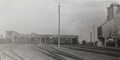
Exmouth Junction’s twelve lane Engine Shed c.1930. The Coal Tower is on the right.
A large coal tower, opened in 1930, was in use practically 24 hours a day, 365 days a year. Coal would be hoisted up out of the wagon into the tender. Anyone nearby was likely to be covered. There was also an area where you would clean out. Many people ended up with lung problems.
During World War II, railway sidings were built for military storage, using clinker from steam engines. Ambulance trains travelling from Southampton to Exeter went into these sidings to await their next assignment. In the RAMM there is a map showing German targets - Exmouth Junction had a big circle around it, but somehow they never hit it.
Exmouth Junction had its own Railway Club, which was very well used. Older drivers would often have 3-4 pints of cider. There were old nameplates all over the walls, worth over £100,000.
At its peak between 1930 and 1960, Exmouth Junction typically had an allocation of over 120 locomotives, but this could rise to 150 on busy summer Saturdays. Additionally, it had responsibility for engines from other depots in the south-west. It was a large employer, with around 500 men working from there.

Exmouth Junction Coal Tower c.1930
By the early 1960s, the railways needed a major overhaul. Steam trains were dirty and had had their day; a more modern alternative was needed, thus diesel / electric trains would be gradually introduced throughout. In the wake of the infamous Beeching Report, a huge number of loss-making lines were completely closed. Many of the remaining lines were downgraded to cut costs: stations were closed, train frequency was cut, and dual track was replaced by single track with few passing places. These changes would be the death knell for Exmouth Junction.
During 1965 steam finished in Okehampton, and by the end of that year in Yeovil. Exmouth Junction started to run down very quickly and closed in 1967. Some employees moved to St Davids, others all over the Southern and Western regions. It was heartbreaking. People who had worked all their lives on the railway suddenly found they had no job. Exmouth Junction was completely ripped up: the steam shed employing 500+ men; the concrete depot; the marshalling yard. Workers who lived in that area were suddenly gone. The impact on Heavitree would have been huge.
The Royal Engineers asked if they could practice by blowing up the coal tower. It was built so solidly that their efforts ended in failure; they gave up after four attempts.
In 1973, the Topsham, and the Salisbury to Exeter lines, were downgraded from dual track to single track. The second track was removed entirely; just a few passing places were left in situ. Train frequency was forced down to one train every two hours, the rails of the single track wore out more quickly, and the journey to Waterloo became much slower than that to Paddington, despite the fact that it’s actually a quicker line.

Polsloe Bridge Halt c.1910
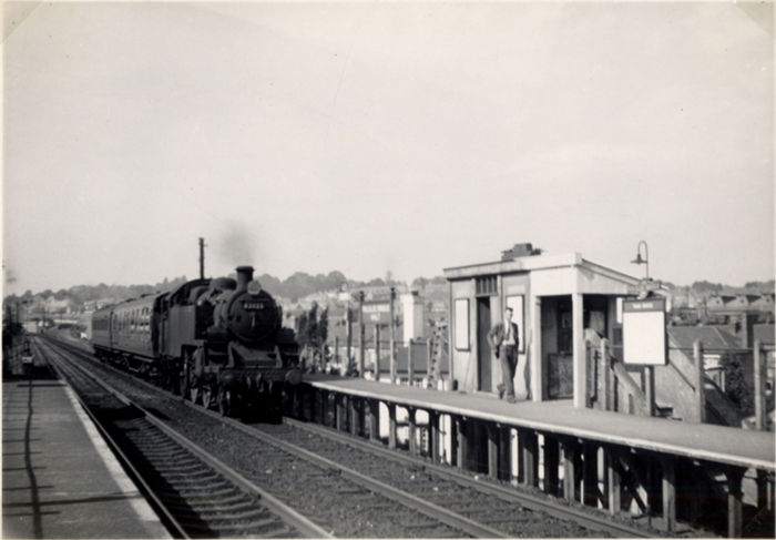
Polsloe Bridge Halt 1959. Both platforms were in use until 1973 when the line was singled.
The site of Exmouth Junction is now occupied by Morrisons. As you come into the car park, you can see where the World War II sidings were, and the cement works. These works provided reinforced concrete, cement, and fencing for the whole of the Southern Railway.
The land housing the sidings was contaminated for years. They were built from clinker; oil would have been dumped there. For a long time, any trees or plants planted would die. In spite the refusal of planning permission for many years, approval was granted in the early 2020s for the building of 400 dwellings.
The railways were a massive part of Heavitree’s local history, but since the closure and demolition of the facilities at Exmouth Junction you wouldn’t appreciate it. All the old drivers are gone, and along with them, the history.
Scroll to top of pageHeavitree And The Trams
Tram services arrived in Exeter in 1882. They were horse-drawn and operated over two routes on behalf of the City Council by the Exeter Tramway Company on a 21 year franchise – St Davids Station to the Mount Pleasant Inn (now Henry’s Bar), and London Inn Square to St Lukes College, Heavitree Road. The latter was extended to Livery Dole in 1893.
The trams were canary yellow, with brown lettering. They had bench-style seats on top, and inside the seats faced each other. Two horses pulled each tram, but four were needed to pull a tram up St David’s Hill.

An Exeter horse-drawn tram
The trams completely bypassed the City centre as traders objected, preferring people to travel by carriage and pull up outside their shops. As a result, the trams were never very profitable, and the service declined appreciably towards the end of the nineteenth century.
With the end of the 21 year franchise looming, in 1902 a poll of residents was taken on whether the trams should a) be run by the City Council and b) run along the High Street. The result was a decisive “yes” on both counts. Clearly the shopkeepers who had opposed horse-drawn trams had noticed that Sidwell Street was thriving, and this time wanted to be part of the action.

A map of the Exeter tram network
In 1904, Exeter Corporation purchased Exeter Tramway Company and its stock. New lines were put down, and the network extended across the River Exe to St Thomas, as well as through Heavitree to Cross Park.
New electric trams began operating in 1905 from a depot in Heavitree Road, close to where the Pyramids now stands.

New electric Exeter tram on Fore Street, Heavitree
The electric trams were dark green and cream, with gold lettering and a dark maroon undercarriage, and utilised the overhead trolley system for their supply of electricity. Within a couple of months, the new trams were carrying 80,000 passengers a week, rising to 100,000 before long.
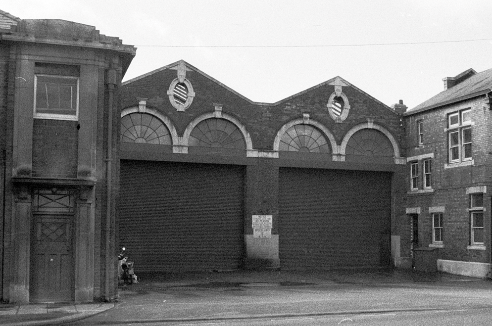
Exeter tram depot in Heavitree Road
Generally, the trams were reliable and ran to time, with few accidents occurring, although the weather caused occasional upheaval. Most of the problems happened during World War I when there was a shortage of staff and of electricity.
Pedestrian safety was the real issue that began to be encountered. To board a tram, one had to walk to the centre of the road. By the 1920s there were a lot more vehicles on the roads, and with many motorists believing they were entitled to keep going in spite the fact the tram had stopped, there were several episodes of people getting hit.

An electric tram at Cross Park, Heavitree
With car ownership increasing exponentially, the High Street was far too narrow for both trams and cars. The Council realised that buses were far more manœuvrable than trams: they could pull in, and there was scope for two lanes of traffic.
In 1931, Exeter’s final tram made its journey, ending a period of almost fifty years of trams between Exeter and Heavitree.
Scroll to top of pageHeavitree Urban District Council
For centuries the parish was responsible for overseeing most things in Heavitree: care of the needy, maintaining law and order, and education, for example. During the nineteenth century, the population of Heavitree grew rapidly, and the area changed from a village into more of an urban area. It became necessary for a more formal body to administer day-to-day affairs, thus the Heavitree Urban District Council (HUDC) was formed in 1896 and took on most of the parish’s responsibilities.

Church Street in 1909 showing the location of the Heavitree UDC offices
Its life proved to be a short one of just seventeen years. It's not clear why this is, but the issue of annexation no doubt came into the equation somewhere. Among the benefits the HUDC brought to Heavitree during its lifetime were:
- the provision of Heavitree Pleasure Ground in 1906;
- the widening of North Street in 1910.
The battle against annexation of Heavitree by Exeter had been going on for decades, and although the HUDC fought a good fight on behalf of the people of Heavitree, it was becoming increasingly clear that the area was in effect already a suburb of Exeter, and thus sooner or later annexation was inevitable. It's not clear why annexation occurred when it did, or how it ultimately came about.
Scroll to top of pageHeavitree Pleasure Ground
One of the most treasured and frequented areas of Heavitree has to be its Pleasure Ground, often incorrectly referred to as Heavitree Park which is located nearby at the intersection of Butts Road and Fore Street.
At the start of the twentieth century, fields and orchards in the Heavitree area were being secured for housing at an alarming rate. Thus, in 1905 the Heavitree Urban District Council (HUDC) purchased four fields off Whipton Lane for the purpose of a Pleasure Ground, similar to those that had already opened in the Belmont and St Thomas areas of Exeter in 1886 and 1891 respectively.
 |
 |
| Site of Heavitree Pleasure Ground, 1904 | Heavitree Pleasure Ground, 1936 |
|---|
The Pleasure Ground was designed to have something for everyone: gardens and open spaces in which to relax and improve well-being, sports areas, and a play-area for children. It had been noted that youths often congregated on Fore Street, causing a nuisance with their antics and colourful language; the development would give them somewhere to go, and something to do.
F.W. Meyer **, an employee of Veitch and Sons, well-established and respected horticulturists in the area, was tasked with planning and ornamental planting of the Pleasure Ground. A path was laid around the site, drainage improved, and trees and shrubs from around the world were planted.
The Heavitree Pleasure Ground was opened on 1st May 1906 by Colonel Vaughan (Chairman of the HUDC), attended by J.W.W. Matthew (Clerk) and F.E. Simpson (Surveyor). A plaque commemorating this can be seen in the wall next to the main entrance in Whipton Lane.

Plaque commemorating the opening of Heavitree Pleasure Ground on 1st May 1906
There was still much to be done. Development continued after this date until the annexation of Heavitree into Exeter in 1913, and beyond.
In 1906, a further area was acquired, and two fields were let for mowing and sheep grazing.
Also in 1906, a tennis court, bowling green, and children’s play-area near the current basketball court, were added, the children having been warned that they must behave properly. To begin with, only Heavitree parishioners were allowed to use the tennis court and bowling green; over time others were allowed to use the facilities but had to pay at a higher rate.
 |
 |
 |
| Early views of Heavitree Pleasure Ground | ||
|---|---|---|
In 1907, Robert James was appointed ground keeper and gardener, at a rate of 24/- a week, and “that he be provided with a cap”. Mr James was needed as several boys had been brought before the Committee and fined for causing damage to the grounds. There was swearing during football matches, and help was needed on Sundays when behaviour was especially poor – broken bottles and damage to plants were noted.
In 1908, Heavitree Cricket Club requested a portion of land for cricket practice.
Other Improvements over the next five years: Entrance gates were provided; ladies and children’s toilets were built; additional trees and shrubs were planted, including in 1911, the King George V coronation oak, which survived until 2016 before being severely lopped due to disease; seats were provided around the swings; see-saws provided in the playground; a plant nursery established.

The plaque in Heavitree Pleasure Ground by the King George V coronation oak in 2016
Over the years, features have been added (new play-area, paddling pools, BMX/skateboard ramps, basketball court), others have come and gone (a pavilion, Heavitree United Football Club using the Ground for matches), some in the original plans by F.W. Meyer never came to fruition (e.g. a large, formal, circular bed in the centre of the Ground with a statue in the midst, a small lake near the bowling green), but the Pleasure Ground remains as popular now as when it was first opened.
 |
 |
 |
| Views of Heavitree Pleasure Ground in the 1970s (Courtesy: Mal Morrison) | ||
|---|---|---|
Parklife Heavitree was established in 2010 to build and nurture the local community, based around the Pleasure Ground. They hold regular events: an annual Fun-Day, weekly keep fit and running groups, and monthly seasonal events (e.g. Easter egg hunt, Carol singing). The group opened a Community Hub near to the bowling green in 2021. This houses a popular café, and is used by numerous groups each week.
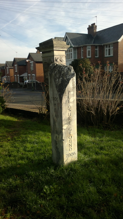
The centenary memorial in Heavitree Pleasure Ground in 2016
Did You Know?
A small part of the current Pleasure Ground used to be a brickworks.
This area - bounded by Roseland Crescent, Hamlin Lane and Chard Road - was only added to the Pleasure Ground after World War II.
Footnote:
** Frederick W. Meyer was born in Germany in 1853, and died in 1906 just a few months after the Pleasure Ground was opened. The 1891 census lists him as living at 15 Elmside. He is buried in the Higher Cemetery. At the suggestion of David Morrish, one of the HLHS founding members, retirement apartments in Butts Road that replaced the old Red Cross H.Q. were named Meyer Court in memory of him.
Sources:
HLHS – Dec 2005 (Newsletter 23), Mar 2007 (Newsletter 28) + Sep 2007 (Newsletter 30);
National Library of Scotland – Ordnance Survey 25", 1841-1952 series, Devon LXXX.7 (1904 + 1936)
The Widening Of North Street
By the beginning of the 20th century Heavitree was starting to expand more rapidly than ever before. Fields and orchards were being sold to developers and laid out for housing at an alarming rate. This in turn would lead to a projected growth of road traffic in the area, and consequently a requirement to improve the existing road network.
North Street, Heavitree had existed for years, yet was still relatively narrow. Although only a short stretch of road, given recent building at Polsloe Park (creating a through-route to Pinhoe Road for the first time via Goldsmith Street and Ladysmith Road), and around South Lawn Terrace, this was an ideal candidate for upgrade. Thus the Heavitree Urban District Council (HUDC), itself only established in 1896, proposed it be doubled in width.

North Street prior to widening
The minutes of the HUDC Streets Committee in 1908 record various payments to owners of properties in North Street to compensate them for the loss of their land required for the widening:
- A Mr Hutchings received three shillings per foot, and £7 10s to include the cost of setting back the railings;
- A Mr C. offered a portion of his garden for £47 10s to include the cost of setting back railings, but this offer was rejected;
- An offer was made by Messrs H & R, for four properties in Homefield Place for the purpose of widening North Street; the HUDC made a lower offer which was subsequently rejected.
An inspection of maps of the area show that corner properties, 8 and 9 Homefield Place, which hitherto had adjoined the property now occupied by the ‘Curry King’ Indian restaurant (then 7 Homefield Place), were demolished and became part of the highway.
 |
 |
| Map of North Street, 1904 | Map of North Street, 1936 |
|---|
In a scheme that cost £2,200, the Medical Officer of Health hailed in his annual report that the street had been turned "from a narrow and dangerous lane, to one of the widest streets in the district."
As an indication of civic pride at the time, a wall plaque marks the completion of the widening by the HUDC. It records the names of Henry Hill (chairman), J.R. Nethercott (vice-chair), J.W.W. Mathew (clerk) and F.E. Simpson (surveyor).

The commemorative plaque to the 1910 widening of North Street, seen here in 2018
A gas lamp, widely known as the Nethercott Lamp (named after the aforementioned J.R. Nethercott), was erected in 1912 to give light to the widened junction; this can still be seen today. Until their relocation in the early 1960s, when there was further modification of the area, there were public conveniences under the street, the entrance being in the centre of the street to the rear of the lamp.

The official unveiling of the Nethercott Lamp in 1912
The number of houses in North Street, according to Besley’s 1909 Exeter Directory was eleven on the east side – known as North Place, and twenty-four on the west – four of which were known as Oak Close, and eighteen of which were known as Shelton Place. The occupations of the inhabitants of these houses make interesting reading: they include several gardeners, a plumber, a blacksmith, a launderess, a coachman, an ironmonger, a wheelwright, an undertaker, a chimney sweep (remembered in the late 1920s as ‘Sooty’ Reed), an insurance agent, a butcher and a dairyman.
Apart from one or two recent additions, most of the buildings in North Street, including the Windsor Castle public house, remain as they were at the time of road widening in 1910.
Scroll to top of pageThe Annexation Of Heavitree
During the nineteenth century, propositions by the Exeter City Council regarding the matter of annexation were persistent as the town of of Heavitree began to develop and expand on its doorstep.
As early as 1835, the Vicar recognised the "increase of building which has lately taken place and converted the Parish into a suburb of Exeter," with the Parish Vestry resolving that "no part of it should come under the new City Council." In 1838 it opposed "any encroachment or extension of the Exeter jurisdiction or power whatever," and formed a standing committee to defeat any attempt. In 1840 it objected to Exeter's attempts to get market jurisdiction in Heavitree, in 1845 to extend county court jurisdiction, and in 1847 it resolved to fight "any attempt to sacrifice the independence of this Parish by incorporating it with the City of Exeter."
The creation of the Heavitree Urban District Council in 1896 gave some continued measure of independence and an elected body with wider powers to improve the district. It carried out a poll of residents in Heavitree around the turn of the century, the results of which are reported thus by the Western Times on 26th January 1900:
Result of polling at Heavitree.
The result of the poll demanded at the recent public meeting on the annexation question was declared early on Wednesday. Little interest was evinced by the inhabitants generally and only a few assembled to hear the result.
The figures were:
- Against Annexation 974
- For 349
- Majority 625
The number of papers sent out was about 1500. There were 15 spoilt votes and 178 did not fill in their paper.
The annexation of St Leonards in 1877 and St Thomas in 1899 had set a precedent however. It had been clear for years that the City Council wanted Heavitree to go the same way. A press cutting from 1912 illustrates well the battle for control of Heavitree. Although it was likely all members of the City Council agreed annexation of Heavitree was a desirable thing, there was something of an internal division as it seemed inappropriate practices might be used.

Press cutting of 4th March 1912, Exeter & Plymouth Gazette
The caption reads:
Miss Heavitree: "Unhand me sir!"
The Pirate Captain: "Once on board the lugger, you will and shall be ours!"
"Exeter wanted something that did not belong to it. The City desired to forcibly take Heavitree,
which was not right." - Alderman Stocker, at the last meeting of the Exeter City Council.
On 21st February 1913, the Devon and Exeter Gazette reported:
'At a meeting of Heavitree Urban District Council, held on Wednesday, among the items of estimated expenditure to be provided for during the ensuing year was a sum of £1,800 for "annexation opposition." The Chairman of the Finance Committee (Mr. White) said the annexation inquiry had already cost Heavitree £2,200 and was an iniquitous business, no doubt engineered by a few interested parties in Exeter. On the recommendation of the Finance Committee it was decided to levy a general district rate of 4s 4d in the £ in no.1 district, and 3s 10d in the £ in no.2 district – an increase of a shilling.'
It was clear from this that during 1913 the Urban District Council intended to continue resisting annexation. Justification for this is portrayed by a cutting from May 1913, that depicts the City Council presenting to the people of Heavitree a very different impression to reality, namely that it was amiable rather than greedy and self-centred.

Press cutting of 12th May 1913, Exeter & Plymouth Gazette
It's unclear as to whether the people of Heavitree felt that the advantages of being a part of Exeter outweighed the disadvantages, they were hood-winked or even forced into annexation by the City Council, they objected to the increasing cost of the resistance campaign and thus lost faith in the Urban District Council, or simply accepted the inevitable having fought a noble battle for so many years.
Whatever the situation, Heavitree finally succumbed at some point during 1913. Exeter had won and Heavitree became merely another district thereof. Life in the area would certainly change, for better or worse, in order to bring the hitherto independently-run town of over a thousand years into line with City practices.
Following annexation, a great controversy apparently raged in the City concerning the adjustment of the salaries of the City officials. This is illustrated in a satirical cartoon from the Devon & Exeter Gazette in 1914. This perhaps realised Heavitree's worst fears, viz. the City Council didn't care about them only promoting itself.
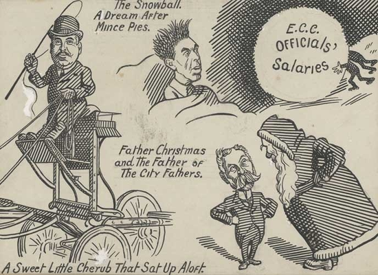
Satirical cartoon from 1914, Devon & Exeter Gazette
[The figures in the illustration represent Councillor Lucas, Councillor McGahey,
and Councillor Thomas Linscott (the oldest member of the Council)]
Writing in the parish magazine a few years after the takeover, the antiquarian Miss Beatrice Cresswell expressed the contemporary views of regret at annexation, and in particular over the loss of the system of rating independent of the City.
Scroll to top of pageChurches Of Heavitree
Heavitree Parish Church
It is likely that a church has stood on the current site in Church Street since the late Saxon era, however the oldest surviving record is of its grant to Exeter Cathedral in 1152. The building was extensively rebuilt in the fifteenth century and restored in 1541.

A lithograph showing Heavitree Parish Church in 1842
After this, no major work took place until the nineteenth century, when population growth meant the building was no longer sufficient for its needs. The old fifteenth century red sandstone building was largely rebuilt between 1844 and 1846 at a cost of £3000 raised by subscription.
Only 2 years after the new building was consecrated however, the lower skirting of the pews and the flooring was found to be "in a state of putrescence." The church was closed for several months whilst rotting timber was replaced and a new concrete floor laid, but also due to the "noxious vapour from the bodies under the floor."
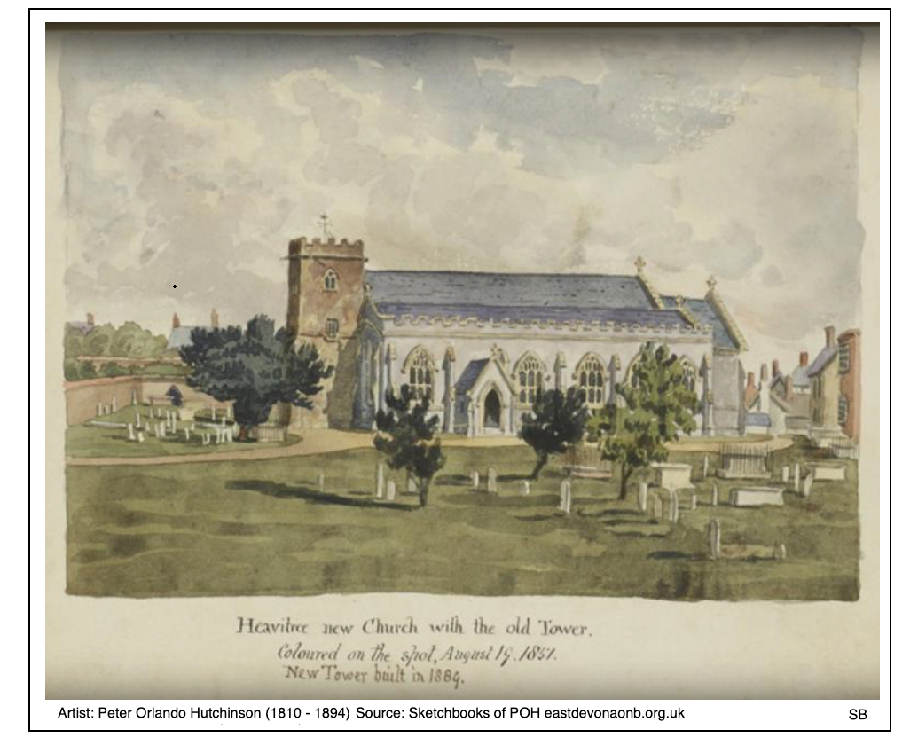
Painting of Heavitree Parish Church in 1857 showing the rebuilt church alongside the older tower (Courtesy: Stephen Bees)
Due to a shortage of funds when the main part of the church was rebuilt, the tower wasn't replaced until 1887. Thus for around 40 years, the new church and the old tower existed alongside one another. A peal of eight bells replaced the original four in 1897 to commemorate Queen Victoria's diamond jubilee.

Heavitree Parish Church in 1880 showing the rebuilt church alongside the older tower
Within the sizeable churchyard stands the Heavitree Yew, the oldest tree in Exeter, which is probably over 500 years old. It is likely that this tree is formed of side-shoots from a much older tree felled at the time of the fifteenth century rebuilding of the church. Whether this was the head tree (heafod treow) beneath which the Saxon kings held court will never be known.
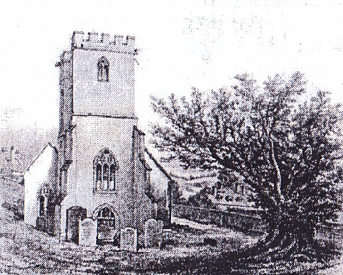
The Heavitree Yew alongside the old church
When the church tower was rebuilt in 1887, the Medieval gargoyles from the old tower were embedded in concrete around the base of the tree. In the early 1990s, having discovered the importance of the tree, Devon members of the International Tree Foundation removed the detritus to allow water to be fed down to the roots; ivy and dead branches were also trimmed back. Members now keep an eye on the tree to ensure it stays healthy.
In 2002, The Tree Council included the tree in their list of 50 'Great British Trees' in celebration of Queen Elizabeth II's golden jubilee; a plaque has since been added in recognition of this fact.
Heavitree Parish Records
The earliest surviving parish record is the baptism of Robert Knoll on 1st February 1556. Records of weddings and burials did not commence until a century later.
During the Civil War and the years following, parishes were subjected to ever-changing and confusing regulations from Parliament as regards the records they had to keep. For example, the Marriage and Registration Act of 1653 denied the Church the right to celebrate marriages and stipulated that clerics had no authority to keep parish registers or bury the dead.
The first surviving marriage record in Heavitree is in 1654. The following gives a taste of how people responded to the various Puritan laws:
	     Weddings
1654		 7
1655		 5
1656		 6
1657		11
1658		38		Cromwell died
1659		39
1660		62		James II restored
1661		21
1662		22
It seems that either many marriages were not recorded when they occurred, or couples felt that a civil marriage had no standing in the eyes of God or their neighbours, and regularised the position as soon as they were able.
St Loyes Chapel
The ruins of St Loyes Chapel in Rifford Road are the remains of a chapel first recorded in 1387 and likely to have been consecrated the year before. It is dedicated to St Loye, a 7th century French Goldsmith who became Bishop of Noyau and was adopted as the patron saint of all metal workers.

The ruins of St Loyes Chapel in 2018
Worship probably ended or declined with the Reformation, and by 1607 part of the building was used as a house. By 1785 it was used as a stable. In the 1890s an attempt was made to restore the chapel but this failed. The ruins survive as an example of the local use of Heavitree Stone.
The Chapel Of St Clare
Although it has often been claimed that the chapel at Livery Dole is medieval in date and was dedicated to St Clarus, this is now known to be false; it was in fact built with the almshouses adjacent to it in 1592. It is possible that the chapel was built as a place where prayers were offered for the souls of persons executed at the nearby crossroads.

The chapel of St Clare alongside the sixteenth century almshouses in 1850
The building consists of a nave, of which the chancel is a continuation. The doorway is at the western end and the windows are filled with stained glass. It is built of Heavitree Stone, one of the few in the Parish, supported by buttresses. The tracery of the eastern window is a mixture of the late Decorated and Perpendicular styles and has probably been taken from a medieval building.
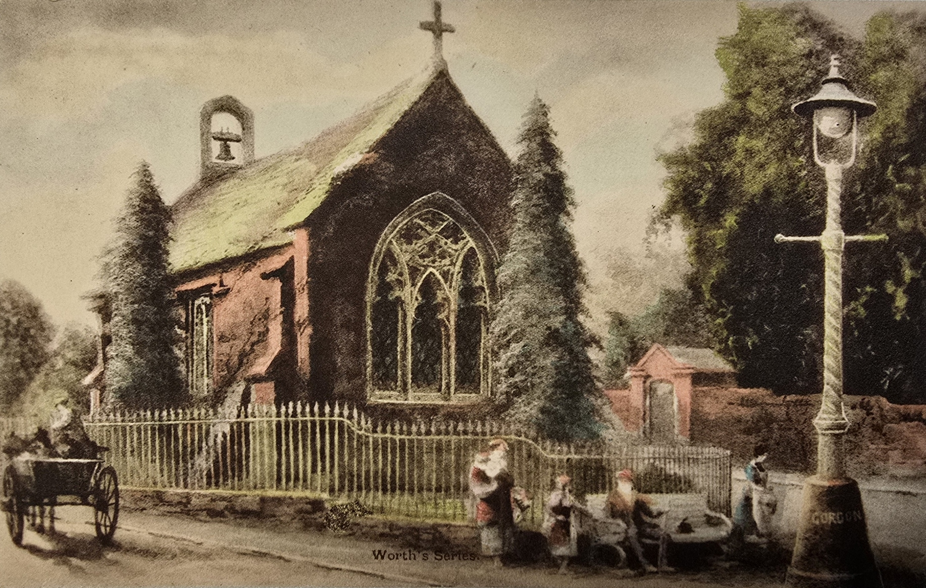
The chapel of St Clare alongside the Gordon Lamp, late 19th / early 20th century
Heavitree Congregational Church
In 1884 Exeter Congregationalists purchased Homefield House and its grounds for £798; Homefield House was formerly located on the corner of what is now Homefield Road.
In 1885 they opened a Mission Chapel in the gardens at a cost of £990 and seating 180. The memorial stone was laid in January of that year and bears witness to the fact that for 18 years hitherto a Mr Joseph Hayman had opened his house for public worship; Mr Hayman lived at Stafford Villas (now 83 Fore Street).

The 1889 OS map showing the Mission Chapel prior to extension.
Prospect Villas can be seen to the left, Homefield House and Brenda Villas to the right.
In 1902 Homefield House was demolished and a new church was built on the site at a cost of £4,000. This was at right angles to the original building, which was incorporated to the rear of the development. The new structure included a hall that seated 450, a lecture hall holding 120, and a basement hall. The foundation stone was laid on 29th September 1902, and the new church dedicated on 2nd June 1903.
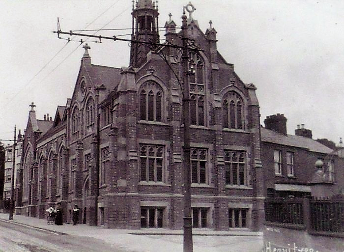
Heavitree Congregational Church in 1907.
Prospect Villas can be seen to its left, Brenda Villas to its right above the railings of Homefield Place.
During World War II the basement was used as an air-raid shelter but was badly damaged in 1942 by enemy bombing. This also destroyed the adjacent Prospect Villas that once stood in Fore Street to the west of the church.
In 1972 the Congregational and Presbyterian Churches merged to form the United Reformed Church, by which the church is now known.
Heavitree Catholic Church
Heavitree House, an early nineteenth century property in Fore Street, was purchased along with the adjoining land in about 1930 for the building of a Roman Catholic church.
The church was built at a cost of £15,000, and is located well back from the road. The foundation stone was laid in June 1931, whilst the church opened in May 1932. In spite of its positioning the structure is readily visible from Fore Street, and is a very striking one even by today's standards. It includes a portico of six marble columns, and a tower that houses a massive 4 ton bell, which at the time was the second largest in Devon, and caused quite a bit of local protest.

A pre-war image of the Catholic Church showing the full height of the tower
Although the tower currently stands at 60 foot high, it was originally stood at 90 foot. A direct hit during the Baedeker Raids of May 1942 caused serious structural damage to the tower and completely destroyed the neighbouring presbytery. The tower was never rebuilt to its former glory.

The Catholic Church in 2011 showing the shortened tower
Meanwhile, Heavitree House was renamed Rosary House by the church and was used as a school for a good number of years. When this closed it was initially used for other purposes by the church before being sold to raise funds. The building is still known by the same name and now houses City Vets.

Rosary House (formerly Heavitree House) is now home to City Vets, seen here in 2019
Heavitree Gospel Hall
In the early twentieth century, the Plymouth Brethren opened Heavitree Gospel Hall on the corner of Alpha Street, opposite where Shaul House is now. In 1935, the Conservative Rooms relocated from Fore Street to to their present home in Church Street. The church moved into the vacant premises and was renamed Ebenezer Gospel Hall. The Alpha Street site was later used as a Weslyan Chapel.
Enemy action in 1942 destroyed the Fore Street building along with others in the vicinity, namely 1-5 Sivell Place and those on the opposite side of Fore Street where the filling station now stands. Mr Alford, graciously opened his home at 'Eagle House', Salutary Mount, for Brethren services at this time.
After the war, the Brethren constructed a Nissan type hut meeting place on the current site, along with a car park where 1-5 Sivell Place had been. This was replaced in 1979 by the present building. The church is now known as Heavitree Evangelical Church.
St Mark's Church
The HLHS has always been interested in developments as the parish of Heavitree became more urbanised.
Contrasting images of St Mark’s Church as a tin tabernacle in Manston Road in 1902 with the 1937 church in Pinhoe Road that stands today really illustrate the changes that occurred as the population of Heavitree grew.
A map from around 1890 shows very few houses on Pinhoe Road, the female reformatory on Polsloe Road, and the tram lines which had reached Mount Pleasant. There was no church on either Manston Road or Pinhoe Road.
In 1899, land was obtained for a church in Manston Road. The Iron Church was erected and first used in 1901. The foundation stone for a new, more permanent, church was laid in 1910; this church was first used for services in 1911.
The ‘Mission Chapel’ is visible in Manston Road on the 1910 map. Other churches in the area by this stage were The Mount Pleasant Methodist Church and Polsloe Park Christian Chapel.
 |
 |
 |
 |
| Tin Tabernacle, Manston Road | Aerial view of St Mark's Church | Laying of foundation stone | Plan of Polsloe Park Church |
|---|
As the population of the area continued to rise, it became clear that this second church was still inadequate. The Polsloe Park Fund was set up to raise money for a bigger, grander church that would seat 500 people. A number of public fundraising events were held, including a Dickens Fair in 1925 and a Shakespearean Fayre in 1927.
Dame Violet Wills, a well-known woman who had grown rich through cigarettes, paid a huge amount towards the new church. The church was always reputed to be paid for by British workmen as they were the ones who had made her rich by buying her Woodbines! The Wills Foundation continues even today, and recently funded a new organ for the church.
In the early 1930s, as funding approached its target, the church site in Pinhoe Road was cleared. Violet Wills increased her donation, and an appeal went out to the people of Exeter for final contributions. In 1937, the church was consecrated. This was preceded by a lunch at Dellers and a procession from the old church to the new.
 |
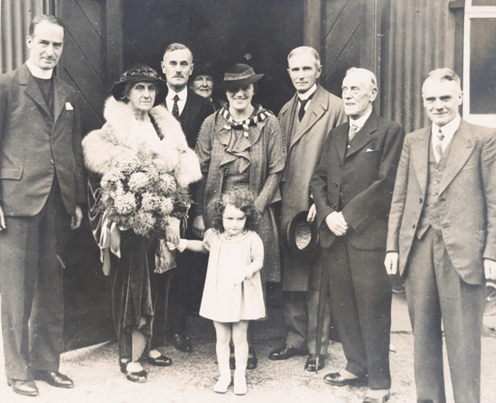 |
 |
| Procession arriving at the new church | Group photo showing Dame Violet Wills (holding flowers) | Extract from burial records showing some of those lost in the Baedeker Raids |
|---|
The Baedeker Raids of WW2 destroyed many buildings in the area and took the lives of parishioners, as can be seen in the burial records from the time.
Bells were acquired in 1951, made from melted down bells from former Exeter churches. A new west window was funded portraying two local saints: St Sidwella and St Katherine.
In 1975, the Manston Road site was sold and a new church hall built near the present church. There are now six 'modern' houses on the land where the original tin tabernacle was located.
Other Churches And Chapels
Mowbray Cottage, the attractive house opposite Meyer Court in Butts Road, entered non-conformist use as an independent, possibly Congregational chapel in 1833. By 1851 the premises appear to have been used by Wesleyan Methodists. It ceased to be used for religious purposes by 1860, and was converted into a private dwelling.

Mowbray Cottage in 2018
Hope Hall in Hope Road was built as a Sunday School by the Baptists in 1905. Apparently, the name of the road was changed from Muddy Lane at the same time. In 1931 they moved to new premises in Wonford Street.

Hope Hall in 2018
The Burnthouse Lane estate has had a number of chapels in the past:
- There was a Salvation Army chapel at the corner of Chestnut Avenue.
- In 1939 the Exeter City Mission built a hall on land now occupied by Wynstream School.
- There was a Brethren Gospel Hall on the Lidl site.
Education In Heavitree
Heavitree Parochial School
With the exception of the small charity school that existed in the eighteenth century, there was no provision for education in Heavitree prior to 1840. In that year, the Heavitree Parochial School was built using public subscriptions raised at the instigation of the local vicar of the day Arthur Atherley; it stood in Fore Street on the site of what is now the Co-op store.
The school was constructed on the site of a church house, the land for which was granted in 1516 by John Kelly, Lord of the Manor, to the vicar and others, on condition that they built a parish house and commemorated the souls of him and his ancestors. That building was described in 1823 as being "in tolerable condition, inhabited by paupers having been placed there by the parish officers." However by 1835, due to the increasing population of Heavitree, the vicar reported that the parish had no workhouse and that "the Poor House, which is very dilapidated, is capable of containing only one tenth of the poor." The building was soon freed by the Poor Law Amendment Act of 1834 which centralised the paupers in the St Thomas Union Workhouse.
Although the 1840 structure was a fairly substantial stone building consisting of one large room with a stepped floor type of gallery, reports indicate that the lighting of the school was unsatisfactory as the sills of the windows were too high up and cast shadows over many of the desks. Ventilation was not good and the one stove was insufficient to warm the school. The playground was enclosed by high walls and was rather sunless.

The 1889 OS map showing the site of the original Heavitree Parochial School
In 1856, St Luke's College Committee of Management entered into an agreement with the vicar and the trustees, which gave the management of the school over to the training college. The school was then run by the Normal Master of the College and was to be a practising school for the students of St Luke's. This continued until 1872 when the college opened their own school. At the time the arrangement was made there were 80 pupils. However, some of the children travelled from country districts, which was a cause of poor attendance in wet weather during summer and autumn terms. Many left school at the age of 9 or 10.
A plot of land on South Lawn Terrace (then still known as Whipton Lane), was donated to St Michael's Church by Augustus Frederick George Warwick, Baron Poltimore, for the building of a new school. The school, a replacement for the Fore Street building, opened to boys on 29th September 1871. The girls, who had hitherto been educated in the old church house in Church Street, a site occupied by a former vicarage and where the Rifford Room now stands, followed a few years later in 1875. The school was known simply as Heavitree School.

The side of the South Lawn Terrace site in 1910 (viewed from the adjacent footpath)
Internally, the building was divided in two, each half having a separate entrance. Similarly, the external plot was divided with separate play areas so, at school, boys and girls never met. A pair of semi-detached houses were provided for the Head teachers. These houses were used more recently to house Heavitree library and a dental surgery. The former was demolished along with the Victorian school buildings in around 2006 when the school was rebuilt as part of an Exeter-wide modernisation programme; the latter remains.
Meanwhile, the original Parochial School building in Fore Street continued as Heavitree Infant School. The house next door, called Lyndale, was an addition to the school in 1895 as the population increased. The school finally closed in 1937 when pupils were transferred to the restructured South Lawn Terrace site. The buildings remained until 1967 when they were demolished making way for the current retail premises. In the interim, the building housed Thorn's Garage, and prior to that it had been successively used as a chair store and a community centre.
| Site of the original Heavitree Parochial School in Fore Street | ||
|---|---|---|
 |
 |
 |
| 1930s | 1958 | Early 1970s |
Returning to the South Lawn Terrace site ... Over the years the school has been restructured or renamed a number of times:
- 1937: the two schools were modernised and re-modelled into a single building. Infants transferred from the Fore Street site. Renamed Heavitree Mixed and Infants School.
- 1975: the school became Heavitree First + Middle School. Pupils over 12 years of age moved to high schools in the area.
- 1997: renamed St Michael's Church of England First + Middle School, marking the school's close and continuing links with Heavitree's parish church over the centuries.
- 2006: as part of a restructuring of all Exeter schools, the Victorian buildings were demolished and replaced with modern buildings further back from the road. The school was further renamed St Michael's Church of England Primary School.
- 2013: the school became a self-governing academy and was renamed St Michael's Church of England Primary Academy.
Ladysmith Schools
The Origin Of The Name Ladysmith
In 1812 following the siege of the Spanish city of Badajos, a young infantry captain, Harry Smith, met and married the beautiful fourteen year-old Spanish noblewoman Juana Maria de los Dolores de Leon.
After a long military career he became Sir Harry Smith, and while he was Governor of Cape Town the town of Ladysmith was named in honour of his wife, Lady Smith.
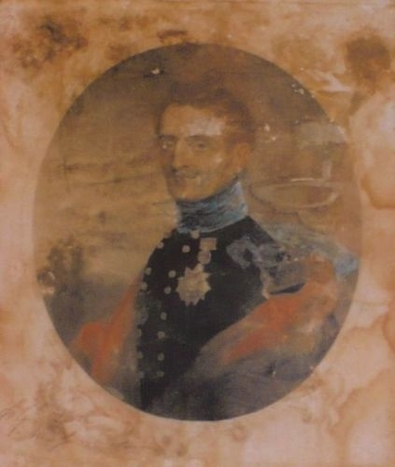 |
 |
| Lt. General Sir Harry Smith, 1788-1860 | Juana Maria de los Dolores de Leon |
|---|
In the winter of 1899/1900 during the Boer War, the British garrison at Ladysmith was besieged for several months by a large Boer army. When it was finally relieved the British public celebrated for several days and many places, including Heavitree, named streets after the scene of a British triumph. A few months later Pretoria was the scene of another British victory.

An illustration of the Boer War, 1899-1902
School History
There are currently two schools in Pretoria Road, Heavitree - Ladysmith Infants and Ladysmith Junior. The original school catering for ages 5-12, built on the current Infants School site, was named Heavitree Council School. It opened in February 1908.
The school subsequently adopted the name of the road on which it stood apparently because local people had been calling it Ladysmith School for some years.
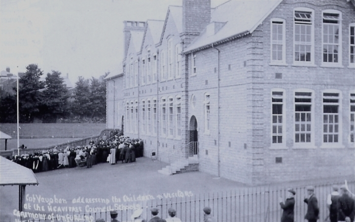
Colonel Vaughan (chairman of the Heavitree Urban District Council) officiates
at the flag unfurling ceremony at Heavitree Council Schools, 1908
Due to the school leaving-age being raised in 1921 from 12 to 14, and the increase in Heavitree's population as further housing was built, it became clear that additional accommodation was required, and in 1936 the foundation stone of what is now the Junior School was laid.
This second building, on the opposite side of Pretoria road, was built to Secondary Modern standards, and was able to accommodate additional pupils when the school leaving-age was raised again in 1948 to 15.
In 1974, following further education reforms raising the leaving-age to 16, Ladysmith Secondary Modern School merged with St James School for girls, Beacon Heath, Exeter. The original Council School became Ladysmith First School and the 1936 building became the Middle School.
 |
 |
| 1936 building | 2017 replacement |
|---|
In 2006, as part of a reorganisation of the school structure in Exeter, the First School was renamed to an Infant School and the Middle School to a Junior School.
2017 saw the demolition of the 1936 buildings to be replaced by new buildings further to the north on the same site. The original 1908 buildings remain, supplemented by additional out-buildings added at various times.
Bramdean School
Bramdean School was opened in 1908 for two scholars in one house, by Mr A Clements Walters. He retired in 1935 after seeing the school expand, both numerically and physically. By now it occupied two joined detached houses (known as Richmond Lodge) of a group of four; the school field was located on the opposite side of the road.
The four houses, collectively known as Richmond Grove, were built in 1834 on land bought from the Baring estate by Edward Eardley, an Exeter Glass and china merchant, who was also involved in the building of properties at Heavitree Park. Richmond Grove lost its name in 1939 when the thoroughfare on which it stood was numbered and named Homefield Road.
The school saw further expansion over the years, with additional buildings added in the grounds.
In the 2010s, poor academic performance led to a decline in pupil numbers, and falling revenue. Closure of the school followed in April 2020. The site reverted to private dwellings during 2023, with only the school sports field remaining.
 |
 |
| Bramdean School buildings c.1920 | |
|---|---|
The building of houses at Richmond Grove were soon followed by three others around the corner in Bicton Place. The middle of these three, named Belmont (Collingwood House from the 1880s) was built in 1835, and used as a private school when Miss Elizabeth Clarence moved there from St Leonards. The 1851 census shows Miss Clarence living there with her two spinster daughters (all school mistresses), twelve female pupils aged eight to seventeen, and three servants.
Scroll to top of pageRetailing In Heavitree
Overview
From the time that retail really took off in the nineteenth century, right through until the latter part of the twentieth century, small, family-run shops could be found on many residential streets, in addition to shops on the main high streets. Smaller shops were initially run from people's front-rooms, but later, purpose-built premises were incorporated into residential developments, many at street junctions or at the corner of a road where they could catch the trade from both streets; they were collectively known as corner shops. In some locations, shops would be grouped together to form a parade. By far the largest proportion of corner shops sold groceries or provisions, and often passed down through several generations of the same family.
With only family members and may be a couple of workers to run the shop, rather than several shifts that we see today, opening hours were limited: most shops would close for an hour at lunchtime, would always be closed on Sunday, often on a Saturday afternoon, and on another weekday afternoon (usually a Wednesday or Thursday); this gave a 5 day working week spread over 6 days for workers; the owner would have accounts and orders to process out the back or after closing. Such hours were more than sufficient: customers worked around the opening hours - shops were there to provide a basic but adequate service for local customers, rather than trying to compete with others shops by attracting customers from a wider area or by staying open over longer hours.
Shopping in the early days was done as a necessity rather than the pastime that it has become today. Visits to larger stores, only to be found in the city centre, would take place no more than a couple of times a month at the very most, as there was little disposable income for every-day folk. Clothing was usually home-made, and was frequently handed down to younger siblings and friends, or could be bought cheaply at jumble sales (car-boot sales, charity shops and door-to-door collections have only been around since the 1990s). Household items would have been very basic and sparse by today's standards.
Before the refrigerator was invented and was cheap enough for everyone to afford, cool storage cupboards known as larders, were used to store food. As most food had a very limited shelf-life, it was necessary to buy in small amounts and to visit the grocery shop on a daily basis or at least several times a week. Customers would be served at the counter - goods were weighed, sliced and parcelled-up by the proprietor.
World War II might be regarded as the hey-day of the local shop. Rationing was introduced due to severe shortages - everyone was allocated to their local corner shop, meaning that they could only buy goods at this particular shop; the shop on the other hand would have a guaranteed and loyal set of customers. Most items were in very short supply, giving rise to the phrases "Dig for Victory" and "Make Do and Mend". Luxuries, that had hitherto been shipped in, were not seen in Britain for years - locally grown substitutes would be used instead, for example, parsnips mixed with banana-flavoured essence were eaten in the absence of real bananas. Those fortunate enough to have a garden or allotment did their bit for the war-effort by growing their own fruit and vegetables, and sharing surplus with neighbours and friends; parks and open spaces were converted into allotments. Home-grown items were very seasonably-orientated, yields varying greatly from one year to another with the weather conditions. Most items were only available for a few weeks each year, but could be blanched or par-boiled then stored in brine for eating as required out of season. Rationing continued for several years after the war for certain items as the country gradually return to normality.
After the war, in practically all areas of life there was a desire to leave the old behind, to look forward and never turn back, to embrace new radical ideas. Retail was no different - by the late 1950s self-service stores (later known as supermarkets) began to open. The convenience of being able to buy everything in a single store, and more and more people being able to afford to own a fridge and a car, gave way to the idea of a 'weekly food shop'. Once loyal customers of the corner shop slowly began to defect; the decline of the local shop had begun. Many survived for a number of decades longer, until their owners retired and younger folk had no desire to take them on.
Today even the larger high-street stores struggle to survive as rents rise, tastes change more rapidly and become more diverse, and on-line shopping becomes more prevalent. However, there is some evidence of late to suggest that there is something of a revolt against larger stores in favour of smaller shops once again, as climate-change and excessive use of packaging, especially (single-use) plastic, has become an important issue for many people; in addition, some supermarkets tempt shoppers with offers that penalise suppliers rather than the shop bearing the cost. Home delivery by larger stores and independent tradesman, that was once common-place but largely died out as people chose to tackle the 'weekly food shop' by themselves, is taking off again as people juggle their time between work and leisure. Sadly, it's unlikely that the corner shop will ever be as ubiquitous as it was in days gone by.
Retailing In Fore Street
As the main street in Heavitree, Fore Street has for many years been lined with a good number of shops and establishments providing a range of services to residents and passers-by.
In common with the local corner shops, in the early years these outlets would have been small, family-run affairs that often saw little change for years. More recently, a number of the small businesses have been taken over by larger franchises seen in many towns and cities. The pace of change has also quickened meaning that shops especially often stay for a much shorter period of time.

Retailing in Fore Street
[transcribed from a booklet published by the Society in 1999 & augmented]
It is interesting to note how the type of outlet has changed over the years. Modern Fore Street, although still relatively thriving, is not perhaps what it once was, now dominated by charity shops and cafés / restaurants rather than shops selling provisions or household items.
| Fore Street, Heavitree (various years) | ||||
|---|---|---|---|---|
 |
 |
 |
 |
 |
| 1905 | 1908 | 1930s | 1973 | 1999 |
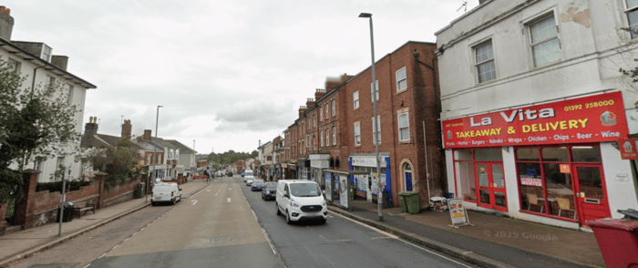 |
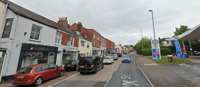 |
|||
| 2022a | 2022b | |||
When Heavitree was a separate urban area from Exeter, Fore Street would have been the main shopping street; sadly now it is seen by many merely as a means to reach the main shopping area - Exeter city centre - with large numbers simply driving through.

Fore Street, Heavitree, looking towards Exeter from the junction with North Street.
The date is uncertain, but between 1912 (when the Nethercott Lamp was erected)
and 1931 (when buses replaced trams)
Whilst we're talking of changing modes of transport and driving through, here are a couple of early images of Heavitree's first garage, the Mote Garage in Fore Street. The exact dates aren't known, but the first is clearly earlier than the second, if the growth on the shrubs is anything to go on. Quite what "Quick Animal Transport" refers to on the second image we're not sure. Could it refer to transportation of livestock to market?
| The Mote Garage, Fore Street, Heavitree | |
|---|---|
 |
 |
| Early 1920s ? | Later 1920s ? |
Banks Of Heavitree
Heavitree's first bank, based at 1 Isca Terrace (now 34 Fore Street), opened in July 1906 as The Union of London and Smiths Bank Limited. By 1919 this became The National Provincial and Union Bank of England, Ltd (Exeter Bank Branch). It relocated to next to Ellis' Place in 1927, by which time the name had been shortened to a more manageable National Provincial Bank. In the early 1970s, the bank enlarged to take over the adjacent property and was renamed again to the National Westminster Bank, latterly known simply as Natwest.

Heavitree's first bank, opened in July 1906
Lloyds Bank also had a branch in Heavitree, initially located next to The Ship Inn but latterly at 65 Fore Street.
In 2015 both banks closed within a few months of each other, due to falling customer numbers as people increasingly turned to on-line banking. This left Heavitree without a bank for the first time in nigh on 110 years.
The Heavitree Dairy
The Heavitree Dairy once occupied the premises on the corner of Regent Square, now the Force Cancer charity shop. This amazing image of the dairy, still instantly recognisable, was posted on the Exeter Memories page by Tony Phipps. The lady standing in the entrance is Tony's gran's sister, Vera, who married Edward Hill. Don Hooper owned the dairy at some point.
Many people have fond memories of shopping at the dairy, and of filling milk bottles to the rear of the premises.
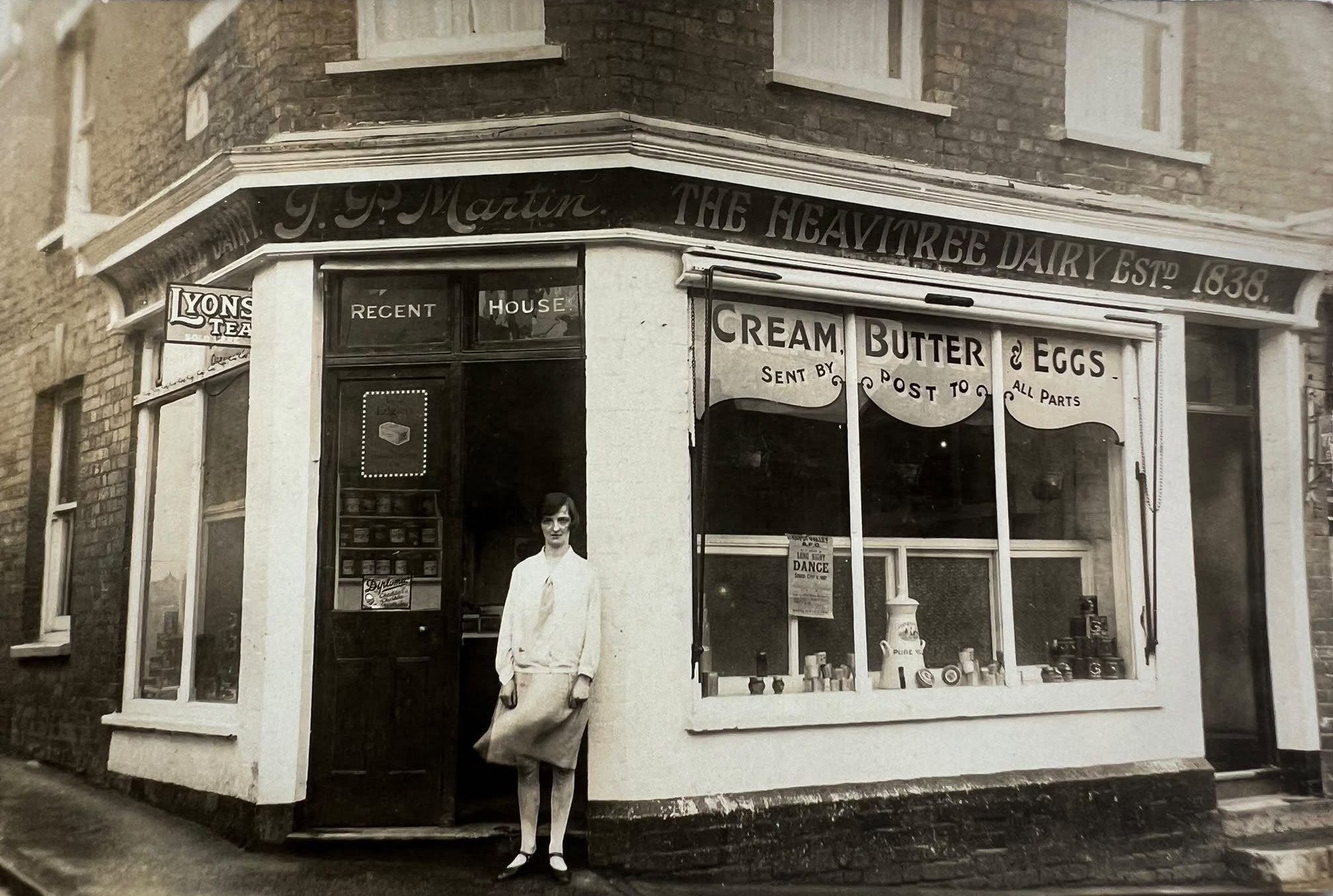
The Heavitree Dairy on the corner of Regent Square (Image courtesy Tony Phipps)
Ghost Signs of Heavitree
It was very interesting to see a ghost sign, temporarily uncovered in early 2026, beneath the laundrette’s modern signage at 92 Fore Street. Quality Radio (not to be confused with Heavitree Radio) was advertised in the Express and Echo in 1956/57.
Thanks to Teresa Smith for discovering this!
| Quality Radio, 92 Fore Street, Heavitree | |
|---|---|
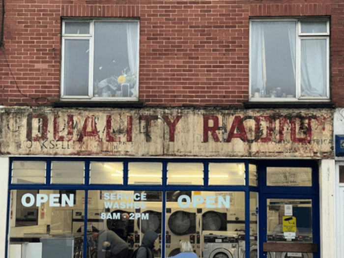 |
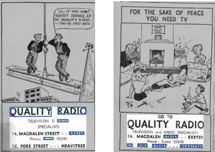 |
| Mid-1950s hoarding revealed in early 2026 | Express and Echo advertisements from the mid-1950s |
Peter Colwell on the Exeter Memories Facebook page remembers:
‘As a child growing up in the ‘50's, Radio House were the first TV & Radio shop to move in there (about 1954). I used to walk the short distance from my home to watch a snowy 14 inch TV through the window. Sad I know!
As time went on, the shop was divided into two separate shops, which is hard to imagine now, since there's no sign of a the separation. It was pretty narrow! Radio House took up one half, and the other was taken up by Rowlands Bookseller. He had the left side, which is why the 'ghost sign' with his signage is way across to the left. Rowlands was a second hand book shop, and later had a popular stall in the Market.
At one point before Rowland came along, an Italian gent opened up one half of the property with Furini's Pasties. Try as he could, he couldn't make a go of it: he went out of business in no time. Back at that time the shop was on the end, and was adjacent to a bomb site. The Devon Air Ambulance building wasn’t built until the 60's or later. I was friends with a lad who lived in the flat above the shop, the entry of which still exists. He was called John Wallage, and he had a sister called Shirley.’
Thank-you for these really interesting memories, Peter.
Lost Corner Shops Of Heavitree
Heavitree holds the 'ghosts' of many lost corner shops. Some live on only in the memories of people who used to work or shop there; others still reveal clues that they were once shops, be it in the shape of a window, or an old advertisement on the side of the building; many have been converted into houses, flats, or offices.
We've gathered together some examples, and some people's memories of shops that have disappeared. This is not a comprehensive list and may include errors. Do you remember shopping in any of these shops, or know of others? Please let us know and we'll update the list.
| Street | Shop | Additional Information / Memories |
|---|---|---|
| Baker Street | Grocers | Number 1. Run by a Jewish lady and her husband. |
| Barrack Road | Dykes grocers | Number 1. |
| Bonnington Grove | Grocers | On the corner of Goldsmith Street. Called Mizens in the 50s and 60s. Believe it became H A & M A Jones grocery. |
| Chard Road | Tellings grocers | On the left hand corner of Chard Road and Nicholas Avenue. 'J.P. Telling did some super magic tricks, and apparently had half a thumb missing. He also had a hobby of breeding exotic fish. As a kid I could only ever afford a basic goldfish from him, but they generally lived a long time.' Later known as Chard Road News. |
| Chard Road Post Office | On the right hand corner of Chard Road and Nicholas Road, opposite Tellings. | |
| Chards sweet shop | On the corner of Whipton Lane. At various times run by Col. Himbury, Philps, Bissex. Also sold fireworks. At one time had a small library you could borrow books from. Latterly Quickprint. | |
| Dawsons grocers | To the right of Chards. Existed until early 2000s, when Quickprint expanded from neighbouring premises. | |
| East Wonford Hill | Fitzroys grocers | On the right hand corner of Victor Lane. 'The little shop with the big stock'. Now a hairdressers. |
| Chemist | On the left hand corner of Victor Street. Now a reptile shop. | |
| First Avenue | Butchers | Number 1 |
| Grocers | Number 23. On the left hand corner of Second Avenue. | |
| Hoker Road | Chemist | Run by Mr Conibear, who apparently used to make his own tinctures on the premises. |
| Wickens | Small paper shop. Later enlarged to become McColl's / Morrisons Daily. | |
| Homefield Road | Hodgsons shoe repairs | Number 1 (Brenda Villas). 'He used to sit in the window of the shop with his assistant, next up to Thornes’ Ironmongers. When he spoke to us young boys he always had a mouthful of tacks that he took out one at a time to nail in the shoes. He also had a cigarette in his mouth at the same time.' |
| Dairy | Number 5. Still there in late 1950s. Since replaced with more modern housing. | |
| Castles | Number 10. Became Fortes chip shop. Open until around 1970. One lady recalls 'Used to get six penny-worth of chips and gribbles after Guides.' | |
| Bakers | Short-lived, but 'the lady made the best doughnuts.' | |
| Ladysmith Road | Chambers grocers | Number 1A. Near the corner of St Marks Avenue. Closed 2013. |
| Post Office & newsagent | On the left hand corner of Lower Avenue. Closed 2015. | |
| Yandells sweet shop | Diagonally opposite the post office, on the left hand corner of Hanover Road. | |
| Marks & Co. | Opposite the post office, on the right hand corner of Hanover Road. Electrical engineers. Closed 2012. | |
| Livery Dole | Top Video | On the corner of Barrack Road and Heavitree Road. The shop closed in 1995. |
| Livery Dole News | Charlie Rogers was newsagent in the 1960s. He always had a pipe or thick cigar in his mouth. Later, the shop was called Langmaids News. At some point ‘The Rainbow Café’ was next door. In the mid 70s there was a Players No.6 cigarette machine outside, selling twenty cigarettes for 20p. | |
| Lower Avenue | Joinery workplace | Behind Ladysmith Road post office. Closed at the same time as the Post Office in 2015. |
| Midway Terrace | Sutton dairy/grocer/greengrocer | Mr & Mrs Sutton took over the shop at 154 Heavitree Road in 1948. They built up the business, and had a milk round covering the full extent of Heavitree and into St Leonards. They retired in 1988. |
| Newcombe Terrace | Newcombe Dairy | Sold ice-lollies in the 1970s. On right hand corner of Newcombe Street, where the entrance was. See also 'Memories Of Heavitree'. |
| Shop | On left hand corner of Newcombe Street, where the entrance was. Opposite the dairy. | |
| Normandy Road | Leylands Paints | Sold wallpaper and paint for some years. Originally a Drill Hall; the Home Guard used it during the war. Sold in the 1980s and converted into flats. |
| North Street | Moores pork butcher | Sold 'the best pies and pasties.' |
| Handyman | Opposite The Windsor Castle PH. 'I remember taking mowers, scissors and other tools to be sharpened up the little alley opposite the Windsor Castle. The old chap always used to do magic with coins for my kids. Lovely man.' | |
| Oakfield Street | Barbers' shop | Run from the front room. The owner also ran a newspaper delivery service. |
| Park Place | Park Place Stores | Grocer + Off License, run by Mrs Stuckey. |
| Park Road | Stamps grocers | Number 25. On the left hand corner of Jubilee Road. 'They would deliver for you; I used to see people sat on a chair while they put the groceries in their bag for them. They did boxes of broken biscuits as well. Anything loose was wrapped in brown paper.' |
| Regent Square | Skinners grocers | Opened by 1886, probably closed at the start of, or during, World War II; became the only double-fronted house in the Square. Located at the bottom of the left side of the square, and numbered 62, the numbering of the premises is somewhat out of kilter with the rest of the square; number 61 is at the top right of the Square. See also page 37 of pdf. |
| Roseland Crescent | The Candy Shop | South Lawn Terrace end. Later moved to South Lawn Terrace and became Robinson's News. 'Rainbow sherbet in cone-shaped bag for 1d; fruit salads were 4 for 1d on way to school.' |
| Thackers | After this it was the Roseland Dairy, then Roseland Stores, selling groceries / greengrocery. Closed 1982. 'I used to deliver customers' grocery orders on Saturday mornings for 3/6 + tips. (1950-1953).' ' My mum used to get her shopping there, it took all afternoon!' | |
| Magnet Stores | Opposite the other shops and turning into Roseland Avenue. Sold groceries, fruit and veg in the early 1960s. | |
| Salters Road | A fish and chip shop + a grocers | Built in the 1930s at the junction with Peryam Crescent. It was initially two shops owned by the Pike family. The Co-op took over and converted the chip shop into a butchers, which they later closed when the two shops merged, and counter-service was replaced by self-service. |
| Tom the butchers | Opposite an orchard. 'I remember PC Gumm catching me scrumping in there and took me back home to Peryam Crescent. God I got a hiding!!!' | |
| Dykes general store | Number 51. On the corner of Lethbridge Road. Previously Tootell's shop. 'I was remembering Tootells shop, when we were kids we always called it Tootell's Hill. Used to go there a lot, can remember being fascinated when the lady used to make 'cones' from paper for our sweets, feeling rich if I had a penny-worth instead of a farthing or ha'penny.' | |
| Handyman store | Opposite Dykes. | |
| Sivell Place | P Gupa | A chap who sold cheap car tyres. |
| Panel Beater Spray Workshop | Next door to P Gupa. Run by Steve Norman Plum. | |
| South Lawn Terrace | Robinson's News | Was previously a video shop, Shauls bakery, hairdressers and gym. |
| Stuart Road | Birds grocers | Number 1. South Lawn Terrace end. Children used to return Corona bottles to top-up their pocket money. |
| Ropers | Number 53. First on the right coming in from Hanover Road. | |
| Warwick Road | Courtney and Son butchers |
Recreation And Pastimes In Heavitree
Heavitree Archery Club
[We are very grateful to Stephen Bees for providing the information below]
A plot of land known as Sixteen Acres belonged to John Milford (1792-1888) of Coaver House.
A number of prestigious events were held on the Sixteen Acres field: in 1850, it was the venue for the Royal Agriculture Society of England exhibition; in 1858 and 1859 it was the venue for the extravagant and spectacular Grand National Archery fête; and in 1863 it was the venue for the Bath and West of England exhibition.
Until 1871, it was the home ground of both the Devon & Exeter Archery Club and the Heavitree Archery Club.
Further reading: The Great Archery Meeting (The Western Times; Exeter, Saturday 24th July 1858)

Tithe apportionment map showing the Sixteen Acres field

1888 map showing the location of the Sixteen Acres field

Bird’s eye view of the show yard for the Royal Agricultural Society exhibition of July 1850
(sketch by Exeter artist Frederick Josiah Ellis (1812-1889))

Engraving of the Grand National Archery fête of 1858 held at Sixteen Acres field
(Courtesy of The London Illustrated News)

2023 Google map showing the former location of the Sixteen Acres field
Heavitree United Football Club
Founded in 1885 as a church team, Heavitree United Football Club is one of the oldest amateur football clubs in Devon.
In the early years matches were played on a pitch where the Royal Devon and Exeter Hospital, Heavitree now stands. After World War II the club returned to a pitch in Heavitree Pleasure Ground, sometimes playing in front of a crowd of several thousand people. In the early 1950s the club moved to its present ground at Wingfield Park.
From 1976 to 1999 they played in the Western Football League, their highest level. These days they are part of the Devon and Exeter Football League.

Heavitree Parish Church football team, 1900
Pinhoe Road Football Ground: The Grecians First Home
St Sidwell’s United (now Exeter City) played their first two seasons (1901/2 and 1902/3) at a ground generally referred to as Pinhoe Road, although some reports merely said Mount Pleasant. It was a sloping pitch roughly in the area in which Monks Road is now situated.
As this is the club’s first ground, we are keen to establish exactly where it was. Frustratingly, we have no maps showing the location, neither do we have any photographs of the pitch or even of a St Sidwell’s team. We know photographs were taken of local clubs at the time – so they must be out there somewhere!

Early newspaper clipping referring to Association Football
It’s likely, although not conclusive, that St Sidwell’s played on the same sloping pitch at Pinhoe Road that was used by Exeter Wesleyan United and Exeter Athletic during the 1900/1 season. It may well have been on land owned by the Countess Dowager of Morley. There’s a Morley Road off Monks Road.
The only detailed information we have on the ground comes from Sid Thomas when reminiscing in the Football Express in 1939. Referring to St Sidwell’s United, he wrote:
‘This little team operated at first in a field on which Monks Road has since been built. In those days there were very few houses on that side of Mount Pleasant, and the whole of the land down to the bottom of Pinhoe Road was entirely unbuilt upon. I remember well that we tried to take a gate in those days and had a sentry-box placed at the entrance to the ground. Result of the first game was that something like 9d was collected. You will see that “gates” were a sore point even in those days, but I saw the time arrive when amateur soccer drew thousands to its matches.’

A map of the likely area of Pinhoe Road Football Ground the early 1900s
Even so, there were signs that association football was growing in popularity. For St Sidwell’s second league game of their first season at home to St David’s, the Evening Post reported that it ‘drew a good gate’. Their next home match against St John’s Athletic was in front of a ‘fair number of spectators’.
It’s also from these newspaper reports that we can glean more about the ground. The most prominent feature was the slope. There were regular mentions, for example, about sides having to ‘play up the hill’. It seems most likely that the slope ran west to east, down towards the Polsloe Bridge area.
This would tie in with the issue of the sun – a problem to this day at St James’ Park which is on a similar axis to the Pinhoe Road ground. Indeed, when St Sidwell’s played the second half up the slope in their very first match against Dawlish, according to one report: ‘The home team had to face the sun but continued to hold their own’. And hold their own they did for two seasons before the move to St James’ Park.

Morley Road, off Monks Road
Why are Exeter City known as ‘the Grecians’? In the past, people who lived in St Sidwells area used to refer to themselves as Grecians, St Sidwells being the first place outside the Roman city walls. This tradition dates back to the 1600s. When people used to write to the Express and Echo, they might sign it ‘from a Grecian’. Charles Dickens even mentioned the Grecians of St Sidwells!
Scroll to top of pageHeavitree Bridge
The Northbrook rises in springs on Stoke Hill. One tributary runs through Mincinglake Valley Park, Polsloe and Hamlin Lane Playing Field, another through Whipton; the two tributaries converge in Vaughan Road. After crossing the Honiton Road, the Northbrook continues its way through Wonford and Ludwell Valley Park to join the River Exe at Northbrook Park and the historic Countess Wear Mill. Its upper reaches are sometimes known as Mincinglake Brook or Whipton Brook; locals know it as The Panny. The origin of this name is much disputed but some say it comes from Indian soldiers billeted at Wyvern Barracks in the First World War, as the Hindi word for water is 'paani'. That said, the Romany word for water is also 'pani'.
 |
 |
 |
| Maps of the Heavitree Bridge area | ||
|---|---|---|
In the nineteenth century and earlier, the Northbrook would have been clean and full of fish. Although it still hosts a good deal of wildlife, it is classified as being in a "poor" state by the Environment Agency. The reason for its condition is unknown, but several factors must surely have a part to play: the Mincinglake Valley was utilised as an official tip for a some years; a great deal of residential development has taken place around the brook; concrete banking has been built in places; and the brook is culverted for considerable stretches in two places - Beacon Heath to Polsloe Bridge, and Vaughan Road to Woodwater Lane.
 |
 |
| 1802 painting of the village of East Wonford showing Heavitree Bridge (Courtesy: Stephen Bees) | |
|---|---|
Until the 1930s, the Honiton Road crossed the Northbrook at Heavitree Bridge, roughly where Sweetbrier Lane and Rifford Road now meet the Honiton Road. The bridge would have been narrow, similar to those seen today at Stoke Canon and Bickleigh. As traffic volumes rose during the 1920s, it became increasingly obvious something had to be done to improve the crossing.
 |
 |
 |
 |
| Images of Heavitree Bridge | |||
|---|---|---|---|
Due to the increase in traffic, in 1932 the Honiton Road was widened as far as Gallows Corner; this included Heavitree Bridge. Over a period of time, the old bridge was removed and the watercourse covered. Maps of the area appear to show that the work wasn't entirely finished until late 1950s / early 1960s.
Flooding was a regular occurrence around the bridge. Even today after a heavy burst of rain, manhole covers lift as the culvert fails to cope with the volume of water.
 |
 |
 |
| Widening of the Honiton Road in 1932 | Flooding outside cottages at Heavitree Bridge | Cottages near Heavitree Bridge |
|---|
There used to be quite a good community in this area – Birchy Barton Farm, the quarry close by, cottages, and even a pub, The Bridge Inn, until the landlord committed suicide in 1866. A few of the cottages near to the site of the bridge remain, but all traces of the bridge itself have gone. Despite this, many still refer to the area as Heavitree Bridge.
- The late Lyndon Taylor's talk on Childhood Memories of the Northbrook and Heavitree Bridge
(recorded Sep 2014) (with kind permission of Paul Taylor)
Wyvern Barracks
The opening of the barracks in 1804 was part of the government’s reluctant response to widespread criticism of the poor standard of soldiers’ accommodation. Even these barracks lacked accommodation for married soldiers – families being separated from other soldiers by a blanket hanging across the room.
The barracks were originally simply called Artillery Barracks to distinguish them from the Cavalry Barracks (Higher Barracks). In 1861 they were renamed Topsham Barracks, and in 1964 the present name was adopted. The wyvern is the traditional dragon of Wessex.

The front of Topsham Barracks
From 1804 to 1815 the barracks housed a number of different Royal Artillery companies. From 1816 to 1867 they were occupied by various cavalry regiments. Infantry units occupied the barracks from 1867 to 1871, and then Artillery regiments returned until it became a training depot in 1944.
The barracks had also been the depot of the Devonshire Regiment since before the First World War. They ceased being a base for active regiments in 1974.

The Royal Artillery, Topsham Barracks
The Inter-War Years
Homes For Heroes
Information and images in this article are courtesy of Dr Julia Neville, an Honorary Research Fellow at the University of Exeter with an interest in twentieth century social change.
Dr Neville is Project Manager for "Devon in the 1920s", a research collaboration between the Devon History Society, the Devon Family History Society, and the South-West Heritage Trust
Introduction
During the course of World War I, the Government started to plan what would happen when it was over. Work began as early as 1916, with a primary focus on the logistics of demobilisation and the munitions industry.
The Ministry of Reconstruction was formed, led by Christopher Addison, and was charged with overseeing the task of rebuilding 'the national life on a better and more durable foundation.’ It produced a series of booklets called “The Aims of Reconstruction”.

Booklet from the series “The Aims of Reconstruction”
The Ministry was of the mind that the country would pick up broken threads and return to the social and industrial situation that existed at the outbreak of war.
The populace thought differently. They doubted the pre-war situation was worthy of being reconstructed. The immensity of the sacrifice of World War I created a demand for a better way of life.
There was much to be ashamed of when looking back at the conditions of 1914, and now, at the end of the war, there was a desire to create a better world, to do justice to the living, and in reverence to the dead.
The problem of housing loomed large. Providing a satisfactory solution would be an enormous task for several reasons:
- There was a shortage of 300,000-400,000 houses in England and Wales
- There were lots of defective and unsanitary houses
- Many places, including Heavitree, had crowded and narrow slum areas
Each of these problems had been exacerbated by the war, and were both urban and rural. There had been no effort to build new houses or repair buildings. Building materials were consistently diverted toward the war-effort.
The Ministry tasked each local authority with calculation of the number of houses needing to be built in their area. There was an agreement in principle by the Cabinet to fund this.
Local authorities were seen as the primary agents in getting this done (a new role for councils); it was also a role for public utility services and private enterprises: everyone would work together to create a better country.
From Promise To Reality

Lloyd George
There was a great need for housing, reinforced by a sense of debt owed to heroes. This commitment to public expenditure had to survive a general election. Now, post war, there was a new electorate which included men who had hitherto been unable to vote, and also many women.
Lloyd George was elected with an overwhelming victory. Now was the time to turn ideas into reality. The task was to make Britain a fit country for heroes to live in, and there was no time to lose.
Within three months, local authorities were to assess the needs of their inhabitants, and decide how to meet them. The Government was to subsidise this, and to make provision where needed.
Exeter’s Post-War Housing Scheme Statistics
Exeter’s local authority had an active committee, and immediately appointed personnel to plan for the future. Using data from the 1911 census, their initial estimate was that they needed to build 300 houses in three years.
The housing commissioner said that this was insufficient. The number was revised to 1000 houses, and by October 1919 the authority was given a provisional agreement. The number of houses built would never reach this figure as the subsidy was later reduced.

Municipal Year Book, 1931
Parlour / non-parlour was a big topic of the time. This referred to whether you had a second room apart from the kitchen. Those against thought that it a waste, as the second room would be kept for best; those in favour felt it would be of great benefit for families with children.
The Opportunities Of Annexation
Exeter City Council had recently swallowed up Heavitree (1913), and so Heavitree was going to absorb many of the new schemes.

Map showing Heavitree Parish boundary
Heavitree was already popular for its location. It was easy to commute into Exeter. Adverts in local papers constantly referred to houses being minutes from the nearest tram stop, whilst being amidst rural surroundings.

Stafford Terrace, Fore Street, Heavitree
The New Estates:
Due to the current level of overcrowding, any new housing had to be built on green-field sites; Polsloe Bridge, Buddle Lane, and Burnthouse Lane, were chosen. Each was a good distance from the City centre, accordingly many complained of the sense of isolation. The areas were nicknamed Shanghai, Chinatown, and Siberia, respectively.

Modern map of Exeter showing the location of proposed housing estates relative to the City centre
Polsloe Bridge Estate
30 acres of land was purchased. Half of this would accommodate 150 homes, the other half was to be left as open space. The Ministry was concerned about standards, and the ratio of open space to development was important. The 1919 manual talked of standards, layouts, etc.
The Tudor Walters Report said that new houses should be cottages of two storeys, in groups of four to six, with medium to low pitched roofs, little exterior decoration and in cul-de-sacs. They wanted to avoid projections at the rear, which might impede sunlight and access.

Housing in Beacon Avenue
The houses were to have three bedrooms, a bathroom (there was debate as to whether this should be up or downstairs), a cold-store, larder, kitchen / living room, and parlour (which shouldn’t be the sunniest room).
The system gave priority to ex-servicemen, disabled servicemen and widows with children.
The Money Runs Out
Departmental Expenditure Plans (£m)
Before long, the country was in the grip of a recession, and Government expenditure increased. The national debt was £359.8 million. The Government had no choice but to agree on austerity measures. Everything was cut, including the housing programme. The pace changed; there were no longer generous subsidies from the Government, so councils could do only what they could afford.
This lasted until 1923, when there was a change of Government and Neville Chamberlain took over as Minster of Health. He wasn’t averse to the idea of municipalities taking on responsibilities. Any builder or organisation could put in a bid and get a grant to build houses. The Housing Act of 1924 supported this even further.
Clearing The Slum Areas

West Quarter slum clearance, Stepcote Hill
Exeter City Council had to designate slum areas. They had already started demolishing Paul Street, but the West Quarter had to be cleared and the occupants moved out.
Rents proved too expensive, however. Residents had been paying 3/6 per week in the West Quarter, but the starting rent for a non-parlour newly-built house was 6/1 a week. For most, finding this extra money was impossible. Houses continued to be condemned, but their occupants had nowhere to go.

Dr J S Steele-Perkins, Chair of the Public Health Committee
The situation came to a head in 1924, when Dr J S Steele Perkins, chair of the Public Health Committee, questioned how the Council could contemplate spending extra money on buildings for themselves when there were such slums in the West Quarter.
This did advance things a little, but didn’t resolve the rents problem.
The First Exeter Church Army Houses, May 1927
An offshoot of the main Church Army organisation built houses in Rutherford Street, Wonford. The group could build more cheaply than the Council as they were subject to fewer regulations. The group particularly wanted to build housing for larger families who earned less than £3 a week. By the end of the 1920s they had built 18 such houses: 14 in Rutherford Street, and 4 in the West Quarter.

Ceremonial unveiling of Church Army housing

Church Army houses in Rutherford Street
Another Crusader – Dr Charles Newton Lovely

Dr Charles Newton Lovely
Dr Lovely was a GP appalled at the conditions of the West Quarter. He really wanted to tackle the problem quickly, and was more entrepreneurial than Church Army Housing. As a very dynamic person, he would target groups as such Mothers’ Unions, or go door to door. He founded the Exeter Workmans’ Dwellings Company Limited (the fore-runner of today's Cornerstone Housing).
The EWD built the Polsloe Bridge Estate. It was slightly less ‘frilly’ – the houses were very plain (the ones in the picture had been upgraded). By the end of 1929 they had provided 79 houses. We can see the difference that his dynamism made. This attracted national congratulation, and Exeter was considered to be leading in the field of voluntary societies.

Upgraded housing in Beacon Avenue
From Renting To Owning
During the 20th century, house ownership increased significantly. In 1918, 77% of houses were rented. By 1939 this had fallen to 38%. This vast rise in private ownership was facilitated by more ready availability of money. In 1923, private builders could apply for a grant from the Government. Houses such as Dr Neville’s grandparents’ house in First Avenue were built.

Housing in First Avenue, Heavitree
The houses had new-fangled features like light switches, and cost-reducing modifications like a lower ceiling height and a combined bathroom and lavatory. Private builders didn’t need to adhere to Government regulation. The house cost £600 in 1927.
Birchy Barton Estate
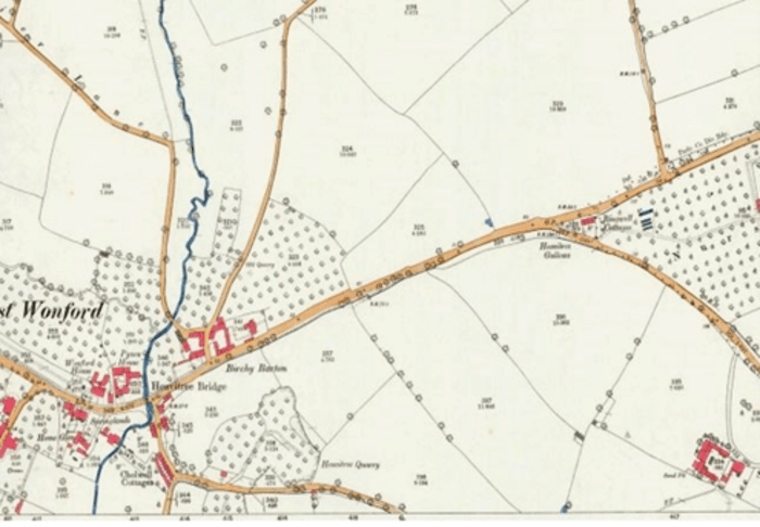
Land at Birchy Barton prior to sale by Lord Poltimore
At this time there were many sales of landed estates.
In this instance, Lord Poltimore sold land in 14 lots:
- Mr G Lee bought the farmhouse
- The Wonford Allotment Holders Association bought Barn Close
- Mr C Warren of Exeter bought the Garden Plot, Footsfield Plot and the Gallows Field
- Mr S Chard of Heavitree purchased Footsfield and Lower North Park
- Mr J W Seward of Exeter bought Higher North Park
- Messrs Drake, Harris, Vincent, and Ardern, secured the arable land

Housing in Lower Hill Barton Road, Birchy Barton
Mr Warren, a City councillor and estate agent, proposed creation of a garden suburb at Birchy Barton. He envisaged 150 semi-detached residences, with room for tennis courts and vegetable gardens.
Burnthouse Lane Estate
The West Quarter was slowly being cleared. Preston Street School classes were becoming progressively smaller as increasing numbers of people moved to Burnthouse Lane. The busiest phase of moving was in the 1930s. The Government had changed its policy to subsidise rents for West Quarter people.

Plan of the Burnthouse Lane estate
Burnthouse Lane had been a small, country lane, but in 1927 the City made a compulsory purchase of 38 acres. It was resolved to be Exeter’s third large development of social housing, and would be Exeter’s very own garden-city with wide roads, churches, trees, and gardens. City architect John Bennett chose a simple, classic style for the houses.

The Dolphin Inn, Burnthouse Lane, in 1935
All did not go smoothly at first, as much of the infrastructure was unfinished. People held a protest meeting, demanding a reduction in rent of at least 2s a week, with free conveyance to school for children, alterations and additions to the bus service, fences, roads and footpaths, lamps fixed to lamp posts, and proper dustbins supplied.
Heavitree in the 1920s
“Devon in the 1920s” project was a research collaboration between the Devon History Society, the Devon Family History Society, and the South-West Heritage Trust.
As part of a series of events for the “Devon in the 1920s Festival” held in 2025, the Heavitree Local History Society themed its annual October walk for that year accordingly.
The walk explored 1920s Heavitree through various stopping points in and around Fore Street.
A sizeable group of 35 people attended the walk, led by Martin Weiler.
Introduction
As Heavitree entered the 1920s, it was still reeling from two big impacts:
Firstly, the devastating impact of the First world War. Over 230 local people were killed in the conflict. They are remembered on the Roll of Honour in the Parish Church and in a booklet published by the Heavitree Local History Society.
Secondly, there was the loss of independence. Until 1913, Heavitree had its own Urban District Council but in that year, it was ‘annexed’ by Exeter. The war delayed the full implications, but the new decade saw Exeter start to truly take over.
Heavitree Pleasure Ground
Heavitree Pleasure Ground was opened in 1906 – one of the major achievements of the former District Council. In the twenties many of the facilities we see today – the play area, bowling green and tennis courts – were already established. However, there were some differences. Heavitree Football Club rented a field in the winter for their games, and grazing of animals still took place.
Trams
The electric tram network had been running since 1904 with a terminus at Cross Park Terrace in Heavitree. The war had decimated the tram workforce, and a number of accidents took place possibly as a result. In August 1917 a tramcar jumped the points just below the Royal Oak pub, hitting a nearby house and demolishing its garden rails and porch.
The twenties were the last decade the trams ran, the system closing in 1931. The trams ran between 7.15am and 11pm. It cost 2d to travel from the Guildhall in Exeter out to Heavitree. The trams had to run quietly on Sundays so as not to disturb church and chapel services.
Interestingly, as today, pot-holes were a problem along the road surfaces in Heavitree. As a result, cyclists and pedestrians used to make their way along the tram network contributing to its wear and tear.
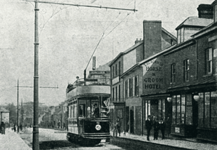
A tram outside the Horse and Groom, Heavitree, 1920s
Motor Cars
In 1904 only 20 cars were registered for use in Exeter. By 1920 it was 140 and growing fast. The number of cars driving down Exeter High Street each day rose from 1,314 in 1920 to 5,901 in 1930.
Many of these cars would drive through Heavitree too. A sign of how many is the arrival of petrol filling stations in Heavitree in the 1920s. In 1923 Harry Edmonds Courtenay opened a filling station on Fore Street where the current Tesco one is. In 1926 AWE Crocker opened another one out at Gallows Corner.
Education
Heavitree’s school was opened in 1840 on the site in Fore Street where the Co-op now stands. Older boys moved to a new school building in South Lawn Terrace in 1871, but infants continued to start their educational journey in the centre of Heavitree until 1937 when they too moved across to South Lawn Terrace.
Shops
The twenties were still the days of lots of independent shops: greengrocers, butchers, bakers, ironmongers, newsagents, drapers, and boot makers. Heavitree had them all along Fore Street. Some were long-lasting establishments such as Leymans, a watchmaker and jeweller, and Grant Artur, the hairdresser. Both were there in 1901 and still in 1939 or later. So was John Thorn the ironmonger.
The shops weren’t all independent even in the 1920s. One of the first chain stores in Fore Street was Eastmans the butchers. They operated from 1906 to 1957 in what is now number 74 (next to the Gun and Sports Shop). The company was formed in 1889 and had over a thousand branches by 1914. In 1923 it in turn was swallowed up by a bigger fish, the American owned Union Cold Storage Company which ran cattle ranches throughout the Americas. Thus, Heavitree had a US multi-national company in the twenties.
Banks
The first bank in Heavitree was the Union of London and Smiths Bank which opened in 1906 where number 34 Fore Street is. By 1919 this had become the National Provincial and Union Bank of England. In 1927 it moved to next to Ellis’ Place; by then it was just called the National Provincial Bank. In the 1970s it expanded next door and was renamed as The National Westminster Bank, and latterly as NatWest.
Pubs
The main pubs in Fore Street would have been instantly recognised in the 1920s – The Royal Oak, the Ship and Pelican, and the Horse and Groom – were all here and had been for many decades. The Horse and Groom later became associated with one of Heavitree’s sporting heroes who blossomed in the twenties.
Cliff Bastin attended Ladysmith School and joined Exeter City as a youngster. He made his debut for their reserves aged 15 in 1927 and played for the first team the following year – the youngest ever until 2016. His outstanding form drew scouts from all over the country, and he was sold to Arsenal in 1929. He went on to be their record goal scorer for many years, and played for England 21 times. After retiring he came back to Heavitree and was landlord of the Horse and Groom.
The Heavitree Brewery
The Heavitree Brewery had been established in 1790 and moved to Church Street in the early 19th Century. Although a very successful company, both in making beer and owning pubs, it was almost brought to its knees around 1920. The manager embezzled considerable funds and fled to Canada. However, he was caught and sentenced to three years penal servitude, and his accomplice to 12 months imprisonment. Things were saved by a supplier of the brewery whose bills were not being paid. He asked to see the books and was horrified. He was subsequently appointed to the board and set about putting everything in order.
Churches
In addition to smaller chapels, the main Parish Church, St Michael’s and All Angels (rebuilt 1846), and the United Reformed Church (opened 1903), were well established in the 1920s; the Catholic Church had yet to be built (opened 1932). One major change in the Parish Church came in 1923 when two galleries were removed thus substantially changing the internal look.
Group photo outside Heavitree Parish Church
Heavitree In The Second World War
Air Raids On Heavitree
Exeter didn't suffer in World War II to the same degree as some of the larger cities such as London, Coventry and Liverpool, the exception being on the night of the 3rd / 4th May 1942.

Map showing location of bombs dropped in the Heavitree area
during the Second World War
The first bomb to cause any damage in Heavitree crashed through the roof of 48 Normandy Road on 6th September 1940. Although it failed to explode, it caused the front of the house to collapse into the street. Fortunately no one was killed.

Bomb damage at 48 Normandy Road on 6th September 1940
(image courtesy of Esmé Kershaw)
There were further air-raids in Exeter during 1940 and 1941, but none as sustained or severe as that on just three nights in April + May 1942. Over this period, Hitler's bombers tried their best to destroy 'The Jewel of the West' as part of The Baedeker Raids, a series of retaliatory raids on historic English cities following allied bombing of the German city of Lübeck in March 1942.
More than 250 people, including 50 Heavitree residents, lost their lives during these raids. Many hundreds more were injured or traumatised, and there was extensive damage to buildings. In Heavitree, properties between the Catholic and Congregational Churches were destroyed, as were 1-5 Sivell Place, and others where the Tesco garage now stands.
Personal Account Of The Reprisal Baedeker Blitz On Exeter, 3rd-4th May 1942, By Thomas Oliver, Teenage Resident Of 3 Baring Place
I was awoken at 02:15 to the sound of sirens. I half dressed and went straight to the playroom which had been strengthened and sandbagged and which we used as our shelter. When we had been in there two minutes we heard 'plane engines. The 'planes sounded as though they were heavily laden and as we later discovered, they were. They soon began to drop their eggs. The first explosions were colossal and I believe that they were in Topsham Road. These explosions were not as bad as some of the other ones we heard later. After about two minutes of continuous high explosives exploding we were conscious of a swishing sound. Immediately the word incendiaries came to our lips. I at once followed daddy out into the hall. Here we were aware of a terrible pungent smell and acrid smoke. Out by the front door Pam had discovered an incendiary underneath the floorboards. Kathleen put paid to this bomb by pouring water down the hole. Meanwhile daddy had been up to the top of the house and reported an incendiary burning in the small attic. I rushed up and started pumping the stirrup pump furiously. Daddy turned the fire extinguisher upside-down to prevent the fire from spreading. Pam, Kathleen and Mrs Cobb brought up water reinforcements. Whilst changing the pump from bucket to bucket I went and put my foot in a bucket of water feeling very silly at doing such a daft thing at that awkward moment. Mrs Cobb went next door to fetch the A.T.S. just in case the fire spread. They came up the stairs all tin-helmeted, laughing and joking as though nothing was happening; luckily they were not needed. The hun was machine-gunning and bombing the whole time. We were not sorry to leave the attic when the bomb was extinguished. The bomb nose could just be seen above my papered ceiling in my bedroom. In the strong-room again we just sat listening to the planes diving over the city and then to the bombs exploding. The scream of the bombs could be heard for quite a time, then there was a short pause and then the thunderous explosion. The nearer bombs were accompanied by the noise of smashing glass or of a ceiling collapsing and the blast of air rushing past outside. Every now and then the house seemed to jump an inch out of the ground. The whole house vibrated and shook. The damage done to the house was comparatively slight. Three ceilings down, five panes of glass smashed, two roofs damaged. After about one and a half hours of continuous bombing the all-clear went. We were never more pleased and thankful to hear an all-clear.
Directly the all-clear went we all rushed down to the gate to behold the spectacle of Mr Reeks' house well on fire. We had seen it before through the smashed glass of our front door. Nothing much could be done as the fire had got too good a hold. However we tried to do the best we could. We got water from the bathroom until the water supply ran out. Anybody and everybody came into the house treading over the hall ceiling to get water. Whilst some people were fighting the fire, others helped the Whitesides to evacuate every bit of furniture out of their house in case it caught fire. A fire had also started at the back of the house in Heavitree Road. Daddy and I therefore used our stirrup pump again to spray the side of the house with water in case some sparks might catch fire to some dry woodwork. Uncle Ted and cousin Dorothy came in while we were doing this. They came over because they had heard our area had been rather badly blitzed.
The city was a terrific sight from the attic window. Fires in every part. There were tremendous flames leaping up from the centre of the city. Probably this was the High Street, Bedford Circus and Southernhay.
At about six o'clock in the morning Pam and I set to to get the furniture back into the Whitesides house as by then the Reeks fire had practically died down although it was actually smouldering for four days. Mrs Leech came over with John and Ann Whiteside for all meals during he day as Mrs Whiteside was too busy getting her house ship-shape.
After breakfast I met Yates staring at the Reeks' ruins. In that house were all the wedding presents of the two daughters. Yates was just off to St Leonards Road to see Mr Bagnall so I decided to go with him as I wanted to go to St Davids Station. We went by way of Lyndhurst Road, where there was an unexploded bomb, and Wonford Road. At the bottom of Wonford Road there was a crater which practically filled the road. There was not really much of Wonford Road left. Passed Mr Gilbert Stephen's house which was still smouldering, then into St Leonards Road. This had also had a bad knocking about. Mr Bagnalls' house was absolutely gutted as also was Mr Liveseys. Saw Mr Bagnall in his A.R.P. uniform in a house nearby and with him he had all his possessions he had in the world. A clock, some rugs and a few other odds and ends. I left Yates here and went on to the end of the road. Here there was a mass of hoses and fire pumps. The whole of Magdalen Street was practically wiped out by fire. Went up past the Maynard School which looked extremely sorry for itself and into Barnfield Hill. The nice big houses opposite the Bradbeers were still on fire but luckily only three were burnt out. I then turned up into Southernhay East - this was appalling; the Southernhay Congregational Church gutted but the spire standing alright. From Dixs Field up to the High Street was completely gone on one side. On the road running parallel to this there was not a single house out of about 30 four storied houses that had escaped being gutted. So I came into the High Street, or what was once High Street; to get into it I had to clamber over bricks and smouldering debris. As yet there had been no proper path made. Soldiers were busy at the corner doing their best to clean up the place. There was a terrible sickly smell of burning all round the place, primarily from Fearis who were burnt out except for the ground floor. To look down High Street was a terrible sight. Hoses playing onto buildings still a mass of flames. There was terrible congestion in London Inn Square: canteens, fire engines from all over the west country. The corner of Longbrook Street and Sidwell Street was completely gone. The Plaza was burnt out. The Savoy was intact except it had its bar smashed up. I went along New North Road past the theatre. Going along the embankment by the Central station there was a terrible smell. Thousands of tins of something had caught fire and were still smouldering. Went on down St Davids Hill. Large branches still in the road. At the station enquired about P.L.A. Also had to go to the canteen with a message from mummy.
Took a taxi into town but could only get as far as North Street. Saw Mr Commis on duty in Queen Street. He told me that his shop was completely burnt out. To get home had to go up Longbrook Street as they found an unexploded bomb in New North Road. I watched some railway A.R.E. filling in a large crater plumb on the railway lines for a little while. Came through the terrible London Inn Square again. Walked home with Dyson. After dinner I had a short rest and then cycled out to Pinhoe to say good-bye to grandpa and also to tell him we were alright. Heavitree was still on fire in parts. On my way home from Pinhoe I came up Pinhoe Road. Saw a huge crater right in the road. It was the whole width of the road and the two pavements. After supper went over to see when Trafford was coming back. I went to bed very early that night and got a lot of extra sleep. Unexploded bombs going off intermittently throughout the night.
During Tuesday I had to cycle over to the Emergency Advice Centre. Here there was everything anyone could possibly want to know. I went there because I had to get some supplementary ration cards. Everything was in splendid working order there. During the day I saw a lot more horrors. Summerland Street area was the worst I think. Only two houses and a pub that could be lived in out of about two hundred in the street. Saw Mr Cocks, Dr Gates houses burnt out. Saw the Maynard School buildings, some time before they will be able to return to school.
The most tragic disaster in the way of damage was the direct hit on St. James' Chapel in the Cathedral. The whole building suffered a severe shock but luckily it was alright and the damage was reparable. The organ was badly knocked around.
Summing up: the damage was terrible although it might have been worse. Above Lyons there is nothing left of High Street except two banks which had to be rebuilt. Sidwell Street from old including the Church up to Summerland Street all gone. Many fires in Blackboy Road. Of course stray bombs all over the place. A bomb in Polsloe Road killed Mrs Down and her son. The Jenner house was badly knocked about by a blast from a bomb in the pit opposite. The Rowes in Matford Avenue had a bomb in their garden. The Miss Brocks were buried under debris caused by a land mine in their garden.
Courtesy: Christopher Rudd
resident of 159 Magdalen Road, Exeter (formerly 3 Baring Place) in 2023
Victory In Europe Day
When Germany signed an unconditional surrender to allied forces on 7th May 1945, it brought to an end nigh on six years of war in Europe. The following day was declared a national holiday to mark Victory in Europe Day (VE Day); the next day (9th May) was also a national holiday.
Jean Smith of Regent Square recalls:
"As it became certain that the war was coming to an end, the women got together to organise street parties. My mother did a raffle every Saturday morning with items being donated from local businesses that she canvassed, the money going towards food, etc. I was trusted to go around selling from a book of cloakroom tickets. I was most upset the time my number came up and I wasn't allowed to have the prize. I asked why I was allowed to buy a ticket with my pocket money but not take the prize; I must have been about nine. As for the VE and VJ parties, trestle tables were laid out along the bottom; we would have had rolls, sandwiches, fairy cakes and lots of lemonade. By the time of the latter, some of the serving men had arrived back. Bill Allen, the milkman, had served in the Royal Navy. Harold Miller, who got married to Winnie from number 7 at the start of the war, had been in the Signals and served in Syria for a lot of the time. His daughter Rita remembers him telling her bedtime stories of what he experienced in the war."
Everyone listened intently as King George VI congratulated the troops for carrying out their duties with "valour and distinction," adding "How unbounded is our admiration for the courage and determination which, under wise leadership, have brought them to their goal of complete and crushing victory."
Prime Minister Winston Churchill announced:
"We may allow ourselves a brief period of rejoicing; but let us not forget for a moment the toil and efforts that lie ahead. Japan with all her treachery and greed, remains unsubdued. We must now devote all our strength and resources to the completion of our task, both at home and abroad."
Many had lost loved ones or seen them suffer life-changing injuries on the battlefield. Yet now that victory had been declared, there was a feeling of tremendous relief following such a lengthy period of suffering and hardship. In spite of food shortages and rationing, the whole community rallied round, and street parties were held just about everywhere, with celebrations widely continuing well into the night.
| Street parties celebrating the end of World War II | ||||
|---|---|---|---|---|
 |
 |
 |
 |
 |
 |
 |
 |
 |
 |
 |
 |
 |
 |
 |
 |
 |
 |
 |
 |
 |
||||
The war in Asia and the Pacific regions was to continue for another three months, and see atomic bombs dropped on Hiroshima and Nagasaki, before Japan finally surrendered on 14th August 1945. Again the following day was declared a national holiday in the form of Victory in Japan Day (VJ Day), heralding further cause for celebration.
A Happy Ending For One Young Couple
In 1939, at the start of the war, Joseph Terry lived with his parents in Wardrew Road, St Thomas.
He joined the Royal Signals, and after spending time in Egypt due to a political rather than a military decision, he was one of the thousands of young men sent to aid Greece against the Germans. In 1941 he was captured in a boat off the island of Kitheria. He said that he was very grateful to the Greek people who hid him during the day from the Germans and smuggled him at night in small boats from island to island.

This photo was taken in Exeter High Street. The young soldier is Joseph Terry. We believe the man with whom he is shaking hands to be the mayor. The couple are his parents.
He was transported to Austria where he was held in Stalag 18a. For six months Mr and Mrs Terry didn’t know what had happened to their only child; eventually they received a letter from the Red Cross to inform them of Joe’s fate. Meanwhile in Southend-on-Sea, Essex, the girls of the local grammar school had been asked to write letters to troops being held as POW. A letter written by one young student, Marjorie Phillips, found its way to Joe. They continued to write to each other and even when Joe was liberated and returned home to Exeter, they continued to correspond. In 1947 Marjorie and Joe married and spent their life together living in Heavitree. Unfortunately, Joe died in 2015, but Marjorie continues to live in Kingsway, Heavitree.
Children Not Forgotten
Members of the community that were too young to play an active role in the war were not forgotten for the position they held. Every school-child in the country received this letter of commendation in 1946 from King George VI.

A letter to school-children from King George VI
The Post-War Years
Factory-Made Housing And Model Cities
Clare Maudling, Post-Doctoral Research Fellow in the University of Exeter Politics Department, gave us a wonderful talk about the construction of social housing, including prefabs, in the Heavitree and Whipton areas after WWII.
As an undergraduate, Clare researched how Exeter was rebuilt after the war for her dissertation, but realised she was just scratching the surface. The housing aspect caught her attention, as this hadn’t really been focused on before.
Introduction
In the inter-war period, Exeter City Council worked hard to address housing issues building 2000 houses between 1920 and 1939.
Two major estates were Buddle Lane, St Thomas (concrete housing), and Burnthouse Lane, Wonford. In the 1920s they experimented with prefabrication to speed up the building process.
There was also a lot of private development, particularly along main roads running out of the city. In 1935 an act was passed preventing developers from altering pre-established roads.
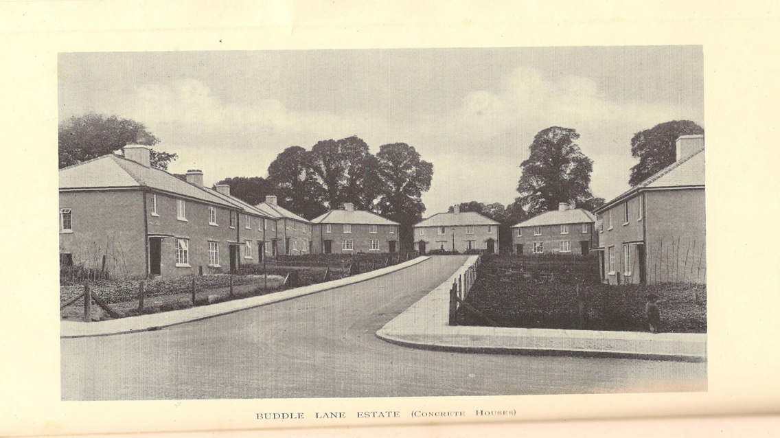
Newly built concrete housing on the Buddle Lane Estate

New housing in Burnthouse Lane
Many houses were built, but with limited amenities. Exeter Estates did plan them, but as money ran low, building was a different matter.
The 1937 map of the Burnthouse Lane estate shows a pink-coloured section that was to house amenities. They did complete a school (Bradley Rowe School), plus some shops and businesses did move from the Quay area.

Map of the Wonford District Housing Estate, Feb 1937, showing land use and building progress
Clare's family, the Scott family, moved from the West Quarter to Burnthouse Lane. The photos below show her great grandparents and the rest of the family. They all worked at Willey’s Foundry. The move meant they now lived a considerable distance from their work near St Thomas. Willey’s paid for the building of Trews Weir Bridge in 1935 to reduce journey time.

| 
|
| Clare's great-grandparents with family members (credit: Clare Maudling) | |
|---|---|
No such planning of amenities applied to private housing. Sometimes amenities were deliberately left out, as it was felt that they lowered the tone. This created a lot of discussion about which amenities people should have; this carried over to post-WWII England.
An Existing Housing Shortage Made Much Worse
There was still a requirement for housing. The new estates hadn’t catered for everyone from the demolished slums. Many were living in poor conditions or were unable to find a home at all.
Despite the valiant effort made in the inter-war years, both time and money were now against everything. With the increasing threat of another World War, this needed to have priority over anything else.
Not only did all building cease, but the housing situation was to be made much worse in the bombing that ensued in the Second World War.

| 
|
| Wartime destruction in Exeter city centre | |
|---|---|
The Baedeker Blitz of the 4th May 1942 affected the city centre especially badly. Clare’s father was born in 1942 in Silver Place; this was just one of the many small streets behind Paris Street that was destroyed just two months later.
The 1951 map shows the area empty of houses. So many of these streets were wrecked: 1500 houses were destroyed, 2700 were damaged. The city lost 21% of its housing stock.

Pre-war map of Exeter city centre (credit: KnowYourPlace)

Post-war map of Exeter city centre, showing the scale of destruction
Additionally, the rate of family creation increased rapidly during and immediately after the war. This resulted in many young couples sharing homes with other family members and in desperate need of a home of their own. By 1947 the housing list came to 5000.
Planning New Housing and Estates
During the 1940s, the government had encouraged people to think about the post-war world; this helped with morale. What would a post-war house and city look like? This was personally relatable,and ideas began to form.

Sketch of a typical pedestrianised Community Centre
The Neighbourhood Planning idea was popular – there would be new neighbourhoods of 5000 people, with a specific centre containing everything people might need. No child should have to cross a main road to get to their primary school. Playing fields would separate estates. Main roads would not pass through the centre but would go around the edge. The new towns would be designed to be accessed by footpaths. The idea was that people wouldn’t need to leave the estates. Some ideas were unpopular, e.g. communal laundries, and crèches.

Artist's drawing of a rebuilt post-war Exeter city centre
The estates were designed to provide a variety of housing (Burnthouse Lane had been criticised for only providing 3-bedroom houses). Post-war, flats, young peoples’ hostel-type rooms, and sheltered accommodation were all needed. You can see this very clearly in Exeter’s post-war estates.
In 1943, Thomas Sharp devised Exeter’s main plan. It wasn’t a clean sweep like in Plymouth. He changed some streets, added others, recommended a new theatre, knocking down the RAMM, a new community centre, etc.

Plan showing Exeter's housing districts with connecting roads
Before the war, Exeter had the claim of being the most congested city in the UK. The A30/A38 came right through the centre. A new road around the city centre was proposed, but incorporating Exe Bridge which was believed to be adequate. There were to be new gardens and green spaces, including a resting place in the middle of the proposed bypass. He wanted all industry cleared from the river to Marsh Barton. New neighbourhood housing areas were proposed, the idea being to try to join up things that had already been built i.e. some more housing in Wonford to join with Burnthouse Lane. He wanted new roads to join them.
In 1944, the government asked all local authorities to start looking for places to build houses. They had to find sites of 5 acres to build 200-300 houses on. The Council chose sites that weren’t on Sharp’s plan, completely ruining it.
The city had land they’d bought before the war, for example land at Stoke Hill had been used for allotments. Sharp felt it was too far from the centre and wanted smaller sites. Luckily, they didn’t acquire Hollow Lane; they chose Hill Barton instead. They used land near Summerway, in Whipton.
One sad aspect was that the land used in Countess Wear was farmland. The farmer didn’t realise he was a tenant farmer; he lost both his land and his home. Other farmers fared better and were paid.
Short-Term, Temporary Housing (Prefabs)
Later in 1944, the government introduced a scheme to quickly but temporarily address the immediate need for large numbers of dwellings. It was known as The Temporary Housing Programme.

Western Morning News article, 23rd Sep 1944
‘Exeter City Council are being recommended by their Housing Committee to make an application to the Minister of Health for 600 factory-made houses … It is contemplated that the houses will remain for about ten years …’
Western Morning News, 23rd September 1944
The Programme would provide short-term housing, in the form of bungalows, for bombed-out families. It would make use of available materials such as aircraft metal, and asbestos concrete (seen as a ‘wonder-material’ back then). The units would be factory produced (prefabricated), then bolted together very quickly on-site. The units soon became colloquially known as prefabs.
| Types of prefab housing | |
|---|---|

| 
|
| AIROH B2 Bungalow (used at Bodley Close) | Uni-Seco Bungalow (used in the Hamlin Lane area) |

| 
|
| Arcon Mk V Bungalow | US-imported bungalows at St Loyes |
Exeter got an allocation of US imported bungalows. They were made of timber and generally lasted 15 years. The first were erected in August 1945 at the bottom of Woodwater Lane, next at Vaughan Road, Hill Barton, and off Topsham Road. Clare’s grandparents were offered one at Hill Barton.
Some were quite close to the branch line to Exmouth. As they were constructed of wood there was some concern that embers from a passing steam train could ignite them; thankfully this never happened.
| Examples of prefab fixtures and fittings | |
|---|---|

| 
|

| |

| 
|
The bungalows had similar internal plans, and generous gardens, a shed made from the old Anderson shelter, built-in kitchen units, a fridge, a copper for washing, and are remembered as being very warm.
The quality of the cookers was rather poor and so the Council replaced most within 2 years, showing that they did take some care. They also spent lots of time discussing the exterior paint colours (green) and interior details.
Few people were enamoured with the idea of the temporary nature of the prefabs, but after moving in they grew to love them and ended up staying. They almost fitted the idea of country cottages.
| Clare’s grandparents’ bungalow at Bodley Close, Whipton Barton (credit:Clare Maudling) | |
|---|---|

| 
|
Permanent Housing and New Estates
The Council had to apply to the government to build houses, and they would agree, but also specify a number of prefabricated houses that would have to be built. Exeter had built Orlit concrete houses in Buddle Lane in the 1920s and so agreed to build 300 in the Whipton Estate. They were incredibly hard to build, however, and this soured their perception of prefab.
Some other types of houses were the BISF House – the top part was metal – using up surplus aircraft (Whipton, Countess Wear), and the Cornish Unit, which used waste from the China Clay industry, and have provided family homes for a long time.
| Plans of new post-war Exeter housing estates | ||
|---|---|---|

| 
| 
|
| Stoke Hill | Countess Wear | Whipton Barton |
The Council took similar care over the building of permanent new estates in Pinhoe, Rifford Road, Countess Wear, Stoke Hill and Whipton Barton. All had mixed bousing: for families, flats, terraces, semis, detached, etc. Some prisoner-of-war (POW) labour was used as a way of supplementing costs. There are many stories of people befriending Italian POWs, and of them making toys for local children, etc.
It took longer for the amenities to be built, as funding lagged behind. Cinemas became less desirable as more people owned TVs, pools were a funding issue, and it was decided to use mobile libraries instead.
| Types of post-war housing | ||
|---|---|---|

| 
| 
|
| Orlit House | BISF House | Cornish Unit House |
Some new buildings were very innovative, for example Toronto House (funded by Canada for UK relief).
Gradually, permanent estates were built at Beacon Heath, and at Broadfields, the temporary prefabs removed, and the tenants moved on. Nothing now remains of them. The estates themselves continue to show what good planning can do.
Today we again face similar problems with the current shortage of housing, and could use lessons from 80 years ago, but sadly we aren’t. Consideration of issues like having the ability to walk to places rather than drive, amenities being available, and planning proper green spaces, should be vitally important, but sadly we do not seem to have learnt much from the past!
Scroll to top of pageHeavitree Social Centre
Built in the 1820s in the grounds of Heavitree Park, and readily visible from East Wonford Hill, is an attractive Grade II listed property, originally known as Park Villa then from the turn of the century as The Knoll.
Soon after World War II ended and servicemen were returning home, the Government was keen on neighbourhoods starting social centres for which it would give grants.
As a result of VE and VJ tea parties held in the South Lawn Terrace area, the organisers, having ended up with a small profit, formed the 'Heavitree Social Committee' and started raising money to buy a centre. It ran weekly events - whist drives, barn dances and a youth club - in the old Parochial School hall where the Co-op now stands.

Park Villa / The Knoll / Wingfield Park that now houses Heavitree Social Club in 2018
The Knoll came on the market and Mrs Ouseley of South Lawn Terrace and Hilda Mitchelmore visited the current owners, Misses Wingfield. They agreed to sell the property to the Committee on the understanding that their name was kept alive in Heavitree. This was duly agreed, and thus the Knoll became known as Wingfield Park, and home to Heavitree Social Centre.
Applications were made for Government grants and a bank loan, and a constitution was drawn up. Alderman C. Hill (Hill, Palmer and Edwards) became president, chairman was Councillor B Howe (Devon Meat), and Mr Partridge (newsagent) served as treasurer. To help pay off the loan, the Committee organised the annual Heavitree Carnival which ran until the 1980s.
In the early 1950s Heavitree United AFC adopted Wingfield Park as their new home. They remain there today, as does the Social Centre although in 2016 it was re-branded Heavitree Social Club.
Scroll to top of pageFamous Heavitree Residents
Richard Hooker
Richard Hooker was born in Heavitree in the Spring of 1554. Along with Sir Walter Raleigh, he is often referred to as being one of the two most influential men to have been born in Devon.
Although he is the lesser known of the two, he was instrumental in the development of Anglicanism, in ensuring that it took a middle road between Roman Catholicism and Protestantism. His defence of every aspect of Anglican worship was acknowledged by Elizabeth I.
A statue of Richard can still be seen in the grounds of Exeter Cathedral, and a special prayer is said each year on the anniversary of his death.
The statue of Richard Hooker on Cathedral Green, Exeter in 2013
John Sampson
John Sampson was born at South Tawton in 1836, but lived at Spreyton near Bow as a child. On leaving education, Sampson initially worked for the Great Western Railway at Churston, South Devon, before moving to Exeter and setting up in business. Over time he became an eminent businessman owning a tin mine, a brewery + The Plymouth & Stonehouse Gas Company.
Sampson built a kiln on Polsloe Road on land attached to the City Workhouse, before transferring his business in around 1870 to a recently purchased piece of land between Polsloe Road and Ladysmith Road. Part of this land was used for his brickworks, which became his chief source of income at a time when much house building was taking place in the area. He employed a large work-force of men and boys, and amassed a considerable fortune.
| Sampson's brickworks | |
|---|---|

| 
|
| 1889 | 2016 |
Sampson acquired a good deal of property - including that in Heavitree, Wonford, Fore Street and St Thomas - reportedly becoming one of the richest men in Exeter area at the time. In 1897, he was listed as: 'John Sampson: brick & tile manufacturer, proprietor of patent vans for removing furniture, agent for London cement, glazed pipes & the Dorset Lime Company’.
Sampson lived in the Polsloe Road area of Heavitree. In 1871, he lived at ‘Floriston Villas’, South Avenue, but later moved to in a fourteen room villa named 'Melrose House', Polsloe Road, on the corner of the lane leading to his brickworks. This lane became known as Sampson’s Lane, a name which it retains to this day; it now acts as a thoroughfare from Polsloe Road to Pretoria Road. To the north of 'Melrose House' was a plot of pasture land (used for housing in the 1960s) and four fourteen room villas that Sampson sold to Mr Price, Mrs Morgan, Mr Quick and a Mr Hussan respectively.

Sampson's fourteen room villa, 'Melrose House' (left),
at the entrance to Sampson's Lane, in 2016
Sampson married twice. His first wife, Jane, died in 1893. He had 2 children by her – both sons. They died at an early age after reaching manhood. Understandably, their death was a terrible blow to Sampson. He married again in 1906; his second wife out-lived him.
Despite his wealth, Sampson had an affinity for poorer folk and filled many public offices:
- He was on the St Thomas Board of Guardians and overseer to the poor.
- A Heavitree parishioner from 1864, he displayed an active interest in Church matters.
- He was a church-warden of Heavitree Parish Church between 1881 and 1904.
- He was, for many years, a member of Heavitree Parish Council.
- He was member of the Heavitree Urban District Council, and as an ardent Conservative was a prominent figure at Conservative Meetings, exhibiting a keen interest in the City contest
(Exeter’s proposal for Heavitree subsummation – a proposition Heavitree residents resisted for many years). - He was a generous supporter of the West of England Institution for the Deaf & Dumb,
being on the House Committee at the time of his death. - A regular follower of the East Devon Hounds.
- A prominent Freemason.
| Maps showing Manor Cottages off Fore Street | Frontage | ||
|---|---|---|---|

| 
| 
| 
|
| Early 1950s | Early 1960s | Early 1970s | 2016 |
In his life-time, Sampson gave a number gifts to Heavitree:
- A piece of ground enabling a road to be built connecting Ladysmith Road to Goldsmith Street, enabling a through-route between old and new Heavitree.
- Land for the building of Heavitree Council School in Ladysmith Road.
- Four houses named ‘Manor Cottages’, to be used as almshouses in Heavitree.
[Maps show these were to the rear of the present-day 120 / 120a Fore Street. The almshouses were demolished in the 1960s, along with the original 120 Fore Street (42 Fore Street prior to re-numbering in the mid to late 1950s)].
[The 1950s and 1960s was a period of much change in Fore Street, e.g. demolition of Ellis’ Place, Shrubbery Place and Gordon Place, and subsequent addition of car parks; relocation of toilets from under North Street to their current location next the Royal Oak; replacement of the North Street police call-box with a police sub-station next to the United Reformed Church; re-numbering of properties.]
A block of apartments, Manor Court, has subsequently been built further to the east in Fore Street. - Two houses in Regent Square (nos. 51 and 52) which were rented out to provide income for the upkeep of the aforementioned almshouses.
| The announcement of John Sampson's death, 19th Jan 1910 | |
|---|---|

| 
|
Sampson died quite unexpectedly at 'Melrose House' aged 75 on the morning of 19th January 1910, after collapsing whilst readying himself for work. A servant called for relative and employee, Tom Shute, of ‘Discombe Villas’, 56 Polsloe Road, who in turn summoned local physician, Dr Wolfe, who ‘pronounced life extinct’. It is believed Sampson died due to a fatty degeneration of the heart.
In his will, Sampson:
- Bequeathed £200 to the vicar and church-wardens of Heavitree Parish Church, to be used for gifts to the poor, and a further £200 for the provision of a parish nurse.
- Left a legacy to install a stained-glass window and a clock in the tower of Heavitree Parish Church. The clock, given to the Church at Christmas 1910, can be found inside and above the west entrance of the Church. It's not known if the stained-glass window was ever installed.
| John Sampson memorial plaque & clock, Heavitree Parish Church | |
|---|---|

| 
|
Sampson's assets were sold by auction at The Half Moon Inn on 22nd September 1910:
- The brickworks + associated buildings and cottages.
- 13 acres of land for building.
- 'Melrose House' and 3 other dwellings named ‘Polsloe Villas’.

The auction map of Sampson's property, 22nd Sep 1910
There are no other records of the existence of the brickworks after its sale. The land was later utilised for the playing fields of Ladysmith Boys’ School built in the 1930s (Ladysmith Junior School following education reforms in the early 1970s).
Sampson's house, 'Melrose House' (40 Polsloe Road), still exists but is now named ‘Rockhaven’. The adjacent property, 38 Polsloe Road, was destroyed by a direct hit during enemy action of as part of the Baedeker Raids on 4th May 1942; it has since been rebuilt.
Sources:
Express & Echo (19th Jan 1910), Exeter Memories, old-maps.co.uk, 1871 census, Mrs Ann Yorath
Dame Irene Vanbrugh
Dame Irene Vanbrugh was a famous actress and film star who was born in the vicarage at Heavitree on 2nd December 1872, the fifth of six children and the youngest girl. Her elder sister, Violet, born in the City centre, but lived in Heavitree during her early years, was also a very successful actress. Their father, the Reverend Reginald Barnes, had became vicar of Heavitree in 1869.
Irene made her debut on the West End stage whilst still in her teens, working almost continually until her death in 1949. She starred in the first run of Oscar Wilde's play The Importance of Being Ernest, also appearing many times on New York's Broadway.

Dame Irene Vanbrugh
Dame Irene had leading roles in a number of major films before the Second World War, sharing the billing with the likes of Douglas Fairbanks and Marlene Dietrich. She was one of the driving forces behind the formation of The Royal Academy of Dramatic Arts. Her youngest brother, Kenneth, was director there for over 40 years; he named its playhouse the Vanbrugh Theatre in honour of his sisters.
In 2014, the Exeter Civic Society installed a blue plaque commemorating the sisters, on the walkway between Roman Walk and Southernhay, at a spot close to where Violet was born.
A further link to the Barnes family is the Gordon Lamp, at the junction of Fore Street and Magdalen Road. Reverend Barnes was a close friend of General Charles Gordon. He was so affected by the General’s death at the siege of Khartoum that he paid for the lamp and its installation in his memory.
Clifford Bastin
Clifford Bastin was born in New North Road, Exeter on 14th March 1912 and attended Heavitree Council School (now Ladysmith Infant School).
His footballing skills were recognised at an early age playing for England's schoolboys team and making his debut for Exeter when he was 16. His potential was brought to the attention of Herbert Chapman, the manager who was destined to turn Arsenal football club into one of the leading clubs in the world.

Clifford 'boy' Bastin - Exeter, Arsenal & England footballer
Dick Manley
Dick was born in 1932 at his parents' house - 25 East Avenue, Heavitree; his grandparents lived next door. His father Charles and grandfather James were cabinet makers and had a workshop in Lower Avenue. Subsequently they set up a new workshop on their land in East Avenue. The wooden hut still stands beside the footpath running down to Lower Avenue. It is an interesting piece of local history as it previously was a World War I barrack room at Wyvern Barracks. On the other side of the path down to Lower Avenue there used to be a market garden run by the Dingle family. They lived at 32 East Avenue, and had a horse and cart which used to go round the Avenues selling vegetables.
Dick followed the family tradition of cabinet making by getting a five year apprenticeship with Brocks who had a shop and factory in King Street. Once qualified, he worked there for a few years until it closed. At this point he decided to set up his own business with Ron Sloman and Stan Hanford. They rented workshop space from the Dingle family in the grounds of 32 East Avenue, trading as 'Manley, Sloman and Hanford', employing a couple of apprentices and an upholsterer, polisher and carpet layer. They got a lot of work from the County Council laying lino and carpets in schools. When Dick married, he bought a plot of land (a former tennis court) behind his parents' house (25 East Avenue). He built a bungalow and lived there until the chance came up to buy number 32 (where is his workshop already was). The workshop is still going strong now trading just as 'Manley and Sloman'.
For many, life as a busy craftsman would be enough. However, Dick was an outstanding rugby player; he started playing whilst at Hele's School and represented Devon Colts. A strong forward, he joined Exeter, made his debut away to Bristol, went on to become club captain and played there for 15 years. While on National Service he won two Army Cup winners medals - the second being played in Hanover, Germany in 1954. He was capped by Devon sixty times. In 1958 Devon beat Yorkshire to win the County Championships, one of the great events of Dick's career. He also played for the Barbarians on thirteen occasions.
Dick's greatest claim to fame was that he played in all four games when England won the Home International Championship in 1963. His caps came late in his career as Dick was 30 when he made his debut against Wales at Cardiff Arms Park. England won 13-6 and also beat France 6-5 and Scotland 10-8. The other game away to Ireland was notable as it was the last 0-0 draw in an International; the weather was terrible and everyone got really bogged down. Dick was offered the chance to tour New Zealand with the England rugby team later in 1963 but turned it down as he was so busy with his Heavitree workshop. I don't have any regrets. That's just the way it was in those days. I had a job to do.
We can all be very proud of this true son of Heavitree who represented his country whilst staying true to his craft and his roots.
The Hoare Family
The Hoare family lived at 27 Church Terrace, Heavitree for a number of years until around the start of the Second World War. They played a significant part in the development of the Express and Echo for over 70 years.
Sam Hoare (d. 1947), was the paper's first works manager/overseer, recruited from the Bideford Gazette by Sir James Owen when the Echo was launched in 1904. He remained in this post until his retirement in 1937.
Sam’s two sons, Marcus Cecil Bradfored Hoare (known generally as Cec) and Eric George Rounsfell Hoare (born in 1911 at 27 Church Terrace), both joined the paper as 15-year-old schoolboys and gave 50 years’ service before retirement.
Cecil became editor and Eric sports editor, retiring in 1968 and 1976 respectively.
Cecil was at one time chairman of the City Rowing Club. His war service included spells in the Home Guard, and as a war correspondent while he was in a reserved occupation and still editing the paper.

Eric, Sam & Cecil Hoare
Eric served in the 4th Devons in Gibraltar and with the King's African Rifles in Kenya.
Eric was a keen cricketer, playing pre-war for Heavitree CC, which was disbanded in September 1939, and later for St James' CC, both of which had grounds, along with Christchurch CC, at Wonford House, until the hospital expansion. St James' are now Topsham St James', whilst Christchurch folded.
Eric took over 800 wickets for Heavitree who were highly-successful in the 1930s. He combined his playing career with writing, under the pen-name ‘Willow’, for the Express and Echo.
Eric’s early sporting success came at Ladysmith School where he played football alongside Clifford Bastin. They played for Exeter and District Schools together with Ladysmith not surprisingly very successful and known as a "wonder team".
The family tradition at the Express and Echo continued when Eric's son, Philip, now living in Stamford, Lincolnshire, joined the paper in 1960. In his four years there, he covered amateur football in the city and has happy memories of watching Heavitree United's first team.
Philip’s Heavitree connections include attending Exeter School, and playing cricket for St James'. He holds Heavitree CC's last scorebook, photos and medals, as well as his father's war diaries which he has transcribed.
Scroll to top of pageNeighbourhood Watch 1831 Style
Helping convict thieves could be a lucrative business in the nineteenth century. Documents held at the Devon Heritage Centre provide details and give great insight into the types of crime that concerned our essentially rural parish at the time.
A handbill dated October 1831 states that:
"Rewards will be paid by the parishioners of Heavitree on the conviction of any person or persons, who shall have stolen any fruit, vegetables, shrubs, gates, fences, poultry, or other property belonging to any person in the parish."
If the offence was committed during the day the reward was 5 shillings, and 10 shillings if at night "between sunset and sun rising."
The notice also stated that 10 shillings would be paid on the conviction of anyone for "housebreaking, or entering and stealing" in the daytime and 20 shillings if was at night.
Applications had to be made to the Overseer of the Poor. The scheme obviously had some impact for another document is an 1832 receipt for 20 shillings paid out by the Overseer for "4 rewards on the conviction of 4 persons for stealing apples."
Scroll to top of pageDisorderly Houses In Heavitree
Local resident, Val Hawker, has shared the story of her great grandmother, Ellen Coles.
She was born Ellen Elizabeth Manley at Cullompton in 1860. She married Harry Coles in 1884 and had seven children. I presume all went well until Harry’s death in 1901, but that’s when it all went a bit pear-shaped. We next hear of her when she was taken to court on 13th January 1903, appearing before Chairman of Magistrates, Mr E F Studd, at Wonford Petty Sessions.
The Exeter Flying Post of 17th January 1903 reports:
"Ellen Coles, of Heavitree, was sentenced to three months hard labour for keeping disorderly houses [brothels] at 2 Sivell Place and 7 Ellis Place, Heavitree, during December. The Chairman said the case was 'the worst they had ever tried.' He commended PC Rowland and all who had assisted in bringing the prisoner to book."
Val’s research reveals that Ellen was again in court a year later for assisting in another brothel in Cheeke Street, Exeter. This time the case was dismissed. I catch up with her again in the 1911 census where she is a domestic in Tiverton workhouse. Here she remained until her death from heart failure in April 1920; she was only 59.
Of course, life was particularly difficult for Ellen’s children. Two of her daughters were sent to Canada, one with Barnardos and the other through the Salvation Army. One son drowned off Plymouth Hoe and another was killed in World War I. Thankfully, my grandmother survived until the mid-1970s.
By amazing co-incidence, at the same time as Val was passing on this family history, the Society was contacted by a researcher with an interest in Ellis Place (sometimes known as Ellis’s Place). This was a row of cottages, now demolished, behind where the Co-op now stands; the electricity sub-station to the rear of the Co-op still bears the name Ellis’s Place. It turns out the street had a further story to tell.
The researcher was investigating the murder in 1949 of Doreen Messenger, of Meadow Way, Heavitree. The man convicted of the murder, Sidney Archibald Chamberlin, lived in Ellis Place. Amazingly he also lived at number 7; the same property that had been a brothel back in 1902. Chamberlin was hung at Winchester Prison on 28th July 1949.
Further information on the case can be found on the True Crime Library website.
Scroll to top of pageHeavitree Police
Peter Hinchliffe, 2025
Heavitree was policed by the Devonshire Constabulary which became operational in 1857. I don’t know when the first policemen arrived in Heavitree, but I believe the police station was in Fore street. Old photographs show a white building below North Street and above the entrance to Regent Square, which I think may have been the “town hall”, school, and police station (no proof of that, just a suggestion).
Traditionally, the management of the police for operational purposes has been divided into Divisions (Superintendent), Sub-Divisions (Inspector), and Sections (Sergeant); Heavitree was a section. There was a police station somewhere in Fore Street, the Sergeant would probably have been in charge for the whole area covered by the Urban District Council, so included Whipton, Wonford, and Countess Wear; he lived at the police station. In 1913, he had 6 constables to provide cover for the area. The station had no cells, so any prisoner they arrested had to be marched to New North Road Police HQ (the red brick building below the prison) where there was a cell.
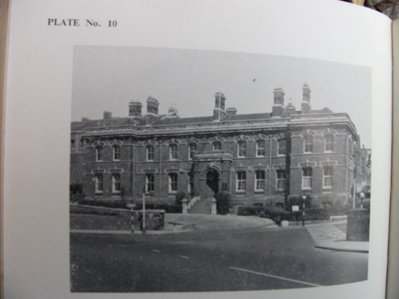
Police HQ New North Road
Heavitree was part of the “X” or Exe Division of the Devon Constabulary which had its Divisional Headquarters at No 9, Mont le Grand which is just off Polsloe Road. This was the home of the Superintendent, who lived above the offices; there was also a stable for his horse. He commanded a swathe of the county, more or less the Exe Valley below Tiverton. I am uncertain when the building was taken into use in the mid-1800s. It was still the “X” Division HQ in 1941. (4)
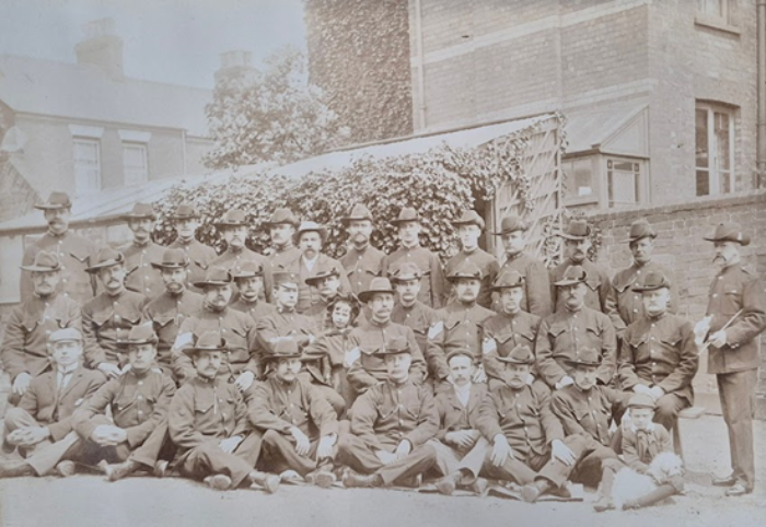
X Division in garden at 9 Mont le Grand c.1903-1909 when the police had different headgear
In ancient times Local government in England was in the hands of Magistrates in each county. In 1828, Counties were divided into Petty Session Divisions; Heavitree was in the Wonford Division. In 1889, County Councils were established, and in 1894 they were sub divided into smaller units, Heavitree became an Urban District with a council. The records for Heavitree Urban District Council can be viewed at the public Record Office, Great Moor House, Exeter. Wonford Magistrates sat at the Castle in Exeter until 2005.
In 1913, when Exeter City expanded to incorporate Heavitree, the Devon Constabulary Police Sergeant who had resided at the police station, retired. The six constables decided to remain members of the Devon Constabulary and were transferred to other stations. They chose this option because, at that time police pay varied between the various police forces, the pay of a constable was greater in the County than the rate in Exeter City. A few years earlier when St Thomas UDC joined Exeter, the policemen did become City men, because the pay was then greater in the City. (1)
The consolidation of the UDC to the City coincided with the appointment of Arthur Nicholson as Chief Constable of Exeter. He had served through the ranks at Bradford and proved to be a visionary with modern ideas. The former Chief had died suddenly whilst still in office, Nicholson inherited his plans for the policing of Heavitree. (2)
At first, Exeter City police continued to operate the police at Heavitree in the same fashion as the County. They stationed a Sergeant at the Heavitree Station, he moved his family into the accommodation at the station and lived rent free, he was provided with free coal and gas to keep the station warm. The county had six houses on lease for their constables, which the City continued their lease.
The advent of the Great War in 1914 brought huge pressure on police forces, almost a third of the manpower were army reservists who were all recalled to the colours. After the war there were great constraints on public finances, which meant there were fewer policemen, the limited technology of the day had to be utilised to make up the shortfall. The telephone was becoming more available in people’s homes and in business premises, but were no public telephones or kiosks, at that time.
The City police was e-organised in 1925 with the installation of Police Boxes and telephone pillars, from which the public could contact the police, fire, and ambulance when required. I have seen no mention of the closure of the police station in Fore Street, which would have been surplus to requirement, when a police box was installed. Until the 1950s there were subterranean lavatories in the centre of the road in North Street, behind the Northcott Lamp; the police box stood on top of them.
| Original style pillar used in Exeter | Sunderland style police box, the type that stood in North Street |
|---|---|
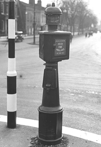 |
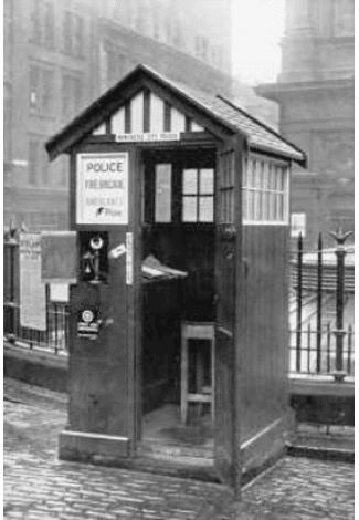 |
The wooden police box in North Street was replaced by a permanent police office, built in the 1950s, between the Congregational and Roman Catholic Churches at the top of Fore Street. It was still in use this century but has since been converted to an office block. (3)
I joined the City Police in 1958 when the Heavitree Beat (Fore Street) had a constable on patrol 24/7. One of the most important rôles for the constable was at the junction of Fore Street/North Street/Church Street for the children crossing for schools. I can honestly say that the many hours I spent walking up and down Heavitree were a total waste of time, I never arrested anyone on that beat, but I don’t know what crimes my presence prevented, nor can I measure the reassurance it gave to the public for their safety and protection.
I do know that I saved numerous children from the life of debauchery they would have faced, by their use of the see-saw or other infant playground equipment available in Heavitree Pleasure Ground on a Sunday!! Can you imagine the moral danger these children were in?! Would you believe their parents were assisting their enjoyment on a Sunday of all days! Until well into the 1960s, the City Council closed all parks at dusk on Saturday, they placed chains with locks around the swings, immobilised any other equipment they could to prevent children playing on them before Monday.
One of the residents In Whipton Lane, overlooking the children’s playground, was also deeply concerned with the children’s moral welfare. At the first sign or sound of a child’s chuckle of enjoyment, he was on the phone, 999 … for the police to stop their happiness.
I am now ashamed to think to think I was party to this religious bigotry.
- Chief Constables Orders and Memos (PA/1/1/3/1/9 pages 116 to 127)
- Chief Constables Orders and Memos (PA/1/1/3/1/9 pages 116 to 127)
- Reports to Exeter City Watch Committee (PA/1/6/3/1/14)
- Correspondence File Devon Record Office (1926B/FR/E/7/1)
Heavitree Postboxes
Heavitree is extremely lucky to have a complete range of post boxes, from the outset of the postal system to the present day. It’s another part of our heritage that deserves not to be forgotten.
Before post boxes, sending letters could be difficult. Lady Patterson of 4 Baring Place wrote in her diary on 14th July 1832:
“I did not know how to convey my letter to Exeter, as the servants were so busy, so gave it to the butcher’s boy. I hope he will take care of it.”
| Victorian postbox | Edward VII postbox | ||
|---|---|---|---|
 |
 |
 |
 |
The first post box to be set up in the United Kingdom was in Carlisle in 1853. Boxes started to spread across the country during the rest of Queen Victoria’s reign. Having distinctive VR markings, we are lucky to have some of these in Heavitree including, for example, at Regents Park.
In Victorian times boxes were cleared seven times a day on weekdays and twice a day on Sundays.
Edward VII only reigned for nine years (1901-10) but again he is well represented in Heavitree. A good example is outside Livery Dole almshouses. The boxes are marked ER with a small VII by the lettering.
| George V postbox | Edward VIII postbox | ||
|---|---|---|---|
 |
 |
 |
 |
We also have several George V (1910-36) boxes locally. The boxes from his reign just have GR. This causes some confusion as some of these were also used when George VI (1936-52) came to the throne. Later VI was added to the GR on boxes. There is a good example of one of these in School Lane, just off Topsham Road.
In between the two Georges, we had the extremely short reign of Edward VIII (1936). Only about 160 post boxes were produced with his lettering and numerals, but we do have one in Heavitree! It stands at the corner of Peryam Crescent and Woodwater Lane – a real rarity.
| George VI postbox | Elizabeth II postbox | ||
|---|---|---|---|
 |
 |
 |
 |
Finally, there are boxes, set up during the lengthy reign of Queen Elizabeth II (1952-2022), bearing the distinctive ER II markings.
Keep an eye out as you walk around Heavitree and check in whose reign each post box was erected.
How long before we see a box created within the reign of Charles III (2022-)? If you come across one in Heavitree, please do let us know.
Scroll to top of pageResearching A Heavitree Silk Merchant
Whilst wandering around the graveyard at Pinhoe Church, I was struck by scale of a memorial in the distance and so ventured over for a closer look. It proved to have a Heavitree connection.
The grave inscription said: ‘In loving memory of Stafford Northcote Green of Heavitree.’ Intrigued by this I set out to see if I could find out who he was.

Headstone on the grave of Stafford Northcote Green, Pinhoe Cemetery
Information on the internet quickly provided a lot of detail. The Devon Heritage Centre holds a 1900 mortgage document which states: ‘Stafford Northcote Green, formerly of Stafford Lodge, Heavitree, now of Exeter, silk mercer.’
This tells us his trade – a silk mercer was a dealer in silk - and also where he lived when in Heavitree. Where is/was Stafford Lodge? Our own Heavitree Local History Society website had the answer to this.
Stafford Lodge was a large, detached building facing the Livery Dole Almshouses. It was built between 1851 and 1861. It is still there today although now known as Rowancroft, part of the University of Exeter complex there. It stands behind a large listed Heavitree Stone boundary wall along the main road into Heavitree.

Stafford Lodge, Heavitree (named Rowancroft in 1890)
We have a man named Stafford, and a house named Stafford. I was keen to delve some more. Thankfully on a genealogy site someone had posted some very useful background details. It turns out that Stafford Lodge belonged to Edward Green (1805-1876), also a silk merchant. He was the son of a brewery manager from Watford.
Edward married Sarah in 1842. She was the daughter of Stafford Northcote. In 1843 their elder son was born and named Stafford Northcote Green. This son later carried on the family’s silk business which operated out of 25 High Street, Exeter.
Presumably when they had the Lodge built in Heavitree they named it after the family name of Stafford. It’s a name with great Devon connections. Sarah’s great grandfather was Sir Henry Northcote, 5th Baronet, who lived at Pynes on the outskirts of Exeter. He had moved there when he married Bridget Stafford. Pynes was the Stafford family home.
The names Stafford and Northcote have quite a bit of resonance, becoming family names and the name of a grand Heavitree house.
Footnote: Stafford Lodge was renamed Rowancroft in 1890 and used as a girls’ school until 1921. By 1927 it was an elementary school for boys in training for holy orders. In 1943 it was requisitioned by the Army Pay Corps. It was rocked by tragedy when one of the female soldiers was murdered in the house by an American serviceman stationed in the city.
Scroll to top of pageResearching Heavitree At The Devon Heritage Centre
The Devon Records Office was founded in 1952 as part of the movement for creating a systematic holding of records post World War II – this hadn’t happened much before the war. It had various bases – the old City Library building and a warehouse on Marsh Barton.
In 1998 Devon County Council bought Great Moor House, Exeter from BT, and when the Heritage Lottery Fund gave them money to convert it, the Records Office moved there in 2005.
In 2012 they amalgamated with the Westcountry Studies Library (which held published materials and was housed a separate building in Exeter city centre) to form the Devon Heritage Centre. There are branch offices in Barnstaple and Plymouth. In 2014 the South-West Heritage Trust was founded, with Somerset and other museums.
Storage facilities at the Devon Heritage Centre
The Centre is open Tuesdays to Thursdays 10-5pm, with Mondays and Fridays reserved for behind the scenes work – lots of cataloguing, clearing, processing, etc, plus tours, open days and group visits. Since the Covid pandemic, advance booking via their website is required. The online catalogue is the main way to find details of what they hold. There is more on the card indexes (dating from the 1950s) at the Centre.
In an average week, three or four packages of ‘things’ arrive to be processed. These could be van-loads of information from businesses or just a few leaflets. There are always things of interest being found in lofts, cellars, collections from societies, local government, etc. Before anything can be stored, it has to be repackaged and referenced.
The Devon Heritage Centre Holds:
- Parish records: records of baptisms, marriages, burials, etc. The earliest record is from 1538, the earliest for Heavitree from 1555. Records survive for 450 parishes, from most parts of the county. Some have lots, some very little as a lot has been lost over the years.
The collection for Heavitree is one of the largest and most comprehensive. In the past, Heavitree was a rural village outside the City. The fact that so much survived is a tribute to how well records were looked after. - School records: mostly for primary schools. These include admission registers, log-books with details of day-to-day events (evacuees, the Blitz, boys not attending school as they were helping with the harvest, etc)
- Hospital and asylum records: Records of Southernhay, plus Exminster, Digby, and Wonford House asylums give a huge insight into mental health care in the mid 19th century.
- Records of ‘Landed Families’ and their estates: vast amounts of material on landholding – title deeds, surveys, what the land was used for, old and interesting maps. Relating to families like the Courtneys, Aclands, Rolle, etc.
- Records of the Diocese of Exeter and local authorities
- Records of clubs and societies
- Records of courts

The earliest parish record for Heavitree held at the Devon Heritage Centre dates from 1555
The Westcountry Studies Library Holds:
Primarily printed material related to Devon, Dorset, Somerset, Cornwall, Bristol and Bath.
- Books: research, novels, street and trade directories
- Photographs and illustrations
- Newspapers: more often than not, people use the National Newspaper Archives. However, it’s free at the library and there are many on microfilm that aren’t online yet.
- Early printed maps and OS maps from 1880s onwards (the Heritage Centre holds manuscript maps, but the Studies Library holds printed ones)
Some Examples Of Items Held:
Rules For The Good Governance Of The Parish, 1586:

Parchment containing articles relating to governance, 1586
This large piece of parchment contains articles relating to governance, drawn up by a group called Four Men of Heavitree. We assume they were senior members of the parish community.
It had been decided upon by the Four Men and all parishioners of the church that records would be kept in a strong chest bounded with iron with three locks and three keys. This would have been kept in the church.
Survey Of The Manor Of Heavitree, 1740:
The ‘manor’ of Heavitree differed slightly from the parish. It was a slightly different legal constitution originating in the feudal system. Historically the main system of governance would have been via the lord of the manor, manorial courts, etc.
This survey is pretty typical: it gives lists of properties, with names of tenants, their rent, and technicalities. Some place names are recognisable.

Extract from Survey of the manor of Heavitree, 1740 - Entry for the Royal Oak
There is reference to the Royal Oak and the name of the landlord at that time. Heavitree at that time was rural. There were a total of 9 acres attached to the pub itself.
The Royal Oak originally stood on the corner of North Street and Fore Street (see map of Heavitree Towne 1816); it moved to its current location in the 1820s.
Milking Cows Without Permission, 1740:
This story is part of the ongoing project to catalogue court sessions, of which there were four each year.
In Exeter there were two sets: the Devon Quarter Sessions and the Exeter Sessions. Exeter was classed as a county AND a city.
These sessions were the main way that less serious crimes were tried. The sessions also had admin responsibilities which were later passed onto county councils (things like the requirement to repair roads).

Record from the Exeter court sessions, 1740
This extract is an example of the sort of crime that would be tried in the quarter sessions: a woman called Mary was accused of breaking and entering and feloniously obtaining 5 quarts of milk from two cows.
The Ruinous State of Heavitree Road, 1747:
This document condemns the mile-long stretch of road from the old workhouse (where Waitrose now stands) towards Honiton, home of the gallows.
It describes the road as very ruinous, deep, broken and in decay, saying that liege-people (citizens) could not pass in their horses, coaches, and carriages without great danger.
Churchwarden’s Account, 1780:
This details money collected from citizens and paid out for expenses of the church.

Extract from the churchwarden's account, 1780
Overseers of the Poor Accounts, 1783:
This records the collection of poor rates and redistributions to the poor of the parish. There were some standard expenses here:
- ‘Information and warrant to search William Hatherly’s house on suspicion of her robing Plias Forward’s garden and carrying away cloaths as it was owt a drying.’
- Coffin for Peter Pibble (a poor person)
- Liquor for putting him into the coffin as he died in a bad fever
(this would be drink given to the undertakers)

Extract from Overseers of the poor accounts, 1783
This is standard stuff but is all part of the fabric of the history of the parish.
The Parish Commemorates The Golden Jubilee Of George III, 1809:
This is from the minutes of a vestry meeting – an aspect of the parish that governed things prior to a Parish Council. In this 50th year, it was decided that a special collection would be taken from landowners and householders, and redistributed amongst the working poor and those receiving parochial relief. John Baring, for example, paid £1 1s (1 guinea).
Maps Of The Manors Of Heavitree And Mount Radford, 1816:
Two good examples of intricate, coloured, hand-drawn maps, produced by John Coldridge, surveyor for the Thomas Baring Estate. They show a number of orchards. The letters and numbers cross-refer to more detail on the plots.

Hand-drawn map of part of the manor of Heavitree, 1816
The Heavitree map was used in 2001 by Den Perrin to sketch a map of Heavitree Towne, highlighting the buildings and road layout of the time (see map of Heavitree Towne in 1816).

Hand-drawn map of Mount Radford and Larkbeare, 1816
Overseer’s Notice, 1831:
This poster offers an incentive to anyone who can help apprehend people of committing crimes locally.

Overseer’s Notice, 1831
Letter To The Parish Highway Surveyors, 1834:
This letter, on behalf of the inhabitants of the Topsham Road, was complaining about the state of the road, in particular the footpath in front of the house of Dr Rhodes.
The letter threatened that unless it was repaired immediately, they would take action and go to the Justice of the Peace at the Quarter Sessions.

Letter of complaint about the state of the footpath on Topsham Road, 1834
Heavitree Parish Tithe Map, 1843:
The giving of one tenth of your land’s income was phased out by 1836, so maps were drawn up of tithing areas. They are superb sources for tracing the history of parishes.

Tithe map, 1843
Heavitree Bridge, 19th Century:
This is from a volume of illustrations of bridges throughout the county, produced for the Quarter Sessions. They are wonderful drawings. You can see the Turnpike Gate is marked, just past the Bridge.
| Heavitree Bridge in the 19th century | ||
|---|---|---|
 |
 |
 |
| Surveyor's drawing | Map | Painting |
Sale Catalogue: Grâs Lawn, 1911:
The Heritage Centre holds thousands of sale catalogues.
Grâs Lawn had a cricket ground attached. The catalogue shows plans, what’s included, and the land attached; there were often photos too.
| Sale of Grâs Lawn, nr. Exeter, 1911 | ||
|---|---|---|
 |
 |
 |
| Catalogue | Plan | Photo |
The Cathedral Archives And Heavitree History
The Cathedral Archive holds two maps of Heavitree that greatly improve confidence in historical facts we could otherwise simply speculate on. They are:
- ‘Map of the Tything of East Wonford in Heavitree’ (a copy of a map made in 1813; we don’t know where the original is or when it was made)
- ‘Map of the Tything of Polsloe and Rolestone Barton in Heavitree, Devon’ (1785)
Field names on the maps pre-date the Victorian era, sometimes stretching back to Tudor or even medieval times. They can give clues on land-use way back in time.
An example is ‘Lower Butts’. This piece of land is shown on the 1889 OS map as ‘Pengelly’s brickworks’, located behind Roseland Crescent. Looking at historical features there, a long wall that stretches along today’s Pleasure Ground, you’d be forgiven for thinking that this had something to do with a Victorian Market Garden that was located where Roseland Avenue and Cobden Villa are now.
 |
 |
 |
| The Cathedral Library | Wall of large ashlar blocks of Heavitree Stone | Map showing 'The Butts' |
|---|
A closer inspection reveals that the wall is made of large ashlar blocks of Heavitree Stone. Blocks like these are very likely to be from Tudor times. Post Black Death, builders were taking a lot of care, and were skilled craftsmen. The cob above the Heavitree Stone is most likely Victorian, but looking below it – could we have a Tudor wall in Heavitree Pleasure Ground?
This is where looking at the tithe maps is interesting. ‘Lower Butts’ extended to ‘Middle Butts’ and then ‘Higher Butts’, which sets us thinking that this land could have been used for archery.
In 1511, Henry VIII ordered that all men under the age of 60 regularly practise archery, and that fathers be responsible for providing their sons and young male servants with archery equipment and training. In 1541 he said that the inhabitants of every town "shall cut Butts and shoot at them."
Looking at the wall on its own would not be enough evidence to say that this area was used for archery. Looking at the tithe map field names alone would also not be enough evidence. However, using both sources together, we can quite confidently say what this area was used for.
Scroll to top of pageLadysmith Road Squilometre Project
Residents were fascinated by the many different designs of housing along the road. Initially housing looks uniform – long terraces line both sides of what is a lengthy road. Closer inspection reveals there are in fact a number of designs in ‘pockets’ of the same type. [Ed: This was frequently the case with early urban housing. Terraces would be built by different developers, sometimes over many years. Any gaps would usually be in-filled at a later date.]
The OS map from 1906 shows a large gap in the middle section of the street. Heavitree Council School (now Ladysmith Infants) opened that year. A lot of housing was going up at the same time. This was a time of rapid, energetic development. One can imagine fields being snapped up. The houses reflect the old field shapes. One landowner owned the unbuilt upon gap, and it seems he hung onto that bit of land and just sold it off little parcel by little parcel. The shop was built as late as the 1930s.
 |
 |
 |
 |
| 1906 OS map showing location of Ladysmith Road | Example of housing in Ladysmith Road | Polychrome bricks from Candy & Co, Newton Abbot | Residents at the unveiling of the new plaque |
|---|
The higher end of the road was connected with the nearby Brick and Tile works. What is interesting is that houses feature so many pale bricks, when Sampson’s Yard was producing red bricks. The polychrome (pale) bricks can’t be quarried in Exeter – so where did they come from, and why not make full use of what was available near by?
Perhaps it was as simple as the local works couldn’t keep up with demands of rapid development. On the other hand, as one imagines the entrepreneurs of Heavitree at the time – Nethercott, Vaughn, and Henry Sivell – sat in meetings wanting gas lamps, trams, their own park … maybe it really was just the joie de vivre of the time; a Belle Époque enthusiasm, that made the builders fancy something special.
Residents gradually pieced together that the arrival of the railway in Exeter would have made it far easier to transport the pale decorative bricks from Candy & Co in Newton Abbot into the City. The building of Exmouth Junction in 1908 would have made it easier still to reach the Polsloe area.
| Images from the 1953 coronation party (Courtesy of Bob Squires) | ||||
|---|---|---|---|---|
 |
 |
 |
 |
 |
| Procession entrants | Fancy dress costumes | The table is laid | ||
The Project wasn’t just about history, but was a way to bring people together. Taking inspiration from the finials from windows, and using the double line of pale bricks as a motif, artists ran a workshop in Ladysmith Infants School, looking at architectural features and using ideas generated to create a plaque outside number 1 Ladysmith Road. This was a way of introducing young minds to history that is all around us.
There was also a party – a historical pageant. After being locked down for so long due to COVID restrictions, residents just wanted a party. They spoke to a resident, Bob Squires, who had been part of the 1953 historical pageant coronation party and still had a programme. The day was very successful; what was especially nice is that older residents, younger people and children all mixed. It was very patriotic, joyful and happy.
Further information on the project can be found here.
Scroll to top of pageThe Entrepreneurial Spirit of Heavitree
And The Heritage Of Victor Street
Introduction
For hundreds of years, Heavitree had been little more than a sleepy, agricultural parish, quite separate from Exeter. It was, however, the biggest parish around Exeter with a perimeter of nigh on twenty miles.
During the 19th century the area changed dramatically. The 1801 census tells us that there were just 833 people living in the parish, over 500 of whom had agriculture as their source of income. By 1901 there were 7529; the population had increased by nearly 7000 people in just 100 years. To ascertain the reason for this, one has to look at how the people of Exeter were feeling.

Plan for the second phase of building on the Polsloe Park estate.
Some of this never materialised as Heavitree Council School was built instead
In the early 19th century, the inhabitants of Exeter were probably wondering how on earth they were going to survive. Health-wise, the city stank, and cholera was ravaging. Little by little, people began moving out from the dirty city to Heavitree, considered at the time to be countryside, with clean air. In order to attract pupils, advertisements for schools talked of how healthy Heavitree was.
Heavitree started to become a counter to Exeter. As industry started to grow, many employees wanted homes in Heavitree. A prime example, the railways, employed hundreds.
There were early developments in the 1820s in Heavitree Park – a series of five grand villas with a wooded area. Even the name 'park' gave the impression of living in the countryside. This was followed by Salutary Mount, Mont le Grand and the Polsloe Park Estate.
Polsloe Park was a massive house and estate of fields and trees, diagonally opposite where Henry's Bar now stands. It slowly started to be sold off. When the main house was put up for sale in 1846, it was described as being "in the most elevated and healthy part of Heavitree, with views and richness of scenery: a town and country residence with three carriage entrances".
This really paints a picture of how Heavitree was viewed at that time.

Plan showing plots of land for sale by auction
Late Victorian / Edwardian Entrepreneurial Heavitree
Heavitree Squilometre takes a Hoskins-inspired approach of starting with what can be seen. The evidence around us shows a whole crop of Victorian and Edwardian builders taking advantage of land-owners selling off their estates, to create rapid development and promote their own social mobility.
In 1896, Heavitree set up its own Urban District Council. The HUDC had a dynamic, innovative approach to the modernisation of Heavitree. Everything from trams, to gas street lighting, to the development of the Pleasure Ground was up for discussion, and there was a notable 'can-do' feel.
Some prominent Heavitree developers of the time were:
a) Henry and Septimus Hitt

Headstone of Septimus Hitt
Henry Hitt and his son Septimus were instrumental in the development of South Lawn Terrace and Alpha Street. They had property in other parts of Exeter, including Walton Street, St Sidwells. Septimus had fortunate marriages, as his headstone shows. His was a success story, but other entrepreneurs were not so successful.
b) John James Fry Ellis

John James Fry Ellis with his wife Brenda and family c.1880
JJF Ellis' name is immortalised on a plaque at the top of Regent Square, but he built several other properties around Exeter. He came from a poor background in Newtown, but really left a mark on Exeter, as a plumber, landlord, aspiring city councillor and property developer. He died young and poor, having got into difficulty with debt, and had to auction most of his properties.
c) Robert Pengelly
Site of Pengelly's brickworks, later part of Heavitree Pleasure Ground
As early as 1852, Robert Pengelly was involved in buying and selling land around South Lawn Terrace. He owned the brickworks (later part of Heavitree Pleasure Ground), and was listed in the 1883 Kelly's directory as 'Brick and Tile Maker'. He lived in Roseland Villa (the large house on the corner of Roseland Crescent and Hamlin Lane).
In October 1883, a Mr Timewall from Newton Abbot, bought numbers 18 and 19 [Ed: South Lawn Terrace?] from Mr Pengelly for £500 (around £25,000 at 2023 prices) as he planned to move to Heavitree to live. Something made him change his mind; he decided it would be “detrimental to his interests", and sold the properties back to Mr Pengelly a month later for £670 (nearer £34,000 at 2023 prices). Why had the price increased by so much in such a short space of time, and why was Mr Pengelly prepared to pay so much more?
By 1889, the Pengelly brothers were listed as "Builders", living in East Street (off Newcombe Terrace), with the brickworks already closed. By 1893, Pengelly was in Magdalen Street, with no mention of a business at all.
Changing Times
What these late Victorian go-getters did, was to move us from a time when land and property was owned by large estate owners like the Poltimores or the Barings, to a point, in the Edwardian period, when anything felt possible. Suddenly we saw rows of terraces appear, often with that distinctive polychrome brickwork – Ladysmith Road, Stuart Road, Normandy Road, for example. There seem to have been multiple builders involved.

Brick bearing 1876 as the year of manufacture
One piece of evidence that this building was rapid and entrepreneurial is the fact that Stuart and Normandy Road in particular follow the original field pattern, suggesting that a field was bought, quickly developed, and properties sold on, leaving the somewhat unusual 45 degree alignment of Stuart Road to South Lawn Terrace.
The Heritage Of Victor Street
The Victor Street Squilometre Project
As part of the Heavitree Squilometre Project, research on Victor Street was voted in by the people of Heavitree.
The residents of Victor Street came together to share stories and experiences of living on the street. They decided to work towards bringing greenery to the street, and secured funding to provide a free window box for anyone who wants one.
The Victor Street 'pod' have a visit booked to the Heritage Centre in October 2023. They hope to find out more about Victor Lane (simply mentioned as an unnamed lane in 1931), and other aspects of the street's history. They are also planning bunting, a parade and a picnic in the Pleasure Ground. There has even been talk of an exhibition.
The Early Days Of Victor Street
When researching the history of the plot, the group discovered that the meadow on which Victor Street was built was called 'The Witchet'. A witchet is apparently a type of poisonous lupin, brought in by the Romans.

Children in Victor Street during building
In 1897, it was described as 'grazing land'. It was purchased by H G Stokes, a butcher of 34 Fore Street (out on East Wonford Hill), and sold as 'freehold building land’. It was described as 2 acres (it was likely that a bit had already been grabbed by the houses on East Wonford Hill). As was common in this age of building, the land would be purchased and houses built a few at a time.
H G Stokes had arrived in Heavitree in 1878, but in 1900 he committed suicide. An inquest at The Horse and Groom cited that he was addicted to alcohol. He shot himself in the face and took 30 minutes to die, leaving behind a wife and seven children. In 1907, 17 properties were being sold off.

Entrance to Victor Street in the early twentieth century
Resident Tammy Laskey's great grandmother, Annie Shute, lived on Victor Street from 1905-1911. Aged 8, she had 7 brothers. In 1911 the family were still there, Annie's father was listed as a 'Mason's Labourer'. Annie left Victor Street to go into service at Bystock Terrace.
Case Study: 35 Victor Street - Sue Jackson
Census And Street Directory Findings
The 1911 census reveals that odd numbers 1 to 35 Victor Street had been built, but no end of the street is mentioned.
The 1921 census, on the other hand, shows that all houses on the street were completed. Many of the same families still lived on Victor Street; a few had moved to a different numbered house on the same street. You can see where people had been widowed because of the war.
The 1921 census is particularly interesting. In addition to requesting the residents' occupation, this one detailed where they worked. In the 53 houses, there was a range of occupations. There were railway workers, builders, mental hospital workers, ...
Sue Jackson also looked at the old street directories in her collection. The first time the path from Victor Street to Whipton Lane is mentioned it is described in Besley's simply as 'a passage to Whipton Lane.' In 1957 and 1961 there was a dairy and builder's yard at the top of the lane. From 1994-2014 it was Apex Roofing Contractors, and is now (2023) called Build Space.
Family Connections
Sue Jackson has very strong connections to Victor Street; her family lived there for many years.

Sue's maternal grandfather, William Henry Bolt, as a young sailor
Sue's maternal grandfather, William Henry Bolt, one of nine children, was born in Sandford on 22nd April 1880, the son of Richard Bolt and Emma Dart. A saying passed down the family was that at their wedding Emma ‘Darted’ into church and ‘Bolted’ out.
William Henry Bolt was a stoker in the Royal Navy until just before 1911. He then emigrated to Nova Scotia where he undertook a variety of jobs. When World War I broke out, he enlisted in the Canadian Navy, again as a stoker.

Sue's maternal grandparents, Emma Jane Bolt + William Henry Bolt
Emma Jane Chanter served as a cook in big London houses. During one of William’s trips back to Devon, they married at St Leonard’s Parish Church in Exeter on 1st February 1917, and the couple returned to Canada.
Sue's mother, Creina Joan Bolt, was born in Halifax, Nova Scotia on 23rd July 1918. The three of them returned to Exeter when Creina was a year old, and the family purchased 35 Victor Street. Creina lived there until her marriage in 1945. William and Emma went on to have a son, Derek Richard Bolt, and another daughter, Muriel Eileen Bolt.

Sue's maternal grandfather, William Henry Bolt, as a coal merchant, with his horse Prince,
outside 35 Victor Street

Sue's maternal grandfather, William Henry Bolt, as a coal merchant, with his horse Prince,
outside 35 Victor Street
After a long career shovelling coal on board ship, William started up his own coal delivery business, getting his coal from a Chanter relative who was an established coal merchant.
Sue's mother used to tell her that he had no head for book-keeping which he left to his wife. William either didn’t know, or couldn’t remember, the names of his customers. He used to write things like ‘Mrs Green Curtains’ or ‘The Painted Lady’ (who evidently overdid the make-up) in his delivery book, leaving Emma to work out who he meant.
He was fond of his beer, and was generous to a fault. When entering his favourite pub after he had finished his deliveries, he would happily buy everyone a drink. His wife got wise to this and used to intercept him and take his money bag off him, otherwise she was left short of housekeeping money for the week ahead.

Sue's mother Creina, aunt Muriel, and uncle Derek (with a Chanter relative?)
Creina, Derek and Muriel all attended the local Heavitree schools. One story told by Sue's mother related to Derek’s school days. He frequently got the cane for misdemeanours, and got septic fingers as a result. His mother eventually got fed up and went to see his teacher. She said she perfectly understood that he needed to be punished, but would he please do her a favour and cane the other hand, as she had just managed to heal his injuries only to have them opened up and bleeding again.
William died 13th October 1945 and Emma Jane followed him on 24th February 1946. Sue was born in December 1947, so sadly never knew either of her maternal grandparents.

Sue's aunt, Muriel Eileen Bolt, sitting on a window sill of 35 Victor Street
Muriel had already married in August 1941 to Percy Reginald Cridlin (known always as George) and they continued to live at 35 Victor Street along with their children, Brian and Pat, until George’s death on 20th March 2004, and Muriel’s move to a care home in Exmouth where she died on 20th September 2008.
Derek married in December 1941 to Olive Mary Channing, and they bought a house at 9 Wyndham Avenue.

Sue's cousin, Brian Cridlin, and a friend, on their tricycles
Sue's mother, Creina, continued to live at 35 Victor Street until she married Albert Henry Richards in December 1945.
Creina had trained as a nurse at the Eye Infirmary before moving to the City Hospital; she was there at the time of the Blitz. She was then moved to Whipton Isolation Hospital, where she met and nursed Albert, who was suffering from TB.
The couple went to live with Derek and Olive until December 1948, when they were given the tenancy of a prefab in Prescot Road, Redhills, when Sue was a year old.
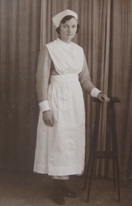
Sue's mother, Creina Joan Bolt, as a nurse
The Channings lived at 49 Victor Street, and are listed there in the 1939 Besley’s street directory. They moved to live with Derek and Olive after Sue's parents moved to the prefab.
Emma’s mother, Mary Chanter (nee Ware), moved from the Crediton area some time after her husband’s death in 1907, to 69 Wonford Street, where she is listed as the occupant in the 1939 Besley’s.
Mary evidently liked to know everyone’s business and earning capacity as in a story related by Sue's mother when Derek went to visit his Gran, Mary was reputed to have said “What might ‘e be earning then Derek?” and his reply was “I might be earning a fortune Gran, but I’m not”.
Mary died in the June quarter of 1944, age 86 – another relative Sue didn’t have a chance to know.
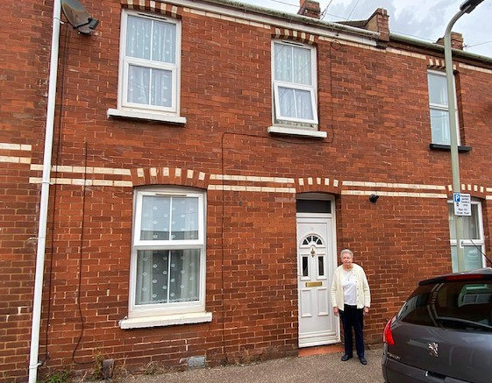
Sue Jackson outside her family's home, 35 Victor Street
Further information on the Victor Street project can be found here.
Scroll to top of pageMile Lane, Beacon Heath: A Hidden Heavitree Treasure
Mile Lane is an ancient path in the Beacon Heath area of Exeter, and rises from Beacon Heath to Stoke Hill. The area lies within the bounds of the Heavitree Parish.
It's not entirely clear why the path is named Mile Lane. It could be the obvious: its length. As the crow flies, from St Katherine's Priory to Stoke Hill is approximately a mile. On the other hand, there is a theory that when the Mincinglake Stream was dammed, Mill Field, which was about half way up, could have given the name to the Lane. Furthermore, Stoke Hill was probably a Roman road (Haldon Hill → Exeter → Stoke Hill → Stoke Canon and beyond), so it may be this was a side-road coming off it, and could date from then.
Mile Lane is well used by walkers, cyclists, and horse-riders alike, yet many in the area are unaware of its presence, let alone its historical significance. These days, it's somewhat lost sandwiched between the edge of the Beacon Heath Estate and Mincinglake Valley Park.
Other than around a dozen houses built at the lower end of the Lane in the early 1920s, Mile Lane remains much the same as it always has been, a tree-lined byway passing through open country. In the past, there were uninterrupted views across cornfields to St Marks Church in Pinhoe. There remains a wonderful view from the top of the Lane looking westwards towards Dartmoor.
When the Beacon Heath Estate was completed in 1953, the initial strip of 1920s houses was separated from the Estate by the hedgerows and trees of Mile Lane; this can clearly be seen on maps of the time. Residents still lead very separate lives today. Additional housing was added to the Estate in the 1970s and 1980s.
 |
 |
 |
| 1934: OS map | 1950s: Aerial photo | 2024: OpenStreetMap |
|---|
Nowadays, Mincinglake Valley Park is off to the left of the Lane, but many still recall the quarry behind the 1920s housing. It was a feeder for West Brick in Monks Road. After the quarry closed, the site was for a while used for landfill; most knew it as ‘The Dump’. Some of the things that were buried there were not very nice; the site is still being monitored by The Environment Agency.
Mincinglake Stream / the Northbrook, known locally as The Panny, runs through the Valley Park, en route to the River Exe. Lots of old Exeter Brewery bottles have been dug up on the banks of the Panny. The area being a valley, means there are a number of other streams. Some of these are now culverted; it's possible to follow the manhole covers along the culverts.
The valley was popular with kids' as a playground. They would make use of gaps in the hedges lining Mile Lane to cut through from the Beacon Heath Estate to ‘The Dump’ and The Panny. They would build rope-swings across the streams of the valley, and were able to scoop buckets into ponds to retrieve an amazing variety of wildlife: newts, grass snakes, adders, and rats.
 |
 |
 |
| View along Mile Lane | View along Mile Lane | View westwards towards Dartmoor from the top of Mile Lane |
|---|
Memories Of Heavitree
Heavitree Dolls' Hospital
A number of people have memories of a Dolls’ Hospital in Fore Street, Heavitree in the 1950s.
It was inside a shop called ‘The Topaz’, a newsagents / confectioners owned by Mr Hollis. It occupied the building that is now Corals, and was next to Dr Tracy and Dr Lamb’s surgery in Homefield Place.
One person remembers it having a large ice-cream cone outside. Her mother would meet her from school every Wednesday (half day) and buy her an ice-cream there.
One lady recalls taking her dolly there, and her being put on a shelf with a goodly number of others lined up waiting to be repaired.
A bear with a broken off head; a doll with perished elastic, and thus whose limbs had fallen off; a 'Tiny Tears'; a 'Chatty Cathy' - were all patients at the hospital over the years.
Roseland Dairy
These are 4 photos of me taken in the late 1960s outside Roseland Dairy which was at no.6 Newcombe Terrace, on the corner of Newcombe Street. The front of the house looked straight down Hamlin Lane towards Polsloe, the shop entrance itself was in Newcombe Street.
| Roseland Dairy, 6 Newcombe Terrace in the late 1960s | |||
|---|---|---|---|
 |
 |
 |
 |
My parents ran the dairy until about 1969. My mother used to deliver bottled milk around the nearby streets using a converted pram. Incidentally, here was another Roseland Dairy in later years located in Fore Street, Heavitree, but there is no connection.
My Grandmother lived in Beacon Lane and was the cleaner in the Heavitree United Reformed Church.
Mark Sanders
Cross Park Terrace
I thought the attached may be of interest for the land my house was eventually built on. The auction notification was obtained from the British Newspaper Archive.
 |
 |
| Auction advert 6th May 1885 | 1915 |
|---|
Lee Cusick
Rosary House School
I was there from the age of five until I was eleven. I was extremely happy there and I found the nuns very kind despite the fact that my family were not Catholics.
The large entrance hall was in a Victorian tiled pattern of shades of terracotta, blue and white. In these days at Rosary House there was a class taken by Miss Beck to the left of the entrance hall, and to the right was the BIG room where assemblies, P.E., plays and other activities took place. Behind was the kitchen where Sister Camelia was in charge; to the left of this, under the stairs were the cloakrooms, toilet and back entrance. There was a student teacher in charge, but I can't remember her name.
Up the grand staircase, to the left was what I think must have been the nuns' quarters. I know Sister Superior's room was there. Dead ahead was a large statue of the Virgin Mary. To the left of this was a row of classrooms. Sister Sebastian's was the first in the row, she took the older children. Sister St John was in the middle, took the lower juniors, and at the front of the house was Sister St Alphie's infant class.
Each doorway had a place to dip one's finger in holy water and cross oneself (strange to a non-Catholic child). The classrooms had a picture of a 'stairway to heaven' where if you brought a penny (old money 1d) your paper image could rise a step upwards until eventually your 'paper child' reached heaven.
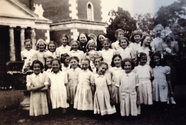
Sister Sebastian's class c. 1949:
L-R Standing: Elaine Cruchet, Jill Hayte, Rosemary Wall, Valerie Parker, Anne Collins, Sister Superior, Beryl Reid, Sister Sebastian, Beryl O'Shea, Unknown, Mary Hodges, Unknown, Monica ?, Unknown, Alisha Ramsdon.
Kneeling: Janet ?, Heather Roxburgh, Judith Bridle, Bridget Matthews, Anne Milne, Josephine ?, Hilary ?, Hazel Smith, Geraldine Roberts, Brenda Lewis, Janet ?, Jennifer Pepperel, Cynthia Kirk.
The unnamed girls to the right in the back row were a year older than Rosemary.
On various days we went to a service in the Sacred Heart Church. I can remember being taken back to the school feeling faint from the cold and being given the old fashioned 'SOL VALATILE' by Sister Camelia in her warm kitchen. Not a lot of heating available with wartime fuel rationing.
There were various places to play at the back of the house, but in the summer we had the joys of the field to the side of the house and behind the church. This was also used for fêtes. The nuns were excellent at craft-work and made lovely things from very little, as during wartime and for some time afterwards, everything was on ration.
Occasionally we went to Palace Gate School by bus from Heavitree to Exeter Centre for 1d (one old penny) return. This was to enable us to use their 'proper gym'. The only school outing I can remember was towards the end of my time there when we were taken to Bristol Zoo - see photo of myself with Julie Kirton. This shows our school summer uniform. Blue and white checked dress, navy blazer with school badge and a straw hat with band and badge on it. In winter, I think we had a navy tunic and white blouse and tie, and probably a jumper or a navy cardigan.
I particularly enjoyed Friday afternoons, it was reading and handicraft work. The reading books were graded, and you usually had a new book for the weekend (what an incentive to get on). We learned joined-up writing with old fashioned copy books, and multiplication tables by rote. The nuns were very dedicated and helped us 'get on' in many ways. Discipline was certainly there but not in a heavy-handed way. If only that were true today!! I later became a primary school teacher and corresponded with Sister Sebastian each Christmas until her death at a convent in Hudsen, America, a region from where she originated, I believe.

Rosemary with Julie Kirton at Bristol School outing
I enclose a photo of Sister Sebastian's class taken about 1949 in front of the school. I have been able to name most but apologise to anyone I've missed out or mis-named. It was taken 70 years ago! The other photo is of myself and Julie Kirton at Bristol School outing.
I am not on the internet but if anyone feels inclined, I would love to hear what happened to you after leaving Rosary House. Sally Robinson would be very happy to pass on any replies.
Rosemary Baxter, née Wall
Regent Square
My family lived in Regent Square from before 1900, at various numbers but always the front, until 1968 when my parents moved to Honiton Road.
Members of my paternal grandmother's family were instrumental in the building of Regents Park and Mont-le-Grand. One set of her great grandparents are buried in Higher Cemetery.
| My grandparents | ||
|---|---|---|
![Lilian Emma Gill + Mary Elston Gill [née Taylor]](images/articles/memories/regent-square/01.png) |
 |
 |
My grandfather was Arthur Robert Dooling who served in the Exeter City Police Force for 34 years. During World War II he was on duty at the top of North Street with the Police Box as his base. I remember taking his lunch up to him in a brief case; my mother would steam it so that he got it hot. He was also Chairman of Heavitree Conservative Club for many years.
My grandfather received a number of medals in his time: In addition to the three standard World War I medals, he was awarded the Defence medal and an Exeter Police Force long-service medal, of which very few were issued. I remember him cleaning them before he wore them for any official parades, etc.
| Regent Square | ||||
|---|---|---|---|---|
 |
 |
 |
 |
 |
| 1937 | Street party 1945 | |||
My mother was one of the original committee members for the Heavitree Social Club, first based in the old school, which she attended as a child, and later at Wingfield House. She also helped with the catering at the Conservative Club, for their men only events as well as the dances.
I lived in Regent Square for the first 19 years of my life.
| Heavitree Carnival float | ||||
|---|---|---|---|---|
 |
 |
 |
 |
 |
Diana Horne is my cousin; she often visited from Eastleigh. Shirley Roberts, Jennifer Ford and Patricia Abbott were cousins.
I've identified the children in the images as far as I can remember, but you'll appreciate that after all this time I’m unable to recall everybody.
| Away from Regent Square | |
|---|---|
 |
 |
Jean Bauman, née Smith
Sally Robinson (former resident of the Square, and a member of the HLHS) has published a detailed piece of research on the Square. The publication can be downloaded here; hard-copies are available on request from the Society.
Chard Road #1
Our house, 8 Chard Road, was built in 1926/7 and was one of the first to be built in the road. Nos. 6, 8, 10 and 12 were built first by a builder called Kent. Strangely, nos. 2 and 4 were built later by a different builder. My family lived there from 1927 to 1981 when my mother died; my sister and I sold it in 1982.
At the front of the house there was path straight to the front door from a brick wall and gate. My father loved gardening, thus the front garden was filled with scented flowers, a white lilac, lilies of the valley, near the door there were roses galore, and special pansies - huge ones - the seeds of which he got from Switzerland.
At the back of the house, there were concrete steps and a flat stretch of concrete below the dining room window where my mother mangled her hand washing. No washing machines or spin dryers in those days. The concrete ended where the toilet is (then accessed by an outside door), the coal cupboard was next to it towards the house. The kitchen was very small and down a step from the hall. There were no hedges between neighbours, only concrete posts with wire through them between neighbouring gardens, so the whole garden was much wider than it is now, though less private. The narrow pathway led straight down to a bank at the very bottom where it joins the park. Along this path were five apple trees and a William pear tree. Across the garden were fruit bushes: gooseberries, red and blackcurrants, raspberries and strawberries. Also a plum tree and greengage trees. Vegetables were grown between all of this.
During World War II when food was rationed, this supply of food was essential for the family. "Dig for Victory" as the saying was. It supplemented the weekly rations - 4oz of bacon, the same of meat, 2oz of cheese, 4oz butter or margarine, 8oz of sugar, 2oz of tea, 1 egg, 2-3 pints of milk - per person per week. Even bread became rationed as the war proceeded. We bottled fruit but with virtually no sugar available. Everything strictly rationed, you had a book with food coupon from which your nominated grocer cut out the week's coupon allowances. We had to mostly produce our own food as the Germans were sinking merchants’ vessels to try to starve us out. 2,500 such vessels were sunk.
We had an Anderson shelter dug into the bank just up from the piped stream at the very bottom of the garden. In it, we had Lloyd Loom chairs and a Valor oil heater. When the sirens went, we all trooped out with a blanket and cushion to sit out the time until the "all clear" was sounded. You could hear the bombs dropping on Exeter. The Luftwaffe followed the River Exe from the coast up to the city. It was very frightening.
The only heating in the house were the big open fires in the lounge (front room) and the dining room. They were tiled and had high mantle shelves above them. Red tiles in the back room, pole blue in the front. Coal was strictly rationed as well, so only put on when really cold. There were two grates, one in each bedroom, but only used it someone was pretty ill. No double glazing or loft insulation. I can remember the frost patterns on my bedroom window in winter. You got dressed very quickly, likewise washing yourself, no heating at all there!
In the corner of the kitchen was a big gas water heater, with a coffer underneath to do your hand washing. This left little space for the cooker, called "The Black Prince", cast iron, also gas run. The sink was opposite, and a draining board. No fridge, just the understairs cupboard made into a larder with the window covered with steel meshing. No carpets; only cold lino and rugs.
I remember life in Chard Road as happy days. Little in the way of comfort, and yet the neighbours all helped each other with the little they had and comforted one another in times of distress.
By the late fifties, things had improved in the country and the open fires were replaced by electric ones in the lounge and dining room, and storage heaters in the hall and main bedrooms. The bathroom was modernised.
When Dad died in the late sixties, the fruit trees, etc went and all was put down to grass, as my mother was seventy by then and she just got someone in to cut it in-season. The coal shed was made into a shower, this with the toilet was then accessed from indoors via the kitchen and the outer doors bricked up.
With kind permission of JoJo Spinks
Chard Road #2
Fred Cole was born in Heavitree on 4th May 1929. At one year old, his family moved into a brand-new house on Chard Road. In 2022, at almost 94, he still lives in the very same house. He shared some of his memories with us.
Chard Road
Fred’s house was completed in 1927 and has stood for nearly 100 years, withstanding the Exeter Blitz and many changes to the area. Fred says that you wouldn’t recognise Chard Road when he was a boy there.
Turning right from his front door, there were two shops on the corner. Fred had a stammer so his mother would send him to the shops with a note so that he didn’t have to speak.
As you walked down the hill towards the bottom of Whipton Lane, you’d come into fields and orchards with apples and pears growing. It felt like the countryside. There was a small, rickety wooden bridge over the Northbrook. Fred and his friends would sometimes steal fruit from the orchards. He was the leader of the gang.
One day they went into one of the orchards and he said,‘I’ve an idea. There’s a policeman in this orchard.’ They went running off but Fred caught his trousers on some barbed wire and tore them. He got home safely however and relaxed.
After a while there was a ring on the doorbell. It was indeed a policeman, but he was a nice policeman.
‘Hello, Constable,’ said Fred's father. ‘Any trouble?’
‘Yes. Have you got a boy called Freddy Cole? He's been pinching apples and pears.’
Fred’s father gave the policeman a nice juicy pear to eat. Once he’d enjoyed it, his father announced, ‘That’s one of the pears my boy pinched!’
 |
 |
 |
 |
| Fred as a young boy | Fred outside 92 Chard Road | Fred with his mum and their dog | Fred standing at the corner of Chard Road and Whipton Lane |
|---|
The houses were quite modern for the time, with gas and electricity, and both indoor and outdoor toilets. Each room had a coal fire; Fred and his mother used to lay them first thing in the morning.
When the houses were new, they just had the floorboards showing. Most people couldn’t afford carpet, so they had lino put down.
In 1949, only three people on Chard Road had cars. Fred knew many of the families who lived there, but most have now died. There is nobody left from Fred’s childhood on the road, and Fred remembers a time when ‘everyone seemed to be friendlier’ (although he very much appreciates talking to his neighbours and their children).
Education and Work
Fred went to Ladysmith School, when the girls and boys were still separate. They went in through their own gates and had their own playgrounds, but the boys frequently went into the girls’ playground and Fred managed to have a girlfriend despite the separation of sexes. He always remembers her as being the only girl who wore a proper school dress and belt in the school’s colours – the rest of the girls wore their own clothes.
The teachers were very nice, despite all carrying canes, which they used ‘very often’. They were kind to Fred, and wouldn’t ask him to read aloud, because of his stammer.
 |
 |
 |
| Fred was educated at Ladysmith School | Fred driving a DMU | Steam train near Dawlish |
|---|
Like most children, Fred left school before he was 14. He went to work on the railways, like his father. He showed us the coal dust which is still under the skin of his forehead, from when he once fell many feet into a pit of hot coal, when he was cleaning out the smoke box. The scars, like everything else around Fred, tell a story. After twelve years as a fireman, Fred became a train driver and worked until he was 63. The photo below shows Fred driving a train along the Dawlish/Teignmouth line.
Heavitree in World War II
It is unsurprising that Fred’s memories of the War and the Exeter Blitz still haunt him today.
Chard Road must have felt very different with the threat of German attack. The Pleasure Ground, which is just behind the houses, had 7ft deep trenches dug along it, so the Germans were unable to land their planes. The children played in the trenches with pretend guns or toy cars. Many people are unaware that there were six anti-aircraft guns stationed in the Pleasure Ground.
The Home Guard was formed, to keep civilians out of mischief. Windows had to be blacked out and cars couldn’t have their lights on: everywhere was pitch black.
Everysone was issued with a gas mask, and at school there were weekly drills to make sure you could put them on quickly – if you weren’t fast enough, you’d be in trouble. Babies had to be put inside a special box before being put inside the shelter.
The Council came around and gave people a choice between an indoor or outdoor shelter. Fred’s family had the outdoor, dug out style of shelter. The family lived near a couple who were very frightened of the war, so Fred’s dad cut a hole in the privet hedge at the bottom of their garden, and every time an air raid siren went off, he and Fred went to check if they were OK.
Fred was coming up to leaving school age when the worst night of the Blitz happened. Before Exeter was directly targeted, the risk had mostly been from planes dropping unused bombs on their way home. On Fred’s birthday, 4th May 1942, at six minutes past midnight, the sirens sounded. Fred’s family rushed to the shelter. His sister, who was eight years younger, sat on his mother’s lap. Fred sat next to his father, with the dear old cat on his lap. The noise was terrible.
‘You’ve never heard such a noise in your life, with the anti-aircraft guns in the Park all firing, the planes overhead, and the shells exploding.’
At one point, Fred’s poor old dad looked at him, put a hand on his arm and said,
‘Boy, I think we are coming to the end of the road.’
The planes were so low. Fred peeped out of the shelter and saw the sky lit up with shells, and in the flashes you could see the bombers, black with a cross on the wing.
When finally the siren sounded the all-clear, the family didn’t know what they would see. They couldn’t believe it when they saw their house was mostly intact. The back doors were blown open and the catch broken in half, but the glass was unbroken. Most houses on the street had several ceilings come down inside, and of course many houses were destroyed, and lives lost in other parts of Heavitree and Exeter.
One of the first people Fred saw was a Home Guard Sergeant, who said:
‘Young chap, you’re not in the Army. I suppose you’ll be very pleased your school has been hit. See that glow in the sky? That’s your school burning.’
This was the senior school at Ladysmith. Luckily it was only two ends. They were patched up and the school remained open.
The next day Fred went into town and saw the devastation first hand. There were no shops, no houses. Sidwell Street only half standing, the High Street was all rubble. Everything was gone, replaced with mountains of rubble.
Fighting in World War II
Fred was called up in 1944, and in training was soon recognised as a first-class sniper. As a corporal he had many experiences, but one that he particularly remembers is an encounter with a Japanese soldier in Indonesia. The two young men were firing at each other when they somehow came together.
The Japanese man was only in his twenties, and spoke fairly good English. He told Fred where he was from in Japan and said something along the lines of:
‘English Tommy, don’t you think it’s about time we packed all this nonsense in?’
He threw down his rifle and bullets. Fred did the same. Fred still has some of these bullets, which he brought back to remind him.
 |
 |
 |
 |
| Fred was called-up for service in 1944 | Fred with comrades in Indonesia awaiting the Japanese on their way to attack | Fred (back for a rest from the firing line), with a friend in Heavitree Pleasure Ground, 1948 | Fred holding bullets kept as a reminder of service in World War II |
|---|
There were various prisoners of war (POWs) in Exeter, and Fred became pally with a couple of Italian POWs. They came into his kitchen for a cup of tea and told him about their experiences and where they came from. They were kept at a POW camp where Tesco is now. The Germans wore red and the Italians blue. There were also Japanese POWs in Heavitree.
Fred’s family had a Dutch girl named Annie come to stay with them for a period after the war. She was 12 years old. Later her 18 year old sister also came to stay. The Dutch had had a terrible time under the Nazis; coming to England was seen as a holiday.
One night Fred took the older girl to the Odeon to watch a film. When they came out, some POWs were walking along Sidwell Street. She gripped his arm so tightly and said that she couldn’t walk past them. They crossed the road and she spat in the gutter.
‘My Sweetheart’
Fred was on leave in 1949, wearing his army uniform with stripes on his arm and his carrying his rifle. He and a friend walked past a train at Exeter Central and there she was, looking out of the window; the smile she gave him was ‘a smile from heaven’.
Despite his friend telling him to hurry up, Fred said,
‘No. That girl on the train smiled at me, a lovely smile. I’m going back to talk to her.’
They had seven or eight minutes before her train departed. In that time, Fred found out that her name was Doreen, she worked at Madam Lakes hairdresser’s in Sidwell Street, and she was on her way home to her parents’ home in Crediton.
Before he left, Fred checked and double-checked that the following day she would be on that same train. And she was. This time he got on with her. She had two or three girlfriends with her. Fred said,
‘Why don’t we go and sit in that coach there on our own.’
| Fred and his 'sweetheart' |  |
 |
 |
 |
 |
|---|---|---|---|---|
| Pre-marriage | At their marriage in 1951 | In their rear garden | In later life | |
He walked her to her home in Crediton, not right to the front door in case they were noticed! It was getting close to tea-time so Fred waited in the park for Doreen to return after she’d eaten. After a fortnight, he met her parents in their cottage, and after courting for 12-18 months, they were married in Heavitree Church in 1951.
Their period of courting involved going dancing or to the pictures. The Gaumont Cinema had a dance hall where they went almost every Thursday night. People smoked a lot but there was no drinking, apart from shandy or lemonade. Fred couldn’t dance very well, but Doreen could. There were several black American soldiers who stayed in Exeter for a few years after the War. They very politely asked Fred if they could dance with his wife; he was happy to let them as they were much better dancers!
After their marriage, Fred and Doreen moved to 8 Roseland Crescent. They had their two boys there, but later moved back to Chard Road where they lived for the rest of their marriage. Fred’s house is full of photos of the couple. He loves to talk about his ‘one love’, with the ‘loveliest smile’ he has ever seen in his life.
Ladysmith School In The 1930s
In the 1930s, Ladysmith School was one of the most recently built schools in Exeter, and consisted of three buildings: the infants', senior boys' and senior girls' schools. The sexes were mixed in the infants' school, and would then be separated when the children went up to senior school at seven.
School began at 9am, when the children would line up in the playground and enter the school to begin lessons. By law, the first lesson of the day was always scripture, even though Ladysmith wasn't a Church of England school. In infants' school, the children would learn the alphabet, their times tables up to seven, their figures, reading (they had to stand and read out passages) and play games. They also learnt the national anthem. At 12pm lunch time began, and all children would return home to eat; Hilda's mum came to collect her from school at lunchtime, and dropped her off again, ready to recommence at 2pm-4pm. It would have been impossible for her to go out to work and do this.
A typical day in the senior school would also begin at 9am, when the children were lined up and marched into the cloakroom, whilst a teacher played a march on the piano. There was no uniform, but the seniors had to change into black plimsolls, which they brought to school in a shoe bag, and hang up their hats and coats.
The school day started with an assembly in the hall. The head teacher, Miss Frayne, had her office upstairs, and at the top of the staircase was a balcony from which she would address the girls. Everybody said a prayer, from the Book of Common Prayer, and sang a hymn, then it was time for lessons.
There were about thirty-five girls to a class. The mornings would be spent sitting in pairs at wooden desks in rows, learning joined-up writing in ink, arithmetic and mental arithmetic, followed by a break, and then History or Geography. Every classroom had a big map, and Hilda remembers the teachers pointing out all the countries in red, which were in our empire, saying 'this is ours …'. The annual Empire Day on 24th May was to be looked forward to; the top classes from all over Exeter would be taken to the Civic Hall (where the pillars at the entrance to the Guildhall Shopping Centre now are; it was pulled down during the post World War II rebuilding). A visitor, often a councillor, would give a speech, and everyone would sing 'I Vow to Thee My Country' and the National Anthem. On return to school, the rest of the day was a holiday.
Afternoons at the senior school were spent knitting, sewing, country dancing or singing songs. They didn't play 'games', instead doing 'drill'. The boys did football, and were known for their excellence. Cliff Bastin, who went on to be a famous footballer, was there at the same time as Hilda. The boys learnt practical skills like woodworking in the afternoons.
There was a single storey building in the playground of the infants' school that served as the 'Domestic Science Centre'. Here, the girls would learn laundry or cooking. In the laundry, they would practise washing clothes with scrubbing boards, removing stains, starching and ironing clothes. There was even a housewifery centre off Queen Street, where girls might be sent for six weeks - Hilda was sent there and learnt how to clean a grate!
Discipline was firm at school, and if you whispered, you might be sent to stand in the corner of the classroom, facing the wall. If you continued, you'd be sent to stand outside the door. As all classrooms opened onto the hall, you would be seen by anyone who passed by. Rude behaviour would result in being hit on the hand with the slipper. The cane was only used at the boys' school. Prefects were chosen in the senior classes, and given jobs with responsibility, such as handing out the 1/3 pint bottles of milk, tidying up the classroom, staying behind to clean the blackboard etc.
Once a term, the nurse would come in to inspect hair. Any girl found to have nits would have to have her hair cut off into an 'Eton crop', which was very shaming. Most working-class people could not afford dentistry, so once a year the school dentist would come and look at teeth. If you had any problems, you would be sent to see the free school dentist at Southernhay.
Hilda had left by 1937, but when World War II broke out, her sister was still at Ladysmith School. The teachers learnt first aid and the children had an air raid drill. They took their masks to school every day, and kept them by their desks. When they heard the siren, each senior child of twelve was responsible for one of the infants. They would need to collect that child and the school was evacuated. Each pair of children would be allocated a house along Ladysmith Road, to which they had to go for shelter. This wasn't ideal for the residents, as it meant it was difficult for them to go out, as they needed to be on standby! The reason for doing this was that if a bomb struck the school, it would not harm a large number of children at once. It took two or three years for Exeter residents to be given air raid shelters. If your garden was big enough, you could dig an Anderson Shelter, or if not the government gave Morrison Shelters, which were like big steel cages, that could protect you from falling masonry etc.
All the teachers at Ladysmith were single women; men were not allowed to teach at a girls' school. When they trained, all female teachers had to sign up to teach for seven years, so that the state got back the money spent on training them. They did have to leave immediately if they got married. A married woman would be expected to be kept by her husband, and her job should become available for someone else. However, due to World War I, women really outnumbered men, so when a teacher at Ladysmith did leave to get married, Hilda remembers it causing a big stir.
In the thirties, everyone started school at five and remained at that one school until they left at fourteen. You would leave at the end of the week that you turned fourteen. Hilda, like many, left on the Friday and started work on the following Monday. There were no exams or tests at school, and parents were not allowed within the school gates - they more or less took it for granted that you were doing OK. It wasn't until 1944 that the Butler Education Act came in, along with the 11+, and Secondary Modern or Grammar schools. Even then it would only be rich children, from public schools, who would have had the opportunity to go to university. This would not have even been a consideration for children at Ladysmith; the education mainly prepared girls for housekeeping. You could go to night school to learn extra skills - Hilda's parents paid for her to learn shorthand typing and book-keeping. Perhaps these days, we don't appreciate how many options are available to us.
Hilda Mitchelmore
Christmas In 1930's Heavitree
Although it had officially become part of Exeter in 1913, twenty years later Heavitree still felt like a village, much like Topsham does today. It had its own community, which came together even more than usual at Christmas time. Hilda was a child living in Newcombe Terrace in the 1930s. She shares some of her memories.
1930's Heavitree would have been an atmospheric place in December after dark, with the gas lights along the main street creating an intimate feel, and almost no cars passing through. Apart from Co-op, all of the shops would have been run by families, who lived above. Every shop would have had a (Christian themed) Christmas display, and shopkeepers would vie with each other to create the best one.
Dunstans would have been the place to buy a Christmas tree, and there were holly wreaths and crosses in the window. A week before Christmas, his butcher's shop on North Street would have had rows of chickens for sale - a luxury for Christmas Day, and probably the only time working-class people would eat chicken all year. Of course, you had to prepare the chicken yourself. Poorer people in the slums, like Ellis Place, would not have had ovens in their houses, and so Mrs Anning at the baker's (where Natwest was until recently) would have opened her bake house early on Christmas day, to cook everyone's lunches.
For those who could afford to set a little money aside, the Royal Oak pub ran a 'thrift club'. Starting in January, every Friday night after getting paid, you could save some money up, to draw out a fortnight before Christmas.
People would make their own decorations. You could buy paper chains, which Hilda and her sister would stick together with glue they made from flour and water. Lots of people would pick holly, which was easy to find, as Heavitree was still surrounded by lots of countryside and scrub land; Hilda found it around the Barrack Road allotments.
Ten days before Christmas, the parish church choir (all men), supplemented by ladies, used to go around the area and sing carols. They didn't collect money, but could be given a mince pie. On Christmas Eve they would be invited back to the vicarage for refreshments.
Hilda belonged to the church guides, and a month before Christmas they would collect up any toys that they no longer needed, and spend meetings painting and renovating them. On Christmas Eve they piled them onto a trek cart and went all around the parish delivering them to poor children in the slums (mostly Wonford, which they called 'the Village'). There was huge deprivation; the 1930s were only twelve years after the end of World War I, and there were a lot of fatherless families, living on a tiny widows' pensions and whatever work the mother could do from home; they were reliant on charity and community support.
Christmas Day was spent at home with the family. The most exciting part of the day for many was when the postman delivered all the Christmas cards, between 10 and 12am. The card giving was part of the celebration for the day; Hilda and her sister would make cards for their parents. The children would have a stocking, perhaps containing a party horn, a notebook and pencil, a comic, something to do, like wool and needles, and an orange at the bottom. They would also sometimes have a small present on Christmas Eve and would have one large present on Christmas Day - Hilda remembers getting a wooden desk.
The rest of the day would be spent playing party games, like Squeak Piggy Squeak, Musical Chairs or Blind Man's Buff. Relatives would often visit, and there would be singing - children were all expected to sing a song alone, and would have their favourite pieces to perform. After the radio came in, the whole family would sit around the radio to listen to the King's speech. They would all stand during the national anthem. Christmas was an exciting time for the children of Heavitree; there would always be parties organised for them. There was a big one at the conservative club in Church Street. The Sunday school children of eight years and older would be taken by bus to the pictures at the Palladium in Paris Street (just up from the Honiton Inn, and lost in World War II). The films were always Laurel and Hardy or cowboys and Indians. They were given an orange when they came out; a treat as the working classes could never afford to buy fruit.
It was always an adventure going to Exeter - you would put your best clothes on for the trip. For a month every year, the big shop called Waltons (where M&S is now) built a fairy land on the second floor, with a series of tableaux: nursery rhymes, a fairy grotto and Father Christmas. You paid to enter, and the money went to local charities - the trip was a highlight of the year.
Thank you so much to Hilda for sharing these memories. They take us back to a time when our busy district of Exeter was a quiet place with a real village feel; where family, community and the Church were the most important things at Christmas time.
Hilda Mitchelmore
Sampson's Lane
Several contributors offer an insight of Sampson’s Lane and the area nearby, including its abattoir and live cattle en route.
The main abattoir building is no longer standing, but a warehouse nearby is believed to be part of the slaughterhouse complex. If a 2021 planning application is successful, then this too is due for demolition. The last vestiges of a bygone Heavitree activity will disappear.
A former resident of North Avenue from 1934 to 1970 reminisces:
The road [North Avenue] used to be very quiet. There were few cars, most things were delivered by horse and cart. I remember from time-to-time cattle were driven down the road to the slaughterhouse behind the cottages off Sampson’s Lane. Thankfully there wasn’t a smell.
Dick Manley’s memories (from HLHS newsletter 40):
East Avenue was an unmade road which used to pond with water thanks to a series of local springs in the area. I remember cows being driven along the street to the abattoir next to Sampson’s Lane. We used to call Sampson’s Lane ‘Bumpy Lane’. In those days it could be accessed directly from East Avenue.
A current resident of North Avenue, John Leech, has first-hand knowledge of the premises, as he visited it as a local Environmental Health Officer [EHO]. John recalls:
Back in the 1980s, Sampson’s Lane was a dirt track connecting Polsloe Road and Pretoria Road. I can’t remember the name of the butcher but if I recall correctly, it was a father and son operation. From the outside, the building looked run-down.; not the sort of premises in which meat would be prepared hygienically. However, the butcher operated in a building within the original building. You entered the outer building via a large double door. There was a large open room containing a portacabin. Inside the portacabin, the meat was butchered in a spotlessly clean environment.
After I’d inspected the premises, the owner told me the original building had previously been used as an abattoir with cattle being driven down Sampson’s Lane. There was a stone floor and wooden beams spanning the building. You could see the hooks in the beams which the butcher said were used for hanging the carcasses. I trained as an EHO in South Wales. The inside of the building was very similar to the abattoir in Abergavenny where I had undertaken my meat inspection training between 1977-80.
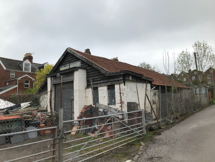
The abattoir building in Sampson's Lane
Tony Cater shared his memories of living in Sampson’s Lane, after reading those shared by others:
My grandparents William [Bill] and Maud Maddocks moved from the West Quarter to Sampson's Cottage during the early to mid '30s. Not sure if they owned or rented it, but suspect the latter. They relocated in the mid '60s to the Council-owned Toronto House off Prince Charles Road. Bill was a foreman at the brickworks.
Their daughter, Vera, was my mother, and after divorcing my father in '43 we both moved into Sampson's Cottage with my grandparents. At that time there was open access from East Avenue and Sampson's Lane. I was born in '41, so was 2 years old. My mother remarried in '47 and we then both lived in Whipton with my stepfather until '51 when we moved to Meadow Way, Heavitree.
I seem to remember that Sampson’s Cottages were a semi-detached pair but am not sure. When we lived there, my grandfather had the garden which I remember extended almost to the border of Ladysmith School.
I don’t recall the abattoir ever being mentioned by my grandparents, so suspect if it was there, it was during the '20s or after they moved. Looking at the photo above, I note the very tall doors. This may mean it was originally used in conjunction with, or maybe it was, the abattoir. High doors are required to accommodate the high mounted rail-work on which cattle to be slaughtered are hung to enable drainage, etc.
I remember in my time, there was a car workshop with mechanic Jack Carnell, owned by Cyril Boobyer who had a used-car business in Sidwell Street opposite the Odeon. I spent a lot of time in the workshop whilst living in Sampson's Cottage and for a few years after. Hooks in the roof beams would be used to help lift out car engines. The Boobyer business eventually moved to Fore Street, Heavitree, and when Cyril retired Jack took it on. I think the site is now a road leading to a small housing development behind Fore Street.
You mention a father and son butchery operation contained within a Portacabin in the same building during the '80s. This was probably a business supplying the catering trade or a centralized unit supplying several retail outlets. Some local meat names that may have operated it: Turton, Leach, Webber, Bridgeman....?
My own career was spent supplying the meat industry with tools and process machinery, initially in the South West, to butcher’s shops, and later nationally and internationally to processors.
I remember Dick Manley. He and my grandfather chatted often.
A final memory. About '45/'46, I was at the top of the Lane when I saw an African American soldier digging a hole beside the house on the left. He then placed a tin of chocolate biscuits in the hole and filled it in. I wonder if it's still there?
Michael Hughes -
Childhood Memories Of Heavitree In The 1930s + 1940s
Michael Hughes was born in Mowbray Maternity Hospital, Heavitree on 1st May 1933. He was brought up in Goldsmith Street, and later moved to Alpha Street in the 1950s. Now living on Beacon Heath, Michael talked to Martin Weiler about his memories of Heavitree.

Michael Hughes in 2024
Exeter Blitz
Michael’s main earliest memories surround the blitz in Exeter during World War Two. “At first, we all had to sit under the stairs when the air raid warnings sounded. Later we had a Morrison shelter set up inside our house. When the sirens went off during the day, I had to take two boys home from Ladysmith School as they lived further away. We also shared the shelter with a neighbour. I didn’t look forward to the air raids, but I did to the stew the neighbour brought in. It was full of Heinz baked beans. It was frightening when bombs were dropping but afterwards you wanted to know what had happened. One dropped on the roof of the school, and I remember saying to my Mum, “Good, I won’t have to go to school in the morning”. There was an air raid shelter in front of the Bramdean School playing fields. We would walk from Heavitree to the Odeon cinema on Saturday mornings. It was totally flattened around there; we used to climb over the bricks. When you looked across from the top of Paris Street, there was only the Cathedral standing. One time we went out to near Exeter Airport and saw a German plane that had been shot down. There was a boy at school who was killed by a mine off St Loye’s Road. Then it really hit you what was happening”.
Home Life
Michael’s Mum, Frances Dorothy nee Hooper, was a Heavitree lass and had been brought up in the same house at 35 Goldsmith Street; also referred to as Lower Goldsmith Street in street directories. His Dad, Alfred, was a plumber from St Thomas. The directories describe his business as ‘Plumber and Hot water Engineer’. Michael recalls that “it was lovely in Goldsmith Street as everyone knew each other. Even when we moved to Alpha Street, a much longer road, it was so friendly, you would know everyone. No one had a car so you could play in the street.
We used to play football in Hanover Road and only had to stop when the Crossmead bus came along”. Meals were simple – Cornflakes for breakfast, a snack at lunchtime and then an evening meal. “My favourite was homemade steak and kidney pudding”.
On Saturday evenings it was fish and chips from Prance’s on Fore Street. Michael remembers the family wireless. “It was the only thing we had for entertainment. It was large with a big battery and accumulator. I had to go to Thorn’s hardware shop to get the accumulator charged up. You had to do that every two or three weeks”. Sometimes for a treat we would go to Exmouth on the train from Polsloe Bridge. When I was older, I would go dancing at The Regal there. I saw many a punch up between boys from Exeter and trainees at the Lympstone camp”.
Education
Michael started at Ladysmith Infants School when he was 5. He used to be delivered there by a local teenage girl as his Mum was busy in the mornings. It was in the grounds of the Infant’s School that Victory in Japan (VJ) was celebrated with a large tea party, of which Michael still has some wonderful photos. His younger sister, Pauline, is there with Michael, as well as Dick Manley, later an England rugby player. He was at School with Frank Potter (Heavitree Local History Society Member), and says Frank was always top in exams.

VJ Day party at Ladysmith School

VJ Day party at Ladysmith School
Michael progressed through the Junior and Senior Schools before attending Technical School in the World War Two huts in Belmont Park. “I studied woodwork and metalwork. A few of us used to walk there, often stopping at Yandell’s shop on the corner of Hanover Road. We would buy a single cigarette each which cost a penny. We would then walk up Sampson’s Lane and smoke them. One day a teacher caught us, but his only question was did we have a spare one for him!”

Technical school boys around 1950
Heavitree Pleasure Gardens
“We had the best times of our lives in the Pleasure Gardens”, says Michael. “After school we would play football there. I also remember climbing around a big pile of white rocks at the far entrance. It was probably dangerous. We used to watch the speedway at the County Ground, and were inspired to make our own track in the Gardens. The Park keeper caught us digging the ground up and played up hell with us. I remember during the war that trenches were built in the Pleasure Gardens as shelter if bombs came”.
Football
Michael enjoyed playing football for his school and later for Heavitree United Reserves. He was a winger and could run fast. At the time Heavitree United’s home ground was in the Pleasure Gardens. It was because of football that Michael was exempted from military service. “I was diagnosed with hammer toes. They said this was caused by wearing football boots that were too tight for me”. Michael’s next-door neighbour in Goldsmith Street, Lawrence Taylor, went on to play as a goalkeeper for Bristol Rovers. He also says that Exeter, Arsenal and England striker, Cliff Bastin (also a Ladysmith School pupil in earlier years), was “everyone’s hero. After his career he came back to Heavitree and ran the Horse and Groom in Fore Street. My Dad used to drink in there and one day Bastin gave him a couple of tickets to go and watch Arsenal at Highbury”. Michael was a keen Exeter City fan watching from the Cowshed at St James Park. “There was a lot of smoke, whistling and shouting in there”.
Shops
Michael’s family never had to go far for essentials. “There was a bakery where the newsagents are now on the corner of South Lawn Terrace. Jam doughnuts would be a special treat from there. We got our milk from Roseland’s Dairy on Roseland Avenue. Our Vegetables came from Swanstons next to the Horse and Groom. Meat was obtained from Eastmans butchers, two up from where the gun shop is now on Fore Street. Our newsagents were Partridges on Fore Street. Stuckey’s was a corner shop in Shelton Place that sold alcohol. There were other more specialist businesses – there was a blacksmith up a lane between North Street and Homefield Road. As well as making horseshoes, he would sharpen tools. We also sometimes helped ourselves. We used to go and scrump apples in Bastin’s orchard near to where we lived”.
Boys’ Brigade
When he was 11, Michael joined the Boys’ Brigade at the Congregational Church (now United Reformed). “Once a month we would march from the Pleasure Gardens to the church. I played the bugle to start with and won the award for best bugler in Exeter. I later changed to playing the drum. We used to march at the Heavitree Carnival and other local carnivals like St Thomas and Topsham. The drummers would be at the front. We even went to London once and played at the Royal Albert Hall. It was the first time I’d ever been to London and remember everyone rushing and tearing around. We went on the roof of St Paul’s Cathedral and scratched our names there”.
After Michael left Technical School, he joined his dad’s plumbing business on Beacon Heath. He married Pauline in 1965 and they had two children, Sally and Barry. Barry, who had Cerebral Palsy, sadly died when he was 19.
A big thank you to Michael for sharing all his memories. He still takes a great interest in Heavitree’s past, and attended a Heavitree Local History Society talk at which the idea of this oral history conversation came about. We are also very grateful for the fabulous photos that Michael showed us of the VJ celebrations at Ladysmith School and his Technical School classmates. Wonderful local history!
The Northbrook And Heavitree Bridge
- Lyndon Taylor's Talk on The Northbrook and Heavitree Bridge (recorded Sep 2014)
(with kind permission of Paul Taylor)
Alan and Ruth Brend’s Heavitree Memories
Alan and Ruth Brend were both born in Heavitree in the 1930s and lived there until moving to the Duryard area of Exeter in 1961. They contacted the Society and very kindly offered to share their memories of Heavitree, some of which go back over 80 years.
Alan and Ruth Brend in 2025
Remembering the Second World War in Heavitree
Alan was born on 23rd July 1934 at 6 Sivell Place in Heavitree. Ruth was born on 4th May 1936 at 18 Woodstock Road in St Loyes. Both have strong childhood memories of the Second World War.
“I remember the day war was declared”, said Alan. “I was playing in the garden at Sivell Place and was called in to listen to the radio broadcast. My father was a gas fitter with the Exeter Gas Company and he was drafted in as a Sergeant Fire Warden. I used to go out with him every evening as he went on patrol. Looking back it’s amazing I was allowed out with my father. One night numbers 1-5 Sivell Place, the properties right next to ours, were hit by a German bomb. I had been woken up when the sirens went off. I remember the noise of the planes, then an eerie silence followed by an explosion. My father used a stirrup pump to fight the fire. We had a lucky escape as the fire singed our walls. The neighbouring houses were destroyed”.
Ruth remembers the bombing of Attwyll Avenue. Her mother and sister had gone shopping, whilst she was left at home waiting for the cleaner, Mrs Baker, to arrive. As she came up the driveway a German plane went over and she flattened herself against the wall. She dived under the kitchen table and stayed there while Attwyll Avenue was bombed.
Ruth’s house in Woodstock Road was also attacked. “It was early in the war and I was asleep in bed when we heard an air raid warning”, recalls Ruth. “A bomb was dropped and it actually bounced off the corner of our house and fell in Cranbrook Road. The impact blew our front door half way up the stairs. I remember sitting on the sofa with glass all around. The wall of our house bowed and we had to go and live in St Thomas for a year. My father went off to Swindon to work in aircraft manufacture so it was a very disruptive time for the family”.
When houses were bombed, people were not altogether honest; items would be stolen opportunistically. For example, Ruth’s doll’s house, which was kept in the outdoor toilet, was stolen. Her mum dug out the carpets while their house was being rebuilt so that they wouldn’t be stolen.
It was a very nerve-wracking period. “The enemy planes would often fly over Exeter on their way further north”, said Alan, “but we knew that if they had spare bombs they could drop them on the way back. So you could never relax once the planes had left the area on their outward flight. You feared what might happen on their return. The German planes had a low ‘mmmmmm’ sound”.
Ruth remembers particularly well the night of the 4th May Blitz in 1942. It was her 6th birthday! “I was all excited but then the sirens went off and we sought refuge in our Morrison Shelter. I don’t think my mother thought we would survive so she said I should open my presents, but it was so dark that I gave up”. Alan’s father spent the blitz repairing gas pipes. He wasn’t allowed to sign up for the armed forces as he was in a reserved occupation.
Alan was at Ladysmith Infant and Junior Schools during the war and remembers how normal it all seemed much of the time. “However, we had to leave school when the sirens went off, and were allocated to a house in a local street. After a time the School developed its own shelter in a cloakroom. Sometimes we would go and look at the aftermath of an explosion. A bomb was dropped on Mitchell’s Orchard behind Sivell Place so we went to explore there. We had to come to terms with tragedies. A friend of mine was killed in Normandy Road”.
Alan also spent a lot of time in Heavitree Pleasure Ground watching our own planes flying over towards Exeter airport. “We knew all the planes and their sounds, like Spitfires”. He also recalls meeting Americans for the first time. “Land girls from up north were billeted in Sivell Place and the US soldiers would come and take them out. We did very well for chewing gum from the Americans”.
When German planes flew over, they would often use their machine guns to shoot at anyone they saw on the street. At one point Alan’s mother was standing by the entrance to the Butcher’s at Regent Square, and was pulled inside suddenly by the butcher, as a plane flew over and fired at her.
Alan remembers cycling at age 8 or 9, to look at the seaside (you couldn’t go on the beach due to defences). He was at Starcross when a German plane came down, and dived under a tree. He also remembers being out on his bike in Heavitree Pleasure Ground when the sirens went off, and hiding in the bushes when he heard the planes go over.
Heavitree Pleasure Ground
It’s no surprise that Alan was drawn to the Pleasure Ground. He says “That’s where you had to go when I was a boy. I can remember being taken to the sandpit there when I was small. Later I’d watch Heavitree United playing there. It was before they moved to Wingfield Park. My father played for the Club in the 1930s and was Chairman in the '40s. He would sometimes take me to away games on the team coach, places like Ilfracombe and Barnstaple. People didn’t have cars then”. Alan’s father also played for Heavitree Cricket Club. Beautiful photos of the football and cricket teams from around 100 years ago proudly hang on the walls of his home.
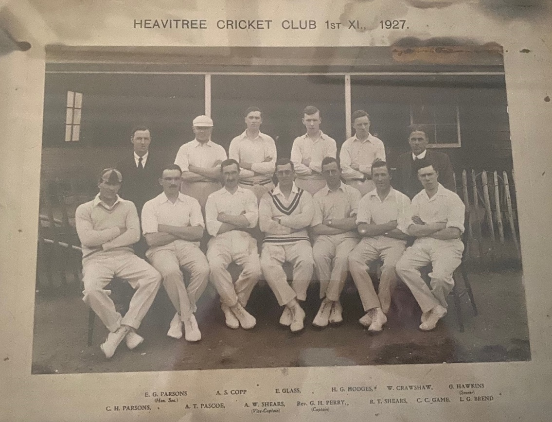
Heavitree Cricket Club 1st XI, 1927. Alan's father, front row far right.
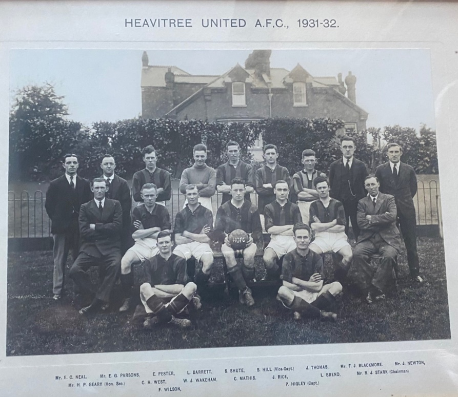
Heavitree United A.F.C., 1931-32. Alan's father, middle row 2nd from right.
Ruth has fond memories of the Pleasure Grounds too. “I used to have music lessons in Hamlin Lane and I would walk back home through the park. I never used to worry at all. I loved to swing on the swings. They went very high. You could go a long way up on them”.
Despite not living in Heavitree for well over 60 years Alan still likes to visit.
“I’m never happier than in Heavitree Pleasure Ground” he says. Now Alan has signed up for a seniors’ group in the park café.
Life in Heavitree
Alan remembers going to the Co-op, which in those days was opposite the Congregational Church. You had a number that you gave to show you were a member. He says, ‘in those days all I did was carry’. People would go to Heavitree shops most days, but if you wanted to buy something like a present for someone you would go into Exeter itself. You generally felt like you were from Heavitree. There weren’t very many people in the centre of Exeter, which was a small commercial and ecclesiastical area – people lived in all the separate areas around like Heavitree, Whipton and Wonford.
Even when Alan worked in a bank in Alphington Street, he would cycle home for lunch, and have time for a nap! Most people went home for lunch at that time; there wasn’t really anywhere you could buy lunch out.
Alan is never happier than when he is sitting on a bench in the Pleasure Ground, remembering watching the planes, with his friends living in all the neighbouring streets, his parents in Higher Cemetery, remembering games of football, cricket and tennis tournaments.
The Carnival and the Circus in Heavitree
Ruth was not allowed to go to the Heavitree carnival because her mum looked down on it, but Alan was part of it, and his dad was a planner. His sister was an attendant to the carnival queen.
After the war, Chipperfield’s Circus came into Wonford. Elephants paraded through the street. One baby elephant was sick and was unable to travel with the rest of the animals in the special train they used. Ruth’s father was asked to help organise getting it back to the circus group. He managed to arrange a Cullen’s Furniture van to transport it!
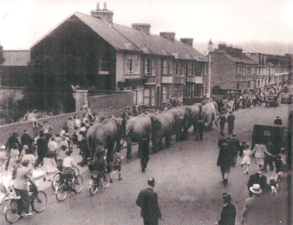
Elephants from Chipperfield's Circus travel along Fore Street, Heavitree (near Whipton Lane) en route to the circus in Wonford (Image courtesy of Olwen Foggin Thomas)
Running the Petrol Station
People are often surprised to hear that there has been a petrol station where the current one is in front of Tesco Extra in Fore Street for over 100 years. The first one was established around 1920. It was known as the Mote Garage and in 1951 was bought by Ruth’s father, Lionel Arthur Underhill, and the family moved in to the house that then stood behind it.
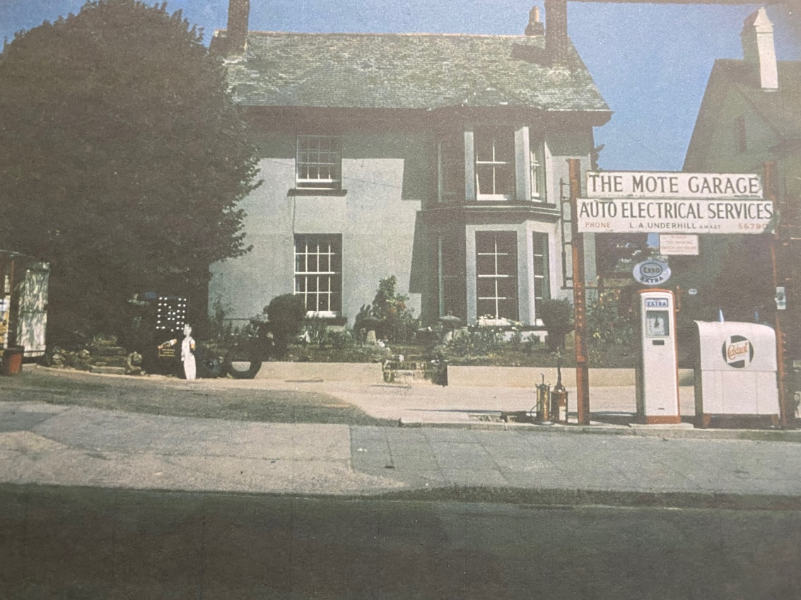
The Mote Garage in the 1950s showing housing to the rear (demolished in the 1960s)
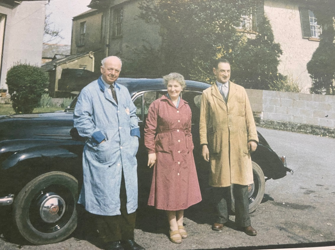
On the forecourt of the Mote Garage in the 1950s. L to R: Lionel Arthur Underhill + Sybil Underhill (Ruth’s father and mother), and Arthur Fricker (Ruth’s Uncle).
Ruth recalls, “There were some big sheds behind the house where a Mr Blatchen ran a transport business including moving cattle around. We took over the sheds when we moved in and let the area out for car parking. There was room for a furniture store too. Behind the sheds was an orchard. Beautiful greengages grew there fertilised by pig poo".
“I used to serve petrol. You had to be very careful with the high level swinging gantry that allowed you to put petrol in cars in the road. If you didn’t operate it correctly you would be splashed by the fuel and it really stung! We had daytime opening hours but if the police knew that someone was desperate for petrol at night they would knock on the door and we would help out".
“Cars were on the increase then and I passed my test on Christmas Eve aged 18. I think the examiner showed some Christmas spirit".
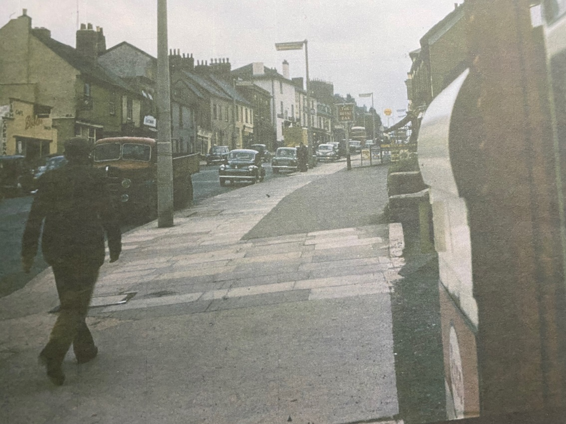
Looking up hill in Fore Street from outside the Mote Garage in the 1950s
Courting 1950s Style
How did Alan and Ruth get together?
Ruth says, “We were both on the same bus going to Heavitree and got off at the same stop. Alan followed me at a discreet distance but obviously took a fancy. The problem was I already had a boyfriend. Then by coincidence the three of us were at a Saturday dance and my boyfriend asked Alan to take me home as he was going in the opposite direction. That was that really. We went off to dances in Exmouth and I often had the use of my father’s car. Alan insisted on taking me by motorbike one time and I had to put a crash helmet on my carefully prepared hair. I wasn’t best pleased!"
"At the time, the men having to go off for National Service for two years split a lot of friendships. We survived all the early challenges and got married in Lympstone in 1961. We moved to West Garth Road in Duryard and have lived there ever since. We’ve now been married for 64 years. Although we left Heavitree we have very happy memories of our early days there”.
Wonford Village School
Jill Fuhaid shared an amazing old photo on Exeter Memories of a 1920s classroom scene at Wonford Village School, and has given permission for it to be shared.
An old postcard of Wonford Village School allows one to imagine what it might have been like internally. The building still exists in 2026, as flats. The school bell can still be seen.
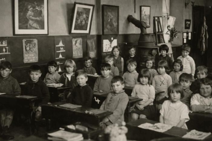 |
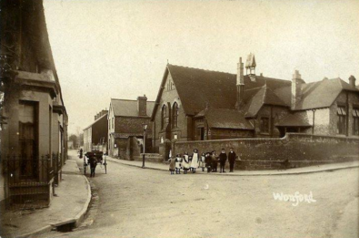 |
| Wonford Village School - Classroom scene 1920s (Image courtesy of Jill Fuhaid). [Edna Woodbury is marked with an 'x'] | Old postcard of Wonford Village School |
|---|
Snippets From The Local Press
5th October 1820 - Exeter Flying Post
Several robberies have lately been committed at Heavitree: on the night of Monday se'night the house of Mr Slocombe, butcher, was broken open and a quantity of meat and other things stolen there from: and early on Saturday morning last, the sum of 5 pounds was stolen from the shop of Mr Sanders, baker: on the following morning (Sunday) the house of Mr Morren was entered, and cash stolen to the amount of between four and five pounds. Several silver spoons, marked, and two watches lay near the place where the money was kept, at Mr Sanders.
On Monday last John Burnett and James Alsop, the former 18 and the latter 17 years of age, were arrested on suspicion of being the offenders, who on being taken before a Magistrate, confessed their guilt and were committed to Bridewell for a further examination at the Castle, on Friday next. Burnett was later convicted of felony, for which he was imprisoned in the Devon County Bridewell and privately whipped.
14th October 1820 - Exeter Flying Post
Heavitree fire on 11th September. Fire at house belonging to Mr Austin (bricklayer) near the Horse and Groom, on the right hand side leading to the church. 5 Houses in front, 5 cottages behind totally destroyed. Water supply problems. Nearly all properties insured.
6th October 1832 - Exeter Flying Post
Heavitree. The [Cholera] epidemic has made its appearance in this beautiful village, but as if only to afford additional evidence of the salubrity of the situation the following is the very satisfactory Report made by the Board this day.
- New cases 0
- Died 0
- Recovered 0
- Remaining 8
24th July 1834 - Exeter Flying Post
Mont-le-Grand sale, together with two houses in Bicton Place and 30 acres of land which is 'healthy, with good views'.
11th January 1838 - Exeter Flying Post
Caution against indiscriminate alms giving
A further proof of the necessity of caution in this respect was afforded on Thursday last at Heavitree. The Rev. Arthur Atherley, the clergyman of the parish, [Heavitree's vicar 1820-1857] had received intimation that a man with a petition to which his name was attached as having given the petitioner 10s, was soliciting contributions, in the parish, and in the course of the day the Rev. gentleman in passing through the village of Wonford, fell in with him, and being unknown to the mendicant, he presented his petition, and solicited alms of Mr Atherley.
Convinced now of the imposition endeavoured to be practised, from the forgery of his own name, Mr Atherley told the man the petition would not be returned, and that he must accompany him. This the beggar did for a short distance, but coming to a part where a lane branched off, the fellow bolted, making off at the top of his speed.
Determined, however, by making an example of the impostor, to endeavour to check this prevalent practice, Mr Atherley pursued him, in which he was joined by Mr Crowther. The fellow outran them for a considerable distance, but at length was taken, and being on Friday brought before the Magistrates at the Castle, was convicted as a rogue and vagabond, and sent to exercise at the treadmill for three weeks.
18th July 1846 - Woolmers Exeter & Plymouth Gazette
Heavitree. During the last week the inhabitants of this quiet village have been moved from their accustomed proprietary by the gaieties of a revel. The streets have been animated by the presence of gingerbread stalls, puppet shows, nut barrows and tumblers, whilst in one of the fields whirligigs, swinging boats and "the American wizard from the wizard's magic cave", have respectively demonstrated their mutual high pretensions to public patronage; not have they languished for want of it. The new parish church of Heavitree is fast progressing to completion and will be consecrated on Monday week.
10th July 1851 - Woolmers Exeter & Plymouth Gazette
Heavitree Fair. On Tuesday and Wednesday the annual holiday fair of this village was held and drew together a large number of the pleasure seeking population of this city and neighbourhood, who delight in such recreations. The day's amusements consisted in climbing a pole for a leg of mutton, donkey racing, etc, etc, and in the evening the dance was enjoyed and entered into with great ardour.
12th July 1871 - Exeter Flying Post
Heavitree had its annual revel on Sunday, and it was attended and it was attended with the usual amount of inebriety and misconduct. The writer of this paragraph witnessed a most disgraceful scene. A lot of roughs (men, women and boys) had been turned out of the public houses and commenced to fight, one across the other, neither of them apparently knowing why they were fighting or who they were fighting with. The language was far from being refined and the women out-vied the men in the elegance of their expressions.These annual gatherings would be more honoured in the breach than in the observance. Yesterday the fair commenced with donkey racing, etc. and today there will be climbing for legs of mutton and women for gown pieces.
1st August 1883 - Exeter Flying Post
The Salvation Army at Heavitree. Complaints by Residents.
At the castle Mr F Orchard said he appeared on behalf of a large number of the inhabitants at Heavitree in order to present a petition asking the Bench to assist them in removing the nuisance and obstruction caused by the Salvation Army. The petition set forth that a body of Salvationists created an intolerable and constant nuisance by their shouting and raving in the public thoroughfare at Heavitree. This was a great annoyance to the inhabitants and he asked the Magistrates to take some steps to stop this state of things.
The petition bore the signatures of fifty persons. Mr Orchard remarked that the obstruction and annoyance were caused at the crossway by the junction of Church Street and Fore Street. The Army took up their stand at the path and they completed blocked the free passage of the road. They remained there for a long time hollering and shouting so much that they could be heard at the turnpike gate. [by this date the turnpike was at Livery Dole]
The Deputy Chief Constable said he was perfectly cognizant of the facts stated but that there had been no obstruction that the police could interfere with or the offenders would have been brought before the Bench. The obstruction was rather caused by persons who went there to molest the Army.
After further discussion the question was dropped.
[This was one of many attempts by Devonians of all types to stop the Salvation Army conducting outdoor services]
23rd March 1900 - Devon & Exeter Gazette
Auction Anstey Orchard, Wonford. 95ft frontage to Fore Street, Wonford, 225ft to road at rear, depth 400ft, area 2a 1r 4p. Ripe for development of 60 houses. Land and buildings let for £25 10s p.a., but early possession can be arranged. Rippon Son an d Co., 8 Queen Street. (Withdrawn at £435, on 20/04/1900 D&EG p14).
30th April 1901 - Devon & Exeter Gazette
Carbolic Acid for Cider
Last evening, while Mr Alfred Oxenham, of Heavitree Bridge, Exeter, was engaged in whitewashing a house, to which he was shortly removing, he drank a portion of the contents of a bottle containing carbolic acid in mistake for cider. Mr Andrews, surgeon, was called, and ordered Mr Oxhenham’s removal to the Royal Devon and Exeter Hospital, where he died soon afterwards. Deceased was 34 years of age, and leaves a widow. An inquest will probably be held today.
Scroll to top of pageResearching Family History
Family history and local history are deeply intertwined. Many people in the HLHS will know that we can’t go far with family history without exploring the area our ancestors lived in.
At our September 2025 quarterly meeting, Sue Bond, Research Coordinator at the Devon Family History Society, talked us through useful sources for researching family history; an example of research for a Heavitree family; and how one might approach research into family history.
Devon Family History Society Header
Useful Sources For Researching Family History
Censuses (1841-1921) + 1939 Register
- 1841 – The least helpful. Has names, male occupations, born in/outside the country, no relationships. Ages are rounded up or down for adults; children’s are accurate. We can’t be certain and it can be dangerous to make assumptions: we need 3 things about a person to be sure it is them.
- 1851-1901 – Roughly the same. Address, names, but this time with relationships, occupation and place of birth. Much more useful to use to find birth and baptism records.
- 1911 – Additional info. Number of children alive/dead, number of years married.
- 1921 – Most recently released. Tells us who was working for whom and what they were doing. Useful to see big employers of the time.
- 1931 – Destroyed by fire in WWII.
- 1939 Register – At the outbreak of WWII to issue identity cards. Also used in 1949 to allocate NHS numbers. Blank lines across names of people who might still be alive. Gives exact dates of birth.
- 1941 – Not taken due to WWII.
- 1951 – Won’t be released until 2052.
Baptisms/births, marriages and deaths/burials
- FreeBMD: Best to search here first. You can search by county, registration district, surname. Once you’ve found the person, look on the GRO site (below). After 1870/80 it tells you the age someone died.
- General Register Office: Here you can search 2 years either side of a date, for births and deaths but not marriages. Tells you the age of any death, having the correct ages makes it easier to send for the correct death certificate.
- Parish registers: Find baptisms (not the same as births – many took place when the child was a good few months old), marriages and burials. Parish registers for Devon are available on FreeREG, and Find My Past (chargeable).
Maps
Directories
- White’s Devon: Can see occupations (University of Leicester Special Collections Online).
- Paterson’s Roads: The Public Domain Review 1826.
- AA Book of C19th: All the routes, etc. Very complementary about Heavitree’s salubrious air.
Newspapers
- British Newspaper Archive: 94,736,236 pages dating from the 1700s, with more constantly being added. Includes:
- Exeter & Plymouth Gazette (1827-52);
- Daily Telegram (1869-1885);
- Exeter Flying Post (1800-1900);
- Exeter Leader (1980-1999);
- Exmouth Chronicle (1920-1920);
- Exmouth Journal (1869-1913);
- Express & Echo (1866-1963).
Wills
Many were destroyed in WWII.
- Devon Wills Project: Should be able to find wills made. Often shows one was made but no detail.
- Family Search Catalogue: Wills for the Diocese of Exeter (County of Devon 1812-1857).
After 1857, search probate records for documents and wills. Costs £1.80 to send for any will. All are public property.
One Place Studies / One Name Studies
If an area has a one-place study, it is worth contacting the people running it. They’ll be volunteers but very keen to share information and knowledge. It could be a street, village, etc, but not a town as this would be too big. Alternatively, search your surname on One-Name Studies.
An Example Of Research For A Heavitree Family
- 1871 – John Brewer (28) born Colyton Raleigh, and his wife Anne born Farringdon, were living in Fore Street, Heavitree. We don’t know the number but could work it out in relation to other census entries, for example if they were next to a pub or police station.
At this time few people were born in Heavitree – most were coming in for work. Mr Brewer was a tailor. Looking backwards, we can find his baptism on FMP. He was born to a carpenter and was baptised in 1842. In the 1861 census he was still in Colyton Raleigh and clearly did his apprenticeship there, before coming to Heavitree to work.
The birth of his youngest child, Alice, was registered in 1869 in St Thomas district (free BMD). The mother’s maiden name was White. Knowing this opened up more information – the plans for their marriage in 1866 (it is also worth looking at the witness for marriages – they might be other family members). The marriage certificate was signed, so they could write.
Looking at baptisms, a son was born in Exeter and baptised in St Sidwells. He was named William Henry White Brewer. Alice was baptised in Heavitree by Rev. Henry Barnes of the Gordon Lamp and actress daughters. - 1881 – Their tailor’s shop was next to the Horse and Groom on Fore Street. Only one son was apprenticed to the father, and there were four more children, all born in Heavitree.
- 1891 – They were living in 8 Isca Terrace, Fore Street. Two sons were learning tailoring and the oldest daughter was assisting in house at the age of 16.
- 1901 – Still at the above address next door to the Horse and Groom (at the beginning of each census section you can work out the direction of the enumerator's route). Edgar was apprenticed to a woman draper (a link to tailoring, but doing his own thing).
- 1911 – Couldn’t find them. It’s often a struggle to find people – it could’ve been a poor record or they could have died. It was later determined that John died aged 61 in 1903. He died of chronic bronchitis and cardiac failure, and his death was registered by one of his sons. He is buried in Heavitree churchyard. This is from the National Calendar of Wills (on Ancestry, FMP or Gov website). His wife died in the same period, at 65, and is buried in Heavitree. The site Find a Grave was useful to find them. They must have had some money to be able to have a grave – most wouldn’t. This explains why they couldn’t be found on the census.
In 1911 there was just one son listed as living at 8 Fore Street, working as a tailor. Two others were living at 4 Baring Cottages. - 1921 – Frank was living at Sagona Terrace in Parr Streer (destroyed in the Blitz). He was working for the Brewer Brothers so had obviously kept on tailoring. His mother in law was living with them, so we could assume his wife’s surname was Widgery?
- 1939 Register – Frank, now a widower, was still a tailor, living at 4 Sagona Terrace. Doris Brewer, Frank’s daughter, had also married a Widgery, so it seems she may have married a distant cousin.
- British Newspaper Archive – featured a 1921 Brewer Brothers advert, listing them as a member of the National Federation of Merchant Tailors. There are often misdemeanours to be found in newspapers. The fact that we didn’t find more means they probably behaved themselves!
- Besleys 1939 – 8 Fore Street was still a tailor but under the family name Yendole, so it must’ve changed hands.
An Approach To Research Into Family History
Free online sites
- Genuki: Very good for Devon – towns and villages – each parish has a page. Bibliography of books/articles about place.
- Online Genealogical Index: One man, covers England, Wales and the Isle of Man. Doesn’t work for Heavitree! A signposting website.
- Cyndi’s List: American but covers the world. Tells you where you might go to find records.
- FamilySearch: Mormon site. So much on it; initially hard to use.
Commerical online sites
Be careful how you search them – they don’t like too much or too little!
- Ancestry: Search – card catalogue, Devon.
- Find My Past: Search – all record sets, Devon. Easy to get baptisms, marriages, and burials. Non-conformist records don’t appear that way; search ‘everything’ for those.
Devon Record Office
A visit here is a must if possible, as there are many things not digitised for Internet access. Booking preferable.
The National Archives
A discovery website.
Devon Family History Society
Tree House, King Street, Exeter
Based at Tree House in King Street, open three days a week. There’s a members’ fee, or for £3 non-members can access subscriptions on computers.
Parish, family files, library, and indexes (a large part are in storage at the moment), family search affiliate library, help and advice. Regularly online, plus face-to-face meetings.
Membership is £18 a year and includes a quarterly journal and access to members’ area.
Scroll to top of pageExeter Civic Society And Their Work In Heavitree
Introduction
The Exeter Civic Society (ECS) was formed in 1961 with the following aims:
- To promote high standards of planning and architecture.
- To educate the public in the geography, history, natural history and architecture of the city.
- To help to secure the preservation, protection, development and improvement of features of historic or public interest across the city.
At the time there were several dire threats to buildings in the city centre. This sowed the seeds for the creation of a society to fight for the protection of these buildings. In the 1960s planning applications weren't advertised at all, but these days the ECS monitor all applications in Exeter, and comment where necessary.
The Society's work is city-wide and ongoing. It always has current issues to be dealing with; these can be found on their website.
The Civic Society's Work In The Heavitree Area
Although there are numerous issues that the ECS have been or are involved with across the city, it is Heavitree and the immediate area on which we concentrate here.
Gordon Lamp, Livery Dole
The Society paid for its renovation, which turned out to be a lot trickier than expected, costing £3080 in 2016. Also the Nethercott Lamp at the top of North Street.
2nd Exeter Scout Hut, South Lawn Terrace
This rebuild was supported because of the high quality of the design. They did object to some minor details of the front courtyard.
Drawing of replacement scout hut
Bramdean School Field, Homefield Road
The Society objected to aspects of the design, and poor access for the older people expected to live there – narrow pavements, poorly lit, lack of crossings & bus services. They are hoping the applicant will pay towards improving the pavement access, but it’s still early days.
Plan of accommodation on Bramdean School field
Windsor Castle Pub, North Street
In spite closing in 2018, there is still no planning permission for this site.
Active Travel – ‘Low Traffic Neighbourhoods (LTNs)’
This is a sore point in Heavitree, and the Society has mixed views. They broadly support having fewer cars and more walking, but think this went too far, too quickly. On a smaller scale it could’ve worked.
Heavitree Church Antennae, Church Street
At the top of the tower there are telephone masts. When mobile phones first became popular, nobody wanted masts near them, which is why they’re up there. The Society wants to protect the fabric of the building as they are updated.
Wonford Inn, Wonford Street
There have been two applications for demolishing the building and replacing with two blocks of flats. The Society objected. The developers should try to find an alternative, community use, and there has been a lack of investigation of this.
Wonford Sports Centre, Rifford Road
They have objected to the demolition as it is only 45 years old, and substantial. The walls are half a metre thick, the foundations are wide, and it has interesting architecture. It would be very expensive to demolish.
The new plans are to refurbish it with lots of new facilities. It is actually built on a waste tip.

Drawing of replacement buildings on Wonford Sports Centre site
Police Station Site, Heavitree Road
This will be student accommodation and co-living accommodation. There were concerns about the effect it would have on homes in Higher Summerlands, as it will be so tall, but it was still approved. Talks are ongoing.
Drawing of replacement buildings on police station site
St James' Weir, Salmon Pool Lane
The Society has expressed its frustration at the expenditure of some £470,000 by the Environment Agency on extending the fish pass at Trews Weir. This became necessary following the semi-collapse of St James' Weir, half a mile down stream. They have long been pointing out the deteriorating condition of St James' Weir and calling for its repair.
The City Council have at last expressed their wish to see the Weir repaired, and the consequent restoration of the leat to Countess Wear, but need now to find a way of funding the repair, which won’t come cheap.
Tree Preservation Taskforce
The Society started this taskforce in 2023 with the aim of looking into how to preserve trees in Exeter. Full details can be found on the ECS website.
The first area to be looked at, with help from Sidmouth Arboretum Trust, was Bull Meadow. It now has its own tree map.
The Dean and Chapter of Exeter Cathedral has also worked with the Sidmouth Arboretum Trust on a map for the ‘Trees of Cathedral Green’.
Easy access to each of these sites is via the QR codes below.
| QR codes for mapped trees |  |
 |
||
|---|---|---|---|---|
| Bull Meadow | Cathedral Green | |||
The taskforce is currently working on a tree map of Prospect Park area, as an example of street trees. We hope they will map the trees in Heavitree Pleasure Grounds in the future.
There was an interesting question about the tree stump near the main entrance of Heavitree Pleasure Ground. It has 135 rings, but this means it is older than the park itself, and maps show it wasn’t there before.
It is believed that the tree was originally located on East Wonford Hill, just up from the junction with Rifford Road. It was felled as it was a danger. A small section of the trunk was relocated to the Pleasure Ground so that it would remain part of the community.
The "Discovering Exeter" Series Of Booklets
In the 1980s & 1990s, the ECS published the “Discovering Exeter” series of booklets on historical aspects of districts in Exeter, including Heavitree. A number of these booklets are now out of print, but have been scanned and are available to ECS members on their website.
Since publication, many of the points of interest in the booklets sadly have gone; at least a quarter of the 40 or so places mentioned in the Heavitree booklet are no longer there.
The ECS are currently working to produce a second series of the booklets; Martin and Sally are working with them on the Heavitree booklet.
Scroll to top of pageHeavitree Around The World
As Europeans moved around the world, it became common for them to [re]name topographical features and places after family names or places where they had grown up. Devon place-names can be found throughout the world; even small villages such as Heavitree are found in other places.
Heavitree Gap, Australia
A river pass which cuts through the MacDonnell mountain-range providing the southern entrance to Alice Springs in the Northern Territories, Australia. It was named by surveyor William W Mills who was working on the new overland telegraph line in the northern territories. Mills, according to the 1851 census, was born in Heavitree, and aged 6 years old lived in Polsloe Park. He said he named the pass Heavitree Gap after his ‘old school in Devon’. This could refer to the school that used to stand on the site of the present Co-op. It is claimed that he named Alice Springs after Alice Todd, the wife of Sir Charles Todd, the Superintendent of Telegraph.
There are a number of Heavitree named places in Alice Springs including a Heavitree Court and a Heavitree Gap supermarket. One should note that although Mills called the pass Heavitree Gap it did already have a name – Ntaripe (pronounced Ndariba) – a sacred site to the indigenous Arrente (Arunda) people.

A view of Heavitree Gap, Australia
Heavitree, New Zealand
Heavitree Farm in New Zealand is on the North Island in the town of Gisborne, close to Hawkes Bay. The farm was purchased by the Newman family in 1987 and they named it Heavitree after their ancestors who originally came to New Zealand from Heavitree, Devon in 1854. They grow a variety of fruit there and produce wine and juice under the banner of their ‘Heavitree Juice Ltd’ company.
Heavitree Street Names, USA
There are three Heavitree street names in the Severna Park area of Maryland, USA: Heavitree Lane, Heavitree Hill and Heavitree Garth. These can be found off Devonshire Lane. The local authority has been approached to see if they can throw any light on the use of the Heavitree name.
Heavitree, Jamaica
Founded in the 1830s it lies at an altitude of 756m (2480 feet) in a mountainous area near the middle of the island. It owes its name to the Davy family. They lived at Mere Farm in the parish before moving to Countess Wear in around 1765. The Davys were involved in slavery and compensated after its abolition in 1833. Heavitree would have been founded using the wealth accumulated from slavery. The estate became a coffee plantation and people still live in Heavitree today.

Maps showing the location of Heavitree, Jamaica
Heavitree, South Africa
Owes its origins to two maiden aunts living in Heavitree, Devon who in 1857 sent money to Natal to enable two sons of the Ralfe family to purchase land at Eden near Ladysmith. They renamed the farm Heavitree. Winston Churchill refers to a skirmish at Heavitree in his Boer War diaries. For many years there was a prize at the local annual cattle show called the Heavitree Gold Cup. Heavitree still exists and you can even stay at the farm as they run a bed and breakfast there.
Heavitree House, Scotland
This is the name of a large house built in Golspie, Sutherland by a James Anderson in around 1850. It subsequently became a hotel and then a farm. It is now private housing although you can stay there. Why it was called Heavitree?
Heavitree Street Names, Plumstead, London
Heavitree Road and Heavitree Close are two street names in Plumstead, Greenwich in London. Heavitree Road was built in 1877 and was so named at the request of a Mr Braund whose birthplace was Heavitree, Devon. This is believed to be Marwood Kelly Braund a solicitor who moved from Devon to Plumstead in the Victorian era.
Heavitree Road, Kingsand, Cornwall
In the early 1900s, local councils in Cornwall decided to rename some of the old, unfashionable streets and go ‘up-market’. In Kingsand, there was much debate with several changes proposed.
At the time in the village, there was a thriving Wesleyan Methodist Church, most members of which lived in a street called Back Lane; they were supposedly ardent tee-totallers. It hadn't gone unnoticed, however, that on Thursdays the dray of the Heavitree Brewery was particularly busy making numerous deliveries. As a result, the fishing fraternity with their characteristic wry humour, nicknamed the street Heavitree Road.
A public meeting, heavily attended by fisher-folk, was held to discuss street re-naming amongst other matters. A vote was taken and secured to officially rename Back Lane to Heavitree Road.
The road can still be seen today. It even has a Heavitree House.
 |
 |
| Heavitree Road, Kingsand | |
|---|---|
Heavitree Way, Taunton
A new street near the railway station and railway line. When approached to discover the link with Heavitree, Devon the local council simply said there wasn’t one but that it “sounds nice”.
Scroll to top of pageObituaries
Here we recall the pivotal role of those who founded and ran the Society for many years from its earliest days.
Den Perrin, 1932 - 2017

Den Perrin, founder of the Heavitree Local History Society, and its first Secretary, passed away on 18th November 2017.
When Den retired from Devon County Council, his active mind turned to potential projects to keep him busy and stimulated. As a Heavitree resident, with a keen interest in history, Den started to explore the idea of a Local History Society.
This culminated on 12th August 1998 when Den, together with David Morrish, Norman Shiel and Martin Weiler, met 'to discuss the possibility of forming a Local History Society for Heavitree'.
The idea was quickly endorsed, and the Society inaugurated in October that year with Den as secretary. From the outset, he was very focussed on doing things rather than just talking about local history. Very speedily he organised for the fledgling Society to publish a guide to the Higher Cemetery, and moreover successfully approached Exeter City Council to pay for this.
Soon after, Den started an annual survey of the shops in Heavitree Fore Street, and researched what had been there previously right back until 1851, producing the results in a booklet. The survey is still continued by members and the changes are updated on our website.
Den also edited a fine publication naming all those from Heavitree who died in World War I - The Heavitree Roll of Honour; when it came to World War II commemorations, Den negotiated the closure of Whipton Lane and organised a street party to mark the 60th anniversary of the end of hostilities. Over 300 enjoyed entertainment, tea and a victory cake.
Den launched the Society newsletter in 2000 and continued documenting the history of the area. Other publications by him included histories of Heavitree Parish Church and Heavitree School. He also wrote a booklet for the Civic Society on all the plaques and public inscriptions around Exeter.
Den's biggest triumph was persuading the Royal Albert Memorial Museum to host an Exhibition on Heavitree's history - Heavitree 2002. This proved a great success and we still use some of the exhibition boards today.
He was very keen on reminding people that Heavitree used to be an independent borough until being annexed by Exeter in 1913. Eventually however he forgave the City, and indeed Den was the main driver behind the setting up of the Exeter Local History Society.
When he organised the first Heavitree Fore Street walk in 2000 an amazing 83 people turned up. Den had touched a nerve. He knew that people were interested in their community and its local history; knew it but crucially did something about it. Everyone with an interest in Heavitree will forever be grateful for Den's foresight and persistence.
The Society is still thriving today - nearly 20 years after Den formed it - a great legacy from the man we are honoured to remember as our founder and inspiration.
David Morrish, 1931 - 2018

David Morrish, co-founder of the Heavitree Local History Society, and its first Chairman, passed away on 14th February 2018.
A County and City Liberal Party Councillor for Heavitree for three decades, David was widely known as 'Mr Heavitree'.
He always had a passionate interest in the local history of Heavitree. In a Heavitree Liberal Newsletter of April 1968 David wrote an article about Heavitree in Australia. Here two of his great interests came together - geography and history.
The newsletter said that David 'makes a spare time hobby of recording aspects of Heavitree's history. As a geographer and Fellow of the Royal Geographical Society, he has been busy tracking down Heavitree's Australian 'twin' '.
Given this level of interest in local history, and his 'can do' attitude, it is no surprise that David supported the formation of a Local History Society. Together with Den Perrin, David drew up plans, before hosting an initial meeting at his Birchy Barton Hill home on 12th August 1998.
David and Den's enthusiasm was infectious, and the Society was quickly inaugurated that October. Den was elected Secretary and David the Chairman, a post he held for 12 years.
David immediately got down to work on issues the Society could research and discuss. He wrote a paper for the Society's first meeting suggesting a number of themes. These included: Heavitree Urban District Council (1896-1913), schools, origins of street names, buildings in the conservation area, census returns, the cemetery, old newspaper reports, breweries and the churches.
Particularly popular were David's guided tours of the Fore Street area. The first one was held on Sunday 2nd July 2000; an amazing 83 people turned up. The Society newsletter reported 'Despite the numbers and the constant roar of traffic, David Morrish managed to both entertain and enlighten all those present'.
It was fitting that the Society's meeting on 6th March 2018 was packed to the rafters. Those present held a minute's silence to remember David, then took the opportunity to share personal memories.
Members stressed David's role in supporting and participating in the Heavitree Community Association.
Our current Secretary, Terry Bound, recalled David's role as a lecturer at St Luke's teacher training college. David led a party, including Terry, over the old bridge at Clyst St Mary to the banks of the river Axe. There they saw all the layers in the shingle cliff and David said "Gentleman this is geography being enacted before your very eyes". Terry said he will never forget those words.
Terry also paid tribute to David's role in researching the historic boundary of Heavitree Parish, and how Heavitree Urban District Council celebrated Queen Victoria's Diamond Jubilee in 1897 by erecting additional boundary stones and reviving the beating of the bounds ceremony, when some even rode round on horseback.
- Autobiography of the late David Morrish (with kind permission of Claire Thorogood)
- The late David Morrish' talk on The Work and Achievements of W G Hoskins
(with kind permission of Paul Taylor)
Quick Links
- Forthcoming events
- Most recent newsletter
- Follow us:
